Page 108 of 298
Once the destination is reached, you will see the checkered flag. Route guidance is finished.
Highway information Requirement: the map content
Highway Information
Highway Informationmust be enabled.
Display mode: while driving on the highway, gas stations, rest stops, rest areas and highway
exits are displayed along with their immediate distances from the current vehicle position. X
To call up the selection mode: while displaying the highway information, slide 9the
controller.
The marker is on the highway information. The associated position is marked on the map.
X To select the desired rest stop/highway exit: turn and press the controller.106
Route guidanceNavigation
Page 109 of 298
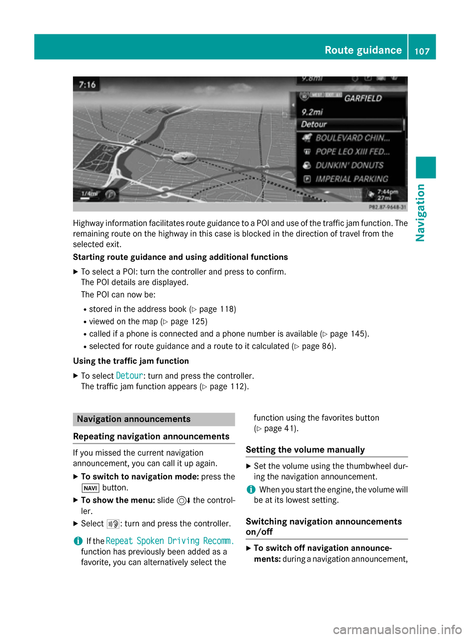
Highway information facilitates route guidance to a POI and use of the traffic jam function. The
remaining route on the highway in this case is blocked in the direction of travel from the
selected exit.
Starting route guidance and using additional functions
X To select a POI: turn the controller and press to confirm.
The POI details are displayed.
The POI can now be:
R stored in the address book (Y page 118)
R viewed on the map (Y page 125)
R called if a phone is connected and a phone number is available (Y page 145).
R selected for route guidance and a route to it calculated (Y page 86).
Using the traffic jam function X To select Detour
Detour: turn and press the controller.
The traffic jam function appears (Y page 112).Navigation announcements
Repeating navigation announcements If you missed the current navigation
announcement, you can call it up again.
X To switch to navigation mode: press the
00BE button.
X To show the menu: slide6the control-
ler.
X Select 006A: turn and press the controller.
i If the
Repeat
Repeat Spoken SpokenDriving
Driving Recomm.
Recomm.
function has previously been added as a
favorite, you can alternatively select the function using the favorites button
(Y
page 41).
Setting the volume manually X
Set the volume using the thumbwheel dur-
ing the navigation announcement.
i When you start the engine, the volume will
be at its lowest setting.
Switching navigation announcements
on/off X
To switch off navigation announce-
ments: during a navigation announcement, Route guidance
107Navigation Z
Page 112 of 298
X
To switch to navigation mode: press the00BEbutton.
X To show the menu: slide6the controller.
X To select Route
Route: turn and press the controller.
X Select Destination Information
Destination Information.
The destination and existing intermediate destinations are displayed with distances, travel
time and arrival time.
X To select destination or intermediate destination: turn and press the controller.
The address appears.
X Select Save
Save.
The destination or intermediate destination can be saved as:
R a navigable contact in the address book
R My Address
X To call up a map: select Map
Map.
X Move the map, change the map scale and select the destination or the intermediate desti-
nation (Y page 93).
X To call the destination or intermediate destination: select Call
Call.
If a phone is connected and a phone number is available, COMAND switches to the tele-
phone function.
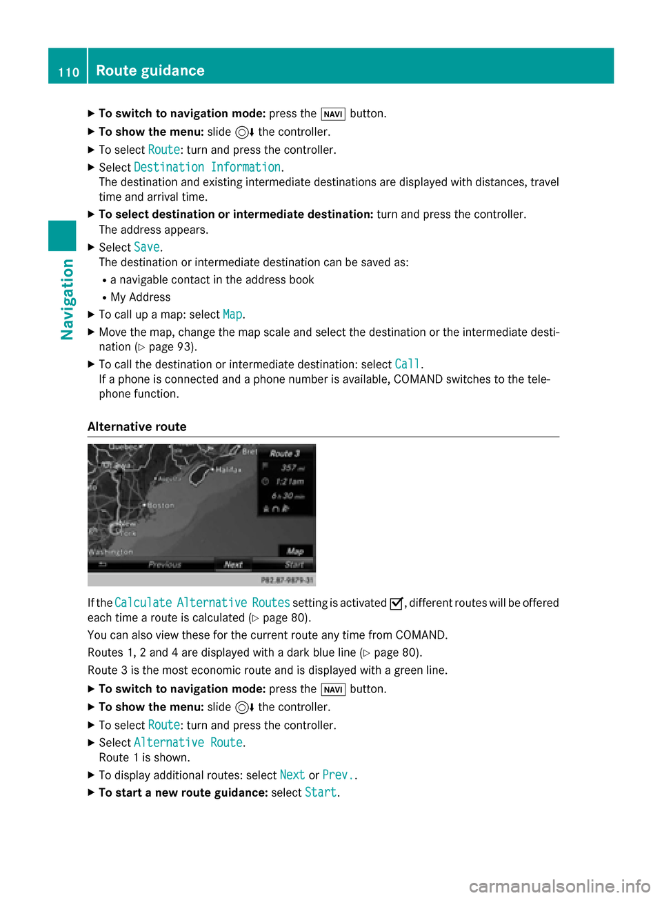
Alternative route If the
Calculate
Calculate Alternative
Alternative Routes
Routessetting is activated 0073, different routes will be offered
each time a route is calculated (Y page 80).
You can also view these for the current route any time from COMAND.
Routes 1, 2 and 4 are displayed with a dark blue line (Y page 80).
Route 3 is the most economic route and is displayed with a green line.
X To switch to navigation mode: press the00BEbutton.
X To show the menu: slide6the controller.
X To select Route
Route: turn and press the controller.
X Select Alternative Route
Alternative Route.
Route 1 is shown.
X To display additional routes: select Next
Next orPrev.
Prev..
X To start a new route guidance: selectStart
Start. 110
Route guidanceNavigation
Page 113 of 298
Route list
X
To switch to navigation mode: press the00BEbutton.
X To show the menu: slide6the controller.
X To select Route
Route: turn and press the controller.
X Select Route List
Route List .
The route list shows the next change of direction and the immediate distances from the
current vehicle position. X
To display additional route sections: turn the controller.
The position of the change of direction that belongs to the respective route section is indi- cated on the map with a cross. Route guidance
111Navigation Z
Page 114 of 298
Where am I?
X
To switch to navigation mode: press the00BEbutton.
X To show the menu: slide6the controller.
X To select Position
Position: turn and press the controller.
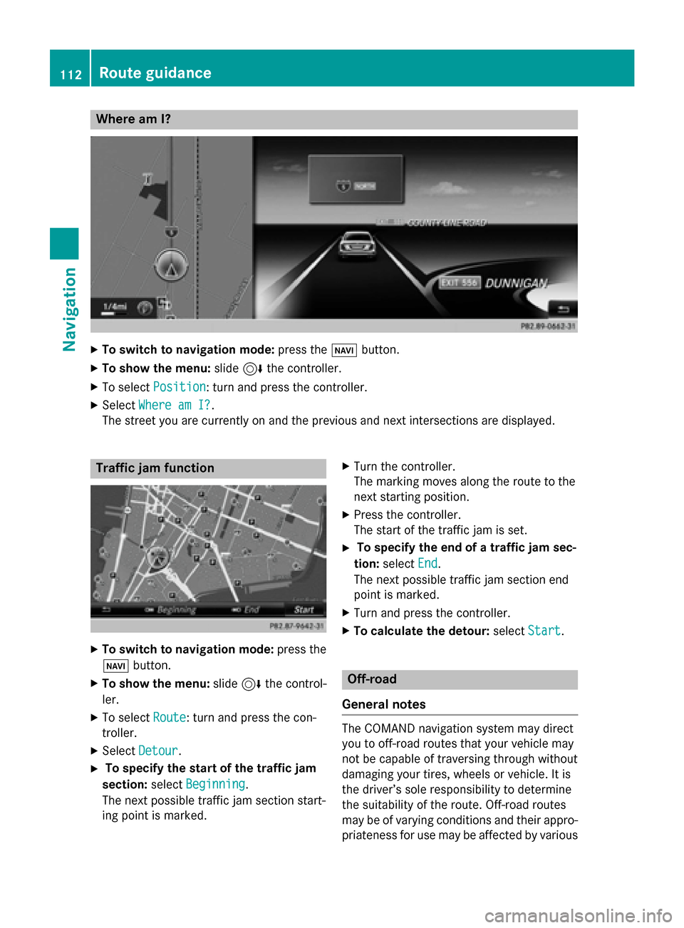
X Select Where am I?
Where am I?.
The street you are currently on and the previous and next intersections are displayed. Traffic jam function
X
To switch to navigation mode: press the
00BE button.
X To show the menu: slide6the control-
ler.
X To select Route
Route: turn and press the con-
troller.
X Select Detour
Detour.
X To specify the start of the traffic jam
section: selectBeginning
Beginning.
The next possible traffic jam section start-
ing point is marked. X
Turn the controller.
The marking moves along the route to the
next starting position.
X Press the controller.
The start of the traffic jam is set.
X To specify the end of a traffic jam sec-
tion: select End End.
The next possible traffic jam section end
point is marked.
X Turn and press the controller.
X To calculate the detour: selectStart
Start. Off-road
General notes The COMAND navigation system may direct
you to off-road routes that your vehicle may
not be capable of traversing through without
damaging your tires, wheels or vehicle. It is
the driver’s sole responsibility to determine
the suitability of the route. Off-road routes
may be of varying conditions and their appro- priateness for use may be affected by various 112
Route guidanceNavigation
Page 115 of 298
factors such as time of day, time of year and
immediate weather conditions that cannot be judged or taken into consideration by the
COMAND system.
Route guidance to an off-road destina-
tion COMAND can guide you to destinations
which are within the area of the digital map,
but which are not themselves on the map.
These destinations are known as off-road
destinations, which you can enter using the
map, for example. In these cases, COMAND
guides you for as long as possible with navi-
gation announcements and displays on roads
known to the system.
If the vehicle reaches an area which is not part
of the digital map, the display appears as a
split-screen view. On the right, an arrow
appears that points to the off-road destina-
tion. You will hear the announcement: "Please follow the arrow on the display". As the vehi-
cle approaches the destination, you will see a
display to this effect.
Route guidance from an off-road loca-
tion to a destination Off-road location: the vehicle's position is on
the digital map, but the map does not contain
any information about that location.
COMAND is also able to guide you to a des-
tination even from an off-road location.
At the start of route guidance, you will see the
Road Not Mapped
Road Not Mapped message, an arrow and
the distance to the destination. The arrow
shows the compass heading to the actual
destination.
As soon as the vehicle is back on a road
known to the system, route guidance contin- ues in the usual way.
Off-road during route guidance Due to road works, for example, there may be
differences between the data on the digital
map and the actual course of the road. In such cases, the system will temporarily be
unable to locate the vehicle position on the
digital map. The vehicle is therefore in an off- road position.
In the display, you will then see the Road
Road Not Not
Mapped
Mapped message, an arrow and the distance
to the destination. The direction arrow shows
the compass heading to the destination.
As soon as the system can assign the vehicle
position to the map again, route guidance
continues in the usual way. Real-time traffic reports
Prerequisites
i This function is currently not available for
Canada.
In order to receive real-time traffic reports via satellite radio, you need to subscribe to SIR-
IUS XM Satellite Radio Traffic Message
Service.
Further information on satellite radio
(Y page 202).
COMAND can receive traffic reports via sat-
ellite radio and take account of these for
route guidance in the navigation system.
Received traffic reports are displayed on the
map either as text or as symbols. Real-time traffic reports
113Navigation Z
Page 116 of 298
Real-time traffic reports on the map
0043
Icon indicating an incident on the route (traffic jam icon)
0044 Display for traffic reports
0087 Map scale
0085 Icon delimiting the section of the route affected (color lines)
When 0044is displayed, traffic reports can be received or traffic reports are available. If it is not
displayed, no reception is possible.
COMAND can show certain traffic incidents on the map. Traffic reports are shown on the map
at scales of 1/32 mi to 20 mi.
X To hide the menu: slide5and press the controller.
The map can be seen in the full-screen display.
X To set the map scale: turn the controller until the desired map scale is selected.0043
Traffic jam on the route
0044 Slow-moving traffic on the route
0087 Road blocked
0085 Traffic disruption
0083 Traffic warning
0084 Dashed red and white line delimiting the traffic warning
006B Road block (crosses along the affected road) 114
Real-time traffic reportsNavigation
Page 117 of 298
006C
Slow-moving traffic (orange line along the affected route)
006D Traffic jam (red line along the affected route) Displaying real-time traffic reports
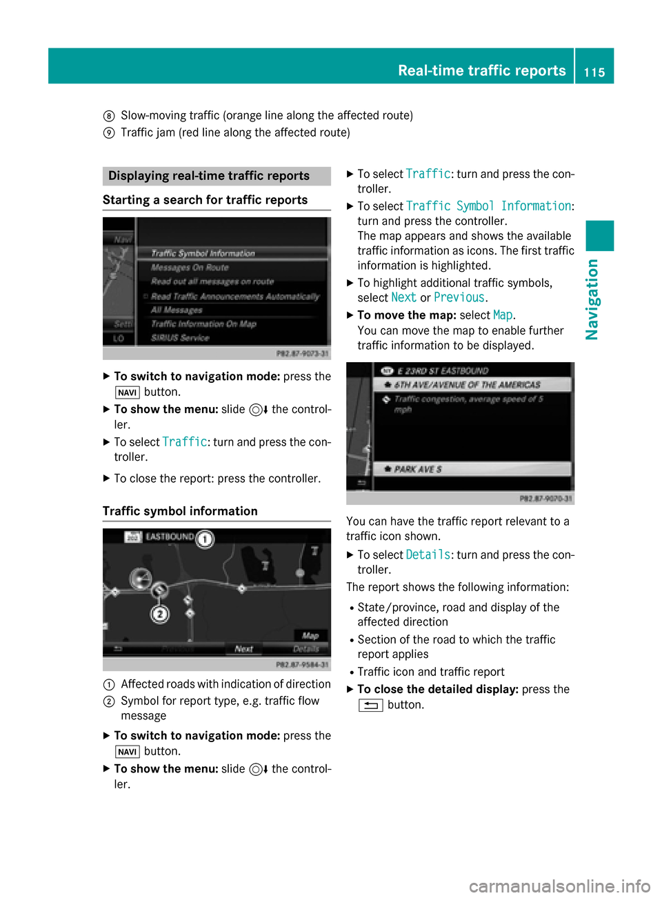
Starting a search for traffic reports X
To switch to navigation mode: press the
00BE button.
X To show the menu: slide6the control-
ler.
X To select Traffic
Traffic: turn and press the con-
troller.
X To close the report: press the controller.
Traffic symbol information 0043
Affected roads with indication of direction
0044 Symbol for report type, e.g. traffic flow
message
X To switch to navigation mode: press the
00BE button.
X To show the menu: slide6the control-
ler. X
To select Traffic Traffic: turn and press the con-
troller.
X To select Traffic Traffic Symbol
SymbolInformation
Information:
turn and press the controller.
The map appears and shows the available
traffic information as icons. The first traffic
information is highlighted.
X To highlight additional traffic symbols,
select Next NextorPrevious
Previous.
X To move the map: selectMap
Map.
You can move the map to enable further
traffic information to be displayed. You can have the traffic report relevant to a
traffic icon shown.
X To select Details Details: turn and press the con-
troller.
The report shows the following information:
R State/province, road and display of the
affected direction
R Section of the road to which the traffic
report applies
R Traffic icon and traffic report
X To close the detailed display: press the
0038 button. Real-time traffic reports
115Navigation Z