Page 83 of 175

Navigation System83
Information Features
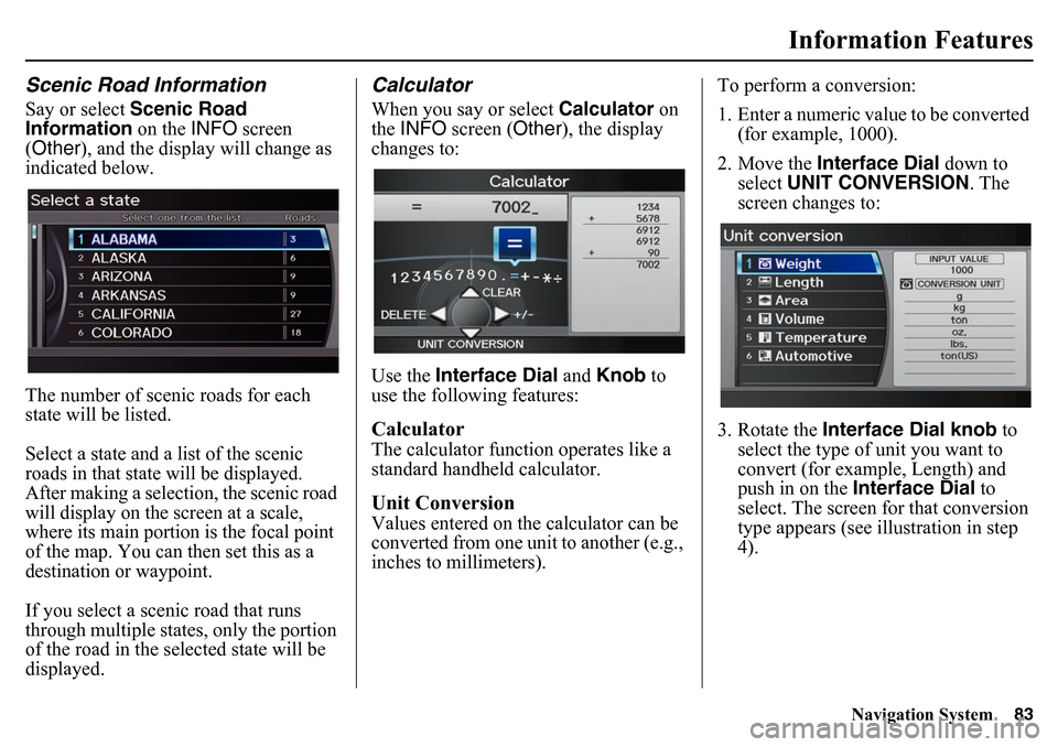
Scenic Road InformationSay or select Scenic Road
Information on the INFO screen
(Other ), and the display will change as
indicated below.
The number of scenic roads for each
state will be listed.Select a state and a list of the scenic
roads in that state will be displayed.
After making a selection, the scenic road
will display on the screen at a scale,
where its main portion is the focal point
of the map. You can then set this as a
destination or waypoint.If you select a scenic road that runs
through multiple states, only the portion
of the road in the selected state will be
displayed.
CalculatorWhen you say or select Calculator on
the INFO screen ( Other), the display
changes to:
Use the Interface Dial and Knob to
use the following features:CalculatorThe calculator function operates like a
standard handheld calculator.Unit ConversionValues entered on the calculator can be
converted from one unit to another (e.g.,
inches to millimeters). To perform a conversion:
1. Enter a numeric value to be converted
(for example, 1000).
2. Move the Interface Dial down to
select UNIT CONVERSION . The
screen changes to:
3. Rotate the Interface Dial knob to
select the type of unit you want to
convert (for example, Length) and
push in on the Interface Dial to
select. The screen for that conversion
type appears (see illustration in step
4).
Page 103 of 175

Navigation System103
System Setup
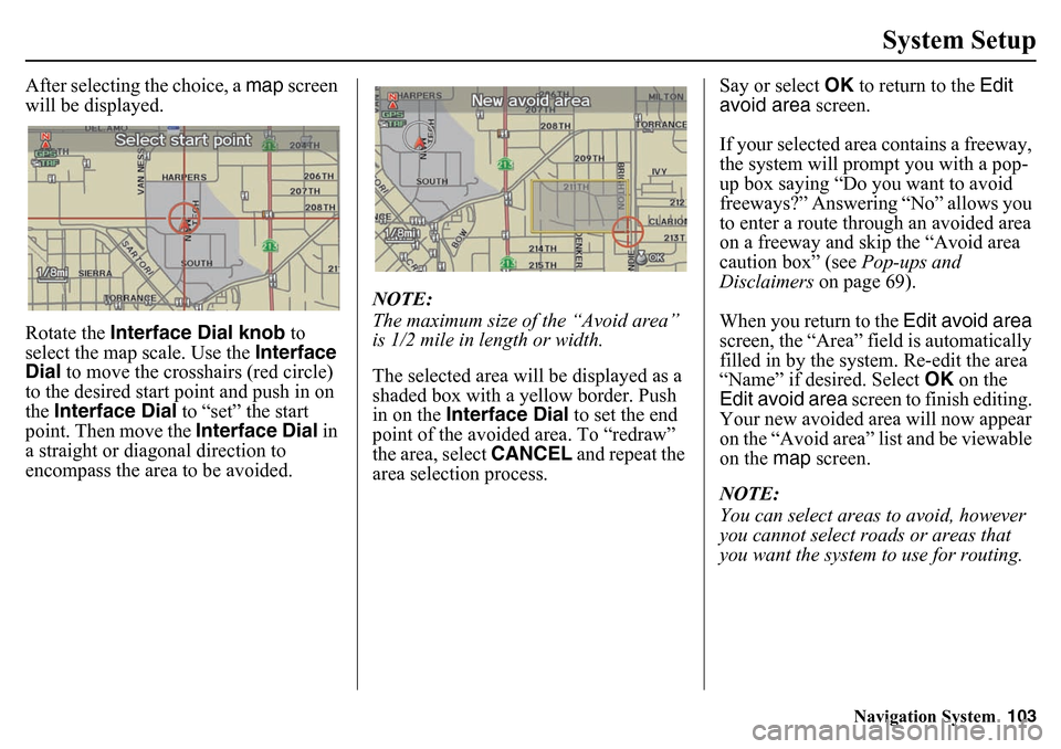
After selecting the choice, a map screen
will be displayed.
Rotate the Interface Dial knob to
select the map scale. Use the Interface
Dial to move the crosshairs (red circle)
to the desired start point and push in on
the Interface Dial to “set” the start
point. Then move the Interface Dial in
a straight or diagonal direction to
encompass the area to be avoided. NOTE:
The maximum size of the “Avoid area”
is 1/2 mile in length or width.
The selected area will be displayed as a
shaded box with a yellow border. Push
in on the
Interface Dial to set the end
point of the avoided area. To “redraw”
the area, select CANCEL and repeat the
area selection process. Say or select
OK to return to the Edit
avoid area screen.
If your selected area contains a freeway,
the system will prompt you with a pop-
up box saying “Do you want to avoid
freeways?” Answering “No” allows you
to enter a route through an avoided area
on a freeway and skip the “Avoid area
caution box” (see Pop-ups and
Disclaimers on page 69).
When you return to the Edit avoid area
screen, the “Area” field is automatically
filled in by the sy stem. Re-edit the area
“Name” if desired. Select OK on the
Edit avoid area screen to finish editing.
Your new avoided area will now appear
on the “Avoid area” list and be viewable
on the map screen.
NOTE:
You can select areas to avoid, however
you cannot select ro ads or areas that
you want the system to use for routing.
Page 118 of 175

118
Navigation System
System InitializationSystem InitializationIf for any reason you lose power to the
vehicle (e.g., the battery was
disconnected), the navigation system
will require initialization.
The navigation system supports a VIN-
recognition anti-theft system. If the
correct navigation system is installed in
the vehicle, you do not need to enter a
code as shown on the screen below.
If this screen appears, press and hold the
audio power button for two seconds to
resume system operation. The system
may need a few moments to reacquire
the GPS signal.
Entering the Security CodeIf another system has been installed in
the vehicle, you will have to enter a
security code for the audio and
navigation system before you can use it
again.
Visit http://radio-navicode.honda.com/
to retrieve the 5-digit security code for
your vehicle, or contact your dealer.
Enter the 5-digit security code in
accordance with the owner’s manual for
your vehicle. If you do not enter the
security code, the navigation and audio
voice will not function.
NOTE:
The anti-theft security code is unrelated
to your optional navigation system PIN
(for Address Book or Home Address).
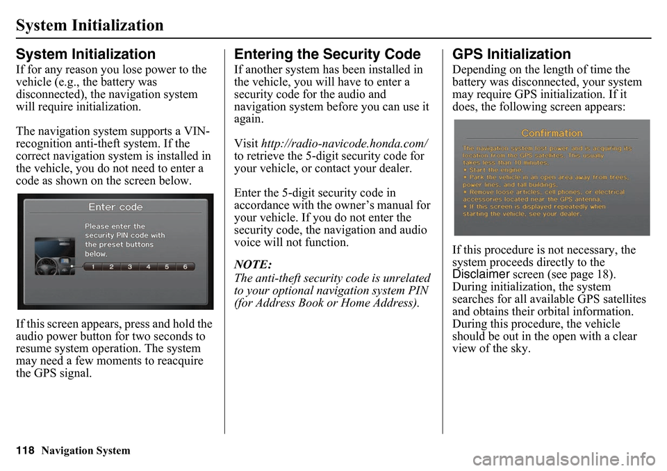
GPS InitializationDepending on the length of time the
battery was disconnected, your system
may require GPS initialization. If it
does, the following screen appears:
If this procedure is not necessary, the
system proceeds directly to the
Disclaimer screen (see page 18).
During initialization, the system
searches for all available GPS satellites
and obtains their orbital information.
During this procedure, the vehicle
should be out in the open with a clear
view of the sky.