2014 MERCEDES-BENZ C-Class phone
[x] Cancel search: phonePage 82 of 270
The search results display the following infor-
mation:
R an arrow that shows the linear direction to
the point of interest
R the linear distance to the POI
R the name of the POI
i The arrow and linear distance to the des-
tination are not visible if you have entered a POI after entering another city.
The arrow is also not shown when search-
ing for a POI in the vicinity of the destina-
tion.
Depending on the POI selected, COMAND
uses different reference points in deter-
mining the linear distance to the destina-
tion:
R vicinity of current position: the linear dis-
tance is the distance of the point of inter-
est from the current vehicle position.
R vicinity of destination: the linear distance
is the distance from the destination
entered to the point of interest.
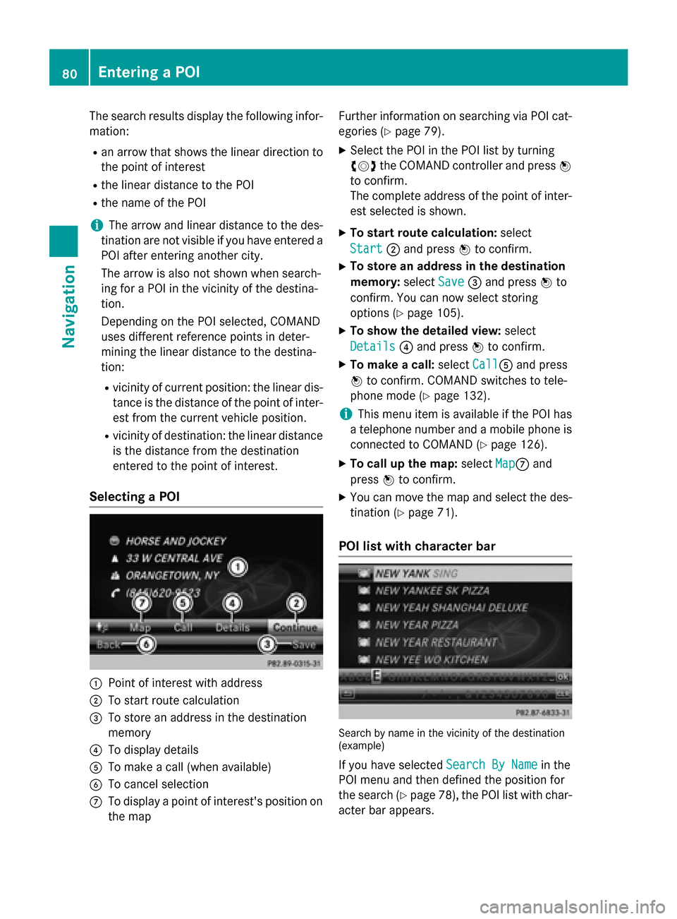
Selecting a POI 0043
Point of interest with address
0044 To start route calculation
0087 To store an address in the destination
memory
0085 To display details
0083 To make a call (when available)
0084 To cancel selection
006B To display a point of interest's position on
the map Further information on searching via POI cat-
egories (Y page 79).
X Select the POI in the POI list by turning
00790052007A the COMAND controller and press 0098
to confirm.
The complete address of the point of inter-
est selected is shown.
X To start route calculation: select
Start
Start 0044and press 0098to confirm.
X To store an address in the destination
memory: selectSave Save0087and press 0098to
confirm. You can now select storing
options (Y page 105).
X To show the detailed view: select
Details
Details 0085and press 0098to confirm.
X To make a call: selectCall
Call0083 and press
0098 to confirm. COMAND switches to tele-
phone mode (Y page 132).
i This menu item is available if the POI has
a telephone number and a mobile phone is
connected to COMAND (Y page 126).
X To call up the map: selectMap
Map006B and
press 0098to confirm.
X You can move the map and select the des-
tination (Y page 71).
POI list with character bar Search by name in the vicinity of the destination
(example)
If you have selected Search By Name Search By Namein the
POI menu and then defined the position for
the search (Y page 78), the POI list with char-
acter bar appears. 80
Entering a POINavigation
Page 83 of 270
Depending on your selection, you can select
all available points of interest on the digital
map or the points of interest in the vicinity of the selected position.
X Proceed as described in "Searching for a
phone book entry" (Y page 137).
If COMAND can assign the characters
entered to one entry unambiguously, the
address entry appears automatically.
X To start route calculation: selectStart
Start
and press 0098to confirm. ZAGAT
®
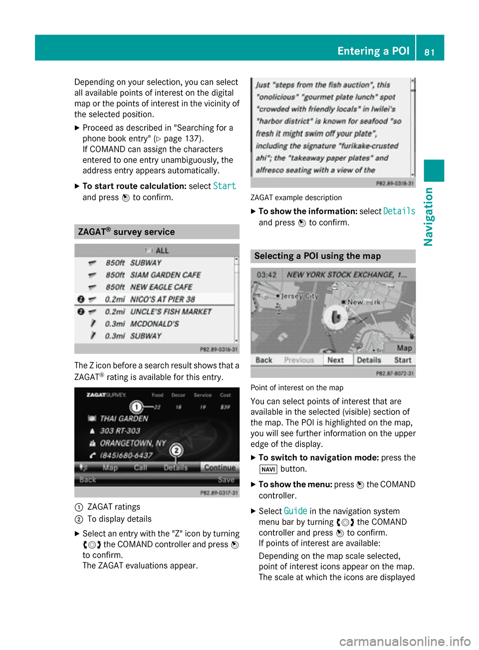
survey service The Z icon before a search result shows that a
ZAGAT ®
rating is available for this entry. 0043
ZAGAT ratings
0044 To display details
X Select an entry with the "Z" icon by turning
00790052007A the COMAND controller and press 0098
to confirm.
The ZAGAT evaluations appear. ZAGAT example description
X To show the information: selectDetails Details
and press 0098to confirm. Selecting a POI using the map
Point of interest on the map
You can select points of interest that are
available in the selected (visible) section of
the map. The POI is highlighted on the map,
you will see further information on the upper
edge of the display.
X To switch to navigation mode: press the
00BE button.
X To show the menu: press0098the COMAND
controller.
X Select Guide Guidein the navigation system
menu bar by turning 00790052007Athe COMAND
controller and press 0098to confirm.
If points of interest are available:
Depending on the map scale selected,
point of interest icons appear on the map.
The scale at which the icons are displayed Entering a POI
81Navigation Z
Page 88 of 270
Selection Explanation
Not Classi‐
Not Classi‐
fied fied Standard entry for per-
sonal points of interest.
COMAND COMAND Personal POIs which you
have imported via the
online function
(Y
page 171). Coffee Coffee
Shops
Shops Symbol and category that
you have created yourself
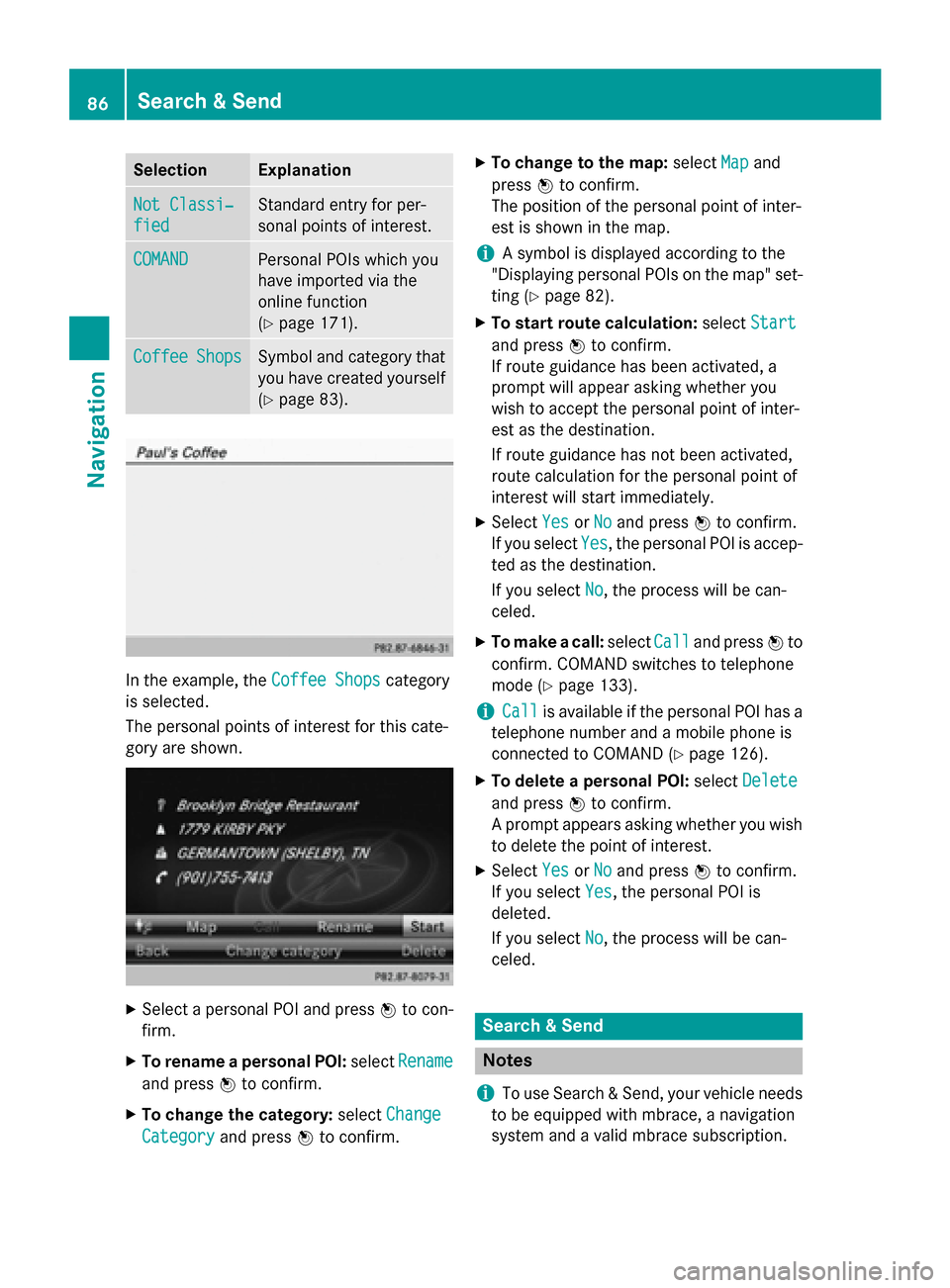
(Y page 83). In the example, the
Coffee Shops
Coffee Shopscategory
is selected.
The personal points of interest for this cate-
gory are shown. X
Select a personal POI and press 0098to con-
firm.
X To rename a personal POI: selectRename Rename
and press 0098to confirm.
X To change the category: selectChange
Change
Category
Category and press0098to confirm. X
To change to the map: selectMap
Mapand
press 0098to confirm.
The position of the personal point of inter-
est is shown in the map.
i A symbol is displayed according to the
"Displaying personal POIs on the map" set- ting (Y page 82).
X To start route calculation: selectStart Start
and press 0098to confirm.
If route guidance has been activated, a
prompt will appear asking whether you
wish to accept the personal point of inter-
est as the destination.
If route guidance has not been activated,
route calculation for the personal point of
interest will start immediately.
X Select Yes YesorNo
No and press 0098to confirm.
If you select Yes
Yes, the personal POI is accep-
ted as the destination.
If you select No No, the process will be can-
celed.
X To make a call: selectCall
Calland press 0098to
confirm. COMAND switches to telephone
mode (Y page 133).
i Call Call
is available if the personal POI has a
telephone number and a mobile phone is
connected to COMAND (Y page 126).
X To delete a personal POI: selectDelete Delete
and press 0098to confirm.
A prompt appears asking whether you wish to delete the point of interest.
X Select Yes
YesorNo
No and press 0098to confirm.
If you select Yes
Yes, the personal POI is
deleted.
If you select No No, the process will be can-
celed. Search & Send
Notes
i To use Search & Send, your vehicle needs
to be equipped with mbrace, a navigation
system and a valid mbrace subscription. 86
Search & SendNavigation
Page 93 of 270
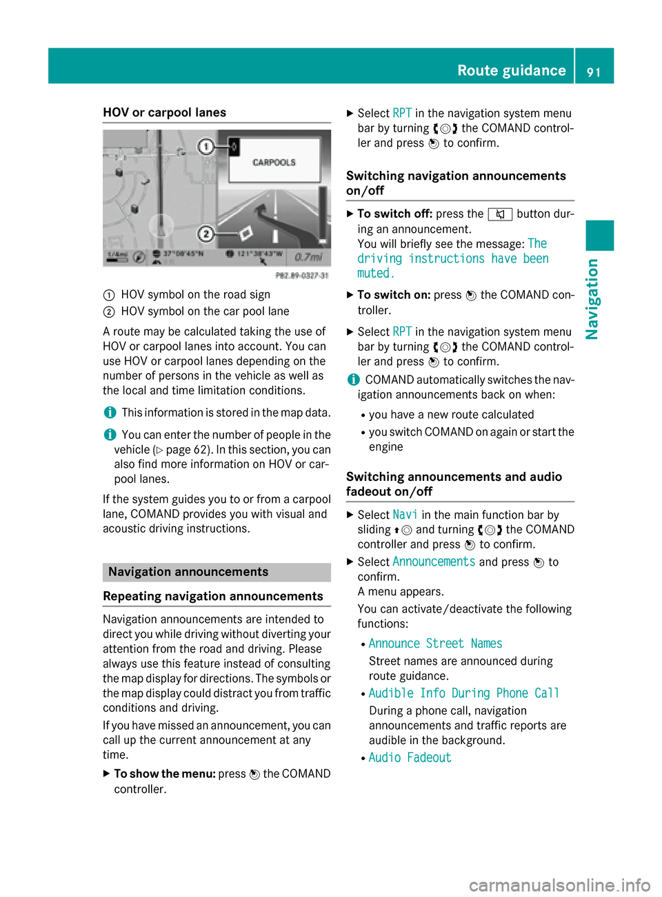
HOV or carpool lanes
0043
HOV symbol on the road sign
0044 HOV symbol on the car pool lane
A route may be calculated taking the use of
HOV or carpool lanes into account. You can
use HOV or carpool lanes depending on the
number of persons in the vehicle as well as
the local and time limitation conditions.
i This information is stored in the map data.
i You can enter the number of people in the
vehicle (Y page 62). In this section, you can
also find more information on HOV or car-
pool lanes.
If the system guides you to or from a carpool
lane, COMAND provides you with visual and
acoustic driving instructions. Navigation announcements
Repeating navigation announcements Navigation announcements are intended to
direct you while driving without diverting your attention from the road and driving. Please
always use this feature instead of consulting
the map display for directions. The symbols or the map display could distract you from traffic
conditions and driving.
If you have missed an announcement, you can call up the current announcement at any
time.
X To show the menu: press0098the COMAND
controller. X
Select RPT
RPT in the navigation system menu
bar by turning 00790052007Athe COMAND control-
ler and press 0098to confirm.
Switching navigation announcements
on/off X
To switch off: press the0063button dur-
ing an announcement.
You will briefly see the message: The The
driving instructions have been
driving instructions have been
muted. muted.
X To switch on: press0098the COMAND con-
troller.
X Select RPT
RPTin the navigation system menu
bar by turning 00790052007Athe COMAND control-
ler and press 0098to confirm.
i COMAND automatically switches the nav-
igation announcements back on when:
R you have a new route calculated
R you switch COMAND on again or start the
engine
Switching announcements and audio
fadeout on/off X
Select Navi Naviin the main function bar by
sliding 00970052and turning 00790052007Athe COMAND
controller and press 0098to confirm.
X Select Announcements Announcements and press0098to
confirm.
A menu appears.
You can activate/deactivate the following
functions:
R Announce Street Names Announce Street Names
Street names are announced during
route guidance.
R Audible Info During Phone Call Audible Info During Phone Call
During a phone call, navigation
announcements and traffic reports are
audible in the background.
R Audio Fadeout Audio Fadeout Route guidance
91Navigation Z
Page 96 of 270
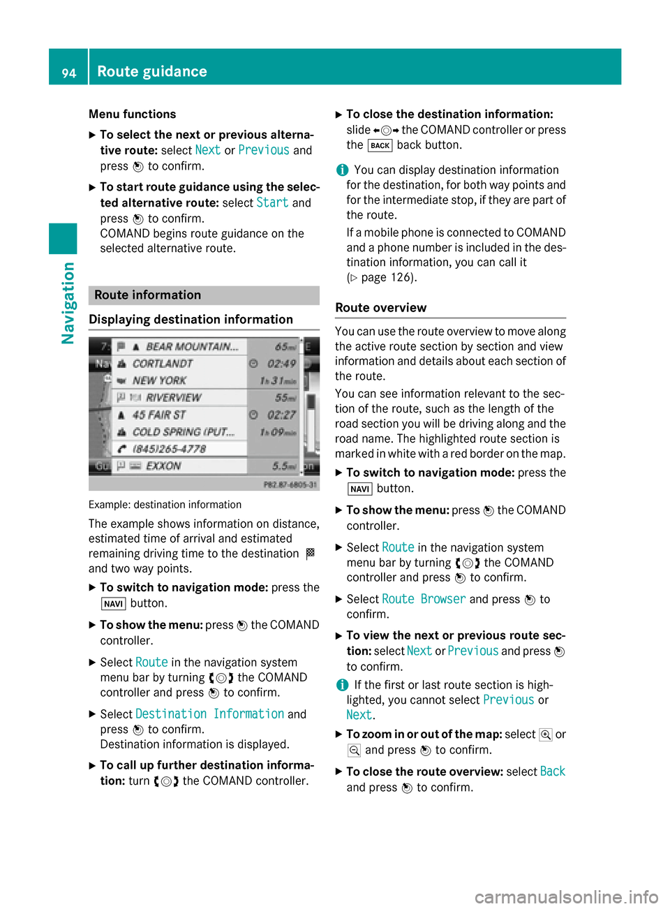
Menu functions
X To select the next or previous alterna-
tive route: selectNext NextorPrevious
Previous and
press 0098to confirm.
X To start route guidance using the selec-
ted alternative route: selectStart
Start and
press 0098to confirm.
COMAND begins route guidance on the
selected alternative route. Route information
Displaying destination information Example: destination information
The example shows information on distance,
estimated time of arrival and estimated
remaining driving time to the destination 004B
and two way points.
X To switch to navigation mode: press the
00BE button.
X To show the menu: press0098the COMAND
controller.
X Select Route Routein the navigation system
menu bar by turning 00790052007Athe COMAND
controller and press 0098to confirm.
X Select Destination Information
Destination Information and
press 0098to confirm.
Destination information is displayed.
X To call up further destination informa-
tion: turn00790052007A the COMAND controller. X
To close the destination information:
slide 009500520096 the COMAND controller or press
the 003D back button.
i You can display destination information
for the destination, for both way points and
for the intermediate stop, if they are part of the route.
If a mobile phone is connected to COMANDand a phone number is included in the des- tination information, you can call it
(Y page 126).
Route overview You can use the route overview to move along
the active route section by section and view
information and details about each section of the route.
You can see information relevant to the sec-
tion of the route, such as the length of the
road section you will be driving along and the road name. The highlighted route section is
marked in white with a red border on the map.
X To switch to navigation mode: press the
00BE button.
X To show the menu: press0098the COMAND
controller.
X Select Route Routein the navigation system
menu bar by turning 00790052007Athe COMAND
controller and press 0098to confirm.
X Select Route Browser Route Browser and press0098to
confirm.
X To view the next or previous route sec-
tion: select Next NextorPrevious
Previous and press0098
to confirm.
i If the first or last route section is high-
lighted, you cannot select Previous
Previousor
Next
Next.
X To zoom in or out of the map: select004Aor
0049 and press 0098to confirm.
X To close the route overview: selectBack
Back
and press 0098to confirm. 94
Route guidanceNavigation
Page 109 of 270
X
Select Yes
YesorNo
No and press 0098to confirm.
If you select Yes
Yes, COMAND deletes the
destination. You will see a message to this effect.
If you select No No, the process will be can-
celed.
i If the navigable address data for the des-
tination being deleted is also assigned to an
address book entry, COMAND will also
delete this data from there. If the corre-
sponding address book entry does not con-
tain any further data, such as telephone
numbers, COMAND deletes the entire
address book entry. Previous destinations
Introduction
COMAND automatically stores the previous
destinations for which route calculation has
been started. If the memory is full, COMAND deletes the oldest destination. You can also
save a destination from the list of previous
destinations in the destination memory. It will
be stored there permanently. Storing a destination permanently in
the destination memory
X Proceed as described in the "From the list
of previous destinations" section
(Y page 70). Storing the vehicle position in the list
of previous destinations
X To switch on navigation mode: press the
00BE function button.
X To show the menu: press0098the COMAND
controller. X
Select Position
Position in the navigation system
menu bar by turning 00790052007Athe COMAND
controller and press 0098to confirm.
X Select Save SaveVehicle
Vehicle Position
Position and press
0098 to confirm.
COMAND stores the current vehicle posi-
tion as a destination in the list of previous
destinations. Storing the crosshair position in the
list of previous destinations
A crosshair appears on the map if you have
moved the map manually (Y page 108). You
can store the crosshair position as a destina-
tion in the list of previous destinations.
X To show the menu: press0098the COMAND
controller.
X Select Position Position in the navigation system
menu bar by turning 00790052007Athe COMAND
controller and press 0098to confirm.
X Select Save Crosshair Position
Save Crosshair Position and
press 0098to confirm. Deleting one of the previous destina-
tions
X To switch on navigation mode: press the
00BE function button.
X To show the menu: press0098the COMAND
controller.
X Select Destination
Destination in the navigation sys-
tem menu bar by turning 00790052007Athe
COMAND controller and press 0098to con-
firm.
X Select From Last Destinations From Last Destinations and
press 0098to confirm.
The list of last destinations appears.
X Select the desired destination and press 0098
to confirm.
The destination address appears. Previous destinations
107Navigation Z
Page 119 of 270

X
Select Yes
YesorNo
No.
If you select Yes
Yes, the entry is deleted.
If you select No
No, the process will be can-
celed. SIRIUS XM service
Displaying SIRIUS XM service informa-
tion You can display the SIRIUS XM service infor-
mation.
X To show the menu: press0098the COMAND
controller.
X Select Navi
Navi in the main function bar by
sliding 00970052and turning 00790052007Athe COMAND
controller and press 0098to confirm.
X Select SIRIUS Service
SIRIUS Service and press0098to
confirm.
The window on the right half of the display shows the telephone number of the pro-
vider (SIRIUS XM) and the serial number of
your service module.
Registering for the SIRIUS XM traffic
report service X
Call the traffic report provider's phone
number shown on the screen.
i You can also have the satellite service
activated online. To do so, visit the SIRIUS
XM Radio website at
http://www.sirius.com (USA).
Once the connection has been established: X Follow the instructions of the operator.
The activation process may take up to ten
minutes.
If registration is not included when purchas-
ing the system, your credit card details will be required to activate your account. Compass function
You can view the current direction of travel,
the current height and the coordinates of the current vehicle position in the compass view.
X To switch to navigation mode: press the
00BE button.
X To show the menu: press0098the COMAND
controller.
X Select Position Position in the navigation system
menu bar by sliding 00520064and turning 00790052007A
the COMAND controller and press 0098to
confirm.
X Select Compass
Compass and press 0098to confirm. Example: compass
0043
Current direction of travel
0044 Current height above average sea level
(rounded)
0087 Current vehicle position: longitude coor-
dinates
0085 Number of GPS satellites currently being
used
0083 Current vehicle position: latitude coordi-
nates
0084 Currently set steering angle of the front
wheels
i To display current elevation
0044, the sys-
tem must be able to receive at least four
satellites. Steering angle 0084can be a max-
imum of 35° in both directions.
X To exit the display: confirmBack Backby press-
ing 0098or press the 0038back button. Additional settings
117Navigation Z
Page 125 of 270
Your COMAND equipment
................124
General notes .................................... 124
Telephony via the Bluetooth ®
inter-
face .................................................... 125
Reception and transmission vol-
ume .................................................... 131
Using the telephone .........................132
Using the phone book ......................136
Using call lists ................................... 140
Using the speed dial list ...................142
Text messages .................................. 144
Using the address book ...................146 123Telephone