Page 87 of 236
Before Use
Navigation l
3-5
About Voice Guidance
During destination guidance, voice guidance
will be provided when reaching an intersec-
tion or nearby the destination.
Voice Guidance
Voice guidance is provided in the following
instances.
Example of voice guidance during destina-
tion guidance
• In front of an intersection :
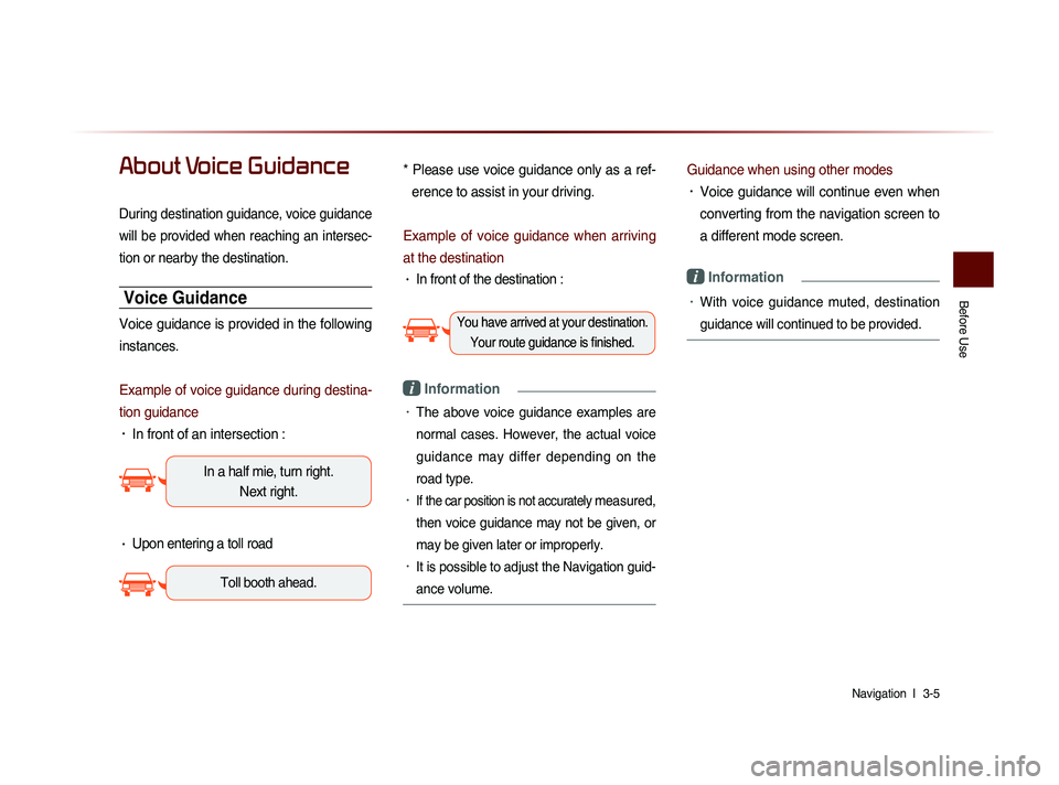
In a half mie, turn right.
Next right.
• Upon entering a toll road
Toll booth ahead.
* Please use voice guidance only as a ref-
erence to assist in your driving.
Example of voice guidance when arriving
at the destination
• In front of the destination :
You have arrived at your destination. Your route guidance is finished.
i Information
• The above voice guidance examples are
normal cases. However, the actual voice
guidance may differ depending on the
road type.
• If the car position is not accurately measured,
then voice guidance may not be given, or
may be given later or improperly.
• It is possible to adjust the Navigation guid-
ance volume.
Guidance when using other modes
• Voice guidance will continue even when
converting from the navigation screen to
a different mode screen.
i Information
• With voice guidance muted, destination
guidance will continued to be provided.
Page 88 of 236
3-6
About GPS
GPS (Global Positioning System) :
GPS is a system developed and operated
by the United States which determines the
current location of the user (Longitude/
Latitude, Coordinates, etc.) by generally
using 4 or more satellites. This system is
used with related GPS information, various
sensors, road map data, and other related
information for the purposes of navigation.
For more information on GPS, refer to Part
6 ‘GPS Information’.
Before Use
Page 89 of 236
Starting Navigation
Navigation l
3-7
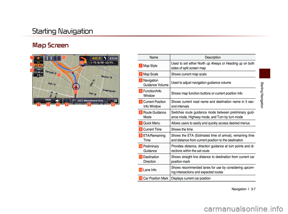
Map Screen
Starting Navigation
6
10
1234
13
127
8
9
Name Description
1 Map Style Used to set either North up Always or Heading up on both
sides of split screen map
2 Map Scale Shows current map scale
3 Navigation
Guidance Volume Used to adjust navigation guidance volume
4 Function/Info
Window Shows map function buttons or current position info
5 Current Position
Info Window Shows current road name and destination name in 5 sec-
ond intervals
6 Route Guidance
Mode Switches route guidance mode between preliminary guid-
ance mode, Highway mode, and Turn by turn mode
7 Quick Menu Allows users to easily and quickly access desired menus
8 Current Time Shows the time
9 ETA/Remaining
Time Shows the ETA (Estimated time of arrival), remaining time
and distance from current position to the destination
10 Preliminary
Guidance Provides distance, direction guidance at turn points and di-
rections within the set route
11 Destination
Direction Shows straight line distance to destination from current car
position mark
12 Lane Info
Shows recommended lanes for use by considering upcom-
ing intersections and expected routes
13 Car Position Mark Displays current car position
5
11
Page 90 of 236
3-8
Initial Screen
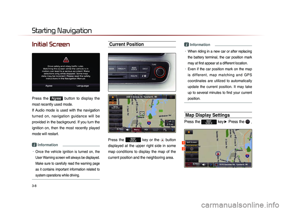
Press the Agree button to display the
most recently used mode.
If Audio mode is used with the navigation
turned on, navigation guidance will be
provided in the background. If you turn the
ignition on, then the most recently played
mode will restart.
i Information
• Once the vehicle ignition is turned on, the
User Warning screen will always be displayed.
Make sure to carefully read the warning page
as it contains important information related to
system operations while driving.
Current Position
Press the MAP
VOICE key or the button
displayed at the upper right side in some
map conditions to display the map of the
current position and the neighboring area.
i Information
• When riding in a new car or after replacing
the battery terminal, the car position mark
may at first appear at a different location.
• Even if the car position mark on the map
i s d i f f e r e n t , m a p m a t c h i n g a n d G P S
coordinates are utilized to automatically
update the current position. It may take
up to several minutes to find your current
position.
Map Display Settings
Press the MAP
VOICE key ▶ Press the
.
Starting Navigation
1
2
Page 91 of 236
Starting Navigation
Navigation l
3-9
This button is used to set map screen
related options, such as Split screen,
H e a d i n g - U p /N o r th U p , a n d L e ft/R i g h t
screen display.
Name Description
1 Split Screen/
Single ScreenSelect between Split Screen
or Single Screen Map
2 Heading-Up/
North-Up Display Map in Vehicle Trav-
eling Direction (Heading-Up)
or North-Up direction
i Information
• The Heading-Up/North-Up, 2D, and map
scale adjustments can be used when
using Split Screen map.
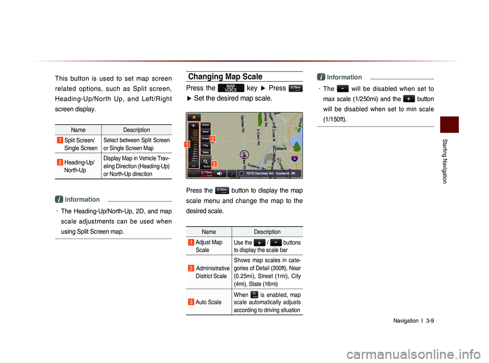
Changing Map Scale
Press the MAP
VOICE key ▶ Press
▶ Set the desired map scale.
Press the button to display the map
scale menu and change the map to the
desired scale.
Name Description
1 Adjust Map
ScaleUse the + / - buttons
to display the scale bar
2 Administrative
District Scale Shows map scales in cate-
gories of Detail (300ft), Near
(0.25mi), Street (1mi), City
(4mi), State (16mi)
3 Auto Scale
When
is enabled, map
scale automatically adjusts
according to driving situation
i Information
• The - will be disabled when set to
max scale (1/250mi) and the
+
button
will be disabled when set to min scale
(1/150ft).
3
12
Page 92 of 236
3-10
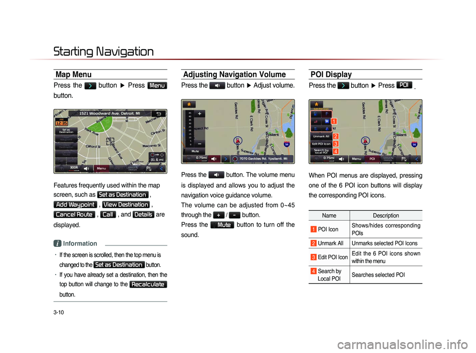
Map Menu
Press the > button ▶ Press Menu
button.
Features frequently used within the map
screen, such as
Set as Destination ,
Add Waypoint , View Destination ,
Cancel Route , Call , and Details are
displayed.
i Information
• If the screen is scrolled, then the top menu is
changed to the
Set as Destination button.
• If you have already set a destination, then the
top button will change to the
Recalculate
button.
Adjusting Navigation Volume
Press the button ▶ Adjust volume.
Press the button. The volume menu
is displayed and allows you to adjust the
navigation voice guidance volume.
The volume can be adjusted from 0~45
through the
+ / - button.
Press the
Mute button to turn off the
sound.
POI Display
Press the > button ▶ Press POI
.
When POI menus are displayed, pressing
one of the 6 POI icon buttons will display
the corresponding POI icons.
Name Description
1 POI IconShows/hides corresponding
POIs
2 Unmark All Unmarks selected POI Icons
3 Edit POI Icon Edit the 6 POI icons shown
within the menu
4 Search by
Local POI Searches selected POI
Starting Navigation
1
2
3
4
Page 93 of 236
Starting Navigation
Navigation l
3-11
Editing POI Icons
Press POI ▶ Press the Edit POI Icon
button ▶ Press
Done
.
Press the Edit POI Icon button to select
the desired facility from the various facility
types.
Up to six favorite facilities can be set.
Press the Default button to reset the dis-
played POI icons.
Initially, Gas Station, Parking, Fast Food,
Hospital, Auto Service, and Bank are set
as default.
Searching POIs
Press the Search by local POI button ▶
Press the search criteria
(
Near current position , Near scroll mark
, or
Near destination ).
1
2
3
Page 94 of 236
3-12
NameDescription
1 Near Current
Position Within the ‘Search by POI’
menu, searches facilities
based on the current ve-
hicle position
2 Near Scroll
Mark Within the ‘Search by POI’
m e n u , s e a r c h e s f a c i l i -
ties based on the current
scrolled position
3 Near
Destination
Within the ‘Search by POI’
menu, searches facilities
b a s e d o n th e l o c a t i o n o f
the destination
The POI mark is displayed according to
the selected criteria.
i Information
• W h e n s e a r c h i n g P O I s , y o u c a n o n l y
search POIs within selected categories.
• The Near scroll mark menu is enabled
only when the map has been scrolled.
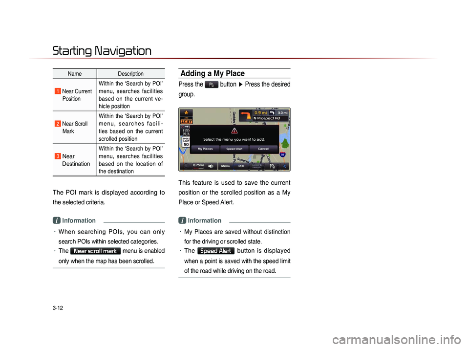
Adding a My Place
Press the button ▶ Press the desired
group.
This feature is used to save the current
position or the scrolled position as a My
Place or Speed Alert.
i Information
• My Places are saved without distinction
for the driving or scrolled state.
• The Speed Alert button is displayed
when a point is saved with the speed limit
of the road while driving on the road.
Starting Navigation