Page 97 of 260
96
Driving to Your DestinationViewing the Route
Navigation
•If Unverified Area Routing is ON,
the route line changes to a dashed
blue-pink line to indicate that the
route line uses unverified streets.
If you leave the calculated route, the system automatically recalculates a route to the
desired destination based on your current location and direction.
2Rerouting P. 49
Blue-pink route line
■Deviating From the Planned Route1 Deviating From the Planned Route
If Rerouting is set to MANUAL and you go off
route, the system wait s for you to manually
initiate recalculation. Rotate i to select
Recalculation and press u.
2 Rerouting P. 49
QRG
Page 98 of 260
97
Driving to Your DestinationViewing the Route
If you leave all mapped (digitized) roads, the system automa tically starts displaying a
series of dots (breadcrumbs) to track the path you are taking. If needed, you can
follow the dots back to the mapp ed road you originally left.
2Off-road Tracking P. 60
■Driving Off-road1 Driving Off-road
A message “Not on a digi tized road” may appear
when you drive half a mi le away from a mapped
road.
Breadcrumbs may occasionally be displayed in
urban areas, such as large parking lots in
shopping malls, in new subdivisions where the
roads are not yet in the database, or in areas
where a GPS signal is unavailable, such as in a
parking garage.
Off-road tracking breadcrumbs are limited to
approximately 150 miles. Breadcrumbs at the
beginning of the trail are deleted if you exceed
that distance.
Breadcrumbs are displayed only at 1/20, 1/8, 1/4,
and 1/2 mile map scales.
QRG
Navigation
Page 99 of 260

98
Driving to Your DestinationListening to Voice Guidance
Navigation
Listening to Voice Guidance
HENTER button (on map) Voice
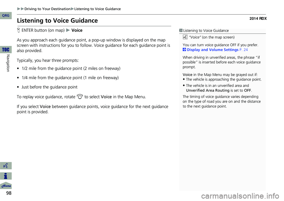
As you approach each guidance point, a pop-up window is displayed on the map
screen with instructions fo r you to follow. Voice guidance for each guidance point is
also provided.
Typically, you hear three prompts:
• 1/2 mile from the guidance point (2 miles on freeway)
• 1/4 mile from the guidance point (1 mile on freeway)
• Just before the guidance point
To replay voice guidance, rotate i to select Voice in the Map Menu.
If you select Voice between guidance points, voice guidance for the next guidance
point is provided.1 Listening to Voice Guidance
d “Voice” (on the map screen)
You can turn voice guidance OFF if you prefer.
2 Display and Volume Settings P. 24
When driving in unverified areas, the phrase “if
possible” is inserted before each voice guidance
prompt.
Voice in the Map Menu may be grayed out if:
•The vehicle is approaching the guidance point.
•The vehicle is in an unverified area and
Unverified Area Routing is set to OFF.
The timing of voice guida nce varies depending
on the type of road you are on and the distance
to the next guidance point.
QRG
Page 100 of 260

99
Map Menu
Displaying the Map Menu
Use the Map Menu to control the icons displayed on the screen and to display traffic
information, weather information, and messa ges. You can also use the Map Menu
to find locations or to cancel the route.
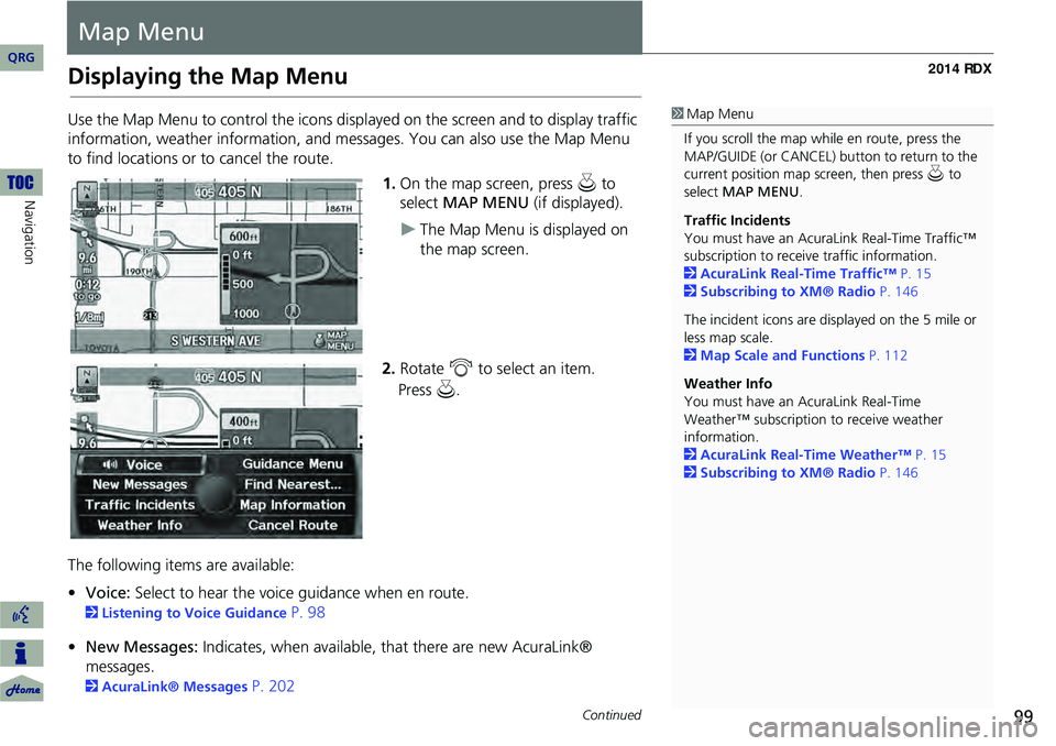
1.On the map screen, press u to
select MAP MENU (if displayed).
The Map Menu is displayed on
the map screen.
2. Rotate i to select an item.
The following items are available:
• Voice: Select to hear the voice guidance when en route.
2Listening to Voice Guidance P. 98
• New Messages: Indicates, when available, that there are new AcuraLink®
messages.
2 AcuraLink® Messages P. 202
1Map Menu
If you scroll the map while en route, press the
MAP/GUIDE (or CANCEL) button to return to the
current position map screen, then press u to
select MAP MENU .
Traffic Incidents
You must have an AcuraL ink Real-Time Traffic™
subscription to receive traffic information.
2 AcuraLink Real-Time Traffic™ P. 15
2 Subscribing to XM® Radio P. 146
The incident icons are displayed on the 5 mile or
less map scale.
2 Map Scale and Functions P. 112
Weather Info
You must have an AcuraLink Real-Time
Weather™ subscription to receive weather
information.
2 AcuraLink Real-Time Weather™ P. 15
2 Subscribing to XM® Radio P. 146
Continued
QRG
Navigation
Press u .
Page 101 of 260
100
Map MenuDisplaying the Map Menu
Navigation
•Traffic Incidents: Displays a list of the traffic incidents around your current
location or on your current route.
2 Traffic Rerouting™ P. 120
• Weather Info: Allows you to view the weather forecast, warning list, warning
map, and radar image map.
2 Weather Information P. 115
• Guidance Menu: Allows you to set or confirm the guidance points and freeway
exits for your route.
2 Guidance Menu P. 101
• Find Nearest…: Allows you to find the nearest place/landmark (e.g., nearest gas
station) by specifying a category. You ca n then add the location to the list of
destinations, set as a waypoint, or set as your destination.
2Changing Your Destination P. 129
• Map Information: Allows you to select the info rmation icons to display on the
map, change the orientation of the ma p, or display your current location.
2Map Information P. 106
• Cancel Route: Cancels your current route.
2Canceling the Route P. 123
QRG
Page 102 of 260
101
Map MenuGuidance Menu
Guidance Menu
HENTER button (on map) Guidance Menu
Display the guidance points and freeway ex its for your route, and set the display
mode for the map and guidance screens.
Rotate i to select an item. Press u.
The following items are available:
• Directions : Displays a list of the guidance points.
2Directions P. 102
• Exit Info : Displays a list of the freeway exits.
2Freeway Exit Information P. 103
• Guidance Mode : Selects the guidance display mode.
2Guidance Mode P. 104
Continued
QRG
Navigation
Page 103 of 260
102
Map MenuGuidance Menu
Navigation
HENTER button (on map) Guidance Menu Directions
Display a list of the guidance points on your route for your confirmation. 1.Rotate i to select a guidance
point from the list. Press u.
The system displays a map of
the guidance point.
2. Press u to select RETURN or press
the CANCEL button to return to
the previous screen.
■ Directions1 Directions
Guidance points with exit information are
indicated by a (freeway exit information)
icon. Move y to select Exit Info to display the
exit information.
2 Freeway Exit Information P. 103
The route guidance inform ation is automatically
deleted when you reac h your destination.
QRG
Page 104 of 260

103
Map MenuGuidance Menu
HENTER button (on map) Guidance Menu Exit Info
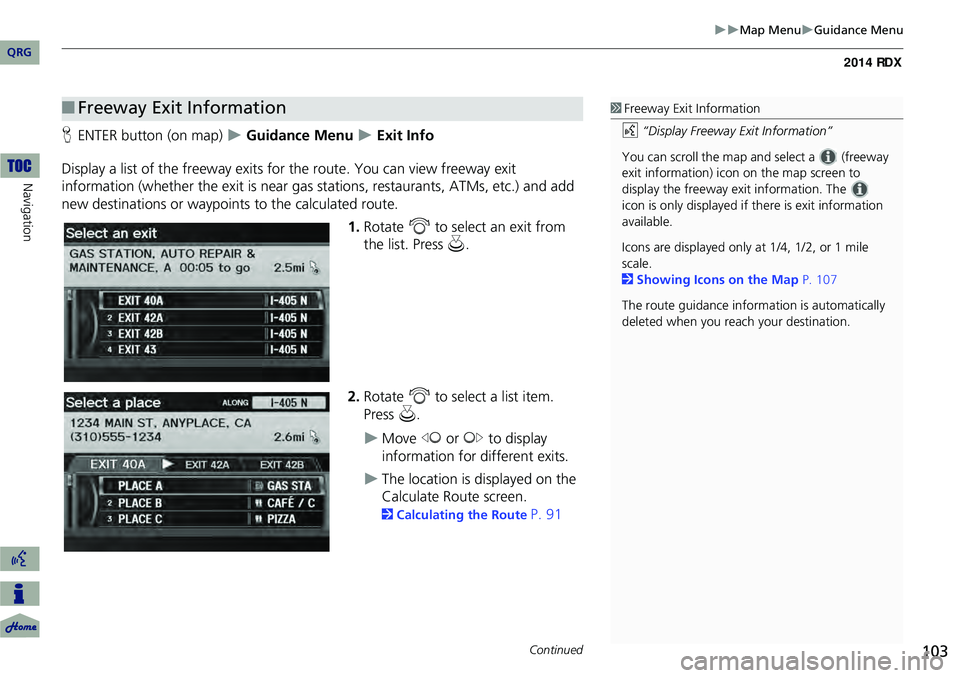
Display a list of the freeway exits for the route. You can view freeway exit
information (whether the exit is near gas stations, restaurants, ATMs, etc.) and add
new destinations or waypoints to the calculated route.
1.Rotate i to select an exit from
the list. Press u.
2. Rotate i to select a list item.
Press u.
Move w or y to display
information for different exits.
The location is displayed on the
Calculate Route screen.
2 Calculating the Route P. 91
■Freeway Exit Information1 Freeway Exit Information
d “Display Freeway Exit Information”
You can scroll the map a nd select a (freeway
exit information) icon on the map screen to
display the freeway exit information. The
icon is only displayed if there is exit information
available.
Icons are displayed only at 1/4, 1/2, or 1 mile
scale.
2 Showing Icons on the Map P. 107
The route guidance inform ation is automatically
deleted when you reac h your destination.
Continued
QRG
Navigation