Page 44 of 315
2-16Navigation
1. Highlight [Map Color] and push.
2. Highlight the preferred map color and push
. The indicator light of the se-
lected color illuminates.
Available map colors
The following map colors are available.
. [Warm]:
Sets warm colors for the map coloring. .
[Cool]:
Sets cool colors for the map coloring.
. [Traffic Emphasis]:
Sets light colors for the map coloring to
emphasize the traffic information.
INFO:
The effect of the setting changes can be
confirmed on the preview displayed on the right
side of the screen.
Changing BirdviewTMangle
The BirdviewTMangle can be changed.
This setting is available only in the BirdviewTM
map or 2D/BirdviewTMsplit map.
1. Highlight [Birdview Angle] and push .
2. Adjust the BirdviewTMangle by pushing the
main directional buttons or rotating the
center dial.
3. Push
Page 45 of 315
![NISSAN GT-R 2013 R35 Multi Function Display Owners Manual 1. Highlight [Left Split Map Settings] and push<ENTER>.
2. Highlight the preferred map setting andpush <ENTER>.
3. Push <MAP>to return to the current
location map screen.
Available setting items
. [Ma NISSAN GT-R 2013 R35 Multi Function Display Owners Manual 1. Highlight [Left Split Map Settings] and push<ENTER>.
2. Highlight the preferred map setting andpush <ENTER>.
3. Push <MAP>to return to the current
location map screen.
Available setting items
. [Ma](/manual-img/5/316/w960_316-44.png)
1. Highlight [Left Split Map Settings] and push.
2. Highlight the preferred map setting andpush .
3. Push
Page 46 of 315

2-18Navigation
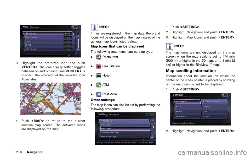
3. Highlight the preferred icon and push. The icon display setting toggles
between on and off each time is
pushed. The indicator of the selected icon
illuminates.
4. Push
Page 47 of 315
![NISSAN GT-R 2013 R35 Multi Function Display Owners Manual 3. Highlight [Others] and push<ENTER>.
4. Highlight [Map Scrolling Information] and
push <ENTER>.
5. Highlight the preferred information item and
push <ENTER>. The indicator of the
selected informatio NISSAN GT-R 2013 R35 Multi Function Display Owners Manual 3. Highlight [Others] and push<ENTER>.
4. Highlight [Map Scrolling Information] and
push <ENTER>.
5. Highlight the preferred information item and
push <ENTER>. The indicator of the
selected informatio](/manual-img/5/316/w960_316-46.png)
3. Highlight [Others] and push.
4. Highlight [Map Scrolling Information] and
push .
5. Highlight the preferred information item and
push . The indicator of the
selected information item illuminates.
The following information items are available.
.[Address Book Icons]
.[Destination/Waypoint Icons]
.[Latitude/Longitude Info]
6. Push
Page 48 of 315
![NISSAN GT-R 2013 R35 Multi Function Display Owners Manual 2-20Navigation
location map screen is displayed, the following
options are available.
.[Store Location]:
Stores the current vehicle location in the
Address Book. The stored location can be
retrieved a NISSAN GT-R 2013 R35 Multi Function Display Owners Manual 2-20Navigation
location map screen is displayed, the following
options are available.
.[Store Location]:
Stores the current vehicle location in the
Address Book. The stored location can be
retrieved a](/manual-img/5/316/w960_316-47.png)
2-20Navigation
location map screen is displayed, the following
options are available.
.[Store Location]:
Stores the current vehicle location in the
Address Book. The stored location can be
retrieved as necessary to set it as a
destination (waypoint) .
“Storing location” (page 2-72)
. [Nearby Places]:
Searches for points of interest near the
current vehicle location, such as restaurants
and gas stations, etc.
“Finding nearby place” (page 2-27)
. [Map View]:
Performs map operations such as the
switching of map type and the setting of
map orientation and scale.
“Map settings” (page 2-5)
. [Map Icons]:
Displays map icons of certain points of
interest (such as restaurants and gas sta-
tions, etc.) on the map around the current
vehicle location.
“Displaying map icons” (page 2-17)
. [Store Tracking]:
Stores in the Address Book the route
travelled from the starting point to the
current location.
“Storing tracked route” (page 2-76)
Scrolled location map screen
If is pushed while a scrolled map
screen is displayed, the following options are
available.
. [New Dest.]:
Sets the destination to the map location
where was pushed. If a destina-
tion is already set, the location will be set as
the new destination.
“Setting point on map” (page 2-42)
. [Add to Route]:
Sets the map location where
was pushed as the destination or a way-
point. This is available only when a sug-
gested route is already set.
“Setting destination or waypoint”
(page 2-56) .
[Nearby Places]:
Searches for points of interest near the map
location where was pushed and
sets them as a destination or waypoint.
Use the same search method as the one for
[Places].
“Finding nearby place” (page 2-27)
. [Store Location]:
Store the map location where
was pushed in the Address Book. The
stored location can be retrieved to set it as
a destination or waypoint.
“Storing location” (page 2-72)
. [Delete]:
Deletes a stored location. To delete, place
the cross pointer over the corresponding
icon.
. [Incident Detail]:
This function can be selected only when the
traffic information icon is displayed. Displays
the details of the traffic information icon.
Place the cross pointer over the icon to be
checked.
Page 49 of 315
INFO:
Incident details are a feature of Traffic Informa-
tion, and an XM NavTraffic
®subscription is
required in order to receive Traffic Information.
Navigation2-21
Page 50 of 315
2-22Navigation
MAP SYMBOLS
This navigation system uses symbols to display facilities.
2-dimensional icons (Plan View)
Page 51 of 315

Road color
The road types are differentiated by colors.
Freeway:
(Red or light red (zoomed in))
Main road:
(Brown or dark yellow)
Narrow street:
(Gray)
Road with incomplete map data:
(Dark green)
Traffic information on map
With a subscription to the XM NavTraffic®
service, traffic information is displayed.“Viewing available traffic information”
(page 6-7)
Free Flow:
(Green)
Moderate traffic:
(Yellow)
Heavy traffic:
(Red)
Section affected by serious traffic event:
(Purple)
The following traffic information icons may be displayed
Accident
Closed road
Information
Road work
Slippery road
Weather
Incident
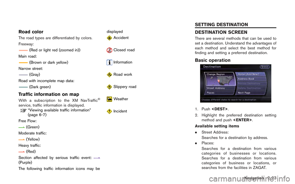
DESTINATION SCREEN
There are several methods that can be used to
set a destination. Understand the advantages of
each method and select the best method for
finding and setting a preferred destination.
Basic operation
1. Push
.
2. Highlight the preferred destination setting method and push .
Available setting items
. Street Address:
Searches for a destination by address.
. Places:
Searches for a destination from various
categories of businesses or locations.
Searches for a destination from various
categories of business or locations, or
searches from the facilities in ZAGAT.
Navigation2-23
SETTING DESTINATION