2011 MERCEDES-BENZ S-Class Button
[x] Cancel search: ButtonPage 171 of 524

XSelect Route in the navigation menu bar by
turning cVd the COMAND controller and
press W to confirm.
XSelect Detour and press W to confirm.XTo block a section of the route: select
More or Less repeatedly and confirm using
the W button until the desired section has
been selected.
iThe length of the blockable route section
is predetermined by the digital map. The
menu items are available accordingly.
XTo start route calculation: select Start
and press W to confirm.
XTo delete the blocked section: select
Delete while the message is shown and
press W to confirm.
COMAND calculates the route without the
block.
Selecting an alternative route
With the "Alternative route" function, routes
other than the original one can be calculated.
XTo switch on navigation mode: press the
S function button once or twice.
XTo show the menu: press W the COMAND
controller.
XSelect Route in the navigation menu bar by
turning cVd the COMAND controller and
press W to confirm.
XSelect Alternative Route and press W
to confirm.
You see the selected route. The display now
shows a split-screen view. On the left-hand
side, one or more alternative routes are
shown from start to destination. The
current route is highlighted dark blue; other
alternative routes appear light blue.
:Distance, estimated time of arrival and
estimated remaining driving time
;Display of events on the route=Display of selected route settingXTo select the next or previous
alternative route: select Next or
Previous and press W to confirm.
The possible alternative routes are shown
in this order: Current Route, Fast
Route, Eco Route, Short Route and
Alternative Route.
XTo select the original route: select Back
as often as necessary and press W to
confirm.
XTo start route guidance using the
selected alternative route: select Start
and press W to confirm.
COMAND accepts the alternative route.
Displaying destination information
Requirement: you have entered a destination
(Y page 151) and possibly an intermediate
stop (Y page 158).
XTo switch on navigation mode: press the
S function button once or twice.
XTo show the menu: press W the COMAND
controller.
XSelect Info in the navigation menu bar by
turning cVd the COMAND controller and
press W to confirm.
Destination information is displayed.
Navigation169COMANDZ
Page 172 of 524
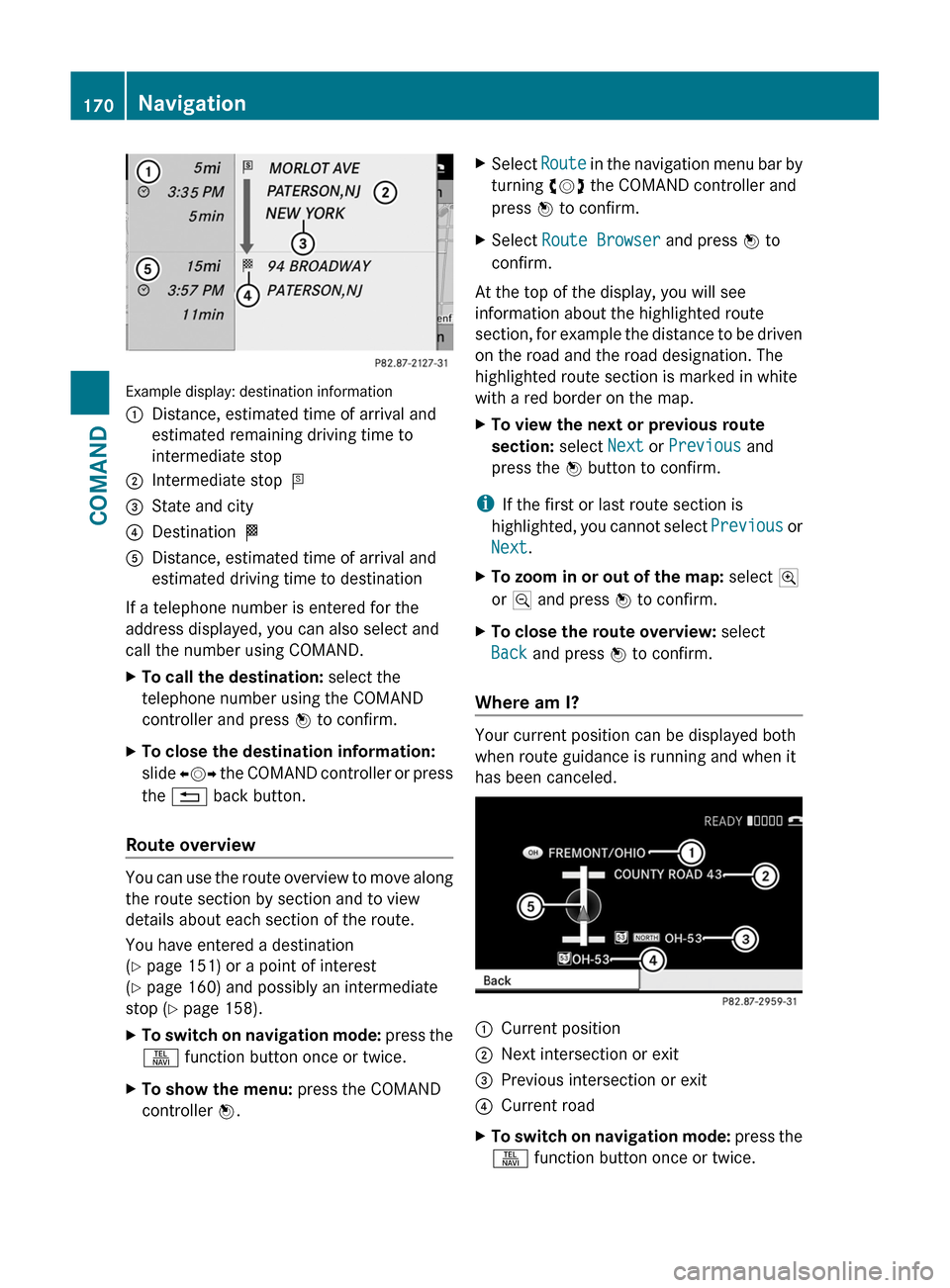
Example display: destination information
:Distance, estimated time of arrival and
estimated remaining driving time to
intermediate stop
;Intermediate stop P=State and city?Destination OADistance, estimated time of arrival and
estimated driving time to destination
If a telephone number is entered for the
address displayed, you can also select and
call the number using COMAND.
XTo call the destination: select the
telephone number using the COMAND
controller and press W to confirm.
XTo close the destination information:
slide XVY the COMAND controller or press
the % back button.
Route overview
You can use the route overview to move along
the route section by section and to view
details about each section of the route.
You have entered a destination
(Y page 151) or a point of interest
(Y page 160) and possibly an intermediate
stop (Y page 158).
XTo switch on navigation mode: press the
S function button once or twice.
XTo show the menu: press the COMAND
controller W.
XSelect Route in the navigation menu bar by
turning cVd the COMAND controller and
press W to confirm.
XSelect Route Browser and press W to
confirm.
At the top of the display, you will see
information about the highlighted route
section, for example the distance to be driven
on the road and the road designation. The
highlighted route section is marked in white
with a red border on the map.
XTo view the next or previous route
section: select Next or Previous and
press the W button to confirm.
iIf the first or last route section is
highlighted, you cannot select Previous or
Next.
XTo zoom in or out of the map: select N
or M and press W to confirm.
XTo close the route overview: select
Back and press W to confirm.
Where am I?
Your current position can be displayed both
when route guidance is running and when it
has been canceled.
:Current position;Next intersection or exit=Previous intersection or exit?Current roadXTo switch on navigation mode: press the
S function button once or twice.
170NavigationCOMAND
Page 177 of 524
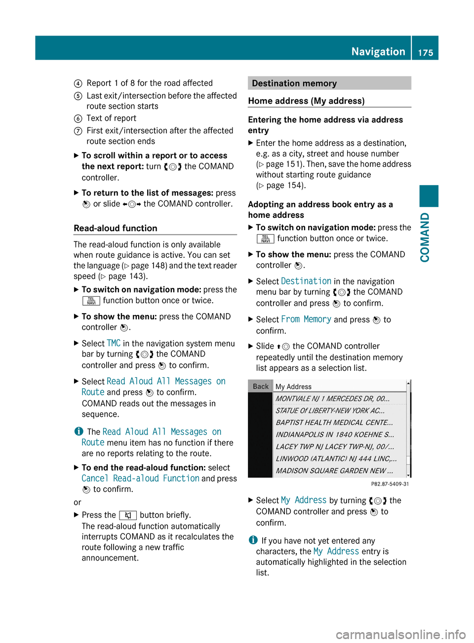
4Report 1 of 8 for the road affected5Last exit/intersection before the affected
route section starts
6Text of reportCFirst exit/intersection after the affected
route section ends
XTo scroll within a report or to access
the next report: turn cVd the COMAND
controller.
XTo return to the list of messages: press
W or slide XVY the COMAND controller.
Read-aloud function
The read-aloud function is only available
when route guidance is active. You can set
the language (Y page 148) and the text reader
speed (Y page 143).
XTo switch on navigation mode: press the
S function button once or twice.
XTo show the menu: press the COMAND
controller W.
XSelect TMC in the navigation system menu
bar by turning cVd the COMAND
controller and press W to confirm.
XSelect Read Aloud All Messages on
Route and press W to confirm.
COMAND reads out the messages in
sequence.
iThe Read Aloud All Messages on
Route menu item has no function if there
are no reports relating to the route.
XTo end the read-aloud function: select
Cancel Read-aloud Function and press
W to confirm.
or
XPress the 8 button briefly.
The read-aloud function automatically
interrupts COMAND as it recalculates the
route following a new traffic
announcement.
Destination memory
Home address (My address)
Entering the home address via address
entry
XEnter the home address as a destination,
e.g. as a city, street and house number
(Y page 151). Then, save the home address
without starting route guidance
(Y page 154).
Adopting an address book entry as a
home address
XTo switch on navigation mode: press the
S function button once or twice.
XTo show the menu: press the COMAND
controller W.
XSelect Destination in the navigation
menu bar by turning cVd the COMAND
controller and press W to confirm.
XSelect From Memory and press W to
confirm.
XSlide ZV the COMAND controller
repeatedly until the destination memory
list appears as a selection list.
XSelect My Address by turning cVd the
COMAND controller and press W to
confirm.
iIf you have not yet entered any
characters, the My Address entry is
automatically highlighted in the selection
list.
Navigation175COMANDZ
Page 180 of 524
will appear asking whether you wish to
overwrite the existing data.XSelect Yes or No and press W to confirm.
If you select Yes, COMAND stores the data.
Deleting a destination or the home
address from the destination memory
XTo switch on navigation mode: press the
S function button once or twice.XTo show the menu: press W the COMAND
controller.XSelect Destination in the navigation
menu bar by turning cVd the COMAND
controller and press W to confirm.XSelect From Memory and press W to
confirm.
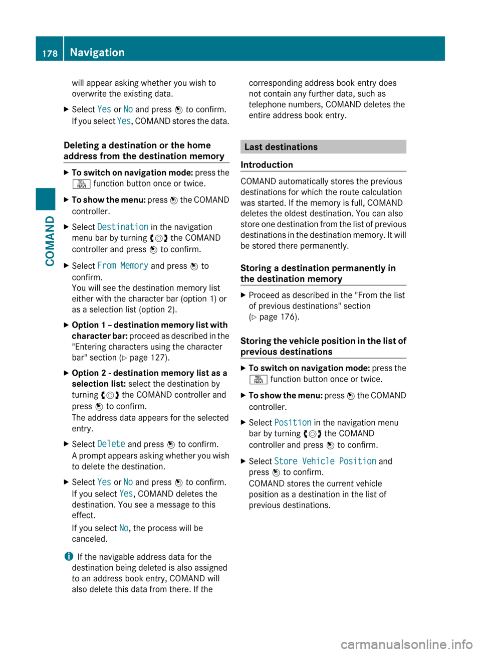
You will see the destination memory list
either with the character bar (option 1) or
as a selection list (option 2).XOption 1 – destination memory list with
character bar: proceed as described in the
"Entering characters using the character
bar" section ( Y page 127).XOption 2 - destination memory list as a
selection list: select the destination by
turning cVd the COMAND controller and
press W to confirm.
The address data appears for the selected
entry.XSelect Delete and press W to confirm.
A prompt appears asking whether you wish
to delete the destination.XSelect Yes or No and press W to confirm.
If you select Yes, COMAND deletes the
destination. You see a message to this
effect.
If you select No, the process will be
canceled.
i If the navigable address data for the
destination being deleted is also assigned
to an address book entry, COMAND will
also delete this data from there. If the
corresponding address book entry does
not contain any further data, such as
telephone numbers, COMAND deletes the
entire address book entry.
Last destinations
Introduction
COMAND automatically stores the previous
destinations for which the route calculation
was started. If the memory is full, COMAND
deletes the oldest destination. You can also
store one destination from the list of previous
destinations in the destination memory. It will
be stored there permanently.
Storing a destination permanently in
the destination memory
XProceed as described in the "From the list
of previous destinations" section
( Y page 176).
Storing the vehicle position in the list of
previous destinations
XTo switch on navigation mode: press the
S function button once or twice.XTo show the menu: press W the COMAND
controller.XSelect Position in the navigation menu
bar by turning cVd the COMAND
controller and press W to confirm.XSelect Store Vehicle Position and
press W to confirm.
COMAND stores the current vehicle
position as a destination in the list of
previous destinations.178NavigationCOMAND
Page 181 of 524
Storing the crosshair position in the list
of previous destinations
Route guidance not active
A crosshair appears on the map if you have
moved the map manually. You can store the
crosshair position as a destination in the list
of previous destinations.
XTo show the menu: press the COMAND
controller W.XSelect Position in the navigation menu
bar by turning cVd the COMAND
controller and press W to confirm.XSelect Save Crosshair Position and
press W to confirm.
Route guidance is active
XTo show the menu: press the COMAND
controller W.XSelect Position in the navigation menu
bar by turning cVd the COMAND
controller and press W to confirm.XSelect Destination Map and press W to
confirm.
You will see the map with a crosshair at the
destination.XTo show the menu: press the COMAND
controller W.XSelect Position in the navigation menu
bar by turning cVd the COMAND
controller and press W to confirm.XSelect Save Crosshair Position and
press W to confirm.
COMAND stores the crosshair position as
a destination in the list of previous
destinations.
Deleting one of the previous
destinations
XTo switch on navigation mode: press the
S function button once or twice.XTo show the menu: press the COMAND
controller W.XSelect Destination in the navigation
menu bar by turning cVd the COMAND
controller and press W to confirm.XSelect From Last Destinations and
press W to confirm.
The list of previous destinations appears.XSelect the desired destination and press
W to confirm.
The destination address appears.XSelect Delete and press W to confirm.
A prompt appears, asking whether the
entry should be deleted.XSelect Yes or No and press W to confirm.
If you select Yes, the entry is deleted.
If you select No, the process will be
canceled.
Map usage and settings
Note
Company logos displayed on the map are
trademarks of the respective companies and
used solely for the purpose of indicating the
location of these companies. The use of such
logos for the map does not indicate approval,
support or advertisement of the navigation
system by the respective companies.
Adjusting the map scale
XTo hide the menu: slide ZV the COMAND
controller and press W when the Full
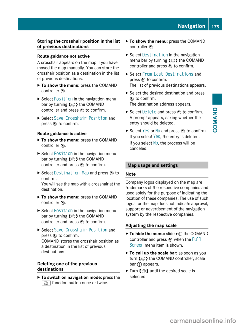
Screen menu item is shown.XTo call up the scale bar: as soon as you
turn cVd the COMAND controller, scale
bar = appears.XTurn cVd until the desired scale is
selected.Navigation179COMANDZ
Page 182 of 524
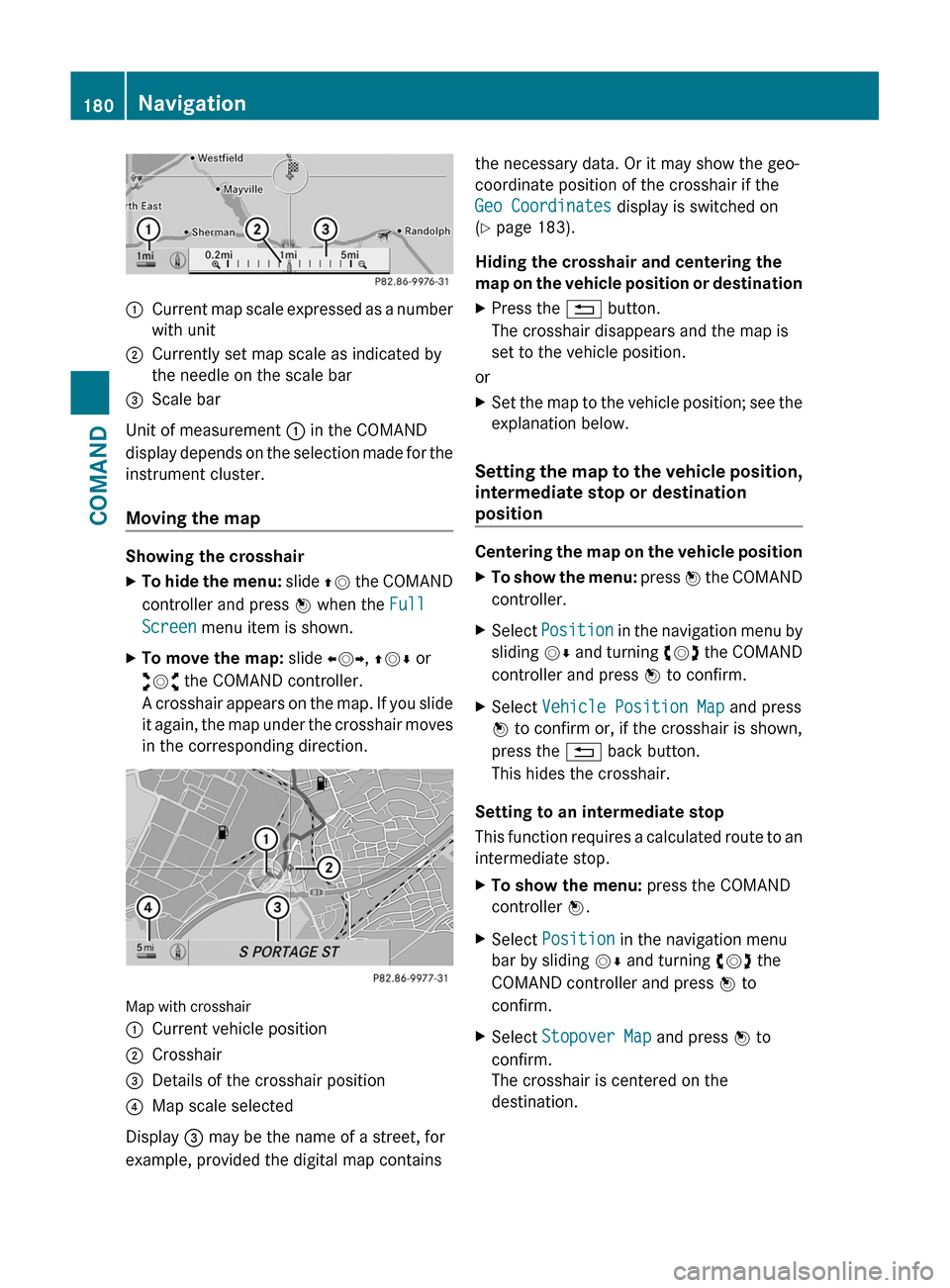
:Current map scale expressed as a number
with unit
;Currently set map scale as indicated by
the needle on the scale bar
=Scale bar
Unit of measurement : in the COMAND
display depends on the selection made for the
instrument cluster.
Moving the map
Showing the crosshair
XTo hide the menu: slide ZV the COMAND
controller and press W when the Full
Screen menu item is shown.
XTo move the map: slide XVY, ZVÆ or
aVb the COMAND controller.
A crosshair appears on the map. If you slide
it again, the map under the crosshair moves
in the corresponding direction.
Map with crosshair
:Current vehicle position;Crosshair=Details of the crosshair position?Map scale selected
Display = may be the name of a street, for
example, provided the digital map contains
the necessary data. Or it may show the geo-
coordinate position of the crosshair if the
Geo Coordinates display is switched on
(Y page 183).
Hiding the crosshair and centering the
map on the vehicle position or destination
XPress the % button.
The crosshair disappears and the map is
set to the vehicle position.
or
XSet the map to the vehicle position; see the
explanation below.
Setting the map to the vehicle position,
intermediate stop or destination
position
Centering the map on the vehicle position
XTo show the menu: press W the COMAND
controller.
XSelect Position in the navigation menu by
sliding VÆ and turning cVd the COMAND
controller and press W to confirm.
XSelect Vehicle Position Map and press
W to confirm or, if the crosshair is shown,
press the % back button.
This hides the crosshair.
Setting to an intermediate stop
This function requires a calculated route to an
intermediate stop.
XTo show the menu: press the COMAND
controller W.
XSelect Position in the navigation menu
bar by sliding VÆ and turning cVd the
COMAND controller and press W to
confirm.
XSelect Stopover Map and press W to
confirm.
The crosshair is centered on the
destination.
180NavigationCOMAND
Page 184 of 524
interest are, for example, gas stations, hotels,
cinemas and restaurants.
The following settings are possible:
RStandard Symbols
Icon display determined by the factory
settings
RPersonal Symbols
You can determine the icons yourself
RNo Symbols
No icons are shown on the map.
XTo show the menu: press the COMAND
controller W.
XSelect Navi in the main function bar by
sliding ZV and turning cVd the COMAND
controller and press W to confirm.
XSelect POI Symbols on Map and press
W to confirm.
XSelect Standard Symbols, Personal
Symbols or No Symbols.
If you select Personal Symbols, the list of
points of interest appears.
XTo switch the icon display on/off: select
the point of interest by turning cVd the
COMAND controller and press W to
confirm.
Depending on the previous setting, the
icons will be switched on O or off ª. You
can switch on the icon displays for more
than one point of interest.
iThe list shows all icons that are contained
on the digital map across all countries.
However, not all points of interest are
available in all countries. As a result, certain
point of interest icons may not be displayed
on the map, even if the icon display is
switched on.
XTo exit the menu: press the % back
button.
Map information in the display
Displaying text messages
During route guidance, you can have map
information displayed at the bottom edge of
the display.
XTo show the menu: press the COMAND
controller W.
XSelect Navi in the main function bar by
sliding ZV and turning cVd the COMAND
controller and press W to confirm.
The main area is active.
XSelect Navi again and press W to confirm.
The navigation menu opens.
XSelect Text Information on Map and
press W to confirm.
The # dot indicates the current setting.
XSelect Arrival Time/Distance,
Current Street, Geo Coordinates or
None, and press W to confirm.
XTo exit the menu: slide XVY the COMAND
controller.
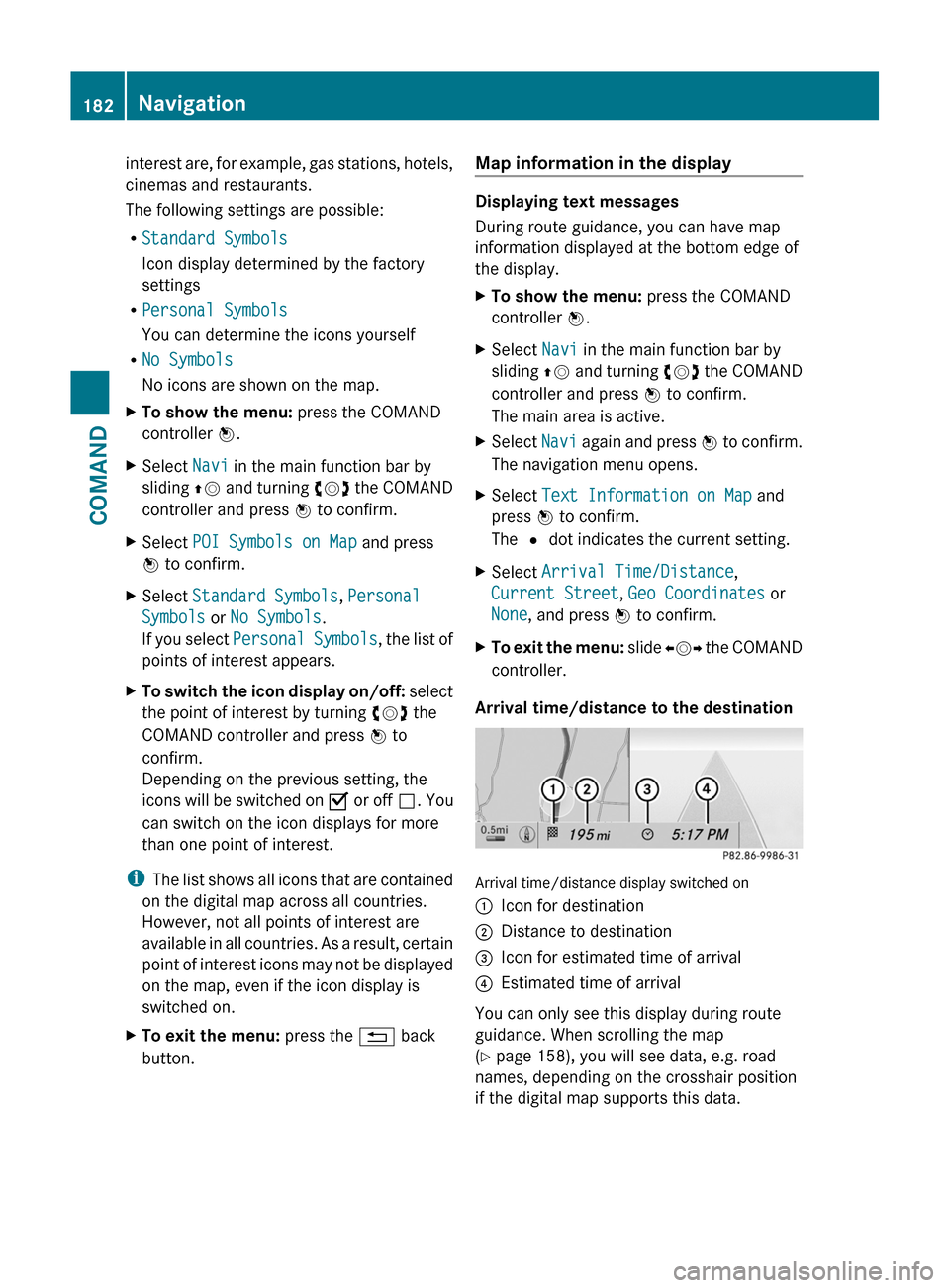
Arrival time/distance to the destination
Arrival time/distance display switched on
:Icon for destination;Distance to destination=Icon for estimated time of arrival?Estimated time of arrival
You can only see this display during route
guidance. When scrolling the map
(Y page 158), you will see data, e.g. road
names, depending on the crosshair position
if the digital map supports this data.
182NavigationCOMAND
Page 187 of 524
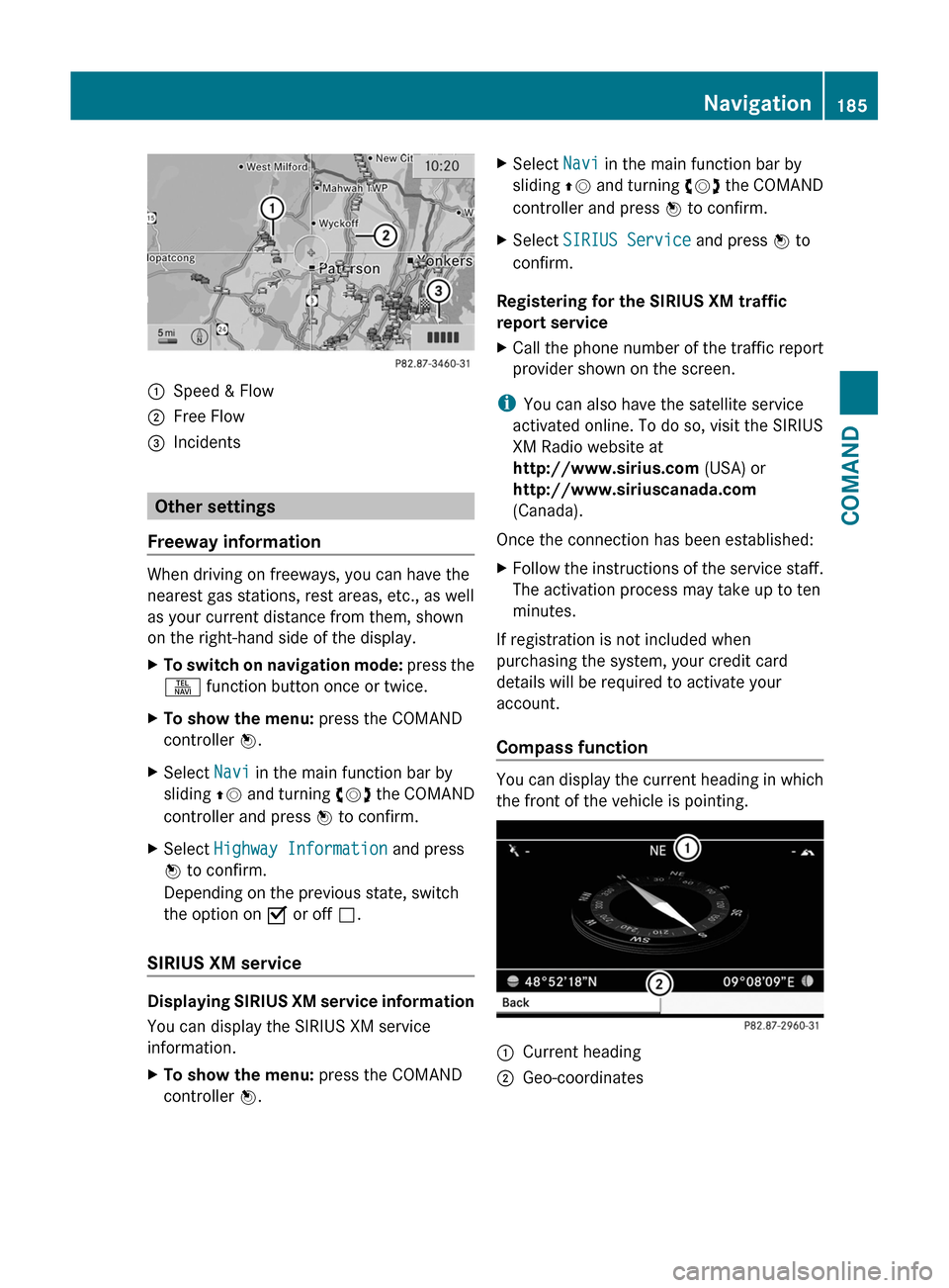
:Speed & Flow;Free Flow=Incidents
Other settings
Freeway information
When driving on freeways, you can have the
nearest gas stations, rest areas, etc., as well
as your current distance from them, shown
on the right-hand side of the display.
XTo switch on navigation mode: press the
S function button once or twice.
XTo show the menu: press the COMAND
controller W.
XSelect Navi in the main function bar by
sliding ZV and turning cVd the COMAND
controller and press W to confirm.
XSelect Highway Information and press
W to confirm.
Depending on the previous state, switch
the option on O or off ª.
SIRIUS XM service
Displaying SIRIUS XM service information
You can display the SIRIUS XM service
information.
XTo show the menu: press the COMAND
controller W.
XSelect Navi in the main function bar by
sliding ZV and turning cVd the COMAND
controller and press W to confirm.
XSelect SIRIUS Service and press W to
confirm.
Registering for the SIRIUS XM traffic
report service
XCall the phone number of the traffic report
provider shown on the screen.
iYou can also have the satellite service
activated online. To do so, visit the SIRIUS
XM Radio website at
http://www.sirius.com (USA) or
http://www.siriuscanada.com
(Canada).
Once the connection has been established:
XFollow the instructions of the service staff.
The activation process may take up to ten
minutes.
If registration is not included when
purchasing the system, your credit card
details will be required to activate your
account.
Compass function
You can display the current heading in which
the front of the vehicle is pointing.
:Current heading;Geo-coordinatesNavigation185COMANDZ