Page 37 of 146

BASIC FUNCTIONS
51
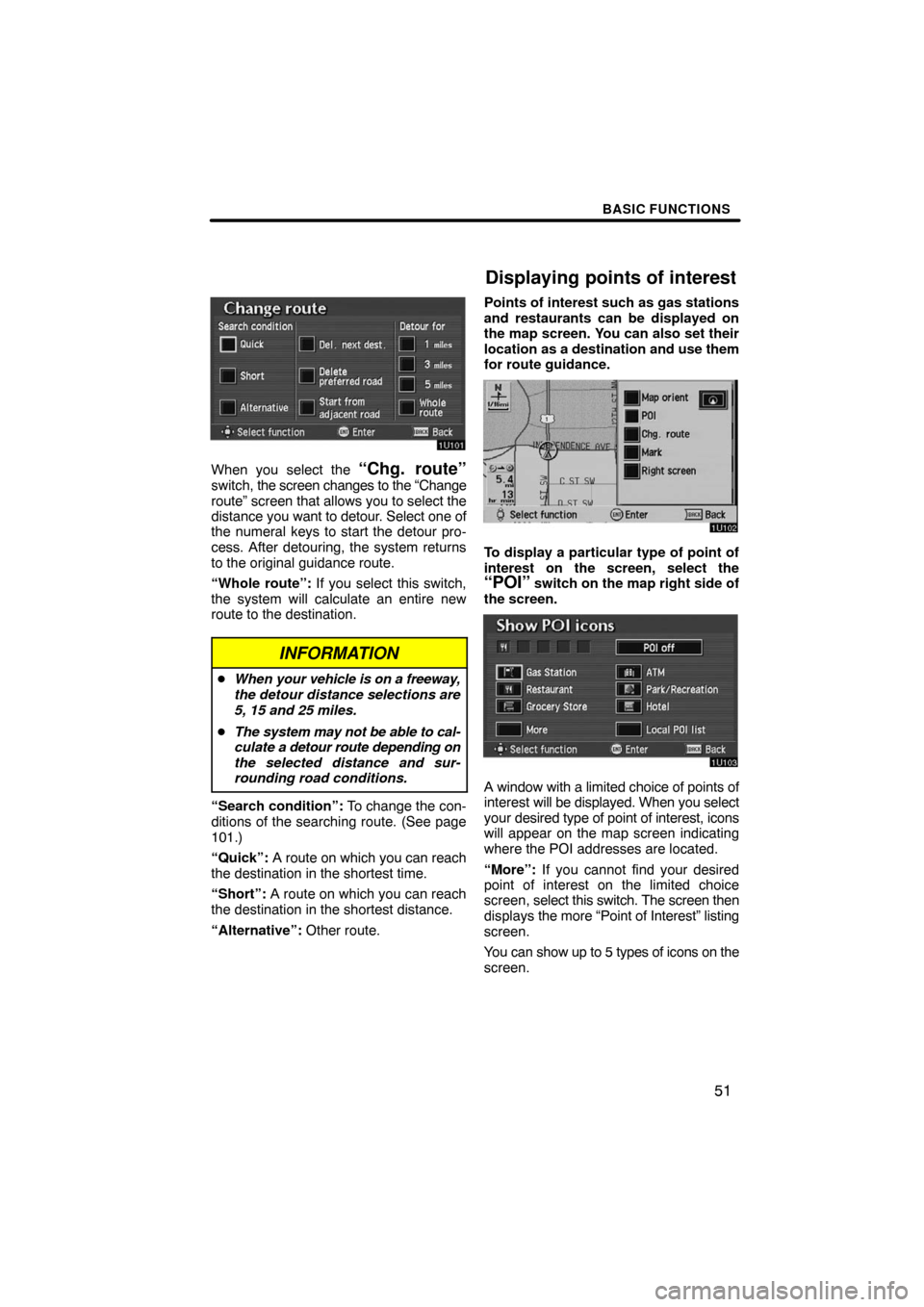
When you select the “Chg. route”switch, the screen changes to the “Change
route” screen that allows you to select the
distance you want to detour. Select one of
the numeral keys to start the detour pro-
cess. After detouring, the system returns
to the original guidance route.
“Whole route”: If you select this switch,
the system will calculate an entire new
route to the destination.
INFORMATION
�When your vehicle is on a freeway,
the detour distance selections are
5, 15 and 25 miles.
�The system may not be able to cal-
culate a detour route depending on
the selected distance and sur-
rounding road conditions.
“Search condition”: To change the con-
ditions of the searching route. (See page
101.)
“Quick”: A route on which you can reach
the destination in the shortest time.
“Short”: A route on which you can reach
the destination in the shortest distance.
“Alternative”: Other route.Points of interest such as gas stations
and restaurants can be displayed on
the map screen. You can also set their
location as a destination and use them
for route guidance.
To display a particular type of point of
interest on the screen, select the
“POI” switch on the map right side of
the screen.
A window with a limited choice of points of
interest will be displayed. When you select
your desired type of point of interest, icons
will appear on the map screen indicating
where the POI addresses are located.
“More”: If you cannot find your desired
point of interest on the limited choice
screen, select this switch. The screen then
displays the more “Point of Interest” listing
screen.
You can show up to 5 types of icons on the
screen.
Displaying points of interest
Page 41 of 146

BASIC FUNCTIONS
55
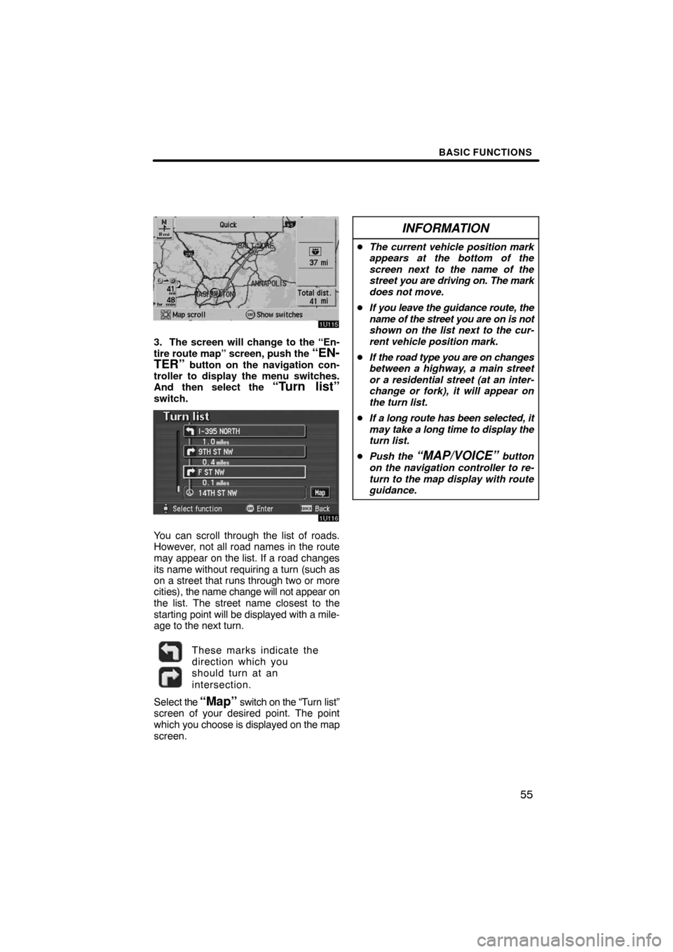
3. The screen will change to the “En-
tire route map” screen, push the “EN-
TER” button on the navigation con-
troller to display the menu switches.
And then select the
“Turn list”switch.
You can scroll through the list of roads.
However, not all road names in the route
may appear on the list. If a road changes
its name without requiring a turn (such as
on a street that runs through two or more
cities), the name change will not appear on
the list. The street name closest to the
starting point will be displayed with a mile-
age to the next turn.
These marks indicate the
direction which you
should turn at an
intersection.
Select the “Map” switch on the “Turn list”
screen of your desired point. The point
which you choose is displayed on the map
screen.
INFORMATION
�The current vehicle position mark
appears at the bottom of the
screen next to the name of the
street you are driving on. The mark
does not move.
�If you leave the guidance route, the
name of the street you are on is not
shown on the list next to the cur-
rent vehicle position mark.
�If the road type you are on changes
between a highway, a main street
or a residential street (at an inter-
change or fork), it will appear on
the turn list.
�If a long route has been selected, it
may take a long time to display the
turn list.
�Push the
“MAP/VOICE” button
on the navigation controller to re-
turn to the map display with route
guidance.
Page 47 of 146

BASIC FUNCTIONS
61
Map database is made based on the
maps, 2006 edition of DENSO, whose
information source comes from
NAVTEQ maps, Tele Atlas maps and
infoUSA POIs.
�2005 NAVTEQ. All rights reserved.�2005 Tele Atlas North America, Inc.
All rights reserved. This material is pro-
prietary and the subject of copyright
protection and other intellectual prop-
erty rights owned by or licensed to Tele
Atlas North America, Inc. The use of
this material is subject to the terms of a
license agreement. You will be held li-
able for any unauthorized copying or
disclosure of this material.
Data by infoUSA Copyright
�2005, All
Rights Reserved.
This product contains proprietary and
confidential property of NAVTEQ, Tele
Atlas and infoUSA. Unauthorized use,
including duplication of this product is
expressly prohibited.There are two types of areas available
for route guidance. (See the following
pages.) In one type of area, primarily
around metropolitan centers, detailed
route guidance is available for the en-
tire area. In the other type of area, all
roads are displayed on the map but
route guidance is limited. The naviga-
tion route might lack precision because
the data (no right turns, one�way traf-
fic, etc.) is not complete. It is still pos-
sible to reach the destination by follow-
ing the arrow direction and distance as
shown on the bottom left of the screen.
The arrow points in the direction of the
destination. The distance shown is as
measured in a straight line from the cur-
rent vehicle position to the destination
area.
COPYRIGHT NOTICE: This area in-
cludes information taken with permis-
sion from Canadian authorities, includ-
ing
�Her Majesty the Queen in Right of
Canada, �Queen’s Printer for Ontario.
Map database information
and updates