2008 HONDA CR-V change time
[x] Cancel search: change timePage 95 of 145

Navigation System95
System Initialization
System Initialization
If for any reason, you lose power to the
navigation system (like the battery was
disconnected), the navigation system
will require initialization. Once
completed, your system will be ready to
use.
This initialization requires the
following:
Entry of the 4-digit anti-theft security code to “unlock” the navigation
system.
GPS initialization (may not be needed depending on the le ngth of time the
system was without power).
Map matching to align the GPS coordinates to a place on the map
(displays current street at the bottom
of the map).
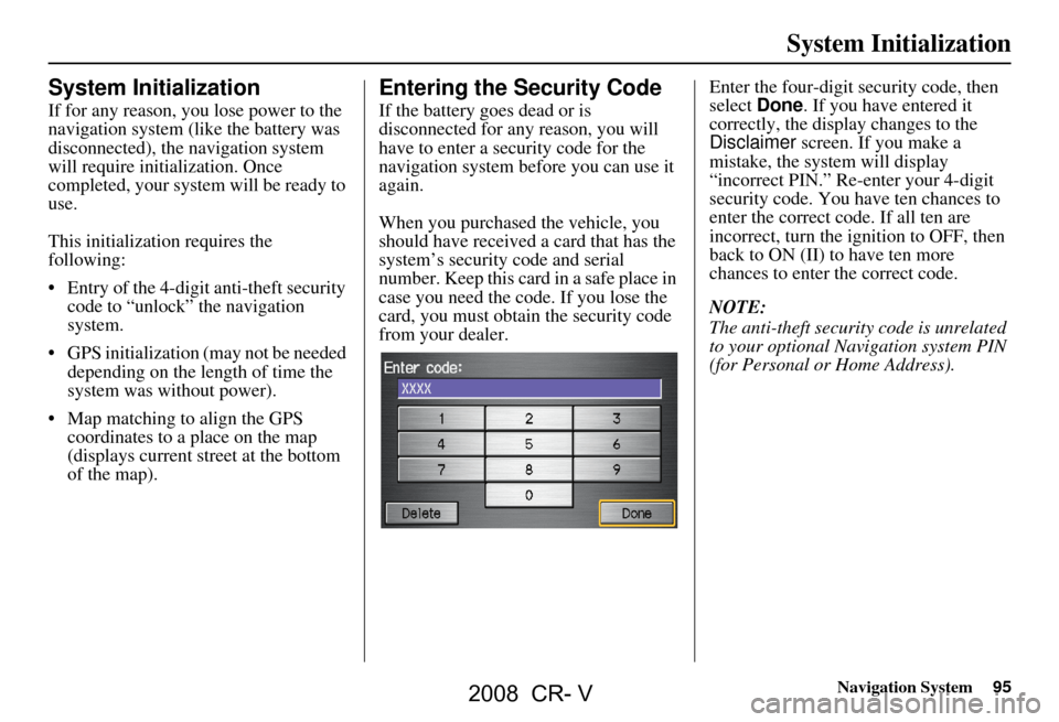
Entering the Security Code
If the battery goes dead or is
disconnected for any reason, you will
have to enter a security code for the
navigation system before you can use it
again.
When you purchased the vehicle, you
should have received a card that has the
system’s security code and serial
number. Keep this card in a safe place in
case you need the code. If you lose the
card, you must obtain the security code
from your dealer. Enter the four-digit security code, then
select
Done. If you have entered it
correctly, the display changes to the
Disclaimer screen. If you make a
mistake, the system will display
“incorrect PIN.” Re-enter your 4-digit
security code. You have ten chances to
enter the correct code. If all ten are
incorrect, turn the i gnition to OFF, then
back to ON (II) to have ten more
chances to enter the correct code.
NOTE:
The anti-theft security code is unrelated
to your optional Navigation system PIN
(for Personal or Home Address).
2008 CR- V
Page 96 of 145

96Navigation System
System Initialization
GPS Initialization
Depending on the length of time the
battery was disconnected, your system
may require GPS initialization. If it
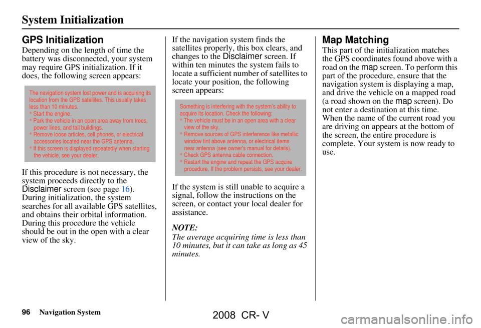
does, the following screen appears:
If this procedure is not necessary, the
system proceeds directly to the
Disclaimer screen (see page16).
During initialization, the system
searches for all available GPS satellites,
and obtains their orbital information.
During this procedure the vehicle
should be out in th e open with a clear
view of the sky. If the navigation system finds the
satellites properly, this box clears, and
changes to the
Disclaimer screen. If
within ten minutes the system fails to
locate a sufficient number of satellites to
locate your position, the following
screen appears:
If the system is still unable to acquire a
signal, follow the instructions on the
screen, or contact you r local dealer for
assistance.
NOTE:
The average acquiring time is less than
10 minutes, but it can take as long as 45
minutes.
Map Matching
This part of the initialization matches
the GPS coordinates found above with a
road on the map screen. To perform this
part of the procedure, ensure that the
navigation system is displaying a map,
and drive the vehicle on a mapped road
(a road shown on the map screen). Do
not enter a destina tion at this time.
When the name of the current road you
are driving on appears at the bottom of
the screen, the entire procedure is
complete. Your system is now ready to
use.
The navigation system lost power and is acquiring its
location from the GPS satellites. This usually takes
less than 10 minutes.
* Start the engine.
* Park the vehicle in an open area away from trees,
power lines, and tall buildings.
* Remove loose articles, cell phones, or electrical
accessories located near the GPS antenna.
* If this screen is displayed repeatedly when starting
the vehicle, see your dealer.
Something is interfering with the system’s ability to
acquire its location. Check the following:
* The vehicle must be in an open area with a clear
view of the sky.
* Remove sources of GPS interference like metallic
window tint above antenna, or electrical items
near antenna (see owner's manual for details).
* Check GPS antenna cable connection.
* Restart the engine and repeat the GPS acquire
procedure. If the problem persists, see your dealer.
2008 CR- V
Page 99 of 145

Navigation System99
Database Limitations
You will find that some points of
interest (POI) may be missing when you
search the database. This can be caused
if at the time the database was gathered,
the name was misspelled, the place was
improperly categorized, or the POI
change is not yet in the database. This
means you may not find places listed
that you know exist. This is also true for
police agencies and hospitals. In
outlying areas, facilities listed may not
be the closest. Always check with local
information sources if you need law
enforcement or hospital services.
Every effort has been made to verify
that the system’s database was accurate
at the time it was created. However,
businesses do fail or move to new
locations, and new businesses start in
the old locations. For this reason, you
may occasionally find “inaccurate”
information when you select and drive
to a point of interest (for example, a
restaurant is now a jewelry store). The
number of these inaccuracies increases
the longer you go without an update. The digitized map database reflects
conditions as they existed at various
points in time before production.
Accordingly, your
DVD may contain
inaccurate or inco mplete data or
information due to the passage of time,
road construction, ch anging conditions,
or other causes.
Due to ongoing software and database
improvements, navigation disc versions
may change in the middle of a
production year. The version shipped
with your vehicle was the most recent
available at the time of production, and
is considered standard equipment for
that vehicle. There is no free program to
retrofit early production vehicles with
the latest disc. For DVD ordering
information, see page102. In addition, this database does not
include, analyze, proc
ess, consider, or
reflect any of the following categories
of information:
Neighborhood quality or safety
Population density
Availability or proximity of law enforcement
Emergency, rescue, medical, or other assistance
Construction work, zones, or hazards
Road and lane closures
Legal restrictions (such as vehicular type, weight, load, height, and speed
restrictions)
Road slope or grade
Bridge height, width, weight, or other limits
Road, traffic or traffic facilities safety, or conditions
2008 CR- V
Page 100 of 145

100Navigation System
Database Limitations
Weather conditions
Special events
Pavement characteristics or conditions
Traffic congestion
Travel time
We assume no liability for any incident
that may result from an error in the
program, or from changed conditions
not noted above.Copyrights
infoUSA-Data: Certain business data provided by infoUSA, Inc., Omaha,
Nebraska, Copyright © 2006, All
Rights Reserved.
EXIT-Data: © ZENRIN CO., LTD. 2006. All Rights Reserved.
2008 CR- V
Page 118 of 145

118Navigation System
When I drive at night, the screen
is bright and will not switch
to the night display mode. Why? The system thinks it’s in
Day display mode. Verify the following: The
display mode in Setup is set to Auto, the dash brightness is not set to
maximum (must adjust with the headlights on), and Map Color in Setup is
set to Black for Night. See Display on page72.
The daytime map screen is dark like the night display mode,
and it is hard to see. Why? Verify the following: The disp
lay mode in Setup is set to Auto, and Map
Color in Setup is set to White for Day. See Display on page72.
During the day, I turned on the lights because it started to
rain, but the screen went dark. How can I make it still display
day mode? Adjust the dash brightness (+) butt
on (with the headlights on) to full
brightness. Remember to set it back to a medium setting, or at night, the
screen will be bright. See Display on page72.
How can I input my destination using map coordinates? The navigation system was not designed for this. However, you can view
the coordinates of an address by touching the vehicle position icon on the
map. See Map Screen Legend on page49.
How do I change or remove my PIN? Go to “Personal Information” in the Setup screen (second) , and select PIN
Number . Select User 1 or User 2 and enter your existing PIN. You then
have the choice to change or remove the PIN. See page78.
I forget the PIN for Home, or the PIN for personal addresses
(User 1 or User 2). How do I reset it? PINs are optional. See information regarding PINs on page78. Your dealer
can reset the PIN for you.
Problem
Solution
Frequently Asked Questions
2008 CR- V
Page 125 of 145

Navigation System125
Frequently Asked Questions
Miscellaneous Other Questions
Problem Solution
My clock frequently changes forward and backward by one
hour. Why is this? The clock is being automatically set based on your GPS location. If you live
and work on the boundary between two
time zones, you can turn off this
feature. See page
92.
Daylight savings time occurred, but the navigation system did
not change time even though Setup shows “Auto Daylight
Saving Time” is “On.” Go to the Clock adjustment
screen in Setup and select DST Selection.
Ensure that the correct DST schedule is selected. For more information, see
Clock Adjustment on page
91.
The navigation system automatic daylight time feature is not
switching the navigation system clock on the correct dates.
Why is this? 1) Go to the
Clock adjustment screen in Setup and ensure that Auto
Daylight Saving Time is On .
2) The navigation system is designed to switch to daylight savings time
according to the months selected in the DST schedule selection screen.
Ensure that the appropriate schedule is selected. For more information,
see Clock Adjustment on page91.
The navigation system clock switched by one hour for no
apparent reason. Wh at can cause this? 1) You may be driving near
a time zone boundary (see Auto Time Zone by
GPS on page
92).
2) The navigation system does not, or incorrectly switches between
standard and Daylight Savings Time. Set Auto Daylight Saving Time
to On on the Clock adjustment screen in Setup, and ensure that the
correct month switching sc hedule is chosen on the DST schedule
selection screen. See page
91 for more information.
When driving near a time zone border, the time changes even
though I am not near the time zone. Why is this? The time zone borders are only appr
oximated in the system. Depending on
the geography of the time zone boundary, the switch to a different zone can
be erratic. See page
92.
My state does not observe dayl ight savings time. How do I
turn off this feature? You can turn off this feature. See page
91.
2008 CR- V
Page 129 of 145

Navigation System129
Glossary
MP3 - A music file format that can be
played from a CD-R or PC card.
MW - Maneuver Window. While on-
route to a destination, this window
displays informatio n about the next
maneuver.
Navi - Abbreviation for the navigation
system.
North Pointer - The map symbol showing the map orientation (see
page54).
Off Route - This occurs when the user
leaves mapped roads. Off road
tracking dots (“breadcrumbs”) are
displayed if the option is enabled in
the Setup screen. The user can use
them to return to a mapped road. The
bottom of the navigation screen will
say “Not on a digitized road.”
Outlying Areas - These are rural areas
that typically have only their main
roads mapped. All other roads are
shown in light brown for reference
only, since they have not been
verified. PC Card -
An adaptor card (sometimes
called a PCMCIA card) that can
contain a compact flash, or SD media
clip with MP3 or WMA music files.
PIN - Personal Identification Number.
A random 4-digit number created by
the customer to protect personal
information.
POI - Point Of Interest. These are the
businesses, schools etc. found under
the Places option on the Enter
destination by screen. See page31.
Polygon - Colored areas on the map
screen denoting parks, schools etc.
See Map Screen Legend “Map
Features” for a list of the assigned
colors. See page49.
QWERTY - Keyboard layout
resembling the typewriter keys. The
keyboard layout can be changed to an
alphabetical layout in the Setup,
Basic Settings screen.
Reminder - Automatic “pop-up”
Calendar message See Calendar on
page68. Security Code -
Code needed to
activate the navigation system or
audio unit (see Entering the Security
Code on page95).
Secure Digital (SD) Media - These can
be installed into a PCMCIA adaptor
to play MP3 or WMA music files.
Touch Sensor - The touch sensors on
the front of the LCD consists of a
touch sensitive re sistive membrane
with an infinite number of possible
touch locations.
Unverified Streets - These streets have
not been verified for turn restrictions,
one-way, etc. They are shown in light
brown on the map. Unverified streets
may be missing from the map, shown
in the wrong location, or have an
incorrect name or address range.
Vehicle Speed Sensor - Provides speed
signal to the navigation system for
moving the VP icon on the map.
Verified Streets - These streets consist
of the detailed metropolitan coverage
areas, and all other inter-town
connection roads. These roads are
shown in black on the map.
2008 CR- V
Page 131 of 145

Navigation System131
Voice Command Index
Global Commands
The system accepts these commands on
any screen.
Help (reads list of the commands for
the displayed screen)
Set up (displays Setup screen (first))
Display map (displays the map
screen)
Display menu (displays the Enter
destination by screen)
Information (displays the
Information screen)
Display audio (displays the audio
screen)
Back (to previous screen, same as
CANCEL or NAVI BACK button)
Cancel (cancels current activity)
What time is it?
The “Voice Command Help” option on
the Information screen lists many of the
following controls. To avoid distraction
while you are driving, the system can
read the commands for you.
The commands are accessible at any
time while driving and can be read to
you so that you do not need to memorize
all of them.
Navigation General
Commands
The system accepts these commands on
a map/guidance screen.
Display menu (if on route, displays
the Change route by screen)
Display navigation (if on route,
displays the Change route by
screen)
Display map
Display map guide (same function as
the MAP/GUIDE button)
Display setup (or just Setup )
Display information (or just
Information )
Display audio screen
Cancel
Backward (or just Back)
What time is it?
Repeat voice (repeats the screen
prompt for most screens)
Help (displays the voice command allowed for the screen you are
viewing)
Voice command help
How long to the destination? (when
on route, tells the time to
destination) How far to the destination?
(when on
route, tells th e distance to
destination)
Display destination map (when on
route, shows the map of the
destination)
Display entire route (when on route,
adjusts the map scale so that the
entire route is displayed)
Register the current location (puts
current location in the personal
Address Book)
2008 CR- V