Page 137 of 187

136 Navigation*
During route guidance
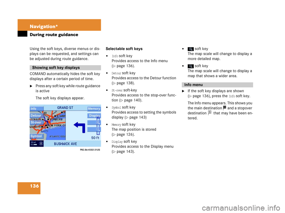
Using the soft keys, diverse menus or dis-
plays can be requested, and settings can
be adjusted during route guidance.
COMAND automatically hides the soft key
displays after a certain period of time.
�P r e s s a n y s o f t k e y w h i l e r o u t e g u i d a n c e
is active
The soft key displays appear.Selectable soft keys
�Info soft key
Provides access to the Info menu
(
�page 136).
�Detour soft key
Provides access to the Detour function
(
�page 138).
�St-over soft-key
Provides access to the stop-over func-
tion (
�page 140).
�Symbol soft key
Provides access to setting the symbols
display (
�page 143)
�Memory soft key
The map position is stored
(
�page 126).
�Display soft key
Provides access to the Display menu
(
�page 143).
� soft key
The map scale will change to display a
more detailed map.
� soft key
The map scale will change to display a
map that shows a wider area.
�If the soft key displays are shown
(
�page 136), press the Info soft key.
The Info menu appears. This shows you
the main destination and a stopover
destination that may have been en-
tered.
Showing soft key displays
Info menu
s
Page 146 of 187

145 Navigation*
During route guidance
You can set the following to be displayed in
the status bar:
�Time of arrival/Dist. to Dest.
If the full-screen map display is activat-
ed (
�page 131), the estimated time of
arrival and the remaining distance to
the destination will be displayed. If you
have entered a stopover destination
(
�page 140), the corresponding data
will be displayed.
�Current-Location display
If the full-screen map display is activat-
ed (
�page 131), the following data will
be displayed:
�The current position as coordi-
nates.
�The number of satellites that can
currently be received.
�The current elevation (ALT = alti-
tude) above sea level.
�No display
The name of the current road is dis-
played.
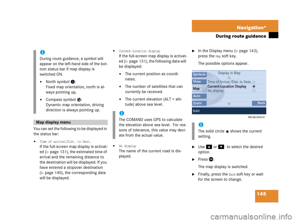
�In the Display menu (�page 143),
press the
Map soft key.
The possible options appear.
�Use % or &0to select the desired
option.
�Press '.
The map display is switched.
�Finally, press the Back soft key or wait
for the screen to change.
i
During route guidance, a symbol will
appear on the left-hand side of the bot-
tom status bar if map display is
switched ON.
�North symbol :
Fixed map orientation, north is al-
ways pointing up,
�Compass symbol :
Dynamic map orientation, driving
direction is always pointing up.
Map display menu
i
The COMAND uses GPS to calculate
the elevation above sea level. For rea-
sons of tolerance, this value may devi-
ate from the actual value.
i
The solid circle shows the current
setting.
Page 166 of 187

165 System
System settings
Setting the time
The UTC time transmitted by the GPS sat-
ellites has to be set to the local time zone.
This enhances
�correct navigation for routes with time-
dependent traffic guidance, and
�correct calculation of the estimated
time of arrival.
�Use# or $ to select the hours or
the minutes.
�Press% or &.
Depending on the selection, hours or
minutes are set.
Setting the minutes:
With GPS reception, each time you
press % o r & changes the time in in-
crements of 30 minutes. Without GPS
reception, the time is changed in 1
minute increments.
Setting the hours:
Each time you press % or &, the
hours change in increments of 1 hour.
�Press the Back soft key.
The new setting is stored.Setting the date
�Use# or $ to select the day, the
month or the year.
�Press% or &.
Depending on the selection, the day,
the month, or the year is set.
�Press the Back soft key.
The new setting is stored.
Setting the date/Time format
�Press the Format soft key.
You will see the date and time following
the currently selected format, as well
as a list of possible formats.
i
There is no automatic change from day-
light saving time to standard time.
This has to be changed manually.
When you change the time zone, the
clock time also changes automatically.
If you enter an incorrect time, the time
difference remains unchanged when
you change time zone.
i
The date can be set only if GPS recep-
tion is available.
��
Page 167 of 187
166 System
System settings
Setting the format:
�Use% or & to select a format.
�Press'.
The appropriate format is selected.
�Press the Back soft key or wait for the
screen to change.
The new setting is stored.
The language setting changes the display
language as well as the language used for
voice instructions in navigation announce-
ments.
�In the System menu (�page 164),
press the
Lang. soft key.
The language list is displayed.The following options are available:
�Instr. cluster settings:
The system switches to the lan-
guage already set in the vehicle in-
strument cluster (
�Vehicle
Operator’s manual).
�All other options:
The system switches to the re-
quested language.
i
List entry 1-3: Date formats
List entry 4 and 5: Time formats
(Entry 5 is not visible on the display ex-
ample below.)
Solid circle : format set
Empty circle : format not set
Setting the language
Page 169 of 187
168 System
System settings
Switching the display dimming
characteristics
You can select from 3 display dimming
modes:
�Day mode
The display is constantly set to daytime
design.
�Night mode
The display is constantly set to night-
time design.
�Automatic
The display will change depending on
the illumination of the instrument clus-
ter.
�Use% or & to select an entry.
�Press'.Adjusting display brightness
�Press the Bright. soft key.
The Brightness display appears.
�Press# or $.
The brightness changes accordingly.
�Press the Back soft key or wait for
screen to change.
The new setting is stored.Use this function to:
�Start or delete voice control individual-
ization (
�page 169)
�Activate/deactivate the voice control
help window
Activate/deactivate the help window
�Open the System menu (�page 164).
�Press the VC tips soft key.
The Voice control menu appears.
Voice control settings*
Page 172 of 187
171 System
System settings
Canceling individualization
You can cancel individualization at any
time during either the first or second
stage. All existing data remains un-
changed.
�During any individualization stage,
press the
Cancel soft key.
Individualization is cancelled.
Deleting individualization
�From the Individualization menu,
press& to select menu item
Delete
individualization
.
�Press'.
A prompt appears, which asks if you re-
ally want to delete the data.
�Press# to select Yes.
�Press'.
The individualization is deleted.Actuating the Reset function resets
COMAND to the factory settings.
In addition, it deletes:
�SMS: All SMS messages.
�Navigation*: All entries in the Destina-
tion memory and in the Last destina-
tion memory.
Reset activation
�Call up the System menu (�page 164).
�Press the Reset soft key.
i
This function is not available if no indi-
vidualization data has been saved.
Reset function
��
Page 174 of 187

173 Glossary
Autostore
Enters the stations with the best recep-
tion (signal strength) into the autostore
memory in order of their reception
quality (from strong to weak).
Balance
Volume adjustment between left and
right speakers.
Bit
(Bi
nary digit)
The smallest unit of digital information.
Bit rate
Measurement of transmission speed.
Indicates the number of ->bits trans-
mitted per time unit.
CD
(C
ompact Disc)
Digital storage medium in disc form.
CD-R
(CD
Recordable)
- > C D w h i c h c a n b e r e a d a n d w r i t t e n b u t
not deleted.CD-RW
(CD
Rewriteable)
->CD which can be read, written and
deleted.
COMAND
(Co
ckpit Management and Data Sys-
tem)
Information and operating center for
vehicle sound and communication sys-
tems, including the radio and CD play-
er, as well as for other optional
equipment (CD changer*, telephone*,
satellite radio*, navigation*).
Coordinates
Indicate the geographical position on
the earth's surface.
DVD
(D
igital Versatile Disc)
Digital storage medium in disc form for
storing large volumes of data.Fader
(Fader control)
Volume control between front and rear
speakers.
Folder
Alternative designation for directories.
Data saved on a storage medium can
be organized into directories for im-
proved clarity. Can be likened to a filing
cabinet containing a number of folders,
each of which holds a number of docu-
ments.
Greenwich meridian
A specific north-south line running
through Greenwich, England.
GPS
(G
lobal Positioning System)
Satellite-based system for relaying
geographic location information to and
from vehicles equipped with special re-
ceivers. Employs DVD digital maps for
navigation.
Glossary
Page:
< prev 1-8 9-16 17-24