Page 8 of 58

8
Before Use
Navigation
Set Up
RDM-TMCIf
necessary
Rear View
Monitor
Introduction
■Extremely low or high temperatures may interfere with normal operationThe inside of the vehicle can become very hot or cold when it is parked for extended
periods in direct sunlight or in cold places with the engine turned off. The navigation system
may not operate normally under such circumstances. Turn off the navigation system until
the inside of the vehicle has cooled down or warmed up. If the system does not operate
thereafter, consult an Authorized Dealer, we recommend an Authorized Mazda Dealer.
This navigation system utilizes GPS* satellite signals, a speed sensor and gyrosensor to track
and display your vehicle’s current position, and to guide you from your starting point to your
destination along a calculated route.
* : GPS (Global Positioning System) is a position detecting system utilizing the signals from GPS satellites
deployed by the U.S. Defense Department.
Screens displayed in this manual may differ from those on the actual display.
Use This Product Safety
Navigation System
Screens
MAZDA6_NAVI_EA.book Page 8 Wednesday, December 28, 2005 1:36 PM
Page 12 of 58

12
RoutingAddress
Book
Getting started
Activation
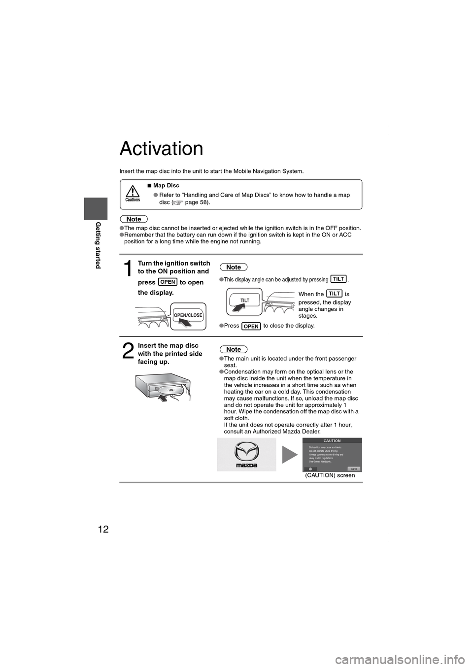
Insert the map disc into the unit to start the Mobile Navigation System.
Note
●The map disc cannot be inserted or ejected while the ignition switch is in the OFF position.
●Remember that the battery can run down if the ignition switch is kept in the ON or ACC
position for a long time while the engine not running.
■Map Disc
●Refer to “Handling and Care of Map Discs” to know how to handle a map
disc (
page 58).
1
Turn the ignition switch
to the ON position and
press
to open
the display.
Note
●This display angle can be adjusted by pressing .
When the is
pressed, the display
angle changes in
stages.
●Press to close the display.
2
Insert the map disc
with the printed side
facing up.Note
●The main unit is located under the front passenger
seat.
●Condensation may form on the optical lens or the
map disc inside the unit when the temperature in
the vehicle increases in a short time such as when
heating the car on a cold day. This condensation
may cause malfunctions. If so, unload the map disc
and do not operate the unit for approximately 1
hour. Wipe the condensation off the map disc with a
soft cloth.
If the unit does not operate correctly after 1 hour,
consult an Authorized Mazda Dealer.
Cautions
OPENTILT
TILT
OPEN
(CAUTION) screen
MAZDA6_NAVI_EA.book Page 12 Wednesday, December 28, 2005 1:36 PM
Page 46 of 58
46
Before
UseGetting
startedRoutingAddress
Book
Navigation Set Up
Navigation Set Up
This function allows you to correct any error in the position or direction of your vehicle display.
Before Steps select
Adjusting Current Position and Direction
select
Open the [Position calibration] screen
Move to the correct position and select .
Use
or to adjust the direction in which you are
heading, and select .
DistanceThis function automatically corrects any error in the display of the current position
that might occur after tire replacement.
select
You will have to drive about 6 miles (10 km) before distance correction is complete.
Set ClockThe current time is
a GPS satellite.
select
Open the [SE
T
Map VersionThe map and softw
select
Map and software
Calibration
MENUENTERENTER
ENTERENTER
ENTER
ENTERENTER
ENTER
ENTER
MAZDA6_NAVI_EA.book Page 46 Wednesday, December 28, 2005 1:36 PM
Page 47 of 58
47
Before
UseGetting
startedRoutingAddress
Book
Navigation Set Up
select
ect .
n which you are
f the current position
correction is complete.
Set ClockThe current time is set using this function. Since time notification is provided by
a GPS satellite.
select
Open the [SET CLOCK] screen
Select if you prefer 24-hour display;
for 12-hour display.
Select to move the setting ahead by one hour,
and similarly, select to move it back by one
hour.
How to exit .
Map VersionThe map and software version numbers can be confirmed using this function.
select
Map and software versions are now displayed.
ENTERENTERENTER
ENTER
ENTERENTER
ENTERENTER
MAZDA6_NAVI_EA.book Page 47 Wednesday, December 28, 2005 1:36 PM
Page 52 of 58

52
Before
UseGetting
startedRoutingAddress
Book
Vo i c e Recognition
As necessary
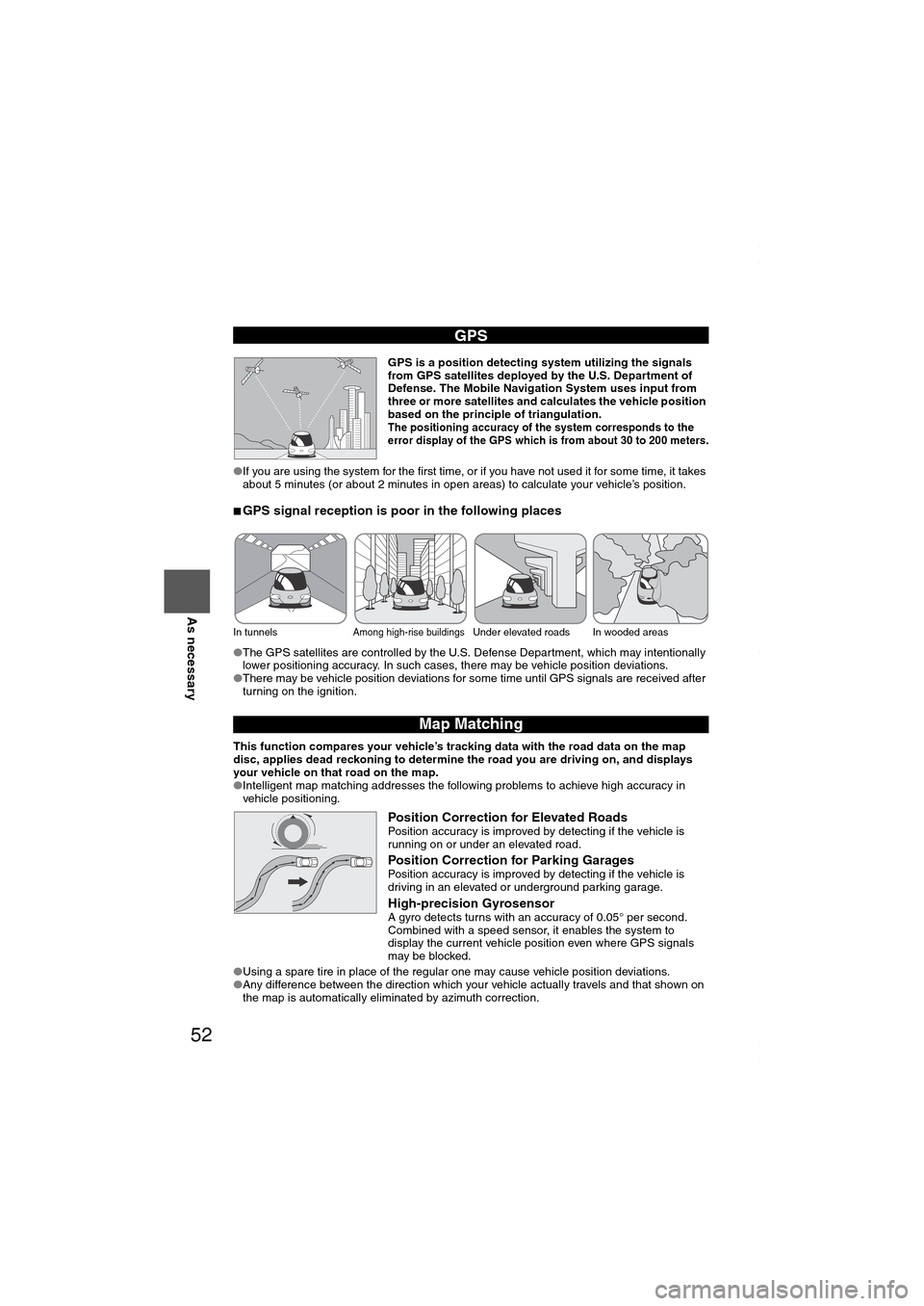
GPS is a position detecting system utilizing the signals
from GPS satellites deployed by the U.S. Department of
Defense. The Mobile Navigation System uses input from
three or more satellites and calculates the vehicle position
based on the principle of triangulation.
The positioning accuracy of the system corresponds to the
error display of the GPS which is from about 30 to 200 meters.
●If you are using the system for the first time, or if you have not used it for some time, it takes
about 5 minutes (or about 2 minutes in open areas) to calculate your vehicle’s position.
■GPS signal reception is poor in the following places
●The GPS satellites are controlled by the U.S. Defense Department, which may intentionally
lower positioning accuracy. In such cases, there may be vehicle position deviations.
●There may be vehicle position deviations for some time until GPS signals are received after
turning on the ignition.
This function compares your vehicle’s tracking data with the road data on the map
disc, applies dead reckoning to determine the road you are driving on, and displays
your vehicle on that road on the map.
●Intelligent map matching addresses the following problems to achieve high accuracy in
vehicle positioning.
Position Correction for Elevated RoadsPosition accuracy is improved by detecting if the vehicle is
running on or under an elevated road.
Position Correction for Parking GaragesPosition accuracy is improved by detecting if the vehicle is
driving in an elevated or underground parking garage.
High-precision GyrosensorA gyro detects turns with an accuracy of 0.05° per second.
Combined with a speed sensor, it enables the system to
display the current vehicle position even where GPS signals
may be blocked.
●Using a spare tire in place of the regular one may cause vehicle position deviations.
●Any difference between the direction which your vehicle actually travels and that shown on
the map is automatically eliminated by azimuth correction.
GPS
In tunnelsAmong high-rise buildingsUnder elevated roads In wooded areas
Map Matching
MAZDA6_NAVI_EA.book Page 52 Wednesday, December 28, 2005 1:36 PM