Page 167 of 226

159 Navigation
Route guidance
You can either select the map in north-up
orientation or position it with the driving di-
rection pointing up.North-up: Map is displayed facing north 1Selecting map orientation
North arrow ! or compass needle <
(black tipping pointing to the north)
2Symbol for current vehicle locationSelecting driving direction pointing up
Heading-up: Map is displayed facing driving
direction pointing up�
Turn the right-hand rotary/push-
button v to highlight 1 and press to
confirm.
Symbol 2 points in the driving direc-
tion, the compass needle will appear.To return to North-up
�
Turn the right-hand rotary/push-
button v to highlight 1 and press to
confirm.
The north arrow will appear again.
Selecting map orientation
Map orienta-
tion
Characteristics
North-up
North arrow always
points to the top
The symbol for the cur-
rent vehicle location is
turning on the map
Heading-up
The symbol for the cur-
rent vehicle location al-
ways points to the top
The compass needle is
turning, the black point
always points north
Page 168 of 226
160 NavigationRoute guidanceYou can store a way point during route
guidance.
1Activates “Way Point” menu�
Turn the right-hand rotary/push-
button v to highlight 1 and press to
confirm.
The “Way Point” menu will appear.
“Way point” menu2Select a category
3Activates the main address menu
(
�page 123)
4Activates the “Points of Interest” selec-
tion menu (
�page 137)
5Activates the main destination memory
menu (
�page 174)
6Activates the Coordinate destination
input menu (
�page 135)
�
Turn the right-hand rotary/push-
button v to highlight 2 to 6 and
press to confirm.
�
Select the desired way point.
�
Start route guidance.
Marking a way point
Page 169 of 226
161 Navigation
Route guidance
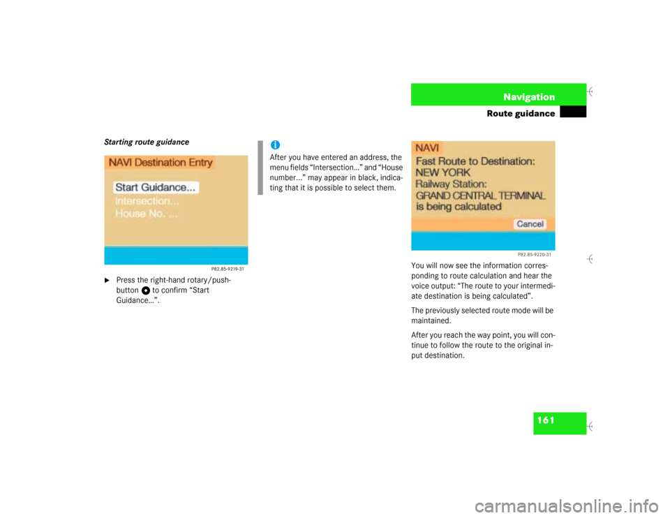
Starting route guidance�
Press the right-hand rotary/push-
button v to confirm “Start
Guidance…”.You will now see the information corres-
ponding to route calculation and hear the
voice output: “The route to your intermedi-
ate destination is being calculated”.
The previously selected route mode will be
maintained.
After you reach the way point, you will con-
tinue to follow the route to the original in-
put destination.
iAfter you have entered an address, the
menu fields “Intersection…” and “House
number...” may appear in black, indica-
ting that it is possible to select them.
P82.85-9220-31
Page 170 of 226
162 NavigationRoute guidanceCanceling the calculation �
Press the right-hand rotary/push-
button v to confirm “Cancel”.Deleting way point
�
Turn the right-hand rotary/push-
button v to highlight “Stop” in the
symbol or map display and press to
confirm.
The “Way Point” menu will appear, “De-
lete stop-over...” is highlighted.
Menu bar is not visible in the map:�
Turn the right-hand rotary/push-
button v.
The menu bar will appear.
�
Press the right-hand rotary/push-
button v to confirm “Delete stop-
over...”.
The way point has been deleted.
If you do not want to delete the way point
�
Press *.iIt is also possible to delete a way point
in the menu (
�page 167).
Page 171 of 226
163 Navigation
Route guidance
Main detour menu
1It is possible to block route sections
ahead
2Ends the detour function, the previous
route is calculated
3It is possible to block route sections in
the route list (
�page 165)
Explanation corresponding 2
�
Detour has not yet been selected
You cannot select “Cancel”
�
Detour has been selected
“Cancel” is highlighted
�
Press ) while any menu is on the
screen during route guidance.
The main detour menu will appear.
�
Turn the right-hand rotary/push-
button v to highlight the desired
menu field and press the button.
^
Selecting a detour
P82.85-9222-31
1223
iTraffic jams are identified by the driver,
not by the COMAND.
If you switch off COMAND for more than
30 minutes during active route
guidance, all manually entered traffic
jams are deleted.
Page 172 of 226

164 NavigationRoute guidanceTraffic jam ahead
If a traffic jam lies ahead, you can block the
route sections following the next turn.Traffic jam menu1Length of the blocked route section in
miles
�
Turn the right-hand rotary/push-
button v to highlight “Traffic Jam
Ahead...” in the main detour menu and
press to confirm.
The traffic jam menu will appear.Entering the length of the blocked route
section
Increasing the blocked section
�
Turn the right-hand rotary/push-
button v to the right.
Decreasing the blocked section
�
Turn the right-hand rotary/push-
button v to the left.
Calculating detour
�
Press the right-hand rotary/push-
button v.
The route will be re-calculated. An in-
formation menu will appear.
After that COMAND continues route
guidance.
iCOMAND suggests reasonable route
sections.
Minimum/maximum length of detour is
governed by the logical grouping of rou-
te sections. If additional detour seg-
ments are required after the original
detour, they must be requested indivi-
dually.
iYou can also select “Traffic Jam Ahead”
during the course of a detour. The cur-
rent detour will then be cancelled.
Page 173 of 226
165 Navigation
Route guidance
Detour in route list�
Turn the right-hand rotary/push-
button v to highlight “Detour in Route
List” in the main detour menu and
press to confirm.
The message “The route list is being
calculated” will appear.
Then the route list will appear.
Route list1Street cannot be blocked off
2Symbol “+”: street contains several
sections which can be blocked off
3Blocked street will appear in redDisplaying an entry in full in a window
�
Press u.
�
Press u again to remove the window.
Page 174 of 226

166 NavigationRoute guidanceCalling detailed route list Detailed route list4Symbol “-” - sections of a road are dis-
played�
Press +.
The detailed route list will appear.Blocking off several streets/street sec-
tions
�
Turn the right-hand rotary/push-
button v to the right.
With each turn, you will block another
section.
The road name will appear in red.
Undoing street block
�
Turn the right-hand rotary/push-
button v to the left.
The street name will appear in black
again.
Switching back to the route list
�
Press ,.
The symbol “+” appears in front of the
street section.
The blocking function is still active.Canceling blocking function, do not recal-
culate the route
�
Press *.
The traffic jam menu will appear.
Ending the blocking function, re-calcula-
ting the route with the blocks selected
�
Press the right-hand rotary/push-
button v.
COMAND re-calculates the route in the
previously selected calculation mode.
A corresponding message will appear.
Then the symbol display will appear
again and COMAND will continue route
guidance.