Page 201 of 276

be turned off.STORING A LOCATION/ROUTE
STORING LOCATION
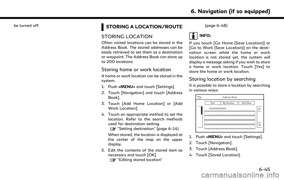
Often visited locations can be stored in the
Address Book. The stored addresses can be
easily retrieved to set them as a destination
or waypoint. The Address Book can store up
to 200 locations.
Storing home or work location
A home or work location can be stored in the
system.
1. Push
Page 203 of 276

.The route is stored in the first available
position number in the stored routes list.
. When 10 routes are already stored in the
address book, a new route cannot be
stored until a route is deleted.
“Deleting stored item” (page 6-51)
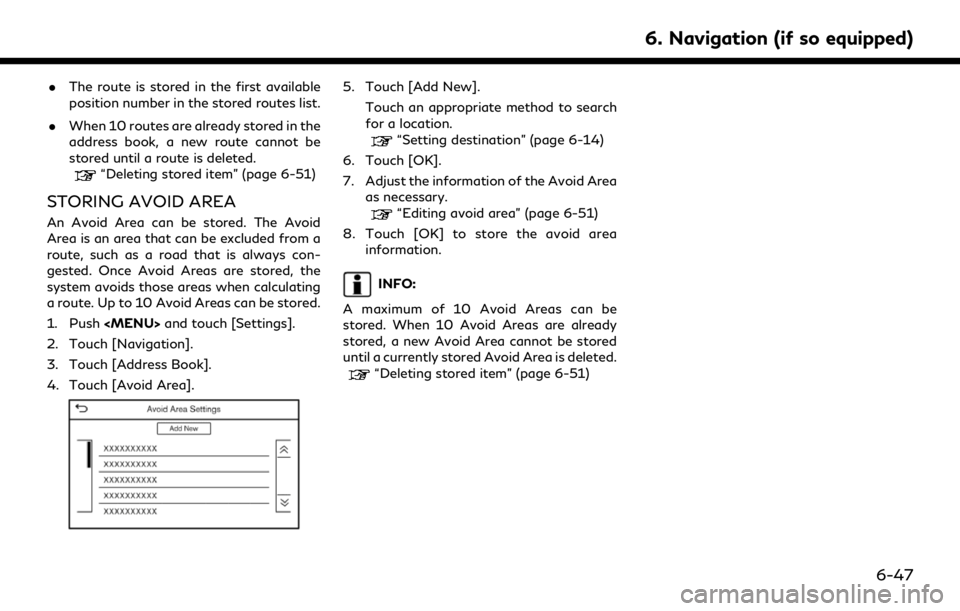
STORING AVOID AREA
An Avoid Area can be stored. The Avoid
Area is an area that can be excluded from a
route, such as a road that is always con-
gested. Once Avoid Areas are stored, the
system avoids those areas when calculating
a route. Up to 10 Avoid Areas can be stored.
1. Push
and touch [Settings].
2. Touch [Navigation].
3. Touch [Address Book].
4. Touch [Avoid Area].
5. Touch [Add New]. Touch an appropriate method to search
for a location.
“Setting destination” (page 6-14)
6. Touch [OK].
7. Adjust the information of the Avoid Area as necessary.
“Editing avoid area” (page 6-51)
8. Touch [OK] to store the avoid area information.
INFO:
A maximum of 10 Avoid Areas can be
stored. When 10 Avoid Areas are already
stored, a new Avoid Area cannot be stored
until a currently stored Avoid Area is deleted.
“Deleting stored item” (page 6-51)
6. Navigation (if so equipped)
6-47
Page 204 of 276
![INFINITI QX80 2020 Infiniti Connection 6. Navigation (if so equipped)
EDITING STORED INFORMATION
Items stored in the system can be edited.
Editing stored location
1. Push<MENU> and touch [Settings].
2. Touch [Navigation] and touch [Address INFINITI QX80 2020 Infiniti Connection 6. Navigation (if so equipped)
EDITING STORED INFORMATION
Items stored in the system can be edited.
Editing stored location
1. Push<MENU> and touch [Settings].
2. Touch [Navigation] and touch [Address](/manual-img/42/35001/w960_35001-203.png)
6. Navigation (if so equipped)
EDITING STORED INFORMATION
Items stored in the system can be edited.
Editing stored location
1. Push
and touch [Settings].
2. Touch [Navigation] and touch [Address Book].
Setting item Action
[Home Location]* [Edit] [Show Icon on Map] Displays the home icon on the map. [Icon] Selects a home icon of a preferred design.
[Sound] Sets the type of the alarm that sounds when the vehicleapproaches home.
[Direction] Sets the alarm to sound when approaching from a specific direction.
[Distance] Sets the alarm to sound when reaching a specific distance to home.
[Phone No.] Stores the home telephone number.
[Move Location] Adjusts the stored home location.
[Delete] Deletes the stored home location.
[OK] Confirms and saves the edited home information.
[Work Location]* [Edit] [Show Icon on Map] Displays the work icon on the map. [Icon] Selects a work icon of a preferred design.
[Sound] Sets the type of alarm that sounds when the vehicleapproaches work.
6-48
Page 205 of 276
![INFINITI QX80 2020 Infiniti Connection [Direction]Sets the alarm to sound when approaching from a
specific direction.
[Distance] Sets the alarm to sound when reaching a specific distance to work.
[Phone No.] Stores the work telephone numbe INFINITI QX80 2020 Infiniti Connection [Direction]Sets the alarm to sound when approaching from a
specific direction.
[Distance] Sets the alarm to sound when reaching a specific distance to work.
[Phone No.] Stores the work telephone numbe](/manual-img/42/35001/w960_35001-204.png)
[Direction]Sets the alarm to sound when approaching from a
specific direction.
[Distance] Sets the alarm to sound when reaching a specific distance to work.
[Phone No.] Stores the work telephone number.
[Move Location] Adjusts the stored work location.
[Delete] Deletes the stored work location.
[OK] Confirms and saves the edited work information.
[Saved Locations] [Sort] [Sort by Number] Sorts the saved locations.
“Searching from address book” (page 6-21)
[Sort by Name]
[Sort by Icon]
[Sort by Group]
[Add New] Adds a new location.
“Storing location by searching” (page 6-45)
Saved Location
List [Edit] [Show Icon on Map] Displays the icon of a stored location on the map.
[Name] Registers a name of the entry.
[Voice Tag] Registers a voice tag for the entry which allows the entry to be used with the Voice Recognition System.
[Icon] Selects an icon for the entry.
[Sound] Sets the type of the alarm that sounds when the vehicle approaches the location.
[Direction] Sets the alarm to sound when approaching from a specific direction.
6. Navigation (if so equipped)
6-49
Page 210 of 276
![INFINITI QX80 2020 Infiniti Connection 6. Navigation (if so equipped)
NAVIGATION SETTINGS
The navigation system can be customized according to the user’s preference.
1. Push<MENU> and touch [Settings].
2. Touch [Navigation].
3. Touch the INFINITI QX80 2020 Infiniti Connection 6. Navigation (if so equipped)
NAVIGATION SETTINGS
The navigation system can be customized according to the user’s preference.
1. Push<MENU> and touch [Settings].
2. Touch [Navigation].
3. Touch the](/manual-img/42/35001/w960_35001-209.png)
6. Navigation (if so equipped)
NAVIGATION SETTINGS
The navigation system can be customized according to the user’s preference.
1. Push
and touch [Settings].
2. Touch [Navigation].
3. Touch the item you would like to set.
Available setting items
Setting item Result
[Map Settings] Sets the display method and direction of the map.
“Map settings” (page 6-9)
[Guidance Settings] Sets the various functions for route guidance.
“Guidance settings” (page 6-40)
[Route Preference] Changes the routing preferences.
“Route Preference” (page 6-34)
[Traffic Info Settings] Sets the various functions of the Traffic information feature.
“Traffic information setting” (page 6-44)
[Speed Limit Indication on Map] Turns on/off the speed limit display function. When this item is turned on, a speed limit indicator will appear on the map screen when available.
[Speed Limit Warning] Turns on/off the speed limit warning.
[Speed Limit Sensitivity] Adjusts the speed limit sensitivity. This function is available when [Speed Limit Warning] is turned on.
[Address Book] Stores locations and routes. Stored items can be edited or deleted.
“Storing a location/route” (page 6-45)
[Customize POIs] Sets the POI categories to be displayed on the Points of Interest screen.
“Customizing POIs ” (page 6-20)
[Adjust Current Location] If the vehicle icon indicating the current vehicle location is not in the correct position, the location of the vehicle icon on the map screen can be adjusted.
6-54
Page 212 of 276

6. Navigation (if so equipped)
GENERAL INFORMATION FOR
NAVIGATION SYSTEM
CURRENT VEHICLE LOCATION
Display of current vehicle location
This navigation system combines the data
obtained from the vehicle (by gyro sensor)
and from GPS (Global Positioning System)
satellites to calculate the current location of
the vehicle. This position is then displayed
throughout route guidance to a destination.
What is GPS (Global Positioning
System)?
GPS is a position detecting system that uses
satellites deployed by the U.S. government.
This navigation system receives radio signals
from three or more different satellites that
orbit 13,049 miles (21,000 km) above the
earth in space, and detect the position of the
vehicle by utilizing the principle of triangula-
tion.
Positioning adjustment:
When the system judges that the vehicle
position is not accurate based on vehicle
speed and gyro sensor data calculations, the
system will automatically adjust the position of the vehicle icon using GPS signals.
Receiving signals from GPS satellites:
The reception of GPS signals can be weak,
depending on the environment. Vehicles in
the following areas/environments may not
receive GPS signals.
* Inside tunnels or parking garages
*In areas with numerous tall buildings
*Under multi-layered highways
6-56
Page 213 of 276
*Areas with numerous tall trees
*In canyons
INFO:
The GPS antenna is located on the instru-
ment panel inside the vehicle. Do not place
any objects, especially cellular phones or
transceivers, on the instrument panel. Be-
cause the strength of the GPS signal is
approximately one billionth of that of TV
waves, phones and transceivers will affect
or may totally disrupt the signal.
Incorrect display of vehicle position
The following cases may affect the display
accuracy of the vehicle’s position or traveling
direction. The accuracy will return to normal
if the driving conditions return to normal.
* When there is a similar road nearby.
*When the vehicle is traveling in an area
with a grid pattern road system.
*When the vehicle is passing through a
large Y-shaped intersection/junction.
6. Navigation (if so equipped)
6-57
Page 215 of 276

*When driving on a road not displayed on
the map screen or a road that has been
changed due to additional construction
or other reasons.
*When the GPS positioning accuracy is
low.
INFO:
. The vehicle icon may be misaligned when
starting the vehicle just after starting the
engine.
. The vehicle icon may also be misaligned if
different sized tires or tire chains are
installed.
. The system has a function that auto-
matically corrects the vehicle icon posi-
tion when it is misaligned from the actual
position.
. Vehicle position correction by GPS may
not function when the vehicle is stopped.
. If the vehicle icon position does not
return to normal even after driving for a
while, correct the vehicle icon position
manually.
Detailed Map Coverage Areas
(MCA) for navigation system
This system is designed to help guiding to
the destination, and it also performs other
functions as outlined in this manual. How-
ever, the system must be used safely and
properly. Information concerning road con-
ditions, traffic signs and the availability of
services may not always be up-to-date. The system is not a substitute for safe, proper
and legal driving.
Map data covers select metropolitan areas.
Map data includes two types of areas:
“Detailed coverage areas” providing all de-
tailed road data and other areas showing
“Main roads only”.
INFO:
Detailed map data is not available in many
areas and is generally limited to select major
metropolitan areas.
ROUTE GUIDANCE
INFO:
. The system will announce street names
when the system language is set to
English. Street names are not announced
when the system is set to French or
Spanish.
Repeating voice guidance
This function is available throughout route
guidance, from the time after the route
calculation is completed until the vehicle
arrives at the destination. Push and hold