2019 VOLVO S60T8 instrument panel
[x] Cancel search: instrument panelPage 4 of 43

2
NAVIGATION
Activating and deactivating the navi- gation system* 4
Navigation system * symbols and buttons
5
Information cards in the navigationsystem * 6
Navigation system * in center display
6
Navigation system * in the instrument
panel 8
Activating and deactivating the navi-gation system * in the instrument panel 8
Navigation system * in head-up display *
9
Voice control for navigation system *
9
Entering a destination directly on the map 10
Entering a destination using an address 10
Entering a destination with a freetext search 11
Entering a POI as a destination 12
Entering a destination using Recent/Favorites/Library 13
Entering a destination with Send to Car 14
Itinerary 15
Viewing an itinerary 16
Editing or clearing an itinerary 16
Viewing alternative routes 17
Viewing points of interest along the route 17
Show guidance in the itinerary 18
Traffic disruptions on map18
Show traffic disruptions along the route 19
Selecting a detour in the navigation system * 19
Real Time Traffic Information (RTTI) 20
Activating and deactivating enhanced traffic information 21
Navigation system * settings
21
Map settings 21
Route settings and guidance 22
Traffic information settings 23
Map updating 24
Updating maps with a computer andUSB flash drive 25
Updating maps from a vehicle withInternet connection 27
Frequently Asked Questions regar- ding the navigation system *28
Navigation license agreements *
29
Navigation system * copyright
35
INDEX
Index 37
TABLE OF CONTENTS
Page 6 of 43

NAVIGATION
* Option/accessory.
4
Activating and deactivating the
navigation system *
The navigation system is automatically activated when the driver's door is opened and is deacti-vated when the driver locks and arms the vehi-cle.
Activating navigation
Navigation system tile
Home button View the map on the center display by tapping the top tile (1) in Home view. If the center display does not show the navigation system tile, press the Home button (2) twicequickly and then tap the navigation system tile(1). A map will appear of the surrounding area and the vehicle's current location (blue triangle).
Tap this symbol to display themap across the entire centerdisplay.
WARNING
Observe the following:
Direct all your attention to the road and make sure that your concentration isfocused on driving.
Follow applicable traffic laws and usegood judgment while driving.
Road conditions can be affected byweather or season, which may make cer-tain recommendations less reliable.
Deactivating navigationWhile the ignition is switched on, the navigationsystem is always active in the background. It switches off automatically when the ignition isswitched off and the vehicle is locked.
NOTE
The navigation system is available even when the engine is turned off. If the battery chargelevel becomes too low, the system will switchoff.
Related information
Navigation system
* in center display (p. 6)
Navigation system
* in the instrument panel
(p. 8)
Navigation system
* in head-up display *
(p. 9)
Voice control for navigation system
* (p. 9)
Navigation system
* symbols and buttons
(p. 5)
Page 9 of 43

NAVIGATION
* Option/accessory.7
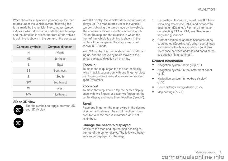
When the vehicle symbol is pointing up, the map rotates under the vehicle symbol following theturns made by the vehicle. The compass symbolindicates which direction is north (N) on the mapand the direction in which the front of the vehicleis pointing is shown in the center of the compass:
Compass symbolsCompass direction
N North
NE Northeast E East
SE Southeast
S South
SW Southwest
W West
NW Northwest
2D or 3D viewTap the symbols to toggle between 2D and 3D display.
With 3D display, the vehicle's direction of travel is always up. The map rotates under the vehiclesymbols following the turns made by the vehicle.The compass indicates which direction is north(N) on the map and the direction in which thefront of the vehicle is pointing is shown in thecenter of the compass: The map scale is notshown in 3D mode. With 2D display, the map is shown with north fac- ing up, and the vehicle symbols moves in theactual compass direction on the map.
Zoom inTo make the map larger, tap the center displaytwice in quick succession with one finger or placetwo fingers on the center display and move themapart ("stretch").
Zoom outTo make the map smaller, tap the center displayonce with two fingers or place two fingers on thecenter display and move them together ("pinch").
ScrollPlace one finger on the map, swipe in the desireddirection and release. The scroll function is onlypossible with the map in maximized view, notminimized.
Change the headers displayedMaximize the map and tap the map heading atthe top of the center display. The following head-ers can be displayed on the map: 1.
Destination Destination, arrival time (
ETA) or
remaining travel time (RTA) and distance to
destination (Distance). For more information on selecting
ETA or RTA, see "Route set-
tings and guidance".
2. Current position as address (Address) or as coordinates (Coordinates). When coordinates are shown, altitude is also shown (Altitude).To choose between address and coordinates,see section "Map settings".
Related information
Navigation system
* settings (p. 21)
Navigation system
* in the instrument panel
(p. 8)
Navigation system
* in head-up display *
(p. 9)
Route settings and guidance (p. 22)
Map settings (p. 21)
Page 10 of 43

NAVIGATION
* Option/accessory.
8
Navigation system * in theinstrument panel
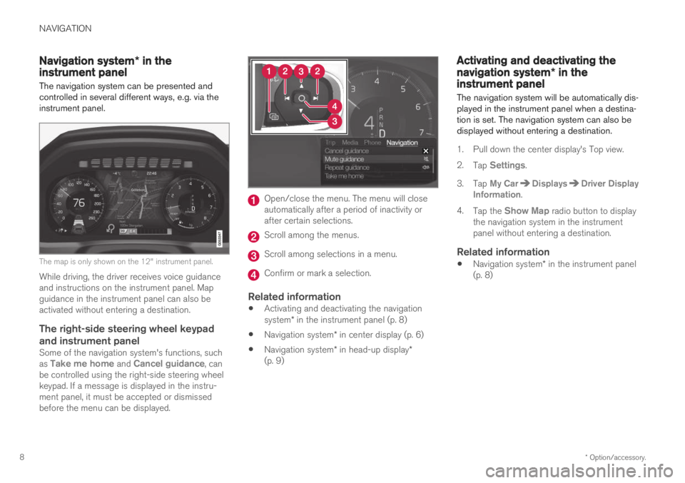
The navigation system can be presented and controlled in several different ways, e.g. via theinstrument panel.
The map is only shown on the 12" instrument panel.
While driving, the driver receives voice guidance and instructions on the instrument panel. Mapguidance in the instrument panel can also beactivated without entering a destination.
The right-side steering wheel keypad and instrument panel
Some of the navigation system's functions, such as Take me home and Cancel guidance, can
be controlled using the right-side steering wheel keypad. If a message is displayed in the instru-ment panel, it must be accepted or dismissedbefore the menu can be displayed.
Open/close the menu. The menu will close automatically after a period of inactivity orafter certain selections.
Scroll among the menus.
Scroll among selections in a menu.
Confirm or mark a selection.
Related information
Activating and deactivating the navigation system
* in the instrument panel (p. 8)
Navigation system
* in center display (p. 6)
Navigation system
* in head-up display *
(p. 9)
Activating and deactivating the
navigation system * in theinstrument panel
The navigation system will be automatically dis- played in the instrument panel when a destina-tion is set. The navigation system can also bedisplayed without entering a destination.
1. Pull down the center display's Top view. 2. Tap
Settings.
3. Tap
My CarDisplaysDriver Display
Information.
4. Tap the
Show Map radio button to display
the navigation system in the instrument panel without entering a destination.
Related information
Navigation system
* in the instrument panel
(p. 8)
Page 11 of 43

NAVIGATION
* Option/accessory.9
Navigation system * in head-up
display*
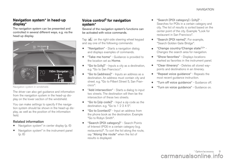
The navigation system can be presented and controlled in several different ways, e.g. via thehead-up display.
Navigation system in windshield.
The driver can also get guidance and information from the navigation system in the head-up dis-play on the lower section of the windshield. You can make settings to specify if the naviga- tion system should be shown in the head-up dis-play, as well as the position of the informationfield.
Related information
Navigation system
* in center display (p. 6)
Navigation system
* in the instrument panel
(p. 8)
Voice control3 for navigation
system *
Several of the navigation system's functions can be activated with voice commands.
Tap on the right-side steering wheel keypad
and say one of the following commands: "
Navigation" - Starts a navigation dialog
and displays examples of commands.
"
Take me home" - Guidance is provided to
the location set as Home.
"
Go to [city]" - Inputs a city as a destination,
e.g. "Go to San Francisco".
"
Go to [address]" - Inputs an address as a
destination. An address must contain city and street. e.g. "Go to Filbert Street 5, San Fran-cisco".
"
Add intersection" - Starts a dialog to input
two streets. The destination will then be the intersection of these two streets.
"
Go to [zip code]" - Input a zip code as the
destination. e.g. "Go to 1 2 3 4 5".
"
Go to [contact]" - Input an address from
the phone book as the destination. Example "Go to Robyn Smith".
"
Search [POI category]" - Search Points
of Interest (POI) in a certain category (e.g. restaurants) 4
. To sort the list along the route,
say "
Along the route" when the list of
results is displayed.
"
Search [POI category] i [city]" -
Searches for POIs in a certain category and city. The list of results is sorted based on thecenter point of the city. Example "Look forrestaurant in San Francisco".
"
Search [POI name]". For example,
"Search Golden Gate Bridge".
"
Change country/Change state5,6
" -
Changes the search area for navigation.
"
Show favorites" - Displays locations
marked as favorites in the instrument panel.
"
Clear itinerary" - Deletes all stored way-
points and destinations in an itinerary.
"
Repeat voice guidance" - Repeats the
most recent guidance instruction.
"
Turn off voice guidance" - Guidance off.
"
Turn on voice guidance" - Guidance on.
Page 15 of 43

NAVIGATION
}}
* Option/accessory.13
Entering a destination with Send to Car (p. 14)
Map settings (p. 21)
Entering a destination usingRecent/Favorites/Library
A destination can be specified in different ways in the navigation system * - selecting from a list is
one of them.
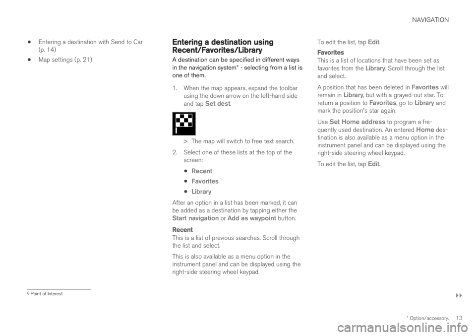
1. When the map appears, expand the toolbar using the down arrow on the left-hand side and tap
Set dest.
> The map will switch to free text search.
2. Select one of these lists at the top of the screen:
Recent
Favorites
Library
After an option in a list has been marked, it can be added as a destination by tapping either the
Start navigation or Add as waypoint button.
Recent
This is a list of previous searches. Scroll through the list and select. This is also available as a menu option in the instrument panel and can be displayed using theright-side steering wheel keypad. To edit the list, tap
Edit.
Favorites
This is a list of locations that have been set as favorites from the Library. Scroll through the list
and select. A position that has been deleted in
Favorites will
remain in Library, but with a grayed-out star. To
return a position to Favorites, go to Library and
mark the position's star again. Use
Set Home address to program a fre-
quently used destination. An entered Home des-
tination is also available as a menu option in the instrument panel and can be displayed using theright-side steering wheel keypad. To edit the list, tap
Edit.
8 Point of Interest
Page 25 of 43

NAVIGATION
}}
* Option/accessory.23
Arrival Time FormatChoose how arrival time will be displayed:
ETA19 (estimated time of arrival at the desti-
nation)
RTA20 (remaining time to arrival at destina-
tion)
Times are displayed according to the time zone of the destination.
Voice Guidance Level1. Tap Voice Guidance Level.
2. Tap desired voice guidance:
None (no automatic voice guidance, but
guidance can be manually requested once)
Low (only one message per guidance
point)
Medium (up to 3 messages per guidance
point, with limited information provided)
Full (up to 4 messages per guidance
point and all available information provi- ded)
Choose Default Route TypeSelect the default type of route to be used:
Fast
Eco
Scenic (highways/freeways are avoided
whenever possible; note that this could lead to longer travel times)
It is also possible to display an alternative routewhile driving.
Route LearningSelect Route Learning to allow data to be col-
lected to optimize route calculations.
AvoidTap Avoidance Settings to open a menu of
options to automatically avoid (if possible) when calculating a route. Possible selections includetunnels, ferries, congestion charge zones, etc.
Suggest service stationTap Propose Gas Station to activate or deacti-
vate the display of suggestions for nearby service stations in the instrument panel when fuel level islow.
Related information
Navigation system
* settings (p. 21)
Map settings (p. 21)
Traffic information settings (p. 23)
Viewing alternative routes (p. 17)
Traffic information settings The following settings determine how traffic information 21
is presented in the navigation sys-
tem *.
SettingsNavigationTraffic
Settings can be personalized in the following areas:
Show and Handle Traffic Events
Avoid Traffic Events
Show Free Flowing Traffic
Real Time Traffic Information
Show & Handle Traffic EventsSelect to display traffic events on the map and use this information to calculate routes:
None
Major
All types
19 Estimated Time of Arrival
20 Remaining Time to Arrival
Page 39 of 43

INDEX
37
A
Activating the system 4 Alternative routeEco, Fast, Scenic 17
C
Copyright 29, 35
D
Detour 19
F
Frequently Asked Questions 28
G
Guidance alternatives 22
Guidance options 21
Guidance points in the Itinerary 18
I
Itinerary 15edit and delete 16
view 16
L
License agreement 29
M
map navigationin head-up display 9
in instrument panel 8
in the center display 6
Map options 21
Map view 21
P
POI 12, 17
Points of interest 12, 17
R
Real Time Traffic Information (RTTI) 20, 21
S
Send to Car 14
Set destination 10, 11, 12, 13, 14
settings 21 map options 21
route and guidance 22
traffic information 23
T
Traffic information 23broadcast 18
Traffic problems along the route 19
Transporting vehicle 29
U
Updating map data 24, 25, 27
INDEX