2017 RENAULT FLUENCE ESP
[x] Cancel search: ESPPage 5 of 96

GB.3
PRECAUTIONS DURING USE
The prior acceptance of the General Conditions of Sale is mandatory befo\
re using the system.
The description of the models given in this manual is based on the speci\
fications at the time of writing. This manual covers
all existing functions for the models described. Whether or not they are\
fitted depends on the equipment model, op-
tions selected and the country where they are sold. This manual may also\
contain information about functions to be
introduced later in the model year. Depending on the make and model of your telephone, some functions may b\
e partially
or completely incompatible with your vehicle’s multimedia system.
For more details, please consult an Authorised Dealer.
Precautions when operating the system
– Operate the controls and read the information on the screen only when ro\
ad conditions allow.
– Set the volume to a reasonable level so that outside noise can be heard.\
Precautions regarding navigation
– Use of the navigation system does not in any way replace the responsibil\
ity or vigilance of the driver when driving the vehi- cle.
– Depending on the geographical area, the map on the SD card may not have \
the latest information on new roads. Be alert. In all cases, Road Traffic Regulations and road signs always take precedence over the direction\
s of the navigation system.
Precautions concerning the equipment
– Do not attempt to dismantle or modify the system, as there is a risk of \
damage to equipment and fire.
– Contact a representative of the manufacturer in the event of malfunction\
and for all operations involving disassembly.
– Do not insert foreign objects or a damaged or dirty SD card into the rea\
der.
– Always clean your screen with a microfibre cloth.
– Use an SD card which is suitable for your navigation system.
It is essential to follow the precautions below when using the system, b\
oth in the interest of safety and to prevent material d amage.
You must always comply with the laws of the country in which you are trav\
elling.
Page 16 of 96
GB.14
Upon delivery of your new vehicle, you
have a few days to update your maps
free of charge. After this, updates will
become payable.SD card
A SD card is supplied with the naviga-
tion system. Amongst other things, this
includes maps for your country or set of
countries.
Before using the SD card, check that it
is not locked.
Updates (especially of maps) are pub-
lished regularly. They are only avail-
able for download by inserting the SD
card of your navigation system into
your computer’s SD port, online at the
“R-Link Store”.
SD CARD: USE, INITIALISATION (1/2)
Only use your SD card for operat-
ing and updating your navigation
system. Do not insert any other
device (camera, portable GPS,
etc.), or in another vehicle.
Only use an SD card which is com-
patible with your vehicle's naviga-
tion system.
You can also download maps cover-
ing more countries than your origi-
nal map (e.g. Western Europe).
Page 26 of 96
GB.24
Controlling navigation with
your multimedia system's
voice recognition
You can enter a navigation address
using the voice control integrated into
your multimedia system. To do this:
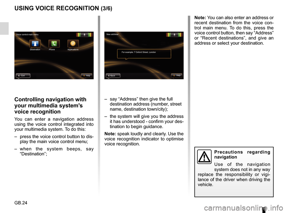
– press the voice control button to dis-play the main voice control menu;
– when the system beeps, say “Destination”; – say “Address” then give the full
destination address (number, street
name, destination town/city);
– the system will give you the address it has understood - confirm your des-
tination to begin guidance.
Note: speak loudly and clearly. Use the
voice recognition indicator to optimise
voice recognition.
USING VOICE RECOGNITION (3/6)
Precautions regarding
navigation
Use of the navigation
system does not in any way
replace the responsibility or vigi-
lance of the driver when driving the
vehicle.
Note: You can also enter an address or
recent destination from the voice con-
trol main menu. To do this, press the
voice control button, then say “Address”
or “Recent destinations”, and give an
address or select your destination.
New address
For example: 7 Oxford Street, London
Back Help
Voice control main menu
Destination
Exit Help Phone Applications
Page 31 of 96
GB.29
ENTERING A DESTINATION (2/5)
For safety reasons, carry
out these operations when
the vehicle is stationary.
Enter an “Address”
This section enables you to enter a
full or partial address: country, town,
street and number.
On first use, the system asks you to
choose the destination country.
Depending on the various version,
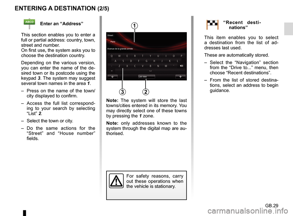
you can enter the name of the de-
sired town or its postcode using the
keypad 3. The system may suggest
several town names in the area 1.
– Press on the name of the town/ city displayed to confirm.
– Access the full list correspond- ing to your search by selecting
“List” 2.
– Select the town or city.
– Do the same actions for the “Street” and “House number”
fields.“Recent desti-nations”
This item enables you to select
a destination from the list of ad-
dresses last used.
These are automatically stored.
– Select the “Navigation” section from the “Drive to...” menu, then
choose “Recent destinations”.
– From the list of stored destina- tions, select an address to begin
guidance.
2
1
3
Street :
Paris
Avenue de la grande armée
List view
Note: The system will store the last
towns/cities entered in its memory. You
may directly select one of these towns
by pressing the 1 zone.
Note: only addresses known to the
system through the digital map are au-
thorised.
Page 37 of 96

GB.35
GUIDANCE (1/4)Guidance screens
Intersection map
During guidance, before each change
of direction, the system will gradually
zoom into the junction.
To deactivate automatic zoom, please
refer to “Advanced” in the “Navigation
settings” section.
Lane images
When approaching a road change (on
major roads), the system may switch
to “Show lane images” mode: an 3D
image provides a close-up view of the
junction with a turn arrow and road
signs.
To deactivate lane images, please
refer to the information on “Advanced
Settings” in the section on “Navigation
settings”.
Precautions regarding
navigation
Use of the navigation
system does not in any way
replace the responsibility or vigi-
lance of the driver when driving the
vehicle.
Guidance Voice
During guidance, before each turning,
the system will give voice instructions.
To deactivate or reactivate voice guid-
ance, please refer to the “Navigation
settings” section.
Page 39 of 96
GB.37
GUIDANCE (3/4)
“Calculate alternative”
Select this menu to make the system
stop the current guidance.
To start guidance again, select “Go
to...” then “Recent destinations”.
“Cancel route”
Select this menu to make the system
stop the current guidance.
To start guidance again, select “Go
to...” then “Recent destinations”.
Change route
To modify your route, from the
“Navigation” menu, select “Change
route” then one of the suggested op-
tions.
Precautions regarding
navigation
Use of the navigation
system does not in any way
replace the responsibility or vigi-
lance of the driver when driving the
vehicle.
“Travel via”
Select this menu to change your route
so that it passes by a particular loca-
tion, to pick someone up on the way, for
example. You choose the location you
want to pass in the same way as you
choose a destination.
You have the same set of options:
Address, Saved addresses, Point of
Interest and Point on the map.
Your system will calculate a new route
to your destination that passes the lo-
cation you chose.
Page 42 of 96
GB.40
Traffic Information Service
Options
To access the Traffic Information
Service options, from the main menu
press “Services”, “Navigation Services”,
then “HD Traffic™”.
“Minimise delays”
Select this option to alter your journey
based on the latest traffic information.
“Read traffic information”
This menu enables you to activate the
audio reading of traffic information.
“Display the map”
This menu enables you to explore the
map and keep up-to-date with the traf-
fic situation in your area. To access
the map, from the main menu, select
the Traffic Information Service then
“Display map”.
The map displays the last searched lo-
cation. Press the icon for an incident to
get more detailed information.
TRAFFIC INFORMATION (1/3)
Precautions regarding
navigation
Use of the navigation
system does not in any way
replace the responsibility or vigi-
lance of the driver when driving the
vehicle.
Traffic Information
Service
Traffic information is a service available
on your navigation system which lets
you receive up-to-date traffic informa-
tion coming from the best local sources.
The “Traffic” service uses TMC informa-
tion transmitted over FM wavebands.
The “HD Traffic™” service uses LIVE
Services information.
These services show events in the form
of dots on the map.
It covers the main roads and is updated
regularly.
Note: the menu title can be “Traffic” or
“HD Traffic™”. “Traffic settings”
Select this menu to set the desired de-
fault calculation method.
“Display traffic on route”
Select this menu to see an overview of
all traffic incidents on your route. Press
the icon for an incident to get more de-
tailed information.
Page 43 of 96
GB.41
TRAFFIC INFORMATION (2/3)
Traffic display
The navigation system indicates traffic
incidents:
– by displaying symbols on the map (list of icons at the end of the sec-
tion);
– with voice messages if the route is recalculated.
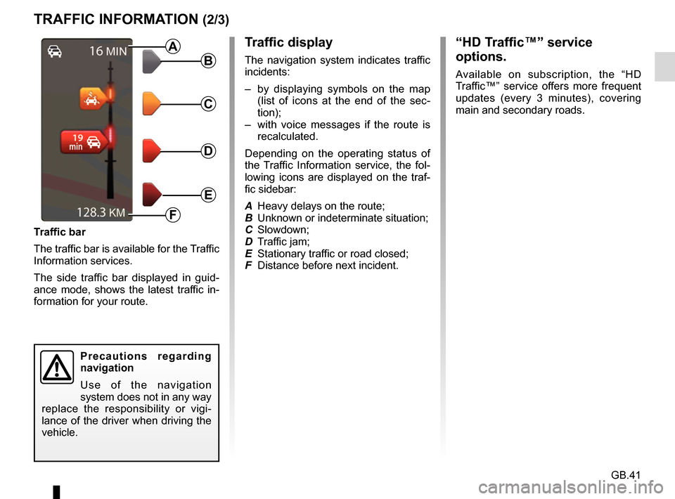
Depending on the operating status of
the Traffic Information service, the fol-
lowing icons are displayed on the traf-
fic sidebar:
A Heavy delays on the route;
B Unknown or indeterminate situation;
C Slowdown;
D Traffic jam;
E Stationary traffic or road closed;
F Distance before next incident.
Traffic bar
The traffic bar is available for the Traffic
Information services.
The side traffic bar displayed in guid-
ance mode, shows the latest traffic in-
formation for your route.B
C
D
E
F
A
Precautions regarding
navigation
Use of the navigation
system does not in any way
replace the responsibility or vigi-
lance of the driver when driving the
vehicle.
“HD Traffic™” service
options.
Available on subscription, the “HD
Traffic™” service offers more frequent
updates (every 3 minutes), covering
main and secondary roads.