2017 MERCEDES-BENZ CLS-Class sat nav
[x] Cancel search: sat navPage 11 of 206
Multiple users ................................ 192
Operating with the headphones ..... 191
Picture settings .............................. 192
System settings ............................. 193
Using the main loudspeaker ..........191
Rear view camera
Displaying the image ........................ 48
Opening the camera cover for
cleaning (COMAND) ......................... 48
Switching on/off (COMAND) ........... 48
Rear-compartment screens .............. 187
Receiving vCards ............................... 112
Redialing (telephone) .......................... 99
Remote control
Button lighting ............................... 188
Changing batteries ........................ 190
Rear Seat Entertainment System ... 187
Reserve fuel level
Switching the function on/off in
COMAND ......................................... 55
Resetting (factory settings) ...............43
Route (navigation)
Selecting an alternative route .......... 76
Setting route options (avoiding:
highways, toll roads, tunnels, fer-
ries) ................................................. 54
Setting the route type (short
route, fast route, dynamic route or
economic route) ............................... 54
Starting calculation .......................... 58
Route guidance
Continue .......................................... 75
Freeway information ........................ 73
General notes .................................. 71
Lane recommendations ................... 72
Off-road ........................................... 77
Traffic reports .................................. 78
S
Safety notesAudio CD and MP3 mode ............... 150
Using the telephone ......................... 93
Satellite radio
Displaying information ................... 148
Overview ........................................ 145
Presets menu view ......................... 146
Registering .................................... 144 Switching to ................................... 144
SatRadio
Channel list updates ...................... 148
Memory functions .......................... 146
Music and sports alerts ................. 147
Notes ............................................. 143
Selecting a category ...................... 145
Selecting a channel ....................... 145
Tagging music tracks ..................... 147
Screen
Selecting for the remote control .... 187
SD memory card
Ejecting .......................................... 154
Inserting ........................................ 154
Inserting/removing ........................ 153
Seat cushion
Adjusting (COMAND) ....................... 46
Seats
Active multicontour seat
(COMAND) ....................................... 46
Adjusting the lumbar support
(COMAND) ....................................... 46
Balance (seat heating) ..................... 47
Massage function (COMAND) .......... 46
Massage programs (COMAND) ........ 46
Resetting settings ............................ 47
Seat functions (COMAND) ............... 46
Selecting for adjustment
(COMAND) ....................................... 46
Setting the driving dynamics
(COMAND) ....................................... 46
Selecting stations
Radio ............................................. 141
Sending DTMF tones ......................... 101
Setting access data
Online and Internet ........................ 127
Setting the audio format
Rear Seat Entertainment System ... 199
Setting the language
COMAND ......................................... 40
Rear Seat Entertainment System ... 199
Setting the night design ..................... 33
Setting the text reader speed ............ 36
Setting the volume
Telephone calls ................................ 26
Settings
Sound settings ............................... 172
Index9
Page 16 of 206
Changes or modifications not expressly
approvedbythe party responsible for compli-
ance could void the user's authority to operate
the equipm ent.
Canada only: The wireless devices of th isveh i-
cle co mply wit hIndustry Canada license-
exempt RSSstandard(s). Operation issubject to
the foll owing two conditions:
1) These devices may not cause interference,
and
2) These devices must accept any interference,
inc ludin g interference that may cause undesired
operation of the device.
Correct use
GWAR NING
Modifications to electronic components, their
software as wellaswirin g can impair their
function and/or the function of other net-
worked components. Inparticular, systems
relevant to safety could also beaffected. As a
result, these may no longer function as inten-
ded and/or jeopardiz e the operating safety of
the veh icle. There isan increased risk of an
acc iden t and injury.
Never tamper with the wiring aswellas elec-
tronic components or their software. You
should have all work to electrical and elec-
tronic equipm ent carried out at a qualified
specialist workshop.
You need to observe the foll owing information
when using the multimed iasystem:
Rthe safety notes inthis manual
Rtraff icrules and regulations
Rlaws and safety standards pertaining to motor
veh icles
Using roof carriers may impair the correct func-
tioning of a roof antenna (phone, satellit e radio,
GPS).
Attaching met alized retrof it filmto the wind-
shield may affect radio reception. This can have
a negative impact on all other antennas (e.g.
emergency call antenna) inthe veh icleinterior.
Protection against theft: this device is equip-
ped with technical provisions to protect it
against theft. Further information on protection against
thef
t can
beobtained from an author-
ized Mercedes-Benz Center.
Qualified specialist workshop
Read the information on qualified specialist
workshops in the vehicle Operator's Manual.
Function restrictions
For safety reasons, some functions are restric-
ted or unavailable while the vehicle isin motion.
You willnotice this, for example, because either
you willnotbe able to select certain menu items
or a message will appear to this effect.
Data stored in the vehicle
Data recording
A wide range of electronic components in your
vehicle contain data memories.
These data memories temporarily or perma-
nently store technical information about:
Rthe vehicle's operating state
Revents
Rmalfunctions
In general, this technical information docu-
ments the state of a component, a module, a
system or the surroundings.
These include, for example:
Roperating conditions of system components,
e.g. fluid leve ls
Rthe vehicle's status messages and those of its
individual components, e.g. number of wheel
revolutions/speed, decelerationinmove-
ment, lateral acceleration, accelerator pedal
position
Rmalfunctions and defects in important system
components, e.g. lights, brakes
Rvehicle reactions and operating conditions in
special driving situations, e.g. air bag deploy-
ment, intervention of stability control sys-
tems
Rambient conditions, e.g. outside temperature
14Introduction
Page 19 of 206
Overview
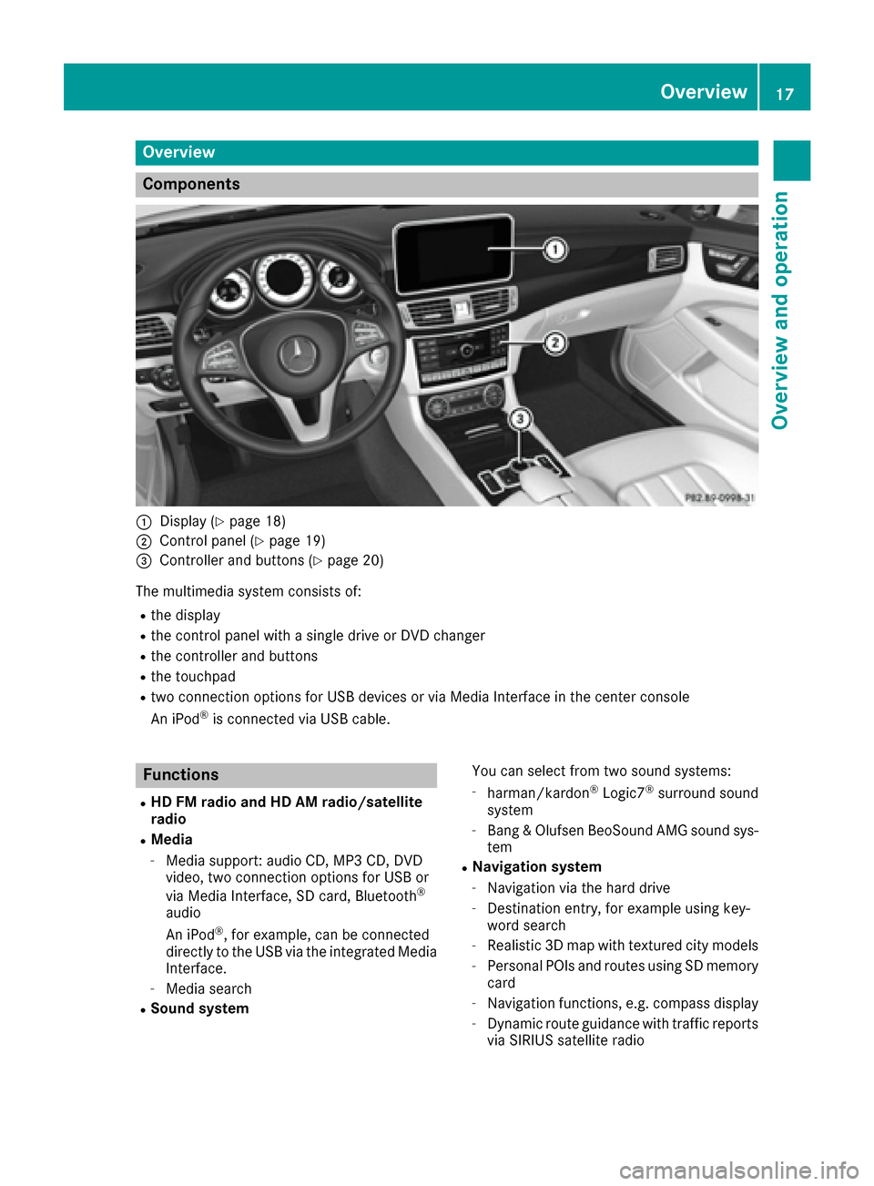
Components
:Display (Ypage 18)
;Control panel (Ypage 19)
=Controller and buttons (Ypage 20)
The multimedia system consists of:
Rthe display
Rthe control panel with a single drive or DVD changer
Rthe controller and buttons
Rthe touchpad
Rtwo connection options for USB devices or via Media Interface in the center console
An iPod®is connected via USB cable.
Functions
RHD FM radio and HD AM radio/satellite
radio
RMedia
-Media support: audio CD, MP3 CD, DVD
video, two connection options for USB or
via Media Interface, SD card, Bluetooth
®
audio
An iPod®, for example, can be connected
directly to the USB via the integrated Media
Interface.
-Media search
RSound system You can select from two sound systems:
-harman/kardon®Logic7®surround sound
system
-Bang & Olufsen BeoSound AMG sound sys-
tem
RNavigation system
-Navigation via the hard drive
-Destination entry, for example using key-
word search
-Realistic 3D map with textured city models
-Personal POIs and routes using SD memory
card
-Navigation functions, e.g. compass display
-Dynamic route guidance with traffic reports
via SIRIUS satellite radio
Overview17
Overview and operation
Page 54 of 206
Your multimediasyste mequipment
These operatin ginstruction sdescribe all th e
standar dan doptional equipment of your multi-
media system, as available at th etime of going
to press. Country-specifi cdifference sare pos -
sible. Bear in min dthat your vehicle may no t
feature all function sdescribed here. Thi salso
applies to safety-relevan tsystems an dfunc-
tions.
Read th einformation on qualifie dspecialis t
workshop sin th evehicle Operator's Manual.
Introduction
Important safet ynotes
GWARNING
If you operat einformation systems an dcom-
munication equipment integrated in th evehi-
cl e whil edriving, you will be distracted from
traffic conditions. You could also los econtro l
of th evehicle. There is aris kof an accident.
Only operat eth eequipment when th etraffic
situation permits. If you are no tsur ethat this
is possible, par kth evehicle payin gattention
to traffic condition san doperat eth eequip-
men twhen th evehicle is stationary.
You mus tobserv eth elegal requirements fo rth e
country in whic hyou are currentl ydrivin gwhen
operatin gth emultimedia system.
The multimedia syste mcalculates th erout eto
th edestination without taking accoun tof th e
following, fo rexample:
Rtraffic lights
Rstop an dyield signs
Rmergin glanes
Rparking or stoppin gin ano parking/n ostop-
pin gzone
Rother road an dtraffic rule san dregulation s
Rnarrow bridge s
The multimedia syste mmay provid eincorrec t
navigation recommendation sif th eactual
street/traffic situation doe sno tcorrespon d
wit hth edigita lmap's data.
Examples of suc hdeviation sincl ude:
Ra
diverted rout e
Rachange in th edirection of aone-way stree tDigital map
sdo no tcover all areas no rall routes
in an area.
Fo rthis reason ,you mus talways observ eroad
an dtraffic rule san dregulation sdurin gyour
journey. Road an dtraffic rule san dregulation s
always hav epriorit yover th esystem' sdrivin g
recommendations.
Navigation announcement sare intended to
direc tyou whil edrivin gwithout divertin gyour
attention from th eroad an ddriving.
Please always use this feature instead of con-
sultin gth emap display fo rdirections. Lookin g
at th eicon sor map display can distract you from
traffic condition san ddriving, an dincrease th e
ris kof an accident.
General notes
Operationa lreadines sof th enavigation
syste m
The navigation syste mmus tdetermin eth eposi-
tion of th evehicle befor efirst use or wheneve r
operational status is restored .Therefore, you
may hav eto drive fo r awhil ebefor eprecise
rout eguidance is possible.
GP Sreception
Amon gother things, correc tfunctionin gof th e
navigation syste mdepends on GPS reception .In
certain situations, GPS reception may be
impaired, there may be interferenc eor there
may be no reception at all, e.g. in tunnels or
parking garages .
iUsing roof carriers may impair th ecorrec t
functionin gof aroof antenn a(phone, satellite
radio, GPS).
Entry restriction
Fo rvehicles in certain countries, there is adat a
entr yrestriction .
Entries can be mad ewhen th eselecto rlever is in
position Por th evehicle is stationary.
Whe nth erestriction is active ,certain entries
canno tbe made. Thi swill be indicated by th e
fac tthat certain men uitems are grayed out an d
canno tbe selected.
52Introduction
Navigation
Page 56 of 206
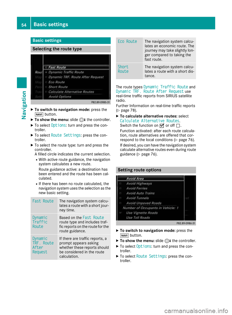
Basic settings
Selecting the route type
XTo switch to navigation mode:press the
Ø button.
XTo show the menu: slide6the controller.
XTo select Options: turn and press the con-
troller.
XTo select Route Settings: press the con-
troller.
XTo select the route type: turn and press the
controller.
A filled circle indicates the current selection.
RWith active route guidance, the navigation
system calculates a new route.
Route guidance active: a destination has
been entered and the route has been cal-
culated.
RIf there has been no route calculated, the
navigation system uses the selection as the
new basic setting.
FastRouteThe navigation system calcu-
lates a route with a short jour-
ney time.
DynamicTrafficRoute
Based on the Fast Routeroute type and includes traf-
fic reports on the route for the
route guidance.
DynamicTRF.RouteAfterRequest
If there are traffic reports, a
prompt appears asking
whether these reports should
be considered in the route
calculation.
Eco RouteThe navigation system calcu-
lates an economic route. The
journey may take slightly lon-
ger compared to taking the
fast route.
ShortRouteThe navigation system calcu-
lates a route with a short dis-
tance.
The route types Dynamic Traffic Routeand
Dynamic TRF. Route After Requestuse
real-time traffic reports from SIRIUS satellite
radio.
Further Information on real-time traffic reports
(
Ypage 78).
XTo calculate alternative routes: select
Calculate Alternative Routes
.
Switch the function on Oor off ª.
Function activated: after each route calcula-
tion, route alternatives are offered that cor-
respond to the local conditions (
Ypage 76).
If desired, you can have the navigation system
calculate alternative routes even during route
guidance (
Ypage 76).
Setting route options
XTo switch to navigation mode: press the
Ø button.
XTo show the menu: slide6the controller.
XTo select Options: turn and press the con-
troller.
XTo select Route Settings: press the con-
troller.
54Basic settings
Navigation
Page 80 of 206

As soon as the system can assign the vehicle
position to the map again, route guidance con-
tinues in the usual way.
Real-time traffic reports
Prerequisites
In order to receive real-time traffic reports via
satellite radio, you need to subscribe to SIRIUS
XM Satellite Radio Traffic Message Service.
Further information on satellite radio
(
Ypage 143).
The multimedia system can receive traffic
reports via satellite radio and take account of
these for route guidance in the navigation sys-
tem. Received traffic reports are displayed on
the map either as text or as symbols.
Real-time traffic reports on the map
Traffic reports are shown on the map with sym-
bols and colored lines. The symbols indicate the
type of traffic report and the colored lines show
the extent of the area affected by the traffic
incident. The symbols are shown in map scales
from 1/32 miles (20 m) to 10 miles (10 km).
When :is displayed, traffic reports can be
received or traffic reports are available. If it is
not displayed, no reception is possible.
XTo hide the menu: slide 5and press the
controller.
The map can be seen in the full-screen dis-
play.
XTo set the map scale: turn the controller until the desired map scale is selected.
The legend shows the symbolic traffic mes-
sages on the map.
:Traffic jam on the route
;Slow-moving traffic on the route
=Road blocked
?Traffic jam
ATraffic warning
BDashed red and white line delimiting the
traffic warning
CRoad block (red crosses along the affected
road)
DSlow-moving traffic (orange line along the
affected route)
ETraffic jam (red line along the affected route)
Displaying real-time traffic reports
Starting a search for traffic reports
XTo switch to navigation mode: press the Ø
button.
XTo show the menu: slide 6the controller.
XTo select Traffic: turn and press the con-
troller.
XTo close the report: press the controller.
78Real-time traffic reports
Navigation
Page 87 of 206
XSelectMap Content.
XSelectText Information On Map.
The #dot indicates the current setting.
XTurn and press the controller.
CurrentStreetshows the current street at
the bottom of the display.
Geo-coordinates
shows the longitude and
latitude, elevation and number of satellites
received.
The elevation shown may deviate from the
actual elevation.
XTurn and press the controller.
Displaying the range on the map
The range can be displayed on the map for elec-
tric vehicles. A circle appears around the current
vehicle position.
For further information on range, see the vehicle
Operator's Manual.
XTo switch to navigation mode: press the
ß button.
XTo show the menu: slide6the controller.
XTo select Options: turn and press the con-
troller.
XSelect Map Content.
XSelectRange on Map.
Switch the display in the map on Oor off ª.
Switching highway information on/off
While driving on the highway, gas stations, rest
stops, rest areas and highway exits are dis-
played along with their immediate distances
from the current vehicle position (
Ypage 73).
XTo switch to navigation mode: press the
ß button.
XTo show the menu: slide6the controller.
XTo select Options: turn and press the con-
troller.
XSelect Map Content.
XSelectHighway Information.
Switch the display in the map on Oor off ª.
Traffic Sign Assist
The function is available depending on the
equipment installed in the vehicle.
The map shows traffic signs detected by Traffic
Sign Assist (see the vehicle Operator's Manual).
XTo switch to navigation mode: press the
ß button.
XTo show the menu: slide6the controller.
XTo select Options: turn and press the con-
troller.
XSelect Map Content.
XSelectTraffic Sign Assist.
Switch the display in the map on Oor off ª.
Displaying the next crossroads
If route guidance is not active, the next cross-
roads can be displayed at the upper edge of the
display.
XTo switch to navigation mode: press the
ß button.
XTo show the menu: slide6the controller.
XTo select Options: turn and press the con-
troller.
XSelect Map Content.
XSelectNext Intersecting Street.
Switch the display in the map on Oor off ª.
Showing the map version
The number of the map data version is shown.
Information about new versions of the digital
map can be obtained from an authorized
Mercedes-Benz Center.
XTo switch to navigation mode: press the
ß button.
XTo show the menu: slide6the controller.
XTo select Options: turn and press the con-
troller.
XSelect Map Content.
XSelectMap Version.
Information on the current map version is
shown.
Map functions85
Navigation
Z
Page 88 of 206
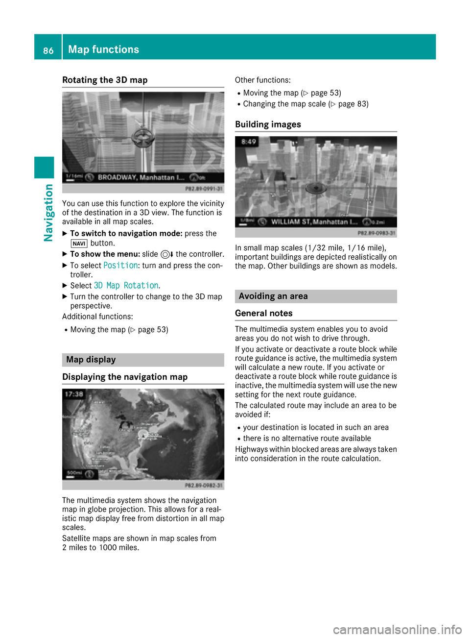
Rotating the 3D map
You can use this function to explore the vicinity
of the destination in a 3D view. The function is
available in all map scales.
XTo switch to navigation mode:press the
Ø button.
XTo show the menu: slide6the controller.
XTo select Position: turn and press the con-
troller.
XSelect 3D Map Rotation.
XTurn the controller to change to the 3D map
perspective.
Additional functions:
RMoving the map (Ypage 53)
Map display
Displaying the navigation map
The multimedia system shows the navigation
map in globe projection. This allows for a real-
istic map display free from distortion in all map
scales.
Satellite maps are shown in map scales from
2 miles to 1000 miles. Other functions:
RMoving the map (Ypage 53)
RChanging the map scale (Ypage 83)
Building images
In small map scales (1/32 mile, 1/16 mile),
important buildings are depicted realistically on
the map. Other buildings are shown as models.
Avoiding an area
General notes
The multimedia system enables you to avoid
areas you do not wish to drive through.
If you activate or deactivate a route block while
route guidance is active, the multimedia system
will calculate a new route. If you activate or
deactivate a route block while route guidance is
inactive, the multimedia system will use the new
setting for the next route guidance.
The calculated route may include an area to be
avoided if:
Ryour destination is located in such an area
Rthere is no alternative route available
Highways within blocked areas are always taken
into consideration in the route calculation.
86Map functions
Navigation