Page 98 of 147

98NavigationTo store a destination in the
favourites list, see Add and save a
favourite .
Notice
The Favourite icon will be greyed out
if no destinations have been saved
as a Favourite.Address
Enter either all or part of the address (i.e. city and street or city centre, area
code etc.).
Notice
Only addresses known to the system through the digital map are
accepted.
● When using for the first time, set the destination country.
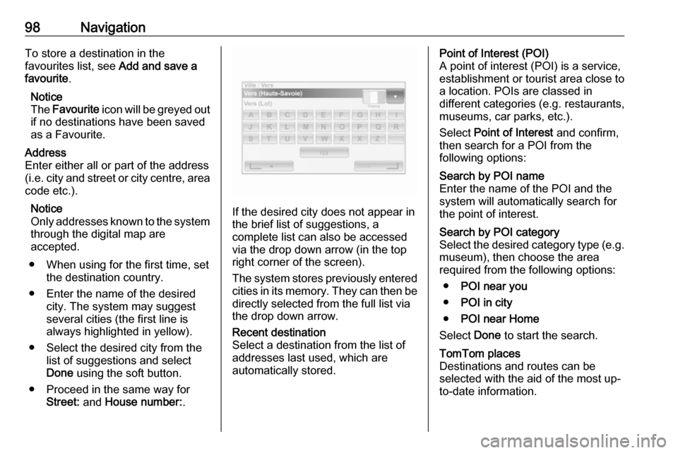
● Enter the name of the desired city. The system may suggest
several cities (the first line is always highlighted in yellow).
● Select the desired city from the list of suggestions and select
Done using the soft button.
● Proceed in the same way for Street: and House number: .
If the desired city does not appear in
the brief list of suggestions, a
complete list can also be accessed via the drop down arrow (in the top
right corner of the screen).
The system stores previously entered
cities in its memory. They can then be directly selected from the full list via
the drop down arrow.
Recent destination
Select a destination from the list of
addresses last used, which are
automatically stored.Point of Interest (POI)
A point of interest (POI) is a service,
establishment or tourist area close to
a location. POIs are classed in
different categories (e.g. restaurants,
museums, car parks, etc.).
Select Point of Interest and confirm,
then search for a POI from the
following options:Search by POI name
Enter the name of the POI and the
system will automatically search for
the point of interest.Search by POI category
Select the desired category type (e.g.
museum), then choose the area
required from the following options:
● POI near you
● POI in city
● POI near Home
Select Done to start the search.TomTom places
Destinations and routes can be
selected with the aid of the most up-
to-date information.
Page 109 of 147

Navigation109The following options are available:● Summary
Shows each waypoint and the destination, including the
waypoint distance, time left to next waypoint and arrival time.
● Normal
Shows each manoeuvre, with
street or place names, distance,
and route section numbers.
This option also shows signpost information, access and
manoeuvre restrictions,
warnings and system preference
information.
● Road list
Shows only the main sections of
the route using road names/
numbers.
This option also shows the length of each section, time left to next
section, arrival time and average
direction.
Alternatively, these itinerary/route
options can be changed by pressing
the "Direction and distance to next
change of direction" tab on the displayduring route guidance. Press
Options to change and sort the details
of the route.
Refer to (NAVI 50) "Information on the display", "Map screen" in the Usage
section 3 78.Edit route
To edit the route by modifying the list
of waypoints, press 7 followed by
y NAVI / ýNav , Route then Edit
Route on the display screen.
The following options are available:Top <:Add waypointBottom <:Add new destinationë:Delete destinationy:Change the route
departure address
(available depending on
version)
To change the order of the waypoints
in the list, press Options followed by
Re-order then move the waypoints
up/down.
For the various methods of entering a
destination, refer to (NAVI 50)
"Destination input" 3 97.
Avoidances
To edit the route by avoiding
particular sections, press 7 followed
by yNAVI / ýNav , Route then
Avoidances /To avoid on the display
screen.
Select a section from the list on the
display screen to be avoided. The
avoided section is highlighted in red.
Confirm the new route by pressing
OK .Alternative routes
To change the route planning
method, press 7 followed by yNAVI /
ý Nav , Route then Alternative routes
on the display screen.
The following options are available,
each with a distance and estimated
time:
● fast
● short
● eco
Select one of the options and confirm the new route by pressing r.
For further information, refer to
(NAVI 50) "Setting up the navigation
system" in the "Usage" section 3 78.
Page 113 of 147

Navigation113●Nearest pharmacy ,
● Nearest vet .
When a service centre is selected, the
location and phone number are
displayed. Select the service centre
as a destination by pressing the soft
button.Drive to help
Use the system to navigate by road
to:
● Nearest car repair services
● Nearest hospital
● Nearest doctor
● Nearest police station
● Nearest pharmacy
● Nearest dentistWhere am I?
The system shows your current
location (address) and gives the GPS
coordinates (latitude/longitude).
NAVI 50 - Help!
When the map screen is displayed,
press Options followed by Where am
I? to check helpful information about
the current location and to search for
Points of Interest (POI) nearby.
To access the map screen at any
time, press 7 followed by sMAP .Where am I?
This menu option contains the
following information:
● current location (address)
● latitude
● longitude
● altitude
● GPS status
Press Options to display the following
options:
● Add to favourites
Refer to (NAVI 50) "Destination
input", "Add and save a favourite" for further information 3 97.
● Country information : Refer to
"Country information" below.Country information
This function allows you to check
country information and legislation for
the current location.
When the Where am I? screen is
displayed, press Options followed by
Country information on the display
screen.This menu option contains the
following information:
● speed limits
● phone country code (International dialling code, e.g.
+49)
● emergency number (e.g. 112)
● legal restrictions, e.g.: ● vehicle equipment requirements, e.g. warning
triangle, first aid kit, fire
extinguisher, spare bulbs,
high-visibility jacket etc.
● headlights legislation
● maximum blood alcohol level
● snow chains legislation
● winter tyres legislationHelp Nearby
This function allows you to search for assistance near your current location.
When the Where am I? screen is
displayed, press Help Nearby on the
display screen.