2016 NISSAN PATHFINDER navigation system
[x] Cancel search: navigation systemPage 111 of 241
![NISSAN PATHFINDER 2016 R52 / 4.G 08IT Navigation Manual .[Guidance Display Settings]:
Activates or deactivates small turn arrow
display on the map.
“Displaying small turn arrow on map”
(page 5-28)
. [Estimated Time]:
Switches the display of estimated t NISSAN PATHFINDER 2016 R52 / 4.G 08IT Navigation Manual .[Guidance Display Settings]:
Activates or deactivates small turn arrow
display on the map.
“Displaying small turn arrow on map”
(page 5-28)
. [Estimated Time]:
Switches the display of estimated t](/manual-img/5/457/w960_457-110.png)
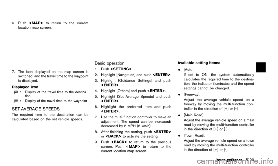
.[Guidance Display Settings]:
Activates or deactivates small turn arrow
display on the map.
“Displaying small turn arrow on map”
(page 5-28)
. [Estimated Time]:
Switches the display of estimated travel time
to the destination or waypoint that is
displayed on the map screen.
“Switching estimated arrival time dis-
play” (page 5-28)
. [Others]:
— [Set Average Speeds]: Set an average vehicle speed for each
type of road, which is reflected in the
calculation of the required time to the
destination.
“Set average speeds” (page 5-29)
— [Auto Reroute]: If the vehicle deviates from the sug-
gested route, the system automatically
recalculates a route.
“Setting Auto Reroute” (page 5-21)
SETTING VOICE GUIDANCE AT IN-
TERSECTIONS
1. Push
2. Highlight [Navigation] and push
3. Highlight [Guidance Settings] and push
4. Highlight [Voice Guidance Settings] and push
5. Highlight [Intersection Guidance Settings]
and push
6. Highlight the preferred item and push
Available setting items
.[Voice Announcements]:
Sets how many times the voice guidance is
announced before the vehicle reaches an
intersection.
1. Highlight [Voice Announcements] and push
2. Highlight the preferred item and push
.[Full]:
The system announces three kinds of
voice guidance: “Turning Point”, “1
Guide” and “2 Guide”.
.[Concise]:The system announces two kinds of
voice guidance: “Turning Point” and “1
Guide”.
Route guidance5-27
Page 113 of 241

6. Push
Page 121 of 241

An Avoid Area can be stored.
The Avoid Area is an area that can be excluded
from a route, such as a road that is always
congested. Once Avoid Areas are stored, the
system avoids those areas when calculating a
route. Up to 10 Avoid Areas can be stored.
1. Push
2. Highlight [Navigation] and push
3. Highlight [Address Book] and push
4. Highlight [Avoid Area] and push
5. Highlight [Add New] and push
INFO:
A maximum of 10 Avoid Areas can be
stored.
When 10 Avoid Areas are already stored, a
new Avoid Area cannot be stored until a
currently stored Avoid Area is deleted.
“Deleting stored item” (page 6-18)
6. Highlight the appropriate method to search for a location and push
“4. Setting destination”
7. Set the following items for the searched
location.
Available setting items:
.[Rename]:
Changes the name.
“Rename” (page 6-16)
.[Move Location]:Adjusts the location of the Avoid Area.
“Move Location” (page 6-16)Storing location/route6-7
STORING AVOID AREA
Page 122 of 241
![NISSAN PATHFINDER 2016 R52 / 4.G 08IT Navigation Manual 6-8Storing location/route
.[Resize Area]:Adjusts the range of the Avoid Area.
“Resize Area” (page 6-16)
.[FWY]:Avoids Freeways.
“FWY” (page 6-17)
.[Delete]:Deletes the avoid area.
“Delete” NISSAN PATHFINDER 2016 R52 / 4.G 08IT Navigation Manual 6-8Storing location/route
.[Resize Area]:Adjusts the range of the Avoid Area.
“Resize Area” (page 6-16)
.[FWY]:Avoids Freeways.
“FWY” (page 6-17)
.[Delete]:Deletes the avoid area.
“Delete”](/manual-img/5/457/w960_457-121.png)
6-8Storing location/route
.[Resize Area]:Adjusts the range of the Avoid Area.
“Resize Area” (page 6-16)
.[FWY]:Avoids Freeways.
“FWY” (page 6-17)
.[Delete]:Deletes the avoid area.
“Delete” (page 6-17)
8. After finishing the setting, highlight [OK] and push
modified. These settings can be edited to make
the navigation system more useful.
BASIC OPERATION
1. Push
2. Highlight [Navigation] and push
3. Highlight [Address Book] and push
4. Highlight the preferred item and push
Available items
.[Stored Location]:
Edits the information of a stored home and
Address.
“Editing stored home and address”
(page 6-8)
. [Stored Routes]:
Edits the information of a stored route.
“Editing stored route” (page 6-14)
. [Stored Tracking]:
Edits the information of a stored tracked
route.
“Editing stored tracking” (page 6-14)
. [Avoid Area]:
Edits the information of a stored Avoid Area.
“Editing avoid area” (page 6-15)
. [Delete Stored Items]:
Deletes a stored location or route.
“Delete stored items” (page 8-10)
. [Transfer Address Book]:
Imports or exports the data of the stored
items using a USB memory.
EDITING STORED HOME AND AD-
DRESS
1. Highlight [Stored Location] and push
EDITING ADDRESS BOOK
Page 137 of 241

7 Viewing technical information
Information screen .................................................................... 7-2Basic operation .................................................................... 7-2
Viewing information about current vehicle location .......... 7-3 Basic operation .................................................................... 7-3
Viewing available traffic information ..................................... 7-3 Basic operation .................................................................... 7-4
Info on route ........................................................................\
. 7-4
Nearby traffic info. ............................................................... 7-5
Display urgent traffic information .................................... 7-5
Traffic information on map ................................................ 7-6
Traffic information settings ................................................ 7-7 Viewing available weather information ................................ 7-8
Displaying weather information screen ....................... 7-9
Destination weather on suggested route screen ... 7-15
Automatically display warnings/watches .................. 7-15
Map update ........................................................................\
..... 7-17
Viewing navigation system unit identification ................. 7-18 Basic operation .............................................................. 7-18
Viewing navigation system version information ............. 7-18 Basic operation .............................................................. 7-18
Viewing GPS current location information ..................... 7-19 Basic operation .............................................................. 7-19
Page 138 of 241

7-2Viewing technical information
This screen sets or displays various information
that is helpful for using the vehicle safely and
comfortably.
Available items include the vehicle information,
Traffic Info. setup, current location information,
GPS information, Voice recognition list and map
version.
Designs and items displayed on the screen may
vary depending on the markets and the models.
INFO:
A NavTraffic subscription is necessary to view
Traffic Info.
BASIC OPERATION
1. Push
2. Highlight the preferred item and push
Available items
.[Fuel Economy]:
Refer to the vehicle Owner’s Manual.
. [Tire Pressure] (if so equipped):
Refer to the vehicle Owner’s Manual.
. [Trip Computer] (if so equipped):
Refer to the vehicle Owner’s Manual.
. [Maintenance]:
Refer to the vehicle Owner’s Manual.
. [Where am I?]:
Displays information regarding the current
vehicle location.
“Viewing information about current
vehicle location” (page 7-3)
. [Traffic Info]:
Allows Traffic Info. setup.
“Viewing available traffic information”
(page 7-3)
. [Weather Info]:
Displays weather information.
“Viewing available weather informa-
tion” (page 7-8)
. [Others]:
— [Map Update]: Display the map version and enable
updating of the map data.
“Map update” (page 7-17)
— [Navigation Version]: Displays the current navigation system
version.
“Viewing navigation system version
information” (page 7-18)
— [GPS Position]: Displays GPS information regarding the
current vehicle location.
“Viewing GPS current location in-
formation” (page 7-19)
— [Voice Recognition]: Displays the voice recognition list.
“9. Voice recognition”
INFO:
The displayed items vary depending on the
options that are equipped on the vehicle.
INFORMATION SCREEN
Page 139 of 241
![NISSAN PATHFINDER 2016 R52 / 4.G 08IT Navigation Manual This displays the information about the vehicle
location on the route when driving according to
route guidance.
BASIC OPERATION
1. Push<INFO>.
2. Highlight [Where am I?] and push <ENTER>.
3. Push <BAC NISSAN PATHFINDER 2016 R52 / 4.G 08IT Navigation Manual This displays the information about the vehicle
location on the route when driving according to
route guidance.
BASIC OPERATION
1. Push<INFO>.
2. Highlight [Where am I?] and push <ENTER>.
3. Push <BAC](/manual-img/5/457/w960_457-138.png)
This displays the information about the vehicle
location on the route when driving according to
route guidance.
BASIC OPERATION
1. Push
2. Highlight [Where am I?] and push
3. Push
screen. Push
current location map screen.
Contents of vehicle location information
*1Next Street:
Displays the next street on the route.
*2Current Street:
Displays the current street on the route.
*3Previous Street:
Displays the previous street on the route.
*4Displays the distance to the next intersec-
tion on the route.
*5Displays the distance traveled from the
previous intersection on the route. NavTraffic information is a subscription service
offered by SiriusXM Satellite Radio.
This service provides real-time information
regarding traffic flow, accidents, road construc-
tion and other incidents, where available.
NavTraffic combines information from commer-
cial and public traffic data providers including
government departments of transportation, po-
lice, emergency services, road sensors, cameras
and aircraft reports. The traffic information is
broadcast to the vehicle by the SiriusXM
satellites. Available traffic information on the
route the driver selected is shown on the
navigation screen so traffic conditions between
you and the destination are known. Three types
of real-time traffic information for major road-
ways are shown on the navigation system:
* Unscheduled traffic data for example, acci-
dents and disabled vehicles.
* Scheduled traffic data, for example road
construction and road closures.
* Traffic flow information (rate of speed data) .
WARNING
NavTraffic information is not a substi-
tute for attentive driving. Traffic condi-
tions change constantly and emergency
Viewing technical information7-3
VIEWING INFORMATION ABOUT
CURRENT VEHICLE LOCATION
VIEWING AVAILABLE TRAFFIC
INFORMATION
Page 144 of 241
![NISSAN PATHFINDER 2016 R52 / 4.G 08IT Navigation Manual 7-8Viewing technical information
4. Highlight the preferred setting and push<ENTER>. The indicator for the selected
setting illuminates.
Available setting items
.[Use Traffic Info]:
Enables all traffi NISSAN PATHFINDER 2016 R52 / 4.G 08IT Navigation Manual 7-8Viewing technical information
4. Highlight the preferred setting and push<ENTER>. The indicator for the selected
setting illuminates.
Available setting items
.[Use Traffic Info]:
Enables all traffi](/manual-img/5/457/w960_457-143.png)
7-8Viewing technical information
4. Highlight the preferred setting and push
setting illuminates.
Available setting items
.[Use Traffic Info]:
Enables all traffic information related func-
tions.
. [Show Incidents on Map]:
Displays the traffic incidents (e.g., accident)
on the map screen.
. [Show Traffic Flow on Map]:
Displays the traffic flow with an arrow on the
map screen.
. [Blink Red Traffic Flow]:
Blinks the red traffic flow lines that represent
congestions.
. [Traffic Announcement]:
Announces the traffic information event on the route.
INFO:
. Even when [Show Traffic Flow on Map] and
[Show Incidents on Map] are set to off, the
list display of [Info on Route] and [Nearby
Traffic Info] will not be affected.
. Even when [Traffic Announcement] is set to
off, the route guidance will not be affected.
Also, the announcement of emergency
information and weather information will not
be turned off.
Voice command
1. Push
wheel switch.
2. After the tone sounds, speak a command.
To turn on or off the traffic information system:
“Information” “Traffic Information” (Standard
mode)
“Traffic Information” (Alternate command mode) NavWeatherXM information is a subscription
service offered by SiriusXM Satellite Radio.
This service provides real-time information
regarding current weather, temperature, warn-
ings, road conditions and forecasts where
available. The weather information is broadcast
to the vehicle by the SiriusXM Satellite Radio.
The service enables you to view the following
information on the navigation system.
. Current weather information icon of the
destination on the screen of suggested
route
. Detailed weather information and forecasts
of an area of interest
. Countrywide and local maps with the
current weather, temperature, warnings and
road condition information
. List of warning/watches events detected
around the current location
. Pop-up messages on the navigation screen
with voice announcements when warnings
and watches are detected around the
current location
VIEWING AVAILABLE WEATHER
INFORMATION