2014 MERCEDES-BENZ GL low oil pressure
[x] Cancel search: low oil pressurePage 200 of 462

RAlways keep the engine running and in gear
when driving on a downhill gradient.
Activate DSR (Ypage 256).
RAlways keep the doors, tailgate, windows
and sliding sunroof closed while driving.
RAdapt your speed to the terrain. The
rougher, steeper or more ruts on the
terrain, the slower your speed should be.
RDrive slowly and at an even speed through
the water. Ensure that a bow wave does not
form as you drive.
RDrive with extreme care on unfamiliar off-
road routes where visibility is poor. For
safety reasons, get out of the vehicle first
and survey the off-road route.
RLook out for obstacles, such as rocks,
holes, tree stumps and furrows.
RCheck the depth of water before fording
rivers and streams.
RWhen fording, do not stop and do not
switch off the engine.
ROn sand, drive quickly to overcome the
rolling resistance. Otherwise the vehicle's
wheels could become stuck in loose
ground.
RDo not jump with the vehicle as this will
interrupt the vehicle's propulsion.
RAlways keep the engine running and in gear
when driving on a slope.
RDo not shift the automatic transmission to
transmission positionN.
iDo not use the HOLD function when
driving off-road, on steep uphill or downhill
gradients or on slippery or loose surfaces.
The HOLD function cannot hold the vehicle
on such surfaces.
Checklist before driving off-road
!If the engine oil warning lamp lights up
while the vehicle is in motion, stop the
vehicle in a safe place as soon as possible.
Check the engine oil level. The engine oil
warning lamp warning must not be ignored.
Continuing the journey while the symbol is
displayed could lead to engine damage.
XEngine oil level:check the engine oil level
and add oil if necessary.
When driving on steep gradients, the
engine oil level must be sufficiently high to
ensure a correct oil supply in the vehicle.
XDEF tank (BlueTEC vehicles):check the
level and top up if necessary (Ypage 186).
XTire-changing tool kit:check that the jack
is working and make sure you have the lug
wrench, a robust tow cable and a folding
spade in the vehicle.
XWheels and tires:check the tire tread
depth and tire pressure.
XCheck for damage and remove any foreign
objects, e.g. small stones, from the
wheels/tires.
XReplace any missing valve caps.
XReplace dented or damaged wheels.
XRims:dented or bent rims can result in a
loss of tire pressure and damage the tire
bead. Therefore, check your rims before
driving off-road and replace them as
required.
Checklist after driving off-road
!If you detect damage to the vehicle after
driving off-road, have the vehicle checked
immediately at a qualified specialist
workshop.
XVehicles with the ON&OFFROAD
package:activate the on-road program
(Ypage 258).
XDeactivate the LOW RANGE off-road gear
(Ypage 259).
XDeactivate DSR (Ypage 256).
XVehicles with the AIRMATIC package:
lower the vehicle to a ride height suitable
for the road conditions, e.g. to the
highway/high-speed level.
XClean the headlamps and rear lights and
check for damage.
XClean the front and rear license plates.
XClean the wheels/tires with a water jet and
remove any foreign objects.
198Driving tips
Driving an d parking
Page 365 of 462

about various special offers at your
workshop.
Rmonthly status information e-mail on oil
level, air pressure, maintenance, brakes,
etc. If applicable, you will receive
information on special offers in the e-mail.
USA only: this information can also be
called up under "Owners Online" at http://
www.mbusa.com.
Information on the data stored in the vehicle
(Ypage 29).
Information on Roadside Assistance
(Ypage 25).
Downloading routes
Downloading routes allows you to transfer
and save predefined routes in the navigation
system. To do this, an SD memory card must
be inserted into the COMAND system. If no
SD memory card is inserted, you must insert
the card into the card slot on the COMAND
system before saving.
A route can be prepared and sent either by a
customer service representative or via the
mbrace portal on the Internet.
Each route can include up to 20 way points.
Once a route has been received by the
navigation system, you will see the
Do you want to start routeDo you want to start route
guidance?guidance?message in the COMAND display.
The route is saved to the SD memory card.
XTo start route guidance:selectYesYes.
An overview of the route is shown in the
display.
iIf you selectNoNo, the saved route can be
called up later via the navigation menu.
XSelectStartStart.
Route guidance is started.
iDownloaded and saved data can be called
up again in COMAND.
You can find further information in the
separate COMAND Operating Instructions.
Speed alert
You can define the upper speed limit, which
must not be exceeded by the vehicle.
If this selected speed is exceeded by the
vehicle, a message will be sent to the
Customer Assistance center. The Customer
Assistance center then forwards this
information to you.
You can select the way in which you receive
this information beforehand. Possible options
include text message, e-mail or an automated
call.
The data you receive contains the following
information:
Rthe location where the speed limit was
exceeded
Rthe time at which the speed limit was
exceeded
Rthe selected speed limit which was
exceeded
Geo fencing
Geo fencing allows you to select areas which
the vehicle should not enter or leave. You will
be informed if the vehicle crosses the
boundaries of the selected areas. You can
select the way in which you receive this
information beforehand. Possible options
include text message, e-mail or an automated
call.
The area can be determined as either a circle
or a polygon with a maximum of ten corners.
You can specify up to ten areas
simultaneously. Different settings are
possible for each area.
USA only: these settings can be called up
under "Owners Online" at http://
www.mbusa.com.
Alternatively, you can trigger an MB Info call
and inform the customer service
representative that you wish to activate geo
fencing.
Currently inactive areas can be activated by
text message.
Features363
Stowage and features
Z
Page 375 of 462

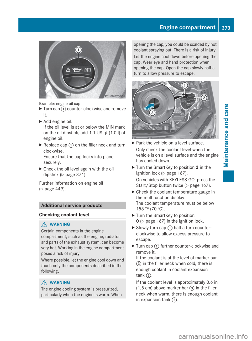
Example: engine oil capXTurn cap�Ccounter-clockwise and remove
it.
XAdd engine oil.
If the oil level is at or below the MIN mark
on the oil dipstick, add 1.1 US qt (1.0 l) of
engine oil.
XReplace cap�Con the filler neck and turn
clockwise.
Ensure that the cap locks into place
securely.
XCheck the oil level again with the oil
dipstick (Ypage 371).
Further information on engine oil
(Ypage 449).
Additional service products
Checking coolant level
GWARNING
Certain components in the engine
compartment, such as the engine, radiator
and parts of the exhaust system, can become
very hot. Working in the engine compartment
poses a risk of injury.
Where possible, let the engine cool down and
touch only the components described in the
following.
GWARNING
The engine cooling system is pressurized,
particularly when the engine is warm. When
opening the cap, you could be scalded by hot
coolant spraying out. There is a risk of injury.
Let the engine cool down before opening the
cap. Wear eye and hand protection when
opening the cap. Open the cap slowly half a
turn to allow pressure to escape.
XPark the vehicle on a level surface.
Only check the coolant level when the
vehicle is on a level surface and the engine
has cooled down.
XTurn the SmartKey to position2in the
ignition lock (Ypage 167).
On vehicles with KEYLESS-GO, press the
Start/Stop button twice (Ypage 167).
XCheck the coolant temperature gauge in
the multifunction display.
The coolant temperature must be below
158 ‡ (70 †).
XTurn the SmartKey to position
0(Ypage 167) in the ignition lock.
XSlowly turn cap�Chalf a turn counter-
clockwise to allow excess pressure to
escape.
XTurn cap�Cfurther counter-clockwise and
remove it.
If the coolant is at the level of marker bar
�
Page 383 of 462

iIf you drive at speeds above 20 mph
(30 km/h) or with the SmartKey in position
0or1in the ignition lock, the cover of the
360° camera closes automatically.
Cleaning the exhaust pipe
!Do not clean the exhaust pipe with acid-
based cleaning agents such as sanitary
cleansers or wheel cleaners.
Impurities combined with the effects of road
grit and corrosive environmental factors may
cause flash rust to form on the surface. You
can restore the original shine of the exhaust
pipe by cleaning it regularly, especially in
winter and after washing.
XClean the exhaust pipe with a chrome care
product tested and approved by Mercedes-
Benz.
Cleaning the trailer tow hitch
HEnvironmental note
Dispose of rags soaked in oil and grease in an
environmentally responsible manner.
!Do not clean the ball coupling with a
power washer. Do not use solvents.
!Please note the care instructions in the
trailer coupling manufacturer's operating
instructions.
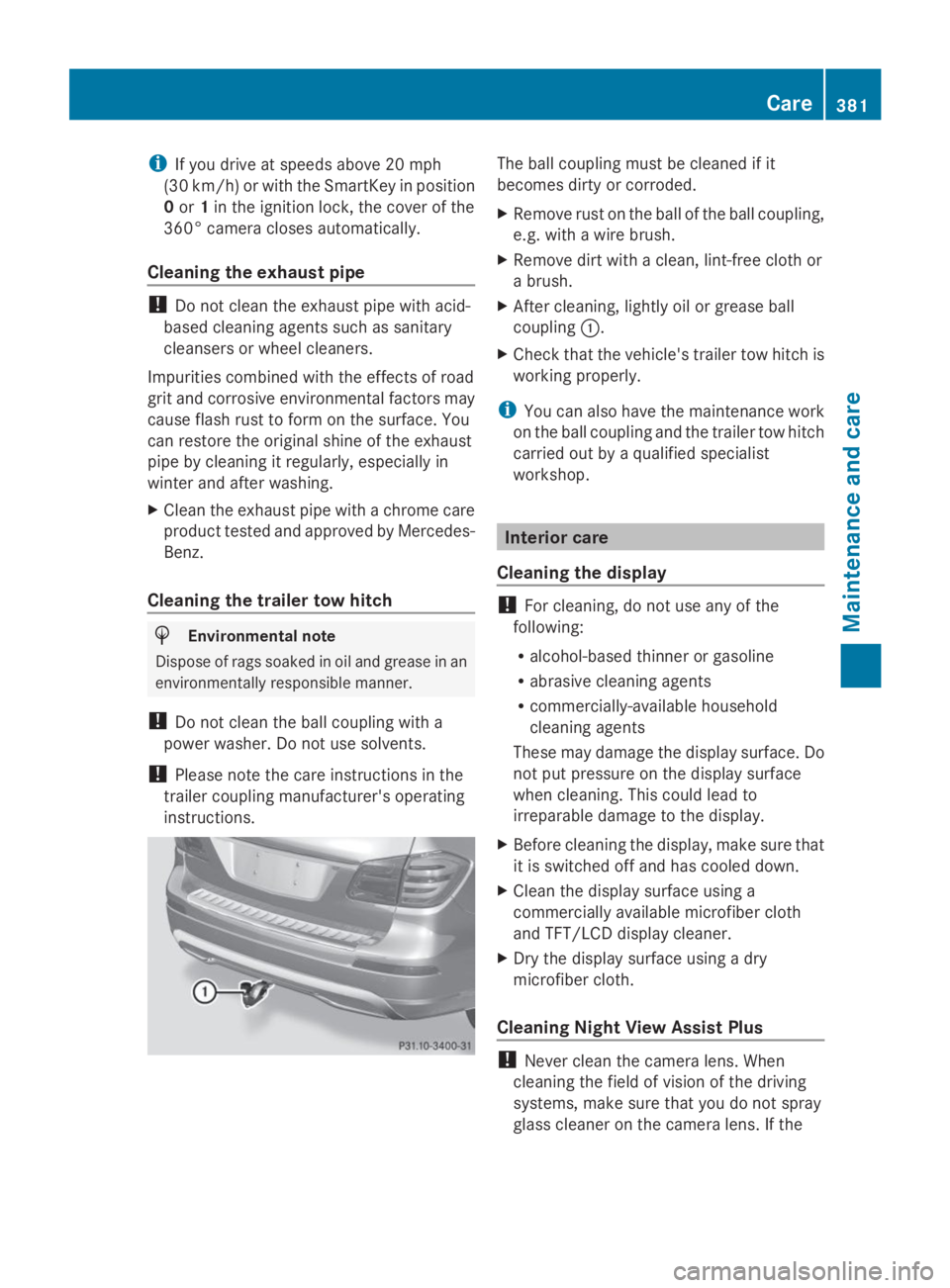
The ball coupling must be cleaned if it
becomes dirty or corroded.
XRemove rust on the ball of the ball coupling,
e.g. with a wire brush.
XRemove dirt with a clean, lint-free cloth or
a brush.
XAfter cleaning, lightly oil or grease ball
coupling�C.
XCheck that the vehicle's trailer tow hitch is
working properly.
iYou can also have the maintenance work
on the ball coupling and the trailer tow hitch
carried out by a qualified specialist
workshop.
Interior care
Cleaning the display
!For cleaning, do not use any of the
following:
Ralcohol-based thinner or gasoline
Rabrasive cleaning agents
Rcommercially-available household
cleaning agents
These may damage the display surface. Do
not put pressure on the display surface
when cleaning. This could lead to
irreparable damage to the display.
XBefore cleaning the display, make sure that
it is switched off and has cooled down.
XClean the display surface using a
commercially available microfiber cloth
and TFT/LCD display cleaner.
XDry the display surface using a dry
microfiber cloth.
Cleaning Night View Assist Plus
!Never clean the camera lens. When
cleaning the field of vision of the driving
systems, make sure that you do not spray
glass cleaner on the camera lens. If the
Care381
Maintenance and care
Z