Page 93 of 404

93
1. BASIC OPERATION
IS300h/250_Navi_EE
NAVIGATION SYSTEM
3
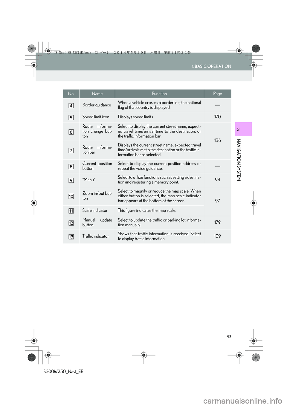
Border guidanceWhen a vehicle crosses a borderline, the national
flag of that country is displayed.
Speed limit iconDisplays speed limits170
Route informa-
tion change but-
tonSelect to display the current street name, expect-
ed travel time/arrival time to the destination, or
the traffic information bar.
136
Route informa-
tion barDisplays the current street name, expected travel
time/arrival time to the destination or the traffic in-
formation bar as selected.
Current position
buttonSelect to display the current position address or
repeat the voice guidance.
“Menu”Select to utilize functions such as setting a destina-
tion and registering a memory point.94
Zoom in/out but-
tonSelect to magnify or reduce the map scale. When
either button is selected, the map scale indicator
bar appears at the bottom of the screen.
97
Scale indicatorThis figure indicates the map scale.
Manual update
buttonSelect to update the traffic or parking lot informa-
tion manually. 179
Traffic indicatorShows that traffic information is received. Select
to display traffic information.109
No.NameFunctionPage
IS_Navi_EE_53C71E.book 93 ページ 2014年5月29日 木曜日 午前11時22分
Page 112 of 404

112
1. BASIC OPERATION
IS300h/250_Navi_EE
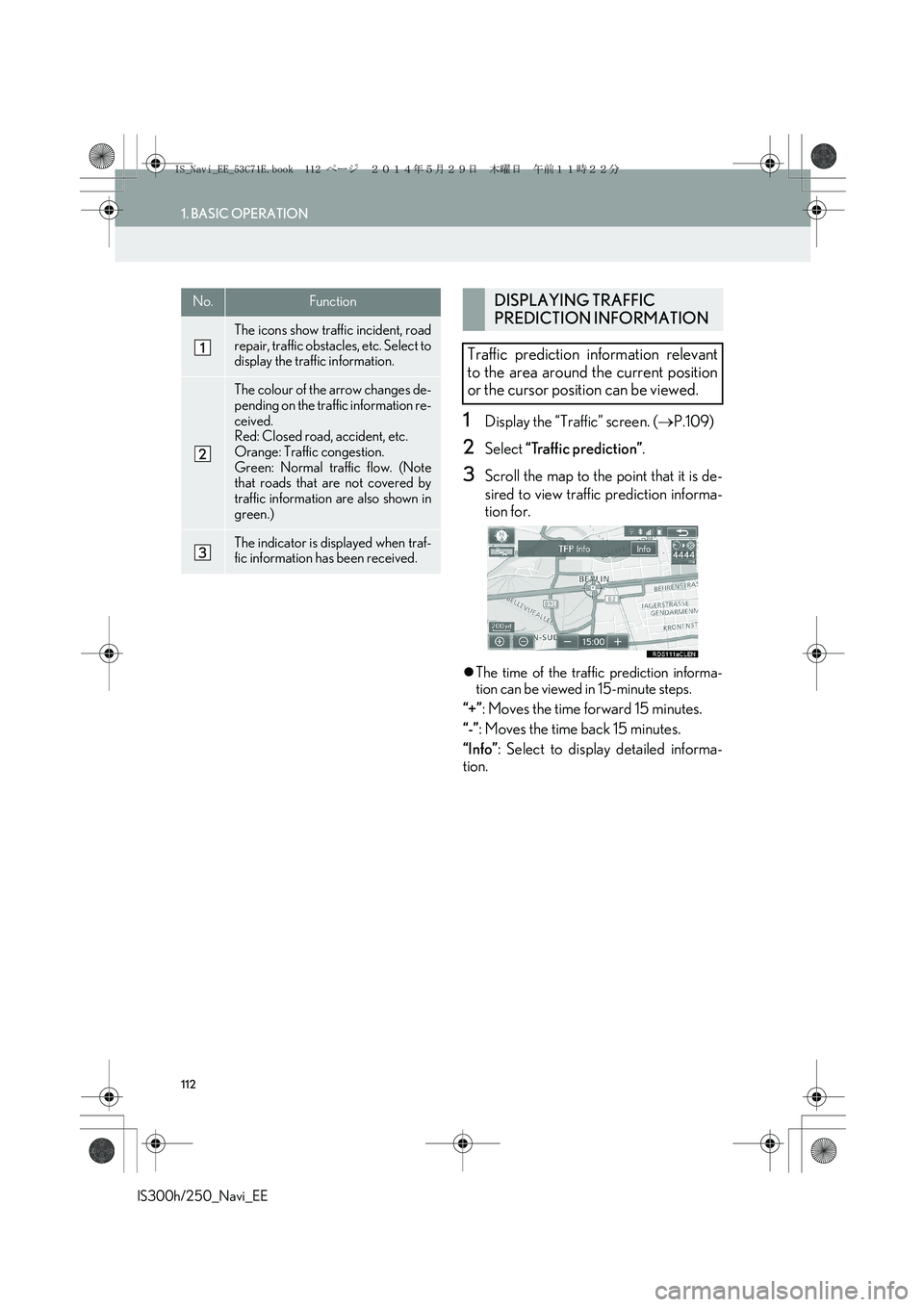
1Display the “Traffic” screen. (→P.109)
2Select “Traffic prediction”.
3Scroll the map to the point that it is de-
sired to view traffic prediction informa-
tion for.
�zThe time of the traffic prediction informa-
tion can be viewed in 15-minute steps.
“+”: Moves the time forward 15 minutes.
“-”: Moves the time back 15 minutes.
“Info”: Select to display detailed informa-
tion.
No.Function
The icons show traffic incident, road
repair, traffic obstacles, etc. Select to
display the traffic information.
The colour of the arrow changes de-
pending on the traffic information re-
ceived.
Red: Closed road, accident, etc.
Orange: Traffic congestion.
Green: Normal traffic flow. (Note
that roads that are not covered by
traffic information are also shown in
green.)
The indicator is displayed when traf-
fic information has been received.
DISPLAYING TRAFFIC
PREDICTION INFORMATION
Traffic prediction information relevant
to the area around the current position
or the cursor position can be viewed.
IS_Navi_EE_53C71E.book 112 ページ 2014年5月29日 木曜日 午前11時22分
Page 172 of 404

172
5. SETUP
IS300h/250_Navi_EE
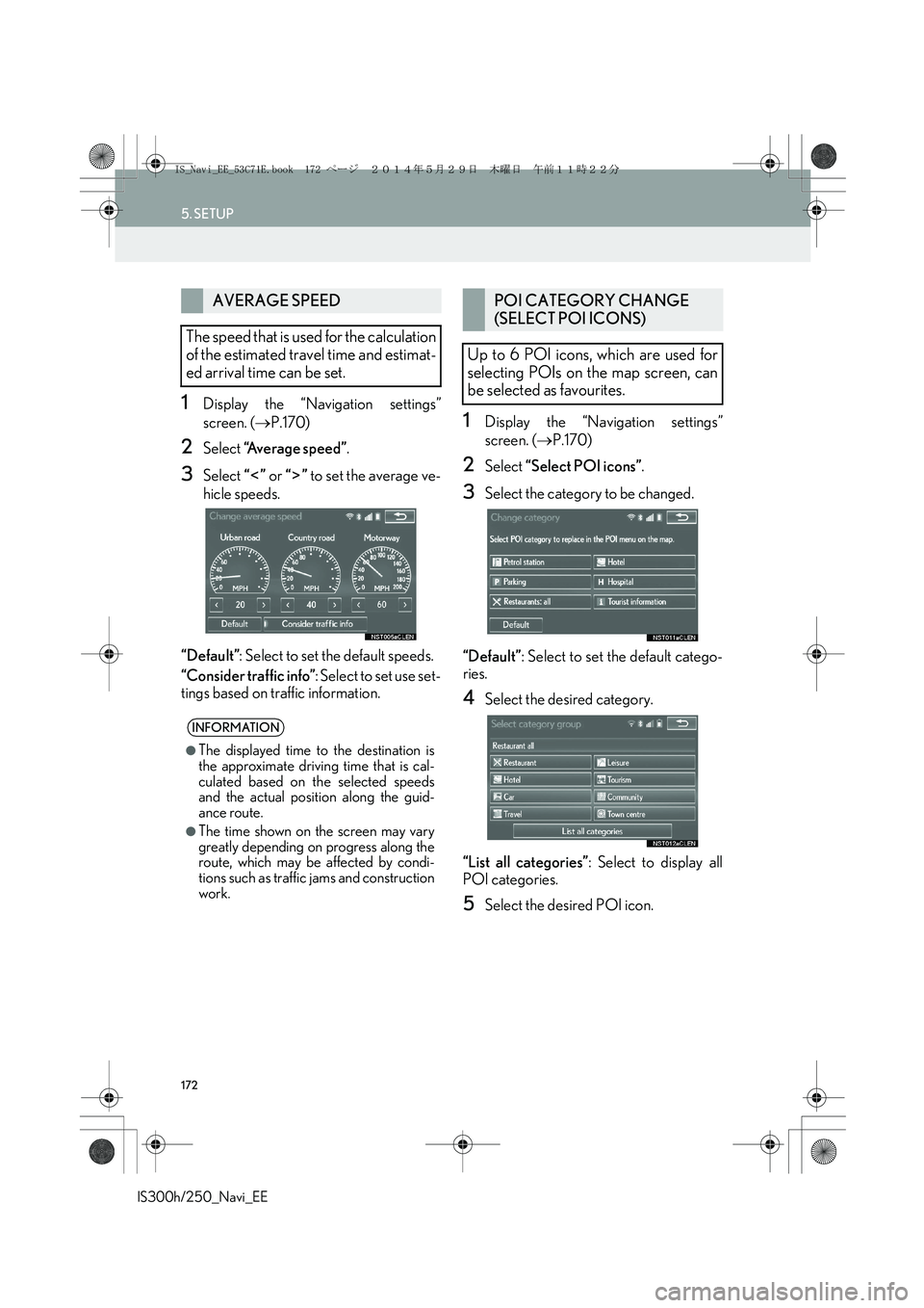
1Display the “Navigation settings”
screen. (→P.170)
2Select “Average speed”.
3Select “” or “” to set the average ve-
hicle speeds.
“Default”: Select to set the default speeds.
“Consider traffic info”: Select to set use set-
tings based on traffic information.
1Display the “Navigation settings”
screen. (→P.170)
2Select “Select POI icons”.
3Select the category to be changed.
“Default”: Select to set the default catego-
ries.
4Select the desired category.
“List all categories”: Select to display all
POI categories.
5Select the desired POI icon.
AVERAGE SPEED
The speed that is used for the calculation
of the estimated travel time and estimat-
ed arrival time can be set.
INFORMATION
●
The displayed time to the destination is
the approximate driving time that is cal-
culated based on the selected speeds
and the actual position along the guid-
ance route.
●The time shown on the screen may vary
greatly depending on progress along the
route, which may be affected by condi-
tions such as traffic jams and construction
work.
POI CATEGORY CHANGE
(SELECT POI ICONS)
Up to 6 POI icons, which are used for
selecting POIs on the map screen, can
be selected as favourites.
IS_Navi_EE_53C71E.book 172 ページ 2014年5月29日 木曜日 午前11時22分
Page 185 of 404

185
6. TIPS FOR THE NAVIGATION SYSTEM
IS300h/250_Navi_EE
NAVIGATION SYSTEM
3
�zAccurate current position may not be
shown in the following cases:
• When driving on a small angled Y-shaped
road.
• When driving on a winding road.
• When driving on a slippery road such as
in sand, gravel, snow, etc.
• When driving on a long straight road.
• When motorway and surface streets run
in parallel.
• After moving by ferry or vehicle carrier.
• When a long route is searched during
high speed driving.
• When driving without setting the current
position calibration correctly.
• After repeating a change of direction by
going forward and backward, or turning
on a turntable in a parking lot.
• When leaving a covered parking lot or
parking garage.
• When a roof carrier is installed.
• When driving with tyre chains installed.
• When the tyres are worn.
• After replacing a tyre or tyres.
• When using tyres that are smaller or
larger than the factory specifications.
• When the tyre pressure in any of the 4
tyres is not correct.�zInappropriate route guidance may occur in
the following cases:
• When turning at an intersection off the
designated route guidance.
• If you set more than 1 destination but skip
any of them, auto reroute will display a
route returning to the destination on the
previous route.
• When turning at an intersection for which
there is no route guidance.
• When passing through an intersection for
which there is no route guidance.
• During auto reroute, the route guidance
may not be available for the next turn to
the right or left.
• During high speed driving, it may take a
long time for auto reroute to operate. In
auto reroute, a detour route may be
shown.
• After auto reroute, the route may not be
changed.
• If an unnecessary U-turn is shown or
announced.
• If a location has multiple names and the
system announces 1 or more of them.
• When a route cannot be searched.
• If the route to your destination includes
gravel, unpaved roads or alleys, the route
guidance may not be shown.
�zIf the vehicle cannot receive GPS signals,
the current position can be adjusted
manually. (→P.1 7 3 )
IS_Navi_EE_53C71E.book 185 ページ 2014年5月29日 木曜日 午前11時22分
Page 195 of 404
195
1. BASIC OPERATION
AUDIO/VISUAL SYSTEM
IS300h/250_Navi_EE
4
�XUsing the instrument panel
1Each time the “RADIO” or “MEDIA”
button is pressed, the audio control
mode changes.
“RADIO” button: To display the radio oper-
ation screen.
“MEDIA” button: To display the external
media operation screen.
�XUsing the Remote Touch
1Press the “MENU” button on the
Remote Touch.
2Select “A u d i o ”.
3Select “Source”.
4Select the desired source.
SELECTING AN AUDIO
SOURCE
INFORMATION
●Dimmed screen buttons cannot be oper-
ated.
IS_Navi_EE_53C71E.book 195 ページ 2014年5月29日 木曜日 午前11時22分
Page 204 of 404

204
2. RADIO OPERATION
IS300h/250_Navi_EE
No.Function
Select to display the manual tuning screen.
Select to display the station list screen.
Select to display the preset station screen.
Select to display the audio source selection screen.
Select to display the audio setting screen.
Select to tune to preset stations/ensembles.
Select to display the time shift operation screen.
Tune/Scroll knob:
•“Presets” screen: Turn to select preset stations/ensembles.
•“Stations” screen: Turn to move up/down the list.
•Manual tuning screen: Turn to step up/down frequencies or change services.
•“DAB time shift” screen: Turn to jump forward/backwards.
Press to turn mute on/off.
•Press to move up/down the preset stations/ensembles.
•Press to move up/down the station list.
•Press and hold 0.8 sec. or more to seek up/down available stations/ensembles continu-
ously while the button is being pressed.
•Press to select a radio mode.
•While in a radio mode, pressing the “RADIO” button changes radio modes.
Power/Volume knob:
•Turn to adjust volume.
•Press to turn the audio system on/off.
•Press and hold to restart the audio system.
INFORMATION
●The radio automatically changes to stereo reception when a stereo broadcast is received.
●If the signal becomes weak, the radio reduces the amount of channel separation to prevent
the weak signal from creating noise. If the signal becomes extremely weak, the radio
switches from stereo to mono reception.
IS_Navi_EE_53C71E.book 204 ページ 2014年5月29日 木曜日 午前11時22分
Page 213 of 404
213
3. MEDIA OPERATION
IS300h/250_Navi_EE
AUDIO/VISUAL SYSTEM
4
1Select .
�zEach time is selected, the mode
changes as follows:
• track repeat
→ off
1Select .
�zEach time is selected, the mode
changes as follows:
•random (1 disc random)
→ off
PLAYING AN AUDIO CD
REPEATING
The track currently being listened to can
be repeated.
INFORMATION
●When is selected, “RPT” appears
on the screen.
RANDOM ORDER
Tracks can be automatically and ran-
domly selected.
INFORMATION
●When is selected, “RAND”
appears on the screen.
IS_Navi_EE_53C71E.book 213 ページ 2014年5月29日 木曜日 午前11時22分
Page 214 of 404
214
3. MEDIA OPERATION
IS300h/250_Navi_EE
1Select .
�zEach time is selected, the mode
changes as follows:
�XWhen random playback is off
• file repeat → folder repeat → off
�XWhen random playback is on
• file repeat → off
1Select .
�zEach time is selected, the mode
changes as follows:
•random (1 folder random)
→ folder random (1 disc random) → off
PLAYING AN MP3/WMA/
AAC DISC
REPEATING
The file or folder currently being listened
to can be repeated.
INFORMATION
●Each time is selected, “RPT”/
“FLD.RPT” appears on the screen.
RANDOM ORDER
Files or folders can be automatically and
randomly selected.
INFORMATION
●Each time is selected, “RAND”/
“FLD.RAND” appears on the screen.
IS_Navi_EE_53C71E.book 214 ページ 2014年5月29日 木曜日 午前11時22分