2014 INFINITI QX60 HYBRID ESP
[x] Cancel search: ESPPage 161 of 267

.An indicator light on
readiness of the emergency support system.
If the indicator light is not illuminated,
pushing
vehicle to the Response Specialist.
The indicator light blinks while connected to
the Infiniti Connection Response Center.
.Even when the indicator light is illuminated,
connection to the Infiniti Connection Re-
sponse Center may not be possible. In such
cases contact with the police or other
agencies should be made using other
devices such as telephones.
.To avoid disconnecting the line, do not turn
off the engine or hybrid system.
.The Bluetooth®Hands-free phone system
will be disabled and it is not possible to
take phone calls while the vehicle is
connected to the emergency support staff
at the Infiniti Connection Response Center.
“ Notice to Bluetooth®Hands-free
phone users” (page 7-6)
VIEWING INFORMATION ABOUT CUR-
RENT VEHICLE LOCATION
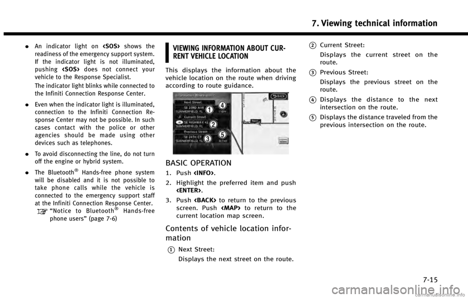
This displays the information about the
vehicle location on the route when driving
according to route guidance.
BASIC OPERATION
1. Push
2. Highlight the preferred item and push
3. Push
screen. Push
Page 191 of 267
![INFINITI QX60 HYBRID 2014 Navigation Manual .[Time Zone]:
Select an appropriate time zone from
the list that appears when this item is
highlighted.
—
Pacific
—Mountain
—Central
—Eastern
—Atlantic
—Newfoundland
—Hawaii
—Alaska
LA INFINITI QX60 HYBRID 2014 Navigation Manual .[Time Zone]:
Select an appropriate time zone from
the list that appears when this item is
highlighted.
—
Pacific
—Mountain
—Central
—Eastern
—Atlantic
—Newfoundland
—Hawaii
—Alaska
LA](/manual-img/42/35043/w960_35043-190.png)
.[Time Zone]:
Select an appropriate time zone from
the list that appears when this item is
highlighted.
—
Pacific
—Mountain
—Central
—Eastern
—Atlantic
—Newfoundland
—Hawaii
—Alaska
LANGUAGE AND UNIT SETTINGS
This changes the language and measure-
ment unit used in the system.
LANGUAGE SETTINGS
1. Push
2. Highlight [Others] and push
3. Highlight [Language & Units] and push
4. Highlight [Select Language] and push
5. Highlight the preferred setting item andpush
selected item illuminates.
Available languages
.[English]
.[Français]
.[Español]
NOTE:
Do not change the ignition switch position
while changing the language. Doing so may
cause a system malfunction.
8. Other settings
8-13
Page 222 of 267

10. General system information
10-2
FEATURES OF THIS NAVIGATION SYSTEM
ROUTE GUIDANCE
The main features of the INFINITI Naviga-
tion System are visual guidance and voice
guidance in selected map coverage areas.
Utilizing a network of GPS (Global Position-
ing System) satellites, the INFINITI Naviga-
tion System tracks the location on the map
and navigates to a preferred location.
Once the destination is set in a map
coverage area, the INFINITI Navigation
System will calculate a route from the
current location to the destination. The
real-time map display and turn-by-turn
voice guidance leads the driver along the
route. These features can be especially
helpful when driving to unfamiliar loca-
tions.
The system may be unable to set a
destination and/or calculate a route when
the destination is outside the map cover-
age area. Additionally, voice guidance may
not be available if the destination is
outside the map coverage area. For more
information on how to set a destination,
refer to section 4.
PLACES OF INTEREST (PLACES) DI-
RECTORY
The INFINITI Navigation System offers an
extensive places of interest (Places) direc-
tory in map coverage areas. This directory
includes a wide variety of destinations
ranging from gas stations, ATMs, and
restaurants to casinos, ski resorts, shop-
ping centers and businesses. A point of
interest can be searched by category, name
or phone number. After selecting a desti-
nation, the INFINITI Navigation System will
calculate a route to that destination.
The Places directory has many uses. For
example, the directory can be sorted by the
various types of restaurants near the
current location. If an ATM or gas station
is needed, the INFINITI Navigation System
can navigate to the closest preferred
location.
For more information on how to use the
Places directory, refer to section 4.
ADDRESS BOOK
The Address Book can store up to 300
locations from map coverage areas into a
personal directory. This is especially useful
for frequently visited locations, such as
clients, relatives and friends. The AddressBook function allows easy access to
frequently visited locations when setting
them as your destination.
For more information on how to use the
Address Book, refer to section 6.
AVOID AREA
The Avoid Area function sets areas or
freeways that the INFINITI Navigation Sys-
tem does not include in the suggested
route when calculating routes. For exam-
ple, if a freeway or area that is always
congested with traffic.
For more information on the Avoid Area
function, refer to section 6.
NavTraffic INFORMATION
When available, the NavTraffic Information
broadcast may help to avoid delays due to
traffic incidents. Traffic jams, roadwork,
closed roads around the current location,
etc. are represented graphically on the
map by icons depicting the nature of the
event. Incidents on the route are automa-
tically brought to the attention when they
are approached.
The NavTraffic Information feature, via the
guidance mode, may help to detour around
traffic problems. For more information on
Page 225 of 267

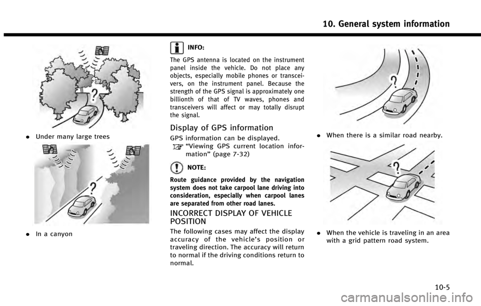
.Under many large trees
.In a canyon
INFO:
The GPS antenna is located on the instrument
panel inside the vehicle. Do not place any
objects, especially mobile phones or transcei-
vers, on the instrument panel. Because the
strength of the GPS signal is approximately one
billionth of that of TV waves, phones and
transceivers will affect or may totally disrupt
the signal.
Display of GPS information
GPS information can be displayed.“Viewing GPS current location infor-
mation” (page 7-32)
NOTE:
Route guidance provided by the navigation
system does not take carpool lane driving into
consideration, especially when carpool lanes
are separated from other road lanes.
INCORRECT DISPLAY OF VEHICLE
POSITION
The following cases may affect the display
accuracy of the vehicle’ s position or
traveling direction. The accuracy will return
to normal if the driving conditions return to
normal.
. When there is a similar road nearby.
.When the vehicle is traveling in an area
with a grid pattern road system.
10. General system information
10-5
Page 229 of 267

.Waypoints that have been passed will
be disregarded by rerouting calcula-
tion.
. If you scroll the map while the sug-
gested route is being drawn, it may
take more time to finish drawing.
. If waypoints are set, the system calcu-
lates multiple routes between way-
points simultaneously, and the
following may result.
—
If one section between waypoints cannot
be calculated, none of the route will be
displayed.
—The route may not connect completely at
some waypoints.
—The route may require a U-turn close tosome waypoints.
. Route calculation may not be com-
pleted in the following cases.
—
If there is no main road within a range of
1.5 miles (2.5 km) from the vehicle, a
message saying so will appear on the
screen. Try recalculating when the vehi-
cle is closer to a main road.
—If there is no main road within a range of1.5 miles (2.5 km) from the destination
or waypoint, a message saying so will appear on the screen. Try setting the
location closer to a main road.
—If the vehicle is too close to the
destination or if there are no roads to
the destination, a message saying so
will appear on the screen.
—If it is impossible to reach the destina- tion or waypoints because of traffic
regulations, etc.
—If the only route to reach the destination
or waypoints is extremely complicated.
—If the destination, current vehicle posi-tion or waypoint is within the “Avoid
Area”.
—If a part of the route is included in the “Avoid Area”.
. The following may occur when the route
is displayed.
—
If you calculate a route on a main road,
the starting point of the route may not
exactly match the current vehicle loca-
tion.
—The endpoint of the route may notexactly match the destination.
—If you calculate a route on a main road, the system may display a route from another main road. This may be because
the position of the vehicle icon is not
accurate. In this case, park the vehicle in
a safe location and reset the vehicle
icon, or continue driving to see if the
position of the vehicle icon is automati-
cally adjusted before recalculating the
route.
—There are cases in which the system
shows an indirect route to reach the
destination or waypoints, if you set them
from stored or facility information. In
order to correct this, you must be careful
about the traffic direction, especially
when lanes with different travel direc-
tions are shown separately, such as
interchanges and service areas.
—This system makes no distinction be-
tween limited traffic control and total
control (blockage). It may show an
indirect route even if the road is usable.
—Even if the freeway preference is set toOFF, a route that uses the freeway may
be suggested.
—Even if the ferry preference is set to OFF,a route that uses a ferry line may be
suggested.
10. General system information
10-9
Page 230 of 267

10. General system information
10-10
—Ferry lines, excluding those that are onlyfor pedestrians, bicycles and motor-
cycles, are stored in this system. Take
into consideration the travel time re-
quired and operational condition before
deciding whether to use them or not.ROUTE GUIDANCE
INFO:
The system will only announce street names
when the system language is set to English.
Street names are not announced when the
system is set to Français (French).
BASICS OF VOICE GUIDANCE
Voice guidance announces which direction
to turn when approaching an intersection
in which a turn is necessary.
NOTE:
.
There may be some cases in which voice
guidance and actual road conditions do not
correspond. This may occur because of
discrepancies between the actual road and
the information on the map data, or it is
due to the vehicle’s speed.
.In case voice guidance does not correspond
to the actual road conditions, follow the
information obtained from traffic signs or
notices on the road.
.Route guidance provided by the navigation
system does not take carpool lane driving
into consideration, especially when carpool lanes are separated from other road lanes.
DIRECTIONS PROVIDED AND DIS-
TANCES TO GUIDE POINTS
Directions will differ, depending on the
road type.
INFO:
Distances may vary, depending on the vehicle
speed.
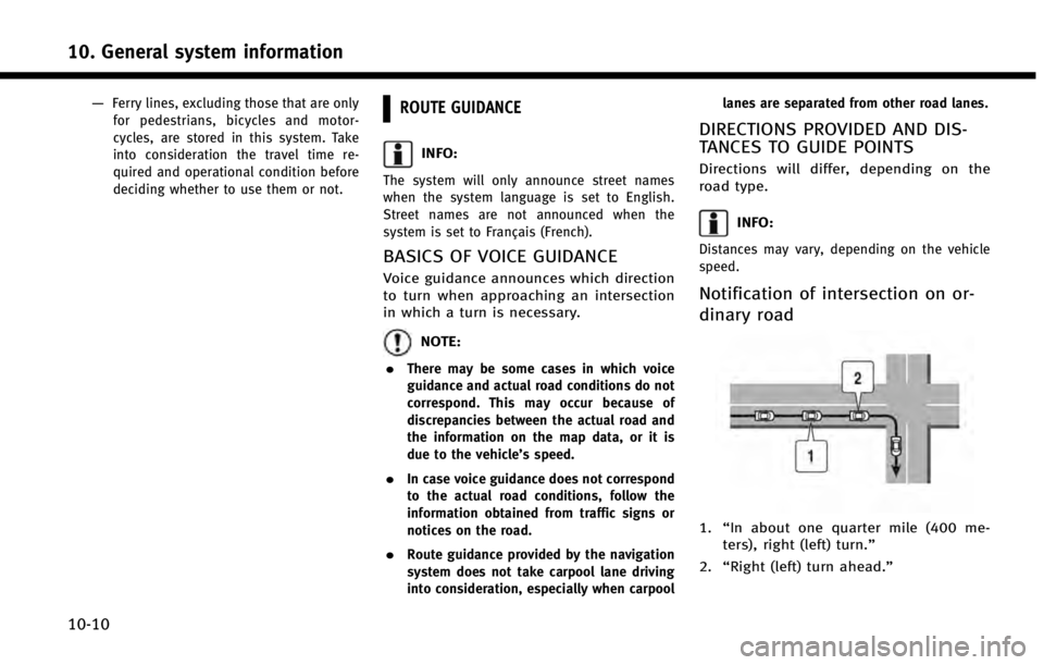
Notification of intersection on or-
dinary road
1.
“In about one quarter mile (400 me-
ters), right (left) turn.”
2. “Right (left) turn ahead.”
Page 233 of 267

in these areas.”When approaching the
endpoint of the suggested road, voice
guidance will announce, “Entering the road
with incomplete map data. Please use the
direction arrow and distance information to
proceed to your destination.”
REPEATING VOICE GUIDANCE
This function is available throughout route
guidance, from the time after the route
calculation is completed until the vehicle
arrives at the destination. Push
Voice guidance will be repeated.
INFO:
.
If
deviating from the suggested route and
when the automatic reroute function is off,
voice guidance will announce, “Proceed to
the highlighted route.”
.If
going in the wrong direction, voice guidance
will announce: “Please make a legal U-turn
if possible.”
NOTES ON VOICE GUIDANCE
. Voice guidance in this system should
be regarded as a supplementary func-
tion. When driving the vehicle, check
the route on the map and follow the
actual roads and traffic regulations.
. Voice guidance is activated only for
intersections with certain conditions.
There may be cases that the vehicle has
to turn, but voice guidance is not
provided.
. Voice guidance contents may vary,
depending on the direction of the turn
and the type of intersection.
. The voice guidance timing will vary
depending on the situation.
. When the vehicle has deviated from the
suggested route, voice guidance is not
available. The system will not announce
this. Refer to the map and recalculate
the route.
“Recalculate route” (page 5-22)
. Voice guidance may not accurately
correspond with road numbers and
directions at freeway junctions.
. Voice guidance may not accurately
correspond to street names at freeway exits.
. The displayed street names may some-
times differ from the actual names, or
“UNKNOWN STREET NAME” may be
displayed.
. Voice guidance is not available when
the [Guidance Voice] is turned off.
“Turning voice guidance ON/OFF”
(page 2-25)
. Voice guidance will start when the
vehicle enters the suggested route.
Refer to the map for directions to the
starting point of the route.
. When approaching a waypoint, voice
guidance will announce, “You have
arrived at waypoint 1 (2, 3, 4,...).”
Voice guidance will switch to the next
section of the route. When voice gui-
dance is not available, refer to the map
for directions.
. In some cases, voice guidance ends
before arrival at the destination. Refer
to the destination icon on the map to
reach the destination.
. If the system recognizes on which side
the destination (waypoint) is located,
voice guidance will announce “on the
10. General system information
10-13
Page 234 of 267

10. General system information
10-14
right/left”after announcing the arrival
at the destination.
. Voice guidance may be partially opera-
tional or inoperative due to the angle of
roads at an intersection.
. Because freeway lane information is
available only for approximately 7,000
major freeways in North America, it is
not possible to display information for
all junctions and exits.
. Freeway exit information may differ
from the information on the actual exit
signs.
. Because it is not possible to consider
data concerning roads that are season-
ally available or unavailable, a route
may be displayed that does not match
the actual traffic restrictions. Be sure to
follow the actual traffic restrictions
while driving.
. Canada and Alaska contain many roads
with incomplete map data. As a result,
when searching for a route, the route
may include roads with incomplete
data. In regions where road data is
not complete, voice guidance may stop
for long periods of time. Be sure to
follow the actual traffic restrictions while driving.NOTES ON NavTraffic INFORMATION
.
The NavTraffic information service is
not provided for some cities. In addi-
tion, the cities for which the traffic
information service is provided may be
changed.
. In some cases, infrastructure problems
may prevent the complete display of
the traffic information. This is not a
malfunction.
. Due to infrastructure problems, or due
to the time when the traffic information
service broadcast is received, the dis-
played information may differ from the
actual traffic conditions.
. Depending on the traffic information, a
detour route may be slower than the
original route.
. NavTraffic is a service of SiriusXM
Satellite Radio. NavTraffic is only avail-
able in select markets and is subject to
data availability. Reception of the
SiriusXM signal may vary depending
on location. It requires a monthly
premium subscription. The service pro-
vider is solely responsible for the
quality and accuracy of the information