Page 49 of 315

�4Suggested route:Appears in bold yellow during route
guidance.
�5/Direction indicator:
Indicates the setting of the map: north al-
ways pointing up or the vehicle’s direction
always pointing up on the display. Touch the
icon to change this setting.
“SETTING THE MAP ORIENTA-
TION” (page 3-15)
�6Scale indicator:
Indicates the scale of the map.
Touch the icon to display the scale bar. This
allows the map scale to be adjusted.
“OPERATING WITH THE
TOUCH OPERATION”
(page 3-5)
�7Arrow and distance:
Indicates the distance to the next guide
point and the turning direction at that guide
point.
�8Stored Location (orange) :
Displays the locations that are stored in the
Address Book. Icons can be changed ac-
cording to personal preferences.
�9Avoid Area (green or blue) :
Displays the areas to avoid that are stored
in the Address Book with green or blue
icons. During the route search, the route
guidance is performed by searching for a
route that avoids those areas.
�10Street name: Displays the name of the street the vehicle
is currently driving on.
�11Traffic indicator:Displays the reception condition of traffic
information transmitted from the provider.
Green: Reception condition is good.
Gray: Reception condition is not good.
No mark: Subscription to XM NavTraffic�
service is not detected.
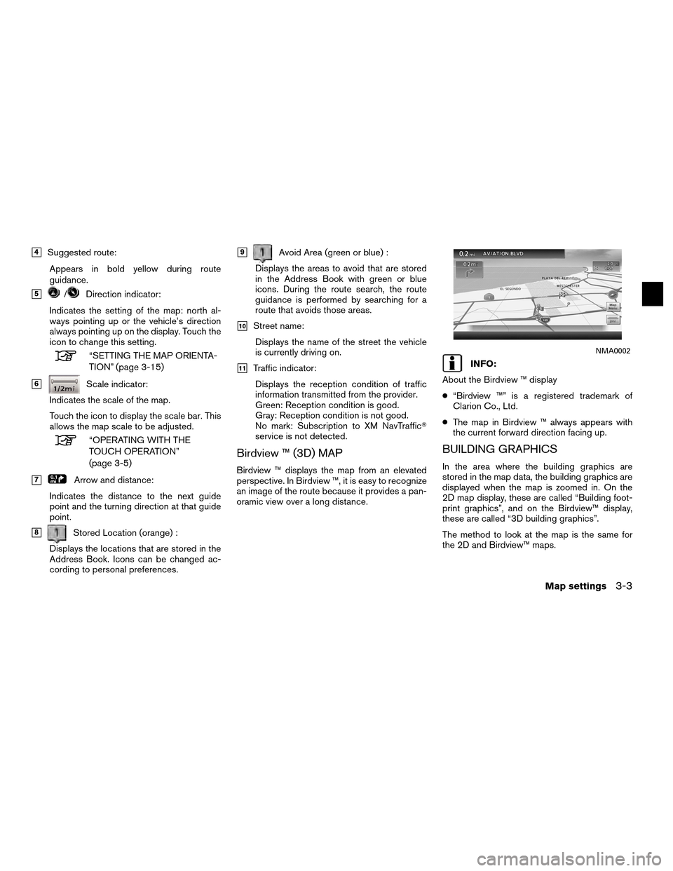
Birdview ™ (3D) MAP
Birdview ™ displays the map from an elevated
perspective. In Birdview ™, it is easy to recognize
an image of the route because it provides a pan-
oramic view over a long distance.
INFO:
About the Birdview ™ display
● “Birdview ™” is a registered trademark of
Clarion Co., Ltd.
● The map in Birdview ™ always appears with
the current forward direction facing up.
BUILDING GRAPHICS
In the area where the building graphics are
stored in the map data, the building graphics are
displayed when the map is zoomed in. On the
2D map display, these are called “Building foot-
print graphics”, and on the Birdview™ display,
these are called “3D building graphics”.
The method to look at the map is the same for
the 2D and Birdview™ maps.
NMA0002
Map settings3-3
Page 197 of 315

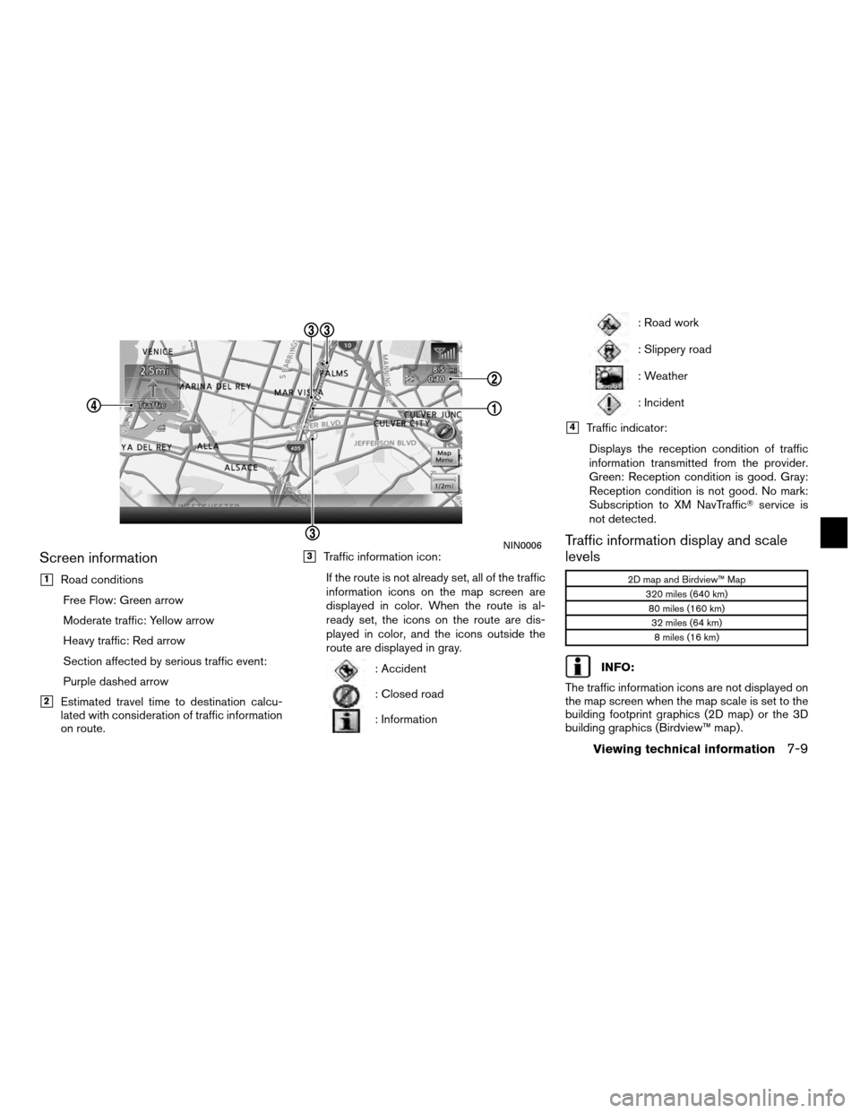
Screen information
�1Road conditionsFree Flow: Green arrow
Moderate traffic: Yellow arrow
Heavy traffic: Red arrow
Section affected by serious traffic event:
Purple dashed arrow
�2Estimated travel time to destination calcu-
lated with consideration of traffic information
on route.
�3Traffic information icon:
If the route is not already set, all of the traffic
information icons on the map screen are
displayed in color. When the route is al-
ready set, the icons on the route are dis-
played in color, and the icons outside the
route are displayed in gray.
: Accident
: Closed road
: Information
: Road work
: Slippery road
: Weather
: Incident
�4Traffic indicator:Displays the reception condition of traffic
information transmitted from the provider.
Green: Reception condition is good. Gray:
Reception condition is not good. No mark:
Subscription to XM NavTraffic� service is
not detected.
Traffic information display and scale
levels
2D map and Birdview™ Map
320 miles (640 km)80 miles (160 km)32 miles (64 km)8 miles (16 km)
INFO:
The traffic information icons are not displayed on
the map screen when the map scale is set to the
building footprint graphics (2D map) or the 3D
building graphics (Birdview™ map) .
NIN0006
Viewing technical information7-9
Page 199 of 315

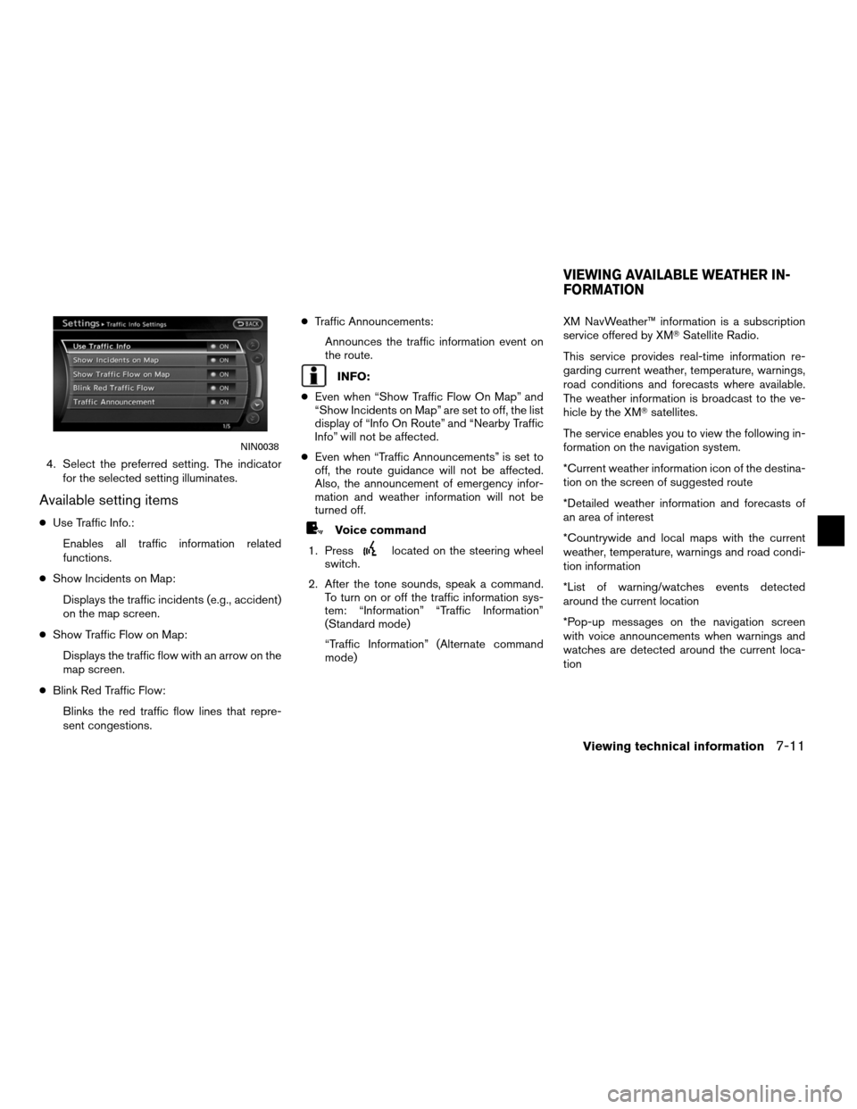
4. Select the preferred setting. The indicatorfor the selected setting illuminates.
Available setting items
●Use Traffic Info.:
Enables all traffic information related
functions.
● Show Incidents on Map:
Displays the traffic incidents (e.g., accident)
on the map screen.
● Show Traffic Flow on Map:
Displays the traffic flow with an arrow on the
map screen.
● Blink Red Traffic Flow:
Blinks the red traffic flow lines that repre-
sent congestions. ●
Traffic Announcements:
Announces the traffic information event on
the route.
INFO:
● Even when “Show Traffic Flow On Map” and
“Show Incidents on Map” are set to off, the list
display of “Info On Route” and “Nearby Traffic
Info” will not be affected.
● Even when “Traffic Announcements” is set to
off, the route guidance will not be affected.
Also, the announcement of emergency infor-
mation and weather information will not be
turned off.
Voice command
1. Press
located on the steering wheel
switch.
2. After the tone sounds, speak a command. To turn on or off the traffic information sys-
tem: “Information” “Traffic Information”
(Standard mode)
“Traffic Information” (Alternate command
mode) XM NavWeather™ information is a subscription
service offered by XM�
Satellite Radio.
This service provides real-time information re-
garding current weather, temperature, warnings,
road conditions and forecasts where available.
The weather information is broadcast to the ve-
hicle by the XM� satellites.
The service enables you to view the following in-
formation on the navigation system.
*Current weather information icon of the destina-
tion on the screen of suggested route
*Detailed weather information and forecasts of
an area of interest
*Countrywide and local maps with the current
weather, temperature, warnings and road condi-
tion information
*List of warning/watches events detected
around the current location
*Pop-up messages on the navigation screen
with voice announcements when warnings and
watches are detected around the current loca-
tion
NIN0038
VIEWING AVAILABLE WEATHER IN-
FORMATION
Viewing technical information7-11
Page 200 of 315

�WARNING
XM NavWeather™ information is not a
substitute for attentive driving.
Weather conditions change constantly
and emergency situations can arise
without warning. Relying only on XM
NavWeather™ information could result
in serious personal injury.
XM NavWeather™ information is available in lim-
ited markets. To subscribe to or check if this ser-
vice is available in the area, call
1-800-XMRADIO (1-800-967-2346) or access
www.xmradio.com/navweather.
INFO:
● If a contract is not completed for the XM
NavWeather™ information service, a message
appears and it will not be possible to check
the information on the traffic information
system.
● The weather information is available only for
areas that provide weather information to XM
NavWeather™.
INFO:
The reception condition of the XM� weather in-
formation transmitted from the provider can be
confirmed using the “Weather” indicator on the
upper right side of the screen.
Green: The reception condition is good.
Gray: The reception condition is not good.
No mark: A subscription to the XM Nav-
Weather™ service is not detected.DISPLAYING WEATHER INFORMA-
TION SCREEN
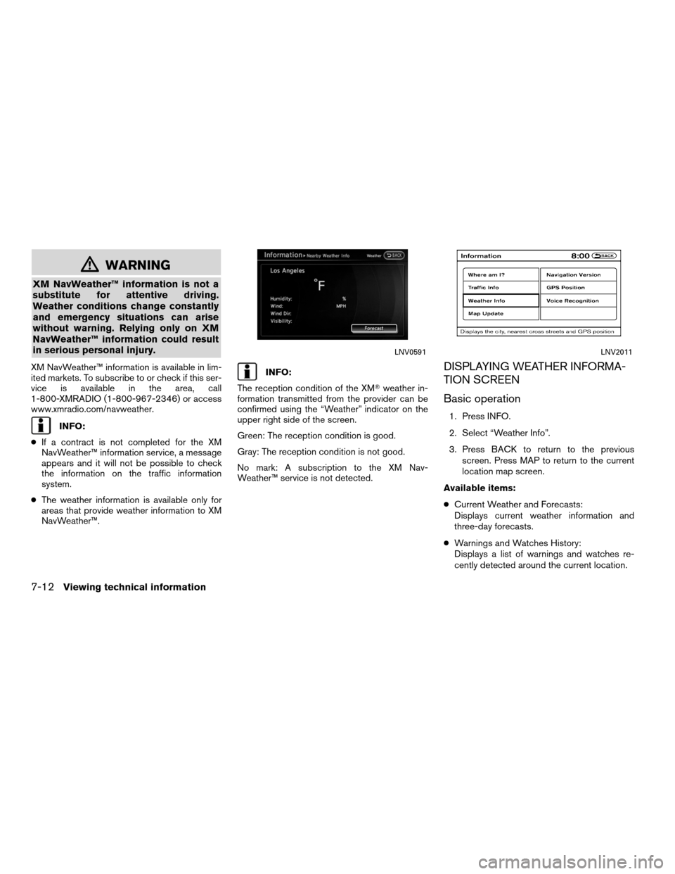
Basic operation
1. Press INFO.
2. Select “Weather Info”.
3. Press BACK to return to the previous
screen. Press MAP to return to the current
location map screen.
Available items:
● Current Weather and Forecasts:
Displays current weather information and
three-day forecasts.
● Warnings and Watches History:
Displays a list of warnings and watches re-
cently detected around the current location.
LNV0591LNV2011
7-12Viewing technical information