Page 18 of 79
The Map Options menu allows you to quickly
store the current position, show position infor-
mation or destination information, and adjust the
map settings.1. Touch the “Menu” key while the route guid-ance map is displayed.
2. The following options are available for se- lection:
● Store Current Location
● Show Position/GPS Information
● Show Destination Information
● Map Setup When zooming in or out, the scale on the bottom
right side of the screen changes to indicate the
new scale level.
MAP SCALE
The following scales are available depending on
the map view:
2D view
3D view
Per approximately 1/2 inch (1 cm) Per approximately 1/2 inch
(1 cm)
150 ft (50 m) 150 ft (50 m)
300 ft (100 m) 300 ft (100 m)
600 ft (200 m) 600 ft (200 m)
1/4 mile (500 m) 1/4 mile (500 m)
1/2 mile (1 km) 1/2 mile (1 km)
1 mile (2 km) 1 mile (2 km)
LNV0938LNV0939
MAP OPTIONS MENU SCREEN CHANGING THE MAP SCALE
Map settings3-5
Page 19 of 79
2D view3D view
2.5 mi (5 km) —
5 mi (10 km) —
10 mi (20 km) —
25 mi (50 km) —
50 mi (100 km) —
100 mi (200 km) —
250 mi (500 km) —Icons of various categories of locations can be
displayed on the map.
MAP SYMBOLS
This navigation system uses symbols to display
various types of facilities. The following icons are
used on the map screen:
LNV0998
LOOKING AT INFORMATION ON THE
MAP
3-6Map settings
Page 20 of 79
Other settings are available for the map screen,
such as switching the map view or changing the
map direction.1. Press the SETUP button.
2. Touch the “Navigation” key.
3. Touch the “Map Setup” key.When selected, the system will offer the fol-
lowing map setting options: ●
Map View
Touch the “Map View” key to toggle be-
tween the 2D or 3D map view.
● North/Heading Up Map
Touch the “North/Heading Up Map” key to
toggle the display between Heading Up and
North Up. When “Head” is selected, the
screen shows the map in the driving
direction. When “North Up” is selected, the
top of the map is always orientated north.
● Auto Zoom
Touch the “Auto Zoom” key to toggle auto-
matic zooming on and off.
LNV0940LNV0942
MAP SETTINGS FOR THE MAP
SCREEN
Map settings3-7
Page 21 of 79

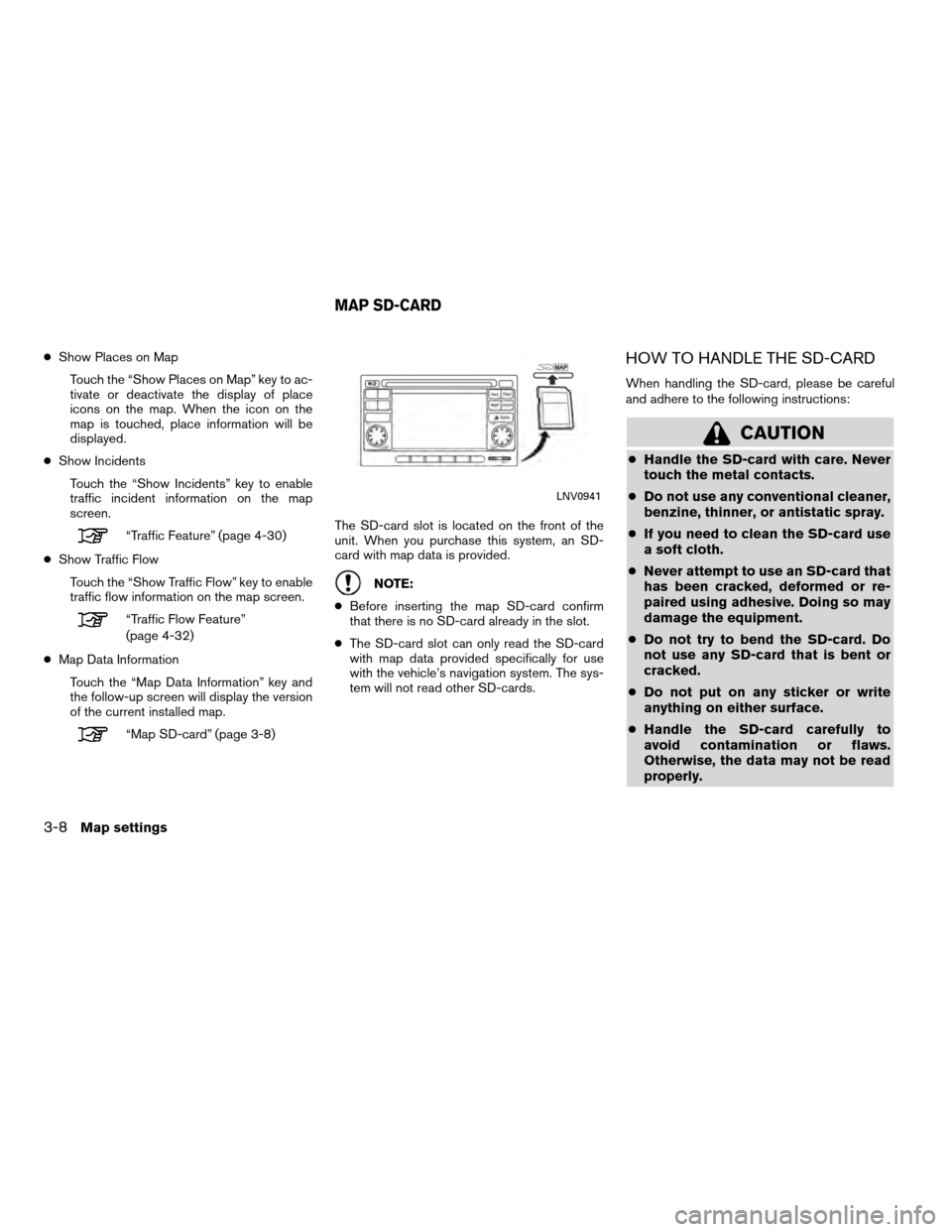
●Show Places on Map
Touch the “Show Places on Map” key to ac-
tivate or deactivate the display of place
icons on the map. When the icon on the
map is touched, place information will be
displayed.
● Show Incidents
Touch the “Show Incidents” key to enable
traffic incident information on the map
screen.
“Traffic Feature” (page 4-30)
● Show Traffic Flow
Touch the “Show Traffic Flow” key to enable
traffic flow information on the map screen.
“Traffic Flow Feature”
(page 4-32)
● Map Data Information
Touch the “Map Data Information” key and
the follow-up screen will display the version
of the current installed map.
“Map SD-card” (page 3-8) The SD-card slot is located on the front of the
unit. When you purchase this system, an SD-
card with map data is provided.
NOTE:
● Before inserting the map SD-card confirm
that there is no SD-card already in the slot.
● The SD-card slot can only read the SD-card
with map data provided specifically for use
with the vehicle’s navigation system. The sys-
tem will not read other SD-cards.
HOW TO HANDLE THE SD-CARD
When handling the SD-card, please be careful
and adhere to the following instructions:
CAUTION
● Handle the SD-card with care. Never
touch the metal contacts.
● Do not use any conventional cleaner,
benzine, thinner, or antistatic spray.
● If you need to clean the SD-card use
a soft cloth.
● Never attempt to use an SD-card that
has been cracked, deformed or re-
paired using adhesive. Doing so may
damage the equipment.
● Do not try to bend the SD-card. Do
not use any SD-card that is bent or
cracked.
● Do not put on any sticker or write
anything on either surface.
● Handle the SD-card carefully to
avoid contamination or flaws.
Otherwise, the data may not be read
properly.
LNV0941
MAP SD-CARD
3-8Map settings
Page 22 of 79

●Do not store the SD-card in locations
exposed to direct sunlight, or in high
temperatures or humidity.
● Always place the SD-card in its stor-
age case when not in use.
SD-CARD REPLACEMENT
For additional SD-cards with map data, contact
the Nissan Navigation Helpdesk.
HOW TO ORDER MAP DATA UP-
DATES
To order updated map data, contact the Nissan
Navigation Helpdesk.
ABOUT THE MAP DATA
● Bosch has compiled the digitized map data
into a usable format. © 2009 Robert Bosch
GmbH all rights in compilation software
reserved. Due to the production timing of the
map data, some new roads may not be
included, or some names and roads may be
different from those in use at the time this map
data is used. ●
Traffic control and regulation data used in this
map data may be different from those in use at
the time this map data is used. When driving,
follow the actual traffic control signs and no-
tices on the roads.
● Reproducing or copying this map software is
strictly prohibited by law.
�WARNING
● This navigation system should not be
used to replace your own judgement.
No itinerary suggested by this navi-
gation system should ever override
any freeway regulations, your own
judgement, or a knowledge of safe
driving practices. Do not follow the
navigation system’s suggested itin-
erary if it would cause you to perform
a dangerous or illegal act, place you
in a dangerous situation, or take you
into an area you consider unsafe. ●
The advice provided by the naviga-
tion system is to be regarded as a
suggestion only. There may be times
when the navigation system displays
the vehicle’s location incorrectly,
fails to suggest the shortest route, or
fails to direct you to your desired
destination. In such instances, rely
on your own judgement taking into
account the driving conditions at the
time.
● Do not use the navigation system to
locate emergency services. The data-
base does not contain a complete
listing of emergency services such as
police stations, fire stations, hospi-
tals and walk-in clinics. Please show
discretion and ask for directions in
such instances.
● As the driver, you alone are respon-
sible for your driving safety.
– In order to avoid a traffic accident, do not operate the system while
driving.
Map settings
3-9
Page 26 of 79

4 Navigation
About route guidance..............................4-2
Voice guidance during route guidance ............4-2
Navigation screen .................................4-3
Basic operation ................................4-3
Available setting items ..........................4-3
Route calculation settings .......................4-4
Setting a destination ...............................4-5
Available destination setting methods .............4-6
Setting a destination from a street address ...........4-6
Setting a destination from the address book .........4-10
Setting a new entry to the address book .........4-10
Setting an entry as a destination .................4-13
Setting a destination from places . . .................4-14Searching for nearby restaurants or gas
stations
...................................... 4-15
Searching for places near current location ........4-16
Searching for places in another city ..............4-18
My Places/User-defined points of interest
(POIs) ........................................ 4-21
Setting destination by map ........................4-26
Setting an intersection as a destination .............4-28
Traffic feature .................................... 4-30
Displaying traffic events along route .............4-30
Traffic icons ................................... 4-32
Traffic flow feature ............................. 4-32
Page 29 of 79
●ROUTE
A route list is available.
If you touch “Route”, a list is shown.
By touching a part of the route, you can see
more detailed information. ●
CANCEL ROUTE
Touch “Cancel Route” to cancel the route
guidance.
NOTE:
If route guidance is not active, both
“Route” and “Cancel Route” cannot be
operated.
ROUTE CALCULATION SETTINGS
The settings the system uses to calculate the
route to a destination can be adjusted to suit
your needs. 1. Press NAV.
2. Touch “Options”.
3. Adjust the settings to the desired level.
● Use Traffic Info:
Set to “Off” to disable traffic info. Set to
“Automatic” for traffic alerts to be controlled
automatically. Set to “Prompt” for traffic
alerts to be displayed when prompted.
LNV0945LNV0946LNV0993
4-4Navigation
Page 32 of 79

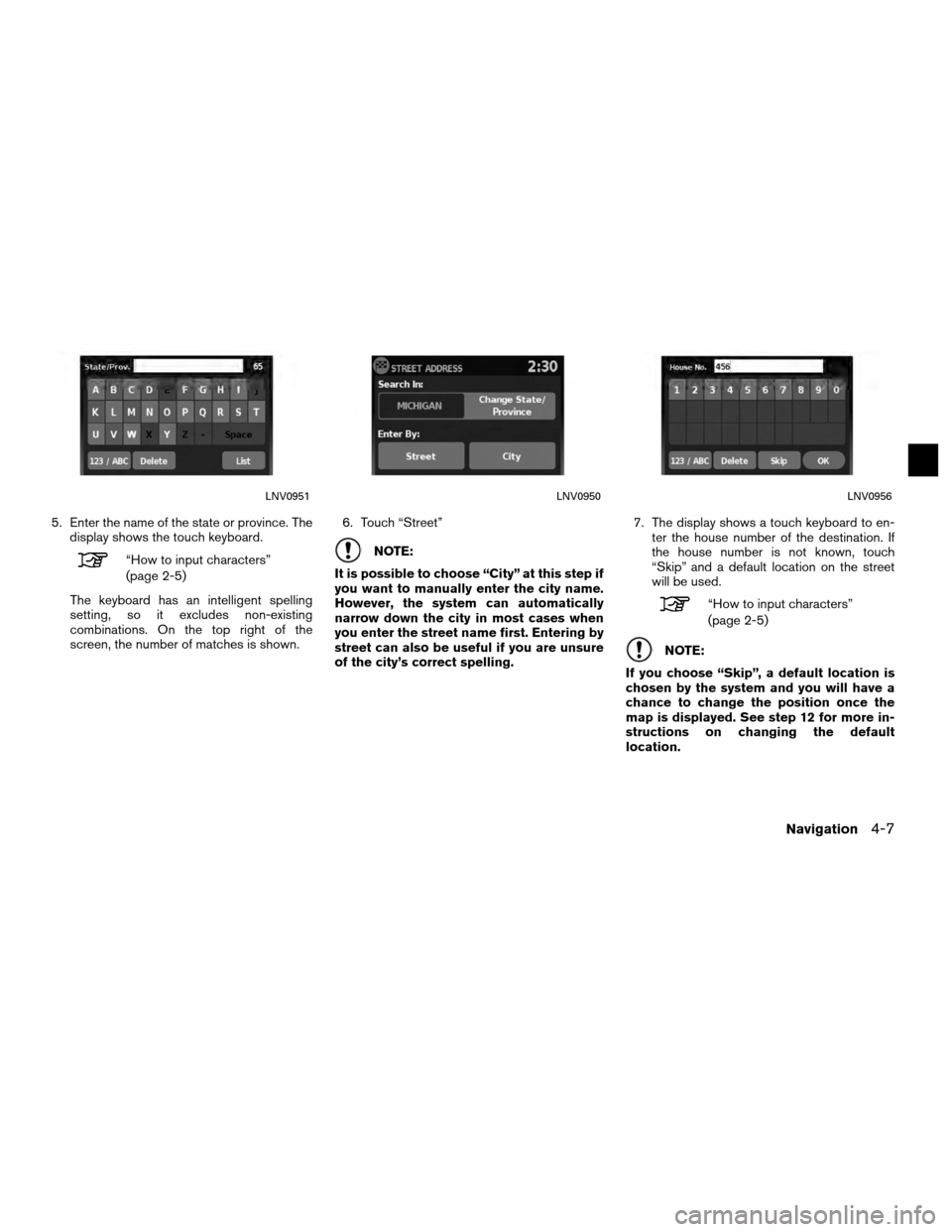
5. Enter the name of the state or province. Thedisplay shows the touch keyboard.
“How to input characters”
(page 2-5)
The keyboard has an intelligent spelling
setting, so it excludes non-existing
combinations. On the top right of the
screen, the number of matches is shown. 6. Touch “Street”NOTE:
It is possible to choose “City” at this step if
you want to manually enter the city name.
However, the system can automatically
narrow down the city in most cases when
you enter the street name first. Entering by
street can also be useful if you are unsure
of the city’s correct spelling. 7. The display shows a touch keyboard to en-
ter the house number of the destination. If
the house number is not known, touch
“Skip” and a default location on the street
will be used.
“How to input characters”
(page 2-5)
NOTE:
If you choose “Skip”, a default location is
chosen by the system and you will have a
chance to change the position once the
map is displayed. See step 12 for more in-
structions on changing the default
location.
LNV0951LNV0950LNV0956
Navigation4-7