Page 124 of 238
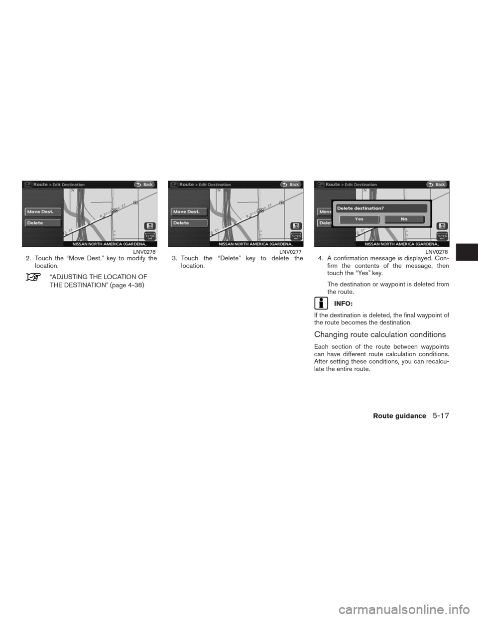
2. Touch the “Move Dest.” key to modify the
location.
“ADJUSTING THE LOCATION OF
THE DESTINATION” (page 4-38)3. Touch the “Delete” key to delete the
location.4. A confirmation message is displayed. Con-
firm the contents of the message, then
touch the “Yes” key.
The destination or waypoint is deleted from
the route.
INFO:
If the destination is deleted, the final waypoint of
the route becomes the destination.
Changing route calculation conditions
Each section of the route between waypoints
can have different route calculation conditions.
After setting these conditions, you can recalcu-
late the entire route.
LNV0276LNV0277LNV0278
Route guidance5-17
�REVIEW COPY—2009 Altima(alt)
Navigation System OM—USA_English(nna)
05/22/08—debbie
�
Page 127 of 238
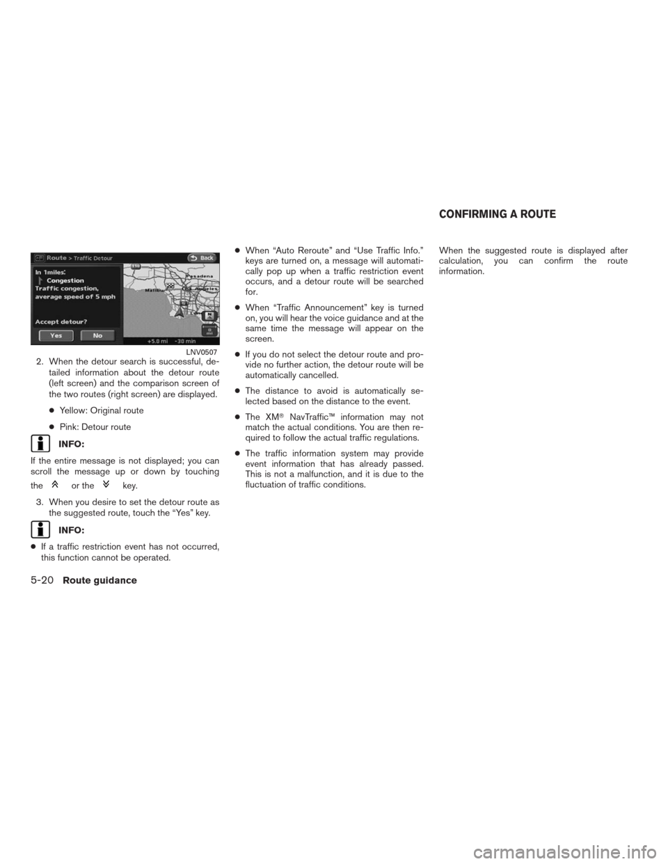
2. When the detour search is successful, de-
tailed information about the detour route
(left screen) and the comparison screen of
the two routes (right screen) are displayed.
●Yellow: Original route
●Pink: Detour route
INFO:
If the entire message is not displayed; you can
scroll the message up or down by touching
the
or thekey.
3. When you desire to set the detour route as
the suggested route, touch the “Yes” key.
INFO:
●If a traffic restriction event has not occurred,
this function cannot be operated.●When “Auto Reroute” and “Use Traffic Info.”
keys are turned on, a message will automati-
cally pop up when a traffic restriction event
occurs, and a detour route will be searched
for.
●When “Traffic Announcement” key is turned
on, you will hear the voice guidance and at the
same time the message will appear on the
screen.
●If you do not select the detour route and pro-
vide no further action, the detour route will be
automatically cancelled.
●The distance to avoid is automatically se-
lected based on the distance to the event.
●The XM�NavTraffic™ information may not
match the actual conditions. You are then re-
quired to follow the actual traffic regulations.
●The traffic information system may provide
event information that has already passed.
This is not a malfunction, and it is due to the
fluctuation of traffic conditions.When the suggested route is displayed after
calculation, you can confirm the route
information.
LNV0507
CONFIRMING A ROUTE
5-20Route guidance
�REVIEW COPY—2009 Altima(alt)
Navigation System OM—USA_English(nna)
05/22/08—debbie
�
Page 207 of 238
INFO:
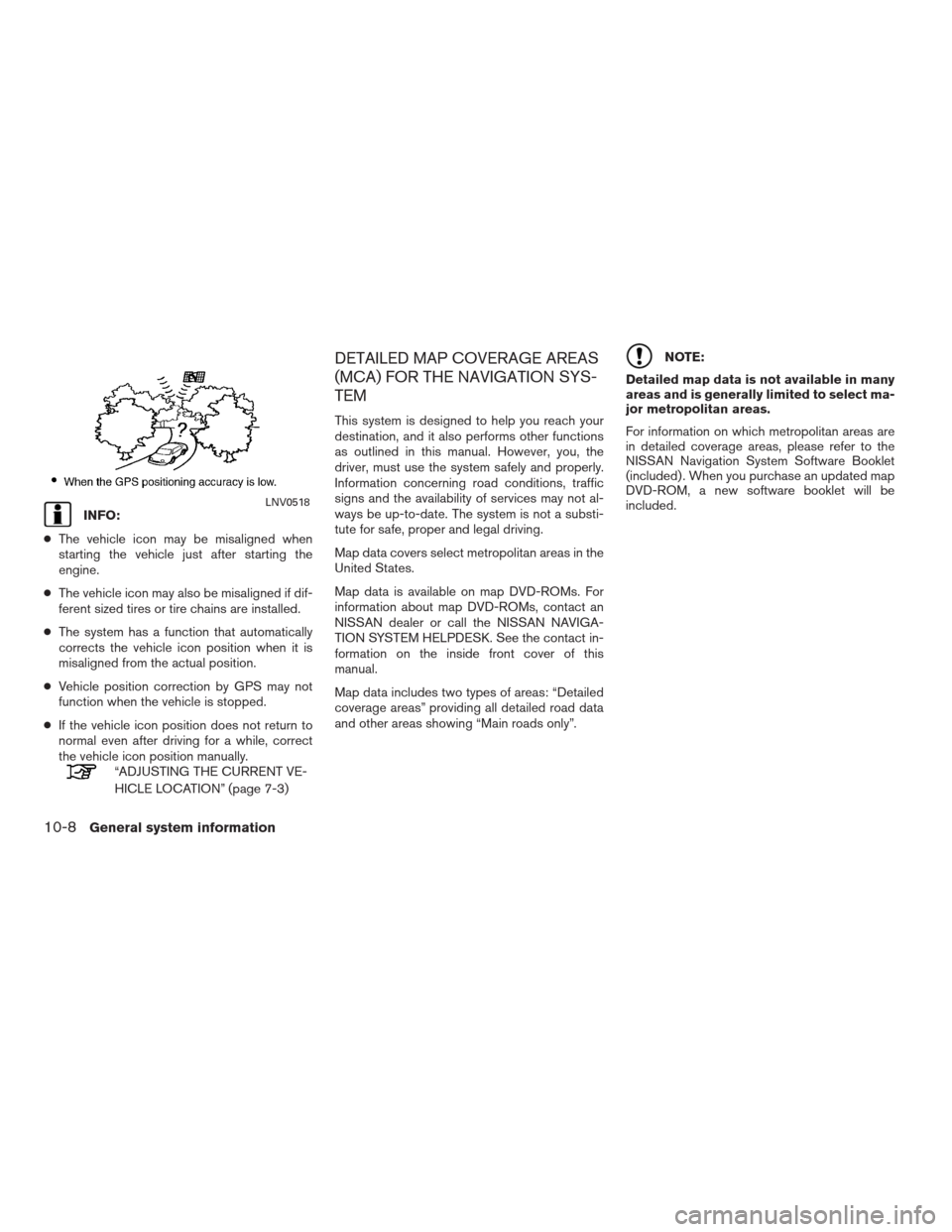
●The vehicle icon may be misaligned when
starting the vehicle just after starting the
engine.
●The vehicle icon may also be misaligned if dif-
ferent sized tires or tire chains are installed.
●The system has a function that automatically
corrects the vehicle icon position when it is
misaligned from the actual position.
●Vehicle position correction by GPS may not
function when the vehicle is stopped.
●If the vehicle icon position does not return to
normal even after driving for a while, correct
the vehicle icon position manually.
“ADJUSTING THE CURRENT VE-
HICLE LOCATION” (page 7-3)
DETAILED MAP COVERAGE AREAS
(MCA) FOR THE NAVIGATION SYS-
TEM
This system is designed to help you reach your
destination, and it also performs other functions
as outlined in this manual. However, you, the
driver, must use the system safely and properly.
Information concerning road conditions, traffic
signs and the availability of services may not al-
ways be up-to-date. The system is not a substi-
tute for safe, proper and legal driving.
Map data covers select metropolitan areas in the
United States.
Map data is available on map DVD-ROMs. For
information about map DVD-ROMs, contact an
NISSAN dealer or call the NISSAN NAVIGA-
TION SYSTEM HELPDESK. See the contact in-
formation on the inside front cover of this
manual.
Map data includes two types of areas: “Detailed
coverage areas” providing all detailed road data
and other areas showing “Main roads only”.
NOTE:
Detailed map data is not available in many
areas and is generally limited to select ma-
jor metropolitan areas.
For information on which metropolitan areas are
in detailed coverage areas, please refer to the
NISSAN Navigation System Software Booklet
(included) . When you purchase an updated map
DVD-ROM, a new software booklet will be
included.
LNV0518
10-8General system information
�REVIEW COPY—2009 Altima(alt)
Navigation System OM—USA_English(nna)
05/22/08—debbie
�
Page 221 of 238
Symptom Possible cause Possible solution
Names of roads and locations differ between Plan
view and Birdview™This is because the quantity of the displayed information is
reduced so that the screen does not become too crowded.
There is also a chance that names of the roads or locations
may be displayed multiple times, and the names appearing
on the screen may be different because of a processing
procedure.This is not a malfunction.
The vehicle icon is not displayed in the correct
position.The vehicle was transported after the ignition switch was
pushed off, for example, by a ferry or car transporter.Drive the vehicle for a while on a road where GPS signals can
be received.
The position and direction of the vehicle icon may be incor-
rect depending on the driving environments and the levels of
positioning accuracy of the navigation system.This is not a malfunction. Drive the vehicle for a while to auto-
matically correct the position and direction of the vehicle icon.
“CURRENT VEHICLE LOCATION” (page 10-4)
When the vehicle is traveling on a new road, the
vehicle icon is located on another road nearby.Because the new road is not stored in the map data, the sys-
tem automatically places the vehicle icon on the nearest road
available.Updated road information will be included in the next version of
the map DVD-ROM.
The screen does not switch to the night screen
even after turning on the headlights.The daytime screen was set the last time the headlights were
turned on.Set the screen to the night screen mode using the Day/Night
button when you turn on the headlights.
“DISPLAY SETTINGS” (page 8-3)
The map does not scroll even when the vehicle is
moving.The current location map screen is not displayed. Press the MAP button.
The vehicle icon is not displayed. The current location map screen is not displayed. Press the MAP button.
The location of the vehicle icon is misaligned from
the actual position.When using tire chains or replacing the tires, speed calcula-
tions based on the speed sensor may be incorrect.Drive the vehicle for a while (at approximately 19 MPH [30 km/h]
for about 30 minutes) to automatically correct the vehicle icon
position. If this does not correct the vehicle icon position, con-
tact a NISSAN dealer.
The map data has a mistake or is incomplete (the vehicle
icon position is always misaligned in the same area) .Updated road information will be included in the next version of
the map DVD-ROM.
VEHICLE ICON
11-4Troubleshooting guide
�REVIEW COPY—2009 Altima(alt)
Navigation System OM—USA_English(nna)
05/22/08—debbie
�