Page 29 of 146
BASIC FUNCTIONS
43
The right half of the screen can be used
as a guidance screen.
See also “Route guidance screen” on page
41.
Split screen near the intersection.
The distance to the intersection is shown
at the bottom of the screen.
Split screen near the exit of the freeway.
You can set the map mode and guid-
ance mode.
1. Push the “MENU” button on the
navigation controller.
2. Select the “Map appearance”switch.
3. It changes to the “Map appearance”
screen and you can select the “Guid-
ance mode”.
Guidance mode:
To display arrow screen
To display turn list screen
To display map screen
Guidance screenMap appearance
Page 30 of 146
BASIC FUNCTIONS
44
Arrow screen
This screen shows the current road name
and the distance to the next corner.
Turn list screen
This screen shows the “turn list” like the
above. You cannot scroll through the list of
roads.Map screen
Single mode
Dual mode
The map screen has 2 modes:
Single mode
Dual mode
The dual mode screen can perform the
following procedures.
�Changing the map scale
�Displaying the POI icon (See page 51.)
�Changing the orientation of the map
Page 31 of 146

BASIC FUNCTIONS
45
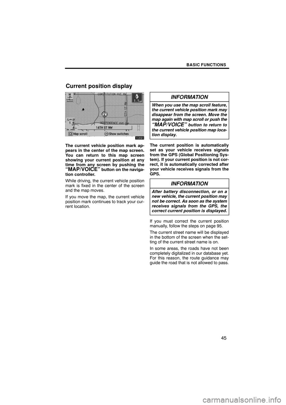
The current vehicle position mark ap-
pears in the center of the map screen.
You can return to this map screen
showing your current position at any
time from any screen by pushing the
“MAP/VOICE” button on the naviga-
tion controller.
While driving, the current vehicle position
mark is fixed in the center of the screen
and the map moves.
If you move the map, the current vehicle
position mark continues to track your cur-
rent location.
INFORMATION
When you use the map scroll feature,
the current vehicle position mark may
disappear from the screen. Move the
map again with map scroll or push the
“MAP/VOICE” button to return to
the current vehicle position map loca-
tion display.
The current position is automatically
set as your vehicle receives signals
from the GPS (Global Positioning Sys-
tem). If your current position is not cor-
rect, it is automatically corrected after
your vehicle receives signals from the
GPS.
INFORMATION
After battery disconnection, or on a
new vehicle, the current position may
not be correct. As soon as the system
receives signals from the GPS, the
correct current position is displayed.
If you must correct the current position
manually, follow the steps on page 95.
The current street name will be displayed
in the bottom of the screen when the set-
ting of the current street name is on.
In some areas, the roads have not been
completely digitalized in our database yet.
For this reason, the route guidance may
guide the road that is not allowed to pass.
Current position display
Page 36 of 146
BASIC FUNCTIONS
50
DELETING YOUR HOME
1. Push the “MENU” button on the
navigation controller to display the
“Menu” screen and select the
“Marked points” switch.
2. Select the “Delete home” switch.
The screen changes and displays the map
location of the home and a message. If you
are sure, select the
“Yes” switch. If not,
select the “No” switch.When you are driving while the route
guidance is operating, you can change
the route to detour around a section of
the route where a delay is caused by
road repairs, an accident, etc.
Select the “Chg. route” switch on the
right side of the screen if you encounter
a reason to divert from the selected
route.
This picture shows an example of how the
system would route you around a delay
caused by a traffic jam.
1
This part indicates the location where
traffic jam is occurring due to road re-
pairs or an accident.
2
These show the detour route sug-
gested by the system.
Detour setting
Page 37 of 146

BASIC FUNCTIONS
51
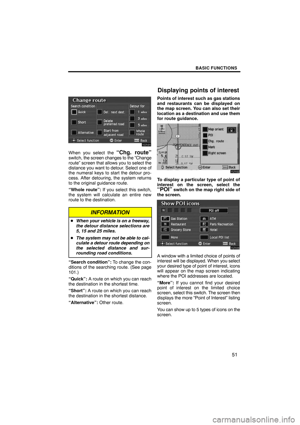
When you select the “Chg. route”switch, the screen changes to the “Change
route” screen that allows you to select the
distance you want to detour. Select one of
the numeral keys to start the detour pro-
cess. After detouring, the system returns
to the original guidance route.
“Whole route”: If you select this switch,
the system will calculate an entire new
route to the destination.
INFORMATION
�When your vehicle is on a freeway,
the detour distance selections are
5, 15 and 25 miles.
�The system may not be able to cal-
culate a detour route depending on
the selected distance and sur-
rounding road conditions.
“Search condition”: To change the con-
ditions of the searching route. (See page
101.)
“Quick”: A route on which you can reach
the destination in the shortest time.
“Short”: A route on which you can reach
the destination in the shortest distance.
“Alternative”: Other route.Points of interest such as gas stations
and restaurants can be displayed on
the map screen. You can also set their
location as a destination and use them
for route guidance.
To display a particular type of point of
interest on the screen, select the
“POI” switch on the map right side of
the screen.
A window with a limited choice of points of
interest will be displayed. When you select
your desired type of point of interest, icons
will appear on the map screen indicating
where the POI addresses are located.
“More”: If you cannot find your desired
point of interest on the limited choice
screen, select this switch. The screen then
displays the more “Point of Interest” listing
screen.
You can show up to 5 types of icons on the
screen.
Displaying points of interest
Page 38 of 146

BASIC FUNCTIONS
52
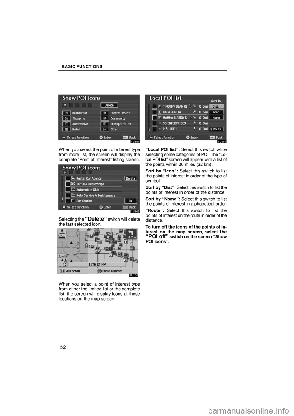
When you select the point of interest type
from more list, the screen will display the
complete “Point of Interest” listing screen.
Selecting the “Delete” switch will delete
the last selected icon.
When you select a point of interest type
from either the limited list or the complete
list, the screen will display icons at those
locations on the map screen.
“Local POI list”: Select this switch while
selecting some categories of POI. The “Lo-
cal POI list” screen will appear with a list of
the points within 20 miles (32 km).
Sort by “Icon”: Select this switch to list
the points of interest in order of the type of
symbol.
Sort by “Dist”: Select this switch to list the
points of interest in order of the distance.
Sort by “Name”: Select this switch to list
the points of interest in alphabetical order.
“Route”: Select this switch to list the
points of interest on the route in order of the
distance.
To turn off the icons of the points of in-
terest on the map screen, select the
“POI off” switch on the screen “Show
POI icons”.
Page 39 of 146
BASIC FUNCTIONS
53
Setting a POI as a destination
You can select one of the points of in-
terest icons on the map screen as a
destination and use it for a route guid-
ance.
1. Select the icon of the point of inter-
est that you want to set as a destination.
Operate the select and scroll lever to move
the cursor
to your desired POI icon.
Then the icon “POI” is centered in the
screen and it overlaps with the cursor
.
2. Push the
“ENTER” button on the
navigation controller, and then the
switch menu appears.
3. Select the “Guide” switch.
The name of the point of interest is dis-
played at the top of the screen. You can se-
lect the other POI icon on the displayed
map.
When you push the
“ENTER” button on
the navigation controller, the information
such as the name and address, etc. are
displayed.
4. If you set the point of interest as a
destination, select the
“Enter ”switch. If not, push the “BACK” but-
ton on the navigation controller, then
the previous screen returns.
Page 40 of 146
BASIC FUNCTIONS
54
When there are 2 screens displayed, se-
lect “Right screen” switch. You can
display the “Edit right screen”.
Select “Show POI icons”. POI icon is
displayed when the indicator next to the
is highlighted, and if not, the POI icon
is not displayed.You can change from the map screen to
a “Turn list” screen that displays the list
of the roads up to your destination. This
list can be used for a route guidance.
1. Push the “MENU” button on the
navigation controller.
2. Screen and select the “Route
overview” switch.
Turn list