2008 NISSAN XTERRA sat nav
[x] Cancel search: sat navPage 29 of 217
Black plate (32,1)
Model "NAV2-N" EDITED: 2007/ 3/ 9
.Wait until the tone sounds before speaking a
command. Otherwise, the command will not
be recognized properly.
.Speak in a natural conversational voice
without pausing between words.
.If the air conditioner is set to “Auto”, the fan
speed is automatically lowered so that your
commands can be recognized more easily.
VOICE COMMAND EXAMPLES
To use the voice recognition function, speaking
one command is sometimes sufficient, but at
other times it is necessary to speak two or more
commands.
As examples, some additional basic operations
by voice commands are described here.
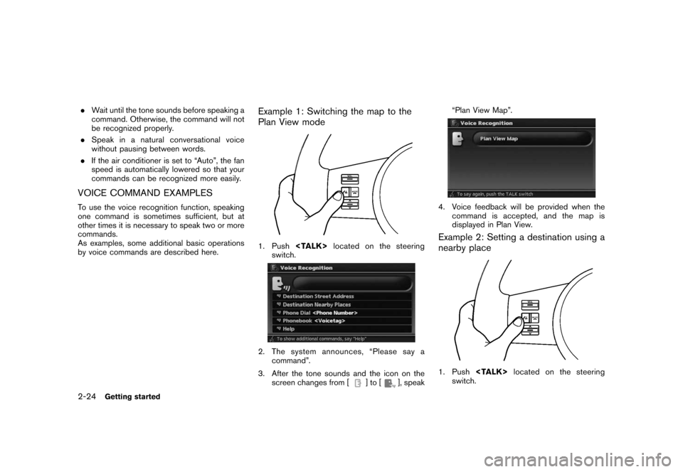
Example 1: Switching the map to the
Plan View mode
1. Push
switch.
2. The system announces, “Please say a
command”.
3. After the tone sounds and the icon on the
screen changes from [
]to[], speak“Plan View Map”.
4. Voice feedback will be provided when the
command is accepted, and the map is
displayed in Plan View.
Example 2: Setting a destination using a
nearby place
1. Push
switch.
2-24Getting started
Page 137 of 217
Black plate (140,1)
Model "NAV2-N" EDITED: 2007/ 3/ 9
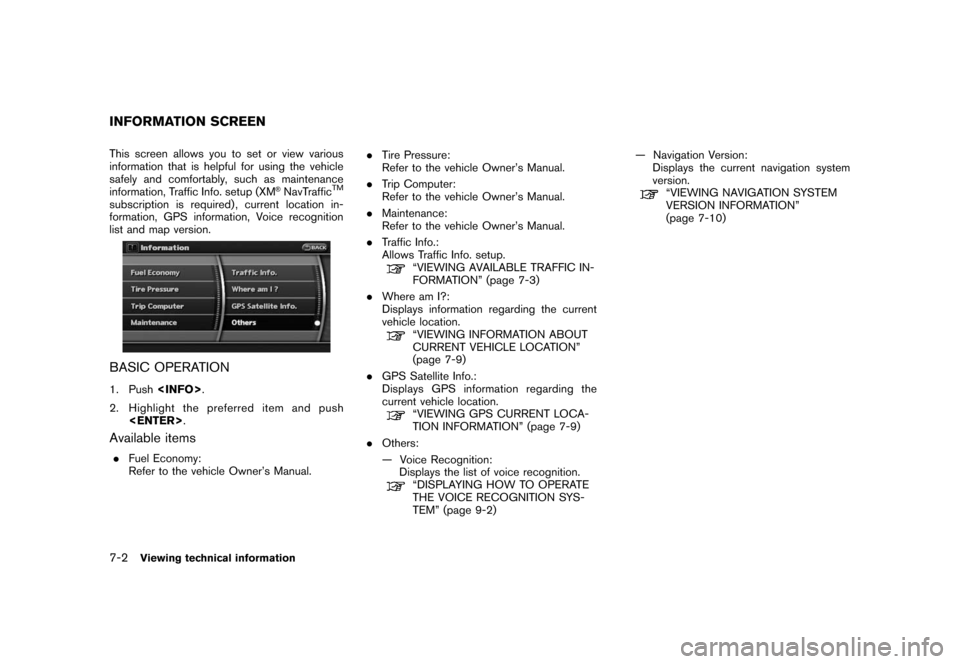
This screen allows you to set or view various
information that is helpful for using the vehicle
safely and comfortably, such as maintenance
information, Traffic Info. setup (XM
®NavTrafficTM
subscription is required) , current location in-
formation, GPS information, Voice recognition
list and map version.
BASIC OPERATION
1. Push
2. Highlight the preferred item and push
Available items
.Fuel Economy:
Refer to the vehicle Owner’s Manual..Tire Pressure:
Refer to the vehicle Owner’s Manual.
.Trip Computer:
Refer to the vehicle Owner’s Manual.
.Maintenance:
Refer to the vehicle Owner’s Manual.
.Traffic Info.:
Allows Traffic Info. setup.
“VIEWING AVAILABLE TRAFFIC IN-
FORMATION” (page 7-3)
.Where am I?:
Displays information regarding the current
vehicle location.
“VIEWING INFORMATION ABOUT
CURRENT VEHICLE LOCATION”
(page 7-9)
.GPS Satellite Info.:
Displays GPS information regarding the
current vehicle location.
“VIEWING GPS CURRENT LOCA-
TION INFORMATION” (page 7-9)
.Others:
— Voice Recognition:
Displays the list of voice recognition.
“DISPLAYING HOW TO OPERATE
THE VOICE RECOGNITION SYS-
TEM” (page 9-2)— Navigation Version:
Displays the current navigation system
version.
“VIEWING NAVIGATION SYSTEM
VERSION INFORMATION”
(page 7-10)
INFORMATION SCREEN
7-2Viewing technical information
Page 138 of 217
Black plate (141,1)
Model "NAV2-N" EDITED: 2007/ 3/ 9
XM®NavTrafficTMinformation is a subscription
service offered by XM®Satellite Radio.
This service providesreal-time information
regarding traffic flow, accidents, road construc-
tion and other incidents, where available.
XM
®NavTrafficTMcombines information from
commercial and public traffic data providers
including government departments of transpor-
tation, police, emergency services, road sen-
sors, cameras and aircraft reports. The traffic
information is broadcast to the vehicle by the
XM
®satellites. Available traffic information on
the route the driver selected is shown on the
navigation screen so traffic conditions between
you and the destination are known. Three types
of real-time traffic information for major road-
ways are shown on the navigation system:
* Unscheduled traffic data for example, acci-
dents and disabled vehicles.
* Scheduled traffic data, for example road
construction and road closures.
* Traffic flow information (rate of speed data) .
WARNING
XM®NavTrafficTMinformation is not a
substitute for attentive driving. Traffic
conditions change constantly andemergency situations can arise with-
out warning. Relying only on XM
®
NavTrafficTMinformation may lead to
a collision and could result in serious
personal injury.
NOTE:
Flow information is provided only for
roads equipped with traffic sensors and
is not available in all markets covered by
the service. Flow data may not be available
on portions of a road that is under
construction.
XM
®NavTrafficTMinformation is available in
limited markets. To subscribe or to check if this
service is available in your area:
call 1-800-XM-RADIO (1-800-967-2346) or
see www.xmradio.com/xmnavtraffic/
INFO:
If you do not have a contract for XM
®
NavTrafficTMtraffic information service, a mes-
sage appears, and it will not be possible to
check the information on the traffic information
system.
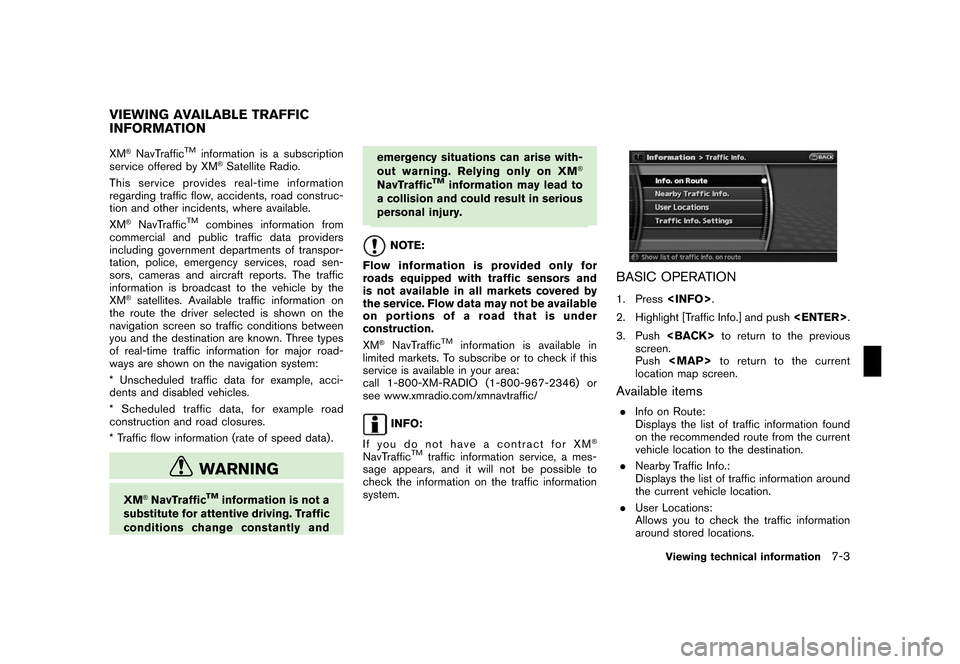
BASIC OPERATION
1. Press
2. Highlight [Traffic Info.] and push
3. Push
screen.
Push
Page 144 of 217
Black plate (147,1)
Model "NAV2-N" EDITED: 2007/ 3/ 9
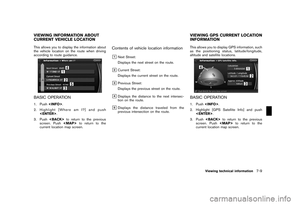
This allows you to display the information about
the vehicle location on the route when driving
according to route guidance.
BASIC OPERATION
1. Push
2. Highlight [Where am I?] and push
3. Push
screen. Push
Page 145 of 217
Black plate (148,1)
Model "NAV2-N" EDITED: 2007/ 3/ 9
Contents of GPS information
&1Calculation:
Displays the GPS positioning method.
3-dimension
Calculating the latitude, longitude
and altitude by four or more satellites.
2-dimension
Calculating the latitude, longitude
and altitude by three or more satel-
lites.
Out of range Cannot calculate because no GPS
satellites can be located.
&2Latitude/Longitude:
Displays the latitude/longitude.
&3Approx Altitude:
Displays the approximate altitude.
&4Positioning status:
It indicates that satellites are available.
It indicates that satellites are being
searched for.
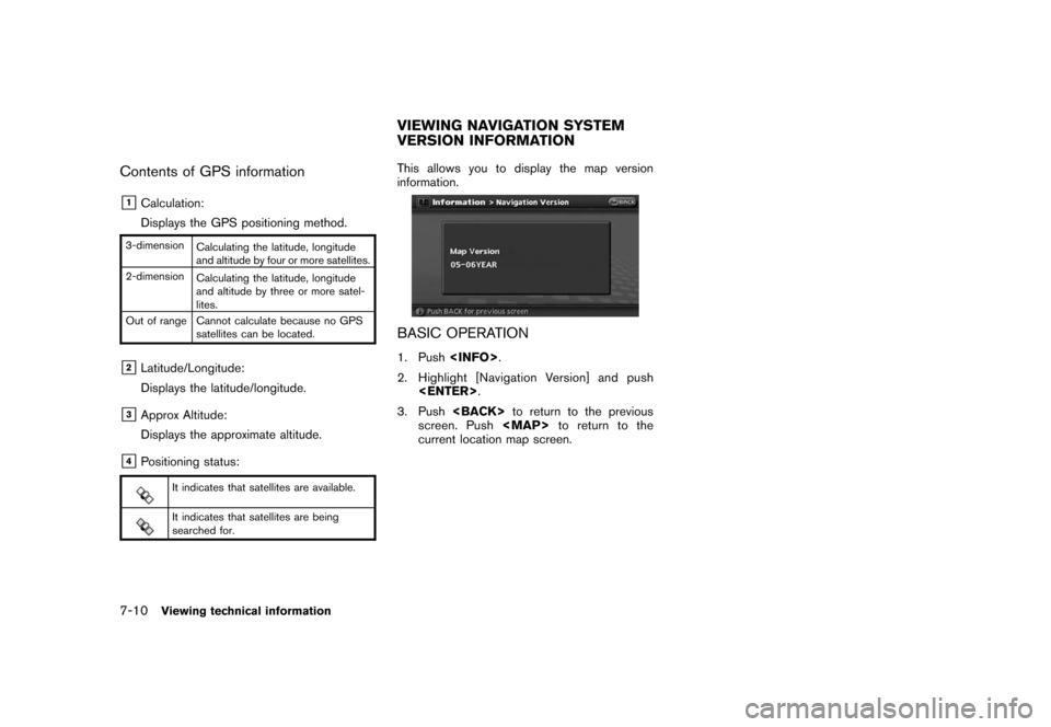
This allows you to display the map version
information.
BASIC OPERATION
1. Push
2. Highlight [Navigation Version] and push
3. Push
screen. Push
current location map screen.
VIEWING NAVIGATION SYSTEM
VERSION INFORMATION
7-10Viewing technical information
Page 166 of 217
Black plate (173,1)
Model "NAV2-N" EDITED: 2007/ 3/ 9
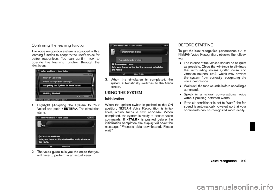
Confirming the learning function
The voice recognition system is equipped with a
learning function to adapt to the user’s voice for
better recognition. You can confirm how to
operate the learning function through the
simulation.
1. Highlight [Adapting the System to Your
Voice] and push
starts.
2. The voice guide tells you the steps that you
will have to perform in an actual case.
3. When the simulation is completed, the
system automatically switches to the Menu
screen.
USING THE SYSTEM
Initialization
When the ignition switch is pushed to the ON
position, NISSAN Voice Recognition is initia-
lized, which takes a few seconds. When
completed, the system is ready to accept voice
commands. If
initialization completes, the display will show the
message: “Phonetic data downloaded. Please
wait.”
BEFORE STARTING
To get the best recognition performance out of
NISSAN Voice Recognition, observe the follow-
ing:
.The interior of the vehicle should be as quiet
as possible. Close the windows to eliminate
the surrounding noises (traffic noise and
vibration sounds, etc.) , which may prevent
the system from correctly recognizing the
voice commands.
.Wait until the tone sounds before speaking a
command.
.Speak in a natural conversational voice
without pausing between words.
.If the air conditioner is set to “Auto”, the fan
speed is automatically lowered so that your
commands can be recognized more easily.
Voice recognition9-9
Page 177 of 217
Black plate (184,1)
Model "NAV2-N" EDITED: 2007/ 3/ 9
ROUTE GUIDANCE
The main features of the NISSAN Navigation
System are visual guidance and voice guidance
in selected map coverage areas. Utilizing a
network of GPS (Global Positioning System)
satellites, the NISSAN Navigation System tracks
your location on the map and navigates you to a
preferred location.
Once you set the destination in a map coverage
area, the NISSAN Navigation System will
calculate a route from your current location to
your destination. The real-time map display and
turn-by-turn voice guidance leads the driver
along the route. These features can be espe-
cially helpful when driving to unfamiliar locations.
The system may be unable to set a destination
and/or calculate a route when the destination is
outside the map coverage area. Additionally,
voice guidance may not be available if the
destination is outside the map coverage area.
For more information on how to set a destina-
tion, refer to section 4.
POINTS OF INTEREST (POI) DIREC-
TO RY
The NISSAN Navigation System offers an
extensive Points of Interest (POI) directory in
map coverage areas. This directory includes a
wide variety of destinations ranging from gasstations, ATMs, and restaurants to casinos, ski
resorts, shopping centers and businesses. By
accessing the Points of Interest directory, you
can search for addresses and phone numbers
for a destination, and just by pushing a button,
the NISSAN Navigation System will calculate a
route to the destination.
The POI directory has many uses. For example,
the directory can be sorted by the various types
of restaurants near your current location. If you
need an ATM or gas station, the NISSAN
Navigation System can navigate you to the
closest preferred location.
For more information on how to use the Points of
Interest directory, refer to section 4.
ADDRESS BOOK
The Address Book can store up to 100 locations
from map coverage areas into a personal
directory. This is especially useful for frequently
visited locations, such as clients, relatives and
friends. The Address Book function allows easy
access to frequently visited locations when
setting them as your destination.
For more information on how to use the Address
Book, refer to section 6.
AVOID AREA
The Avoid Area function allows you to identify
areas or freeways that you would like theNISSAN Navigation System to avoid when
calculating routes. For example, if a freeway or
area is always congested with traffic, you can
set the NISSAN Navigation System to calculate
routes that exclude that freeway or area.
For more information on the Avoid Area function,
refer to section 6.
XM®NavTrafficTMINFORMATION
When available the XM®NavTrafficTMInforma-
tion broadcast allows you to avoid delays due to
traffic incidents. Traffic jams, roadwork, closed
roads around your current location, etc. are
represented graphically on the map by icons
depicting the nature of the event. Incidents on
the route are automatically brought to your
attention when you approach them.
The XM
®NavTrafficTMInformation feature, via
the guidance mode, allows you to detour around
traffic problems. For more information on the
XM
®NavTrafficTMInformation feature, please
refer to section 5.
AUTOMATIC REROUTE
If you deviate from the suggested route, the
NISSAN Navigation System will automatically
recalculate a new route to your destination.
For more information on the Automatic reroute
function, refer to section 5.
FEATURES OF THIS NAVIGATION
SYSTEM
10-2General system information
Page 178 of 217
Black plate (185,1)
Model "NAV2-N" EDITED: 2007/ 3/ 9
DETOUR
If you want to make a detour due to traffic
conditions, you can use the Detour function to
calculate an alternative route. The NISSAN
Navigation System can calculate a route using
secondary roads that will return you to primary
roads after a specified number of miles.
For more information on the Detour function,
refer to section 5.
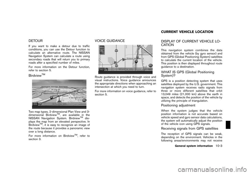
BirdviewTM
Two map types, 2-dimensional Plan View and 3-
dimensional BirdviewTM, are available in the
NISSAN Navigation System. BirdviewTMdis-
plays the map from an elevated perspective. In
Birdview
TM, it is easy to recognize an image of
the route because it provides a panoramic view
over a long distance.
For more information on Birdview
TM, refer to
section 3.
VOICE GUIDANCE
Route guidance is provided through voice and
visual instructions. Voice guidance announces
the appropriate directions when approaching an
intersection at which you need to turn.
For more information on voice guidance, refer to
section 5.
DISPLAY OF CURRENT VEHICLE LO-
CATION
This navigation system combines the data
obtained from the vehicle (by gyro sensor) and
from GPS (Global Positioning System) satellites
to calculate the current location of the vehicle.
This position is then displayed throughout route
guidance to a destination.
WHAT IS GPS (Global Positioning
System)?
GPS is a position detecting system that uses
satellites deployed by the U.S. government. This
navigation system receives radio signals from
three or more different satellites that orbit
13,049 miles (21,000 km) above the earth in
space, and detects the position of the vehicle by
utilizing the principle of triangulation.
Positioning adjustment
When the system judges that the vehicle
position information is not accurate based on
vehicle speed and gyro sensor data calculations,
the system will automatically adjust the position
of the vehicle icon using GPS signals.
Receiving signals from GPS satellites
The reception of GPS signals can be weak,
depending on the environment. Vehicles in the
following areas/environments may not receive
CURRENT VEHICLE LOCATION
General system information10-3