Page 12 of 217
Black plate (15,1)
Model "NAV2-N" EDITED: 2007/ 3/ 9
MENU SCREENS AND THEIR PUR-
POSES
Push,,,
orto display the corre-
sponding menu screen.
How to select a menu item
Example:screen
1. Turn the center dial clockwise or counter-
clockwise or push the up or down button of
the main directional buttons. An item is
highlighted accordingly.2. To select the preferred menu item, highlight
the item and push. The next
screen is displayed.
3. Pushto return to the previous
screen without applying any changes.
Push
Page 40 of 217
Black plate (43,1)
Model "NAV2-N" EDITED: 2007/ 3/ 9
BirdviewTM
Operating with the multi-function con-
troller
The main directional buttons and additional
directional buttons allow movement in the
following ways.
Hold down one of the main directional buttons
or additional directional buttons to continue to
rotate or move across the map in that direction.
Rotates the map clockwise.
Rotates the map counterclockwise.
The cross pointer moves in the direc-
tion of the arrow.
Once you start moving on the map, the cross
pointer appears.Screen information:
&1Cross pointer
&2Distance from the vehicle position to the
cross pointer
&3Street name
Operating with the touch operation
1. Touch the screen.
Displays the cross pointer and 8-directional
key.
Map settings3-7
Page 41 of 217
Black plate (44,1)
Model "NAV2-N" EDITED: 2007/ 3/ 9
2. Touch the direction you desire to scroll to.
The map continues to scroll while the screen
is touched.
3. Touch []or[] to change the
direction of the map.
: Rotates the map clockwise.
: Rotates the map counterclockwise.
INFO:
When the operation is performed during driving,
the scrolling is stopped after the screen scrolls
to the touched direction for a specified amount.
If the map scale is set to 180 ft (60 m) or less,
the map cannot be scrolled while driving.
3-8Map settings
Page 43 of 217
Black plate (46,1)
Model "NAV2-N" EDITED: 2007/ 3/ 9
OPERATING WITH THE CENTER DIAL
1. Turn the center dial on the map screen. The
map scale is displayed.
2. Use the center dial to adjust the map scale.
&1Clockwise: Zoom in
&2Counterclockwise: Zoom out
INFO:
Free zoom:
Depending on the setting, using the center dial
to change the map scale may adjust the scale
normally, or it may engage the free zoom (finer
scale adjustment in smaller steps) .
“NAVIGATION SETTING” (page 8-4)
OPERATING WITH THE TOUCH OP-
ERATION
1. Touch.
Displays the scale.
2. Touch [ZOOM IN] or [ZOOM OUT] to
change the scale.
3-10Map settings
Page 146 of 217

Black plate (22,1)
8 Other settings
Model "NAV2-N" EDITED: 2007/ 3/ 8
Settings screen................................................. 8-2
Basic operation............................................. 8-2
Display settings................................................. 8-2
Basic operation............................................. 8-2
Display........................................................ 8-3
Brightness.................................................... 8-3
Contrast...................................................... 8-3
Background color........................................... 8-3
Navigation setting............................................... 8-4
Basic operation............................................. 8-4
Customizing nearby places............................... 8-5
Map color settings.......................................... 8-6Displaying the AV information on the map
screen......................................................... 8-6
Settings the keyboard layout of the character
input screen.................................................. 8-7
Adjusting the current vehicle location.................. 8-7
Reset all navigation settings to default................ 8-8
Volume adjustment............................................. 8-9
Basic operation............................................. 8-9
Clock settings.................................................8-10
Basic operation...........................................8-10
Language and unit settings.................................8-11
Language settings........................................8-11
Unit settings...............................................8-12
Page 147 of 217

Black plate (152,1)
Model "NAV2-N" EDITED: 2007/ 3/ 9
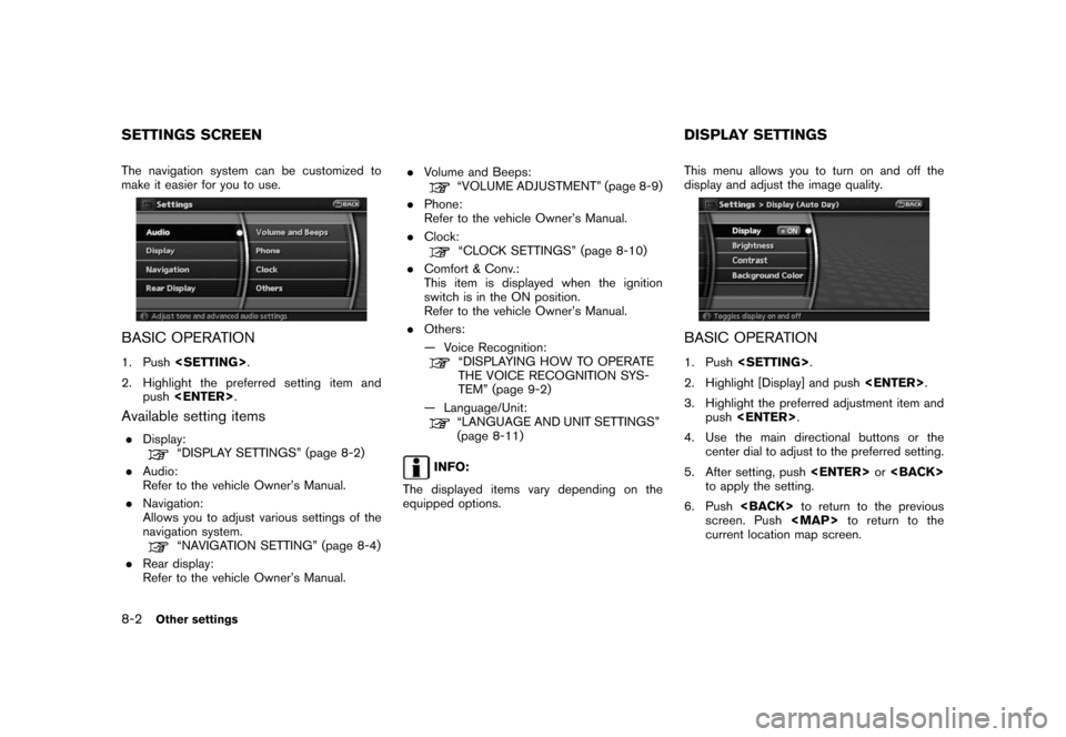
The navigation system can be customized to
make it easier for you to use.
BASIC OPERATION
1. Push.
2. Highlight the preferred setting item and
push.
Available setting items
.Display:“DISPLAY SETTINGS” (page 8-2)
.Audio:
Refer to the vehicle Owner’s Manual.
.Navigation:
Allows you to adjust various settings of the
navigation system.
“NAVIGATION SETTING” (page 8-4)
.Rear display:
Refer to the vehicle Owner’s Manual..Volume and Beeps:
“VOLUME ADJUSTMENT” (page 8-9)
.Phone:
Refer to the vehicle Owner’s Manual.
.Clock:
“CLOCK SETTINGS” (page 8-10)
.Comfort & Conv.:
This item is displayed when the ignition
switch is in the ON position.
Refer to the vehicle Owner’s Manual.
.Others:
— Voice Recognition:
“DISPLAYING HOW TO OPERATE
THE VOICE RECOGNITION SYS-
TEM” (page 9-2)
— Language/Unit:
“LANGUAGE AND UNIT SETTINGS”
(page 8-11)
INFO:
The displayed items vary depending on the
equipped options.This menu allows you to turn on and off the
display and adjust the image quality.
BASIC OPERATION
1. Push.
2. Highlight [Display] and push.
3. Highlight the preferred adjustment item and
push.
4. Use the main directional buttons or the
center dial to adjust to the preferred setting.
5. After setting, pushor
to apply the setting.
6. Pushto return to the previous
screen. Pushto return to the
current location map screen.
SETTINGS SCREEN DISPLAY SETTINGS
8-2Other settings
Page 155 of 217

Black plate (160,1)
Model "NAV2-N" EDITED: 2007/ 3/ 9
when the beep function is set to on. The
beep that sounds when pushing and holding
a button or when a prohibited operation is
performed cannot be set to off.
INFO:
For more details about [Ringer Vol.], [Incoming
Call] and [Outgoing Call], refer to the vehicle
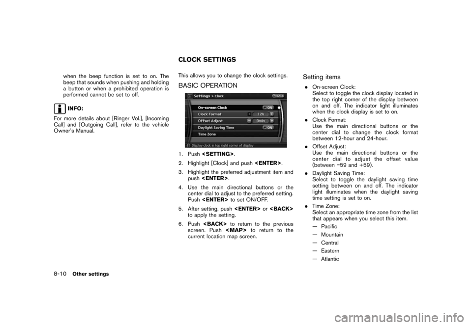
Owner’s Manual.This allows you to change the clock settings.
BASIC OPERATION
1. Push.
2. Highlight [Clock] and push.
3. Highlight the preferred adjustment item and
push.
4. Use the main directional buttons or the
center dial to adjust to the preferred setting.
Pushto set ON/OFF.
5. After setting, pushor
to apply the setting.
6. Pushto return to the previous
screen. Pushto return to the
current location map screen.
Setting items
.On-screen Clock:
Select to toggle the clock display located in
the top right corner of the display between
on and off. The indicator light illuminates
when the clock display is set to on.
.Clock Format:
Use the main directional buttons or the
center dial to change the clock format
between 12-hour and 24-hour.
.Offset Adjust:
Use the main directional buttons or the
center dial to adjust the offset value
(between−59 and +59) .
.Daylight Saving Time:
Select to toggle the daylight saving time
setting between on and off. The indicator
light illuminates when the daylight saving
time setting is set to on.
.Time Zone:
Select an appropriate time zone from the list
that appears when you select this item.
— Pacific
— Mountain
— Central
— Eastern
— Atlantic
CLOCK SETTINGS
8-10Other settings
Page 184 of 217

Black plate (191,1)
Model "NAV2-N" EDITED: 2007/ 3/ 9
— If the destination, current vehicle position
or waypoint is within the “Avoid Area”.
— If a part of the route is included in the
“Avoid Area”.
.The following may occur when the route is
displayed.
— If you calculate a route on a main road,
the starting point of the route may not
exactly match the current vehicle loca-
tion.
— The endpoint of the route may not
exactly match the destination.
— If you calculate a route on a main road,
the system may display a route from
another main road. This may be because
the position of the vehicle icon is not
accurate. In this case, park the vehicle in
a safe location and reset the vehicle
icon, or continue driving to see if the
position of the vehicle icon is automati-
cally adjusted before recalculating the
route.
— There are cases in which the system
shows an indirect route to reach the
destination or waypoints, if you set them
from stored or facility information. In
order to correct this, you must be careful
about the traffic direction, especially
when lanes with different travel direc-tions are shown separately, such as
interchanges and service areas.
— This system makes no distinction be-
tween limited traffic control and total
control (blockage) . It may show an
indirect route even if the road is usable.
— Even if the freeway preference is set to
OFF, a route that uses the freeway may
be suggested.
— Even if the preference is set to OFF, a
route that uses a ferry line may be
suggested.
— Ferry lines, excluding those that are only
for pedestrians, bicycles and motor-
cycles, are stored in this system. Take
into consideration the travel time re-
quired and operational condition before
deciding whether to use them or not.INFO:
The announcement of the street name during
route guidance is available only when English is
set as the language for the system. Street
names are not announced if French is set for the
system.
BASICS OF VOICE GUIDANCE
Voice guidance announces which direction to
turn when approaching an intersection in which
a turn is necessary.
NOTE:
.There may be some cases in which
voice guidance and actual road condi-
tions do not correspond. This may
occur because of discrepancies be-
tween the actual road and the informa-
tion on the map data, or it is due to the
vehicle’s speed.
.In case voice guidance does not corre-
spond to the actual road conditions,
follow the information obtained from
traffic signs or notices on the road.
ROUTE GUIDANCE
General system information10-9