Page 61 of 164
INTERSECTION
To set an intersection as a destination:
1. Press DEST.
2. Select INTERSECTION to
program a destination to a major
intersection.
3. Under STREET #1, use the
keypad to type in the name of the
first street. The streets that
intersect with your STREET #1 will
appear in a list. Select the desired
street (STREET #2) from the list.
The list can be sorted alphabetically,
or in the order of distance from the
current position. After entering the desired intersection, select the city
from the list. The Destination Map will appear.
•STATE/PROV:Press to set the State, Province or Territory using the
keyboard or select from List . The preset value for this field is based
on current position (Auto Fill On) or previous selection (Auto Fill
Off), depending on the settings.
2008(nv1)
Supplement
USA(fus)
Navigation features
59
Page 63 of 164
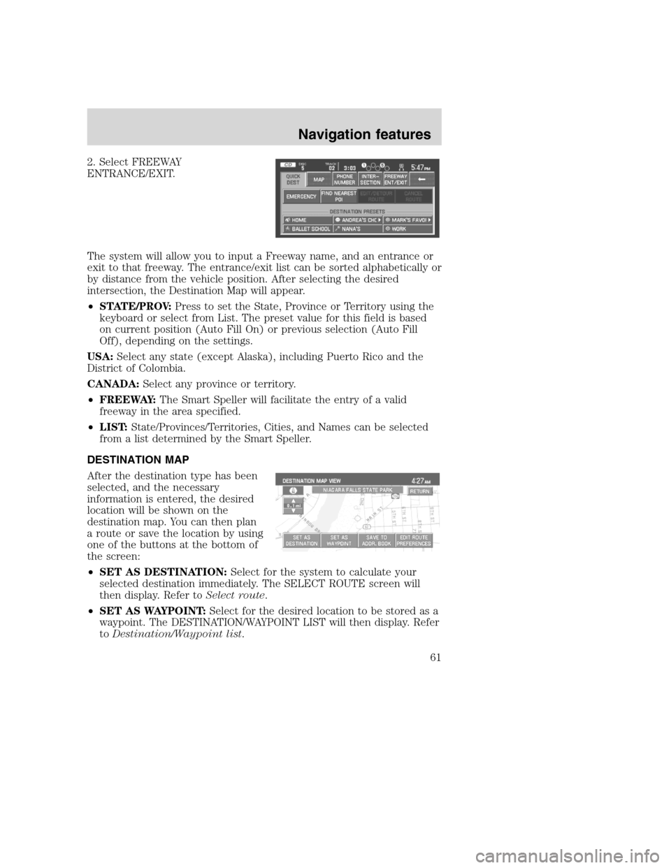
2. Select FREEWAY
ENTRANCE/EXIT.
The system will allow you to input a Freeway name, and an entrance or
exit to that freeway. The entrance/exit list can be sorted alphabetically or
by distance from the vehicle position. After selecting the desired
intersection, the Destination Map will appear.
•STATE/PROV:Press to set the State, Province or Territory using the
keyboard or select from List. The preset value for this field is based
on current position (Auto Fill On) or previous selection (Auto Fill
Off), depending on the settings.
USA:Select any state (except Alaska), including Puerto Rico and the
District of Colombia.
CANADA:Select any province or territory.
•FREEWAY:The Smart Speller will facilitate the entry of a valid
freeway in the area specified.
•LIST:State/Provinces/Territories, Cities, and Names can be selected
from a list determined by the Smart Speller.
DESTINATION MAP
After the destination type has been
selected, and the necessary
information is entered, the desired
location will be shown on the
destination map. You can then plan
a route or save the location by using
one of the buttons at the bottom of
the screen:
•SET AS DESTINATION:Select for the system to calculate your
selected destination immediately. The SELECT ROUTE screen will
then display. Refer toSelect route.
•SET AS WAYPOINT:Select for the desired location to be stored as a
waypoint. The DESTINATION/WAYPOINT LIST will then display. Refer
toDestination/Waypoint list.
2008(nv1)
Supplement
USA(fus)
Navigation features
61
Page 68 of 164
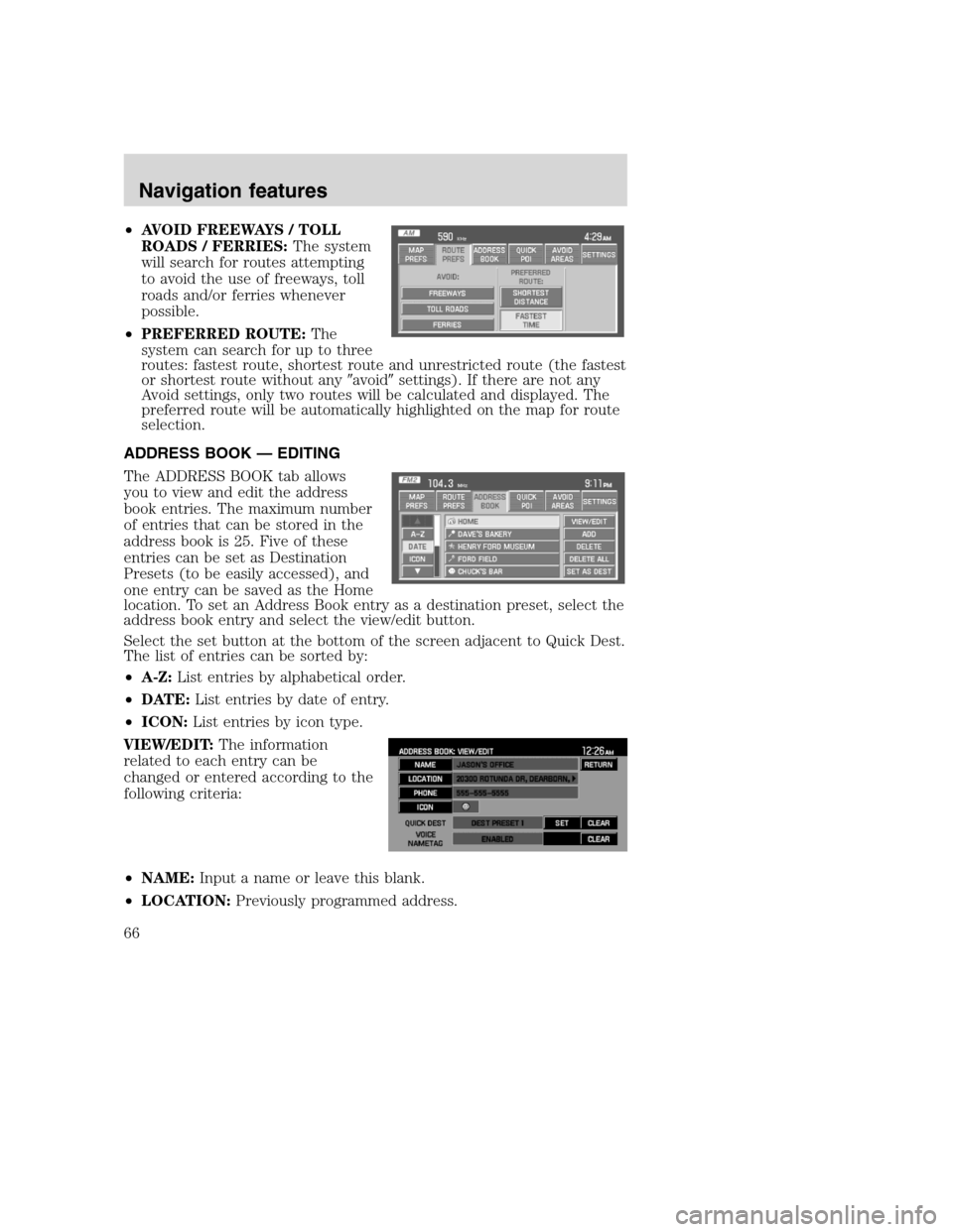
•AVOID FREEWAYS / TOLL
ROADS / FERRIES:The system
will search for routes attempting
to avoid the use of freeways, toll
roads and/or ferries whenever
possible.
•PREFERRED ROUTE:The
system can search for up to three
routes: fastest route, shortest route and unrestricted route (the fastest
or shortest route without any�avoid�settings). If there are not any
Avoid settings, only two routes will be calculated and displayed. The
preferred route will be automatically highlighted on the map for route
selection.
ADDRESS BOOK — EDITING
The ADDRESS BOOK tab allows
you to view and edit the address
book entries. The maximum number
of entries that can be stored in the
address book is 25. Five of these
entries can be set as Destination
Presets (to be easily accessed), and
one entry can be saved as the Home
location. To set an Address Book entry as a destination preset, select the
address book entry and select the view/edit button.
Select the set button at the bottom of the screen adjacent to Quick Dest.
The list of entries can be sorted by:
•A-Z:List entries by alphabetical order.
•DATE:List entries by date of entry.
•ICON:List entries by icon type.
VIEW/EDIT:The information
related to each entry can be
changed or entered according to the
following criteria:
•NAME:Input a name or leave this blank.
•LOCATION:Previously programmed address.
2008(nv1)
Supplement
USA(fus)
Navigation features
66
Page 69 of 164
•PHONE NUMBER:Select to edit phone number for the specified entry.
•ICON:Select from a list of available icons. All icons, except for the
Home icon, can be used more than once.
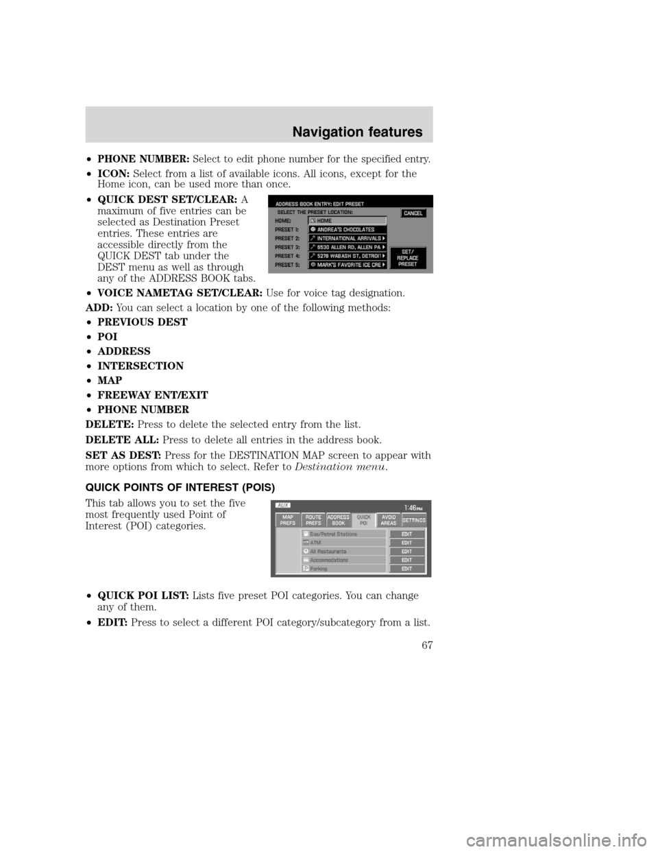
•QUICK DEST SET/CLEAR:A
maximum of five entries can be
selected as Destination Preset
entries. These entries are
accessible directly from the
QUICK DEST tab under the
DEST menu as well as through
any of the ADDRESS BOOK tabs.
•VOICE NAMETAG SET/CLEAR:Use for voice tag designation.
ADD:You can select a location by one of the following methods:
•PREVIOUS DEST
•POI
•ADDRESS
•INTERSECTION
•MAP
•FREEWAY ENT/EXIT
•PHONE NUMBER
DELETE:Press to delete the selected entry from the list.
DELETE ALL:Press to delete all entries in the address book.
SET AS DEST:Press for the DESTINATION MAP screen to appear with
more options from which to select. Refer toDestination menu.
QUICK POINTS OF INTEREST (POIS)
This tab allows you to set the five
most frequently used Point of
Interest (POI) categories.
•QUICK POI LIST:Lists five preset POI categories. You can change
any of them.
•EDIT:Press to select a different POI category/subcategory from a list.
2008(nv1)
Supplement
USA(fus)
Navigation features
67
Page 71 of 164
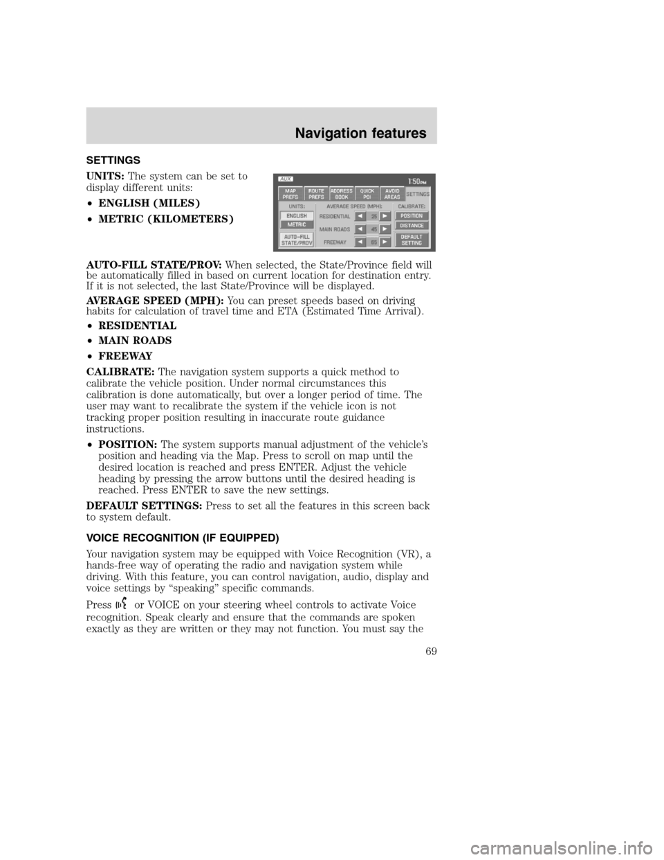
SETTINGS
UNITS:The system can be set to
display different units:
•ENGLISH (MILES)
•METRIC (KILOMETERS)
AUTO-FILL STATE/PROV:When selected, the State/Province field will
be automatically filled in based on current location for destination entry.
If it is not selected, the last State/Province will be displayed.
AVERAGE SPEED (MPH):You can preset speeds based on driving
habits for calculation of travel time and ETA (Estimated Time Arrival).
•RESIDENTIAL
•MAIN ROADS
•FREEWAY
CALIBRATE:The navigation system supports a quick method to
calibrate the vehicle position. Under normal circumstances this
calibration is done automatically, but over a longer period of time. The
user may want to recalibrate the system if the vehicle icon is not
tracking proper position resulting in inaccurate route guidance
instructions.
•POSITION:The system supports manual adjustment of the vehicle’s
position and heading via the Map. Press to scroll on map until the
desired location is reached and press ENTER. Adjust the vehicle
heading by pressing the arrow buttons until the desired heading is
reached. Press ENTER to save the new settings.
DEFAULT SETTINGS:Press to set all the features in this screen back
to system default.
VOICE RECOGNITION (IF EQUIPPED)
Your navigation system may be equipped with Voice Recognition (VR), a
hands-free way of operating the radio and navigation system while
driving. With this feature, you can control navigation, audio, display and
voice settings by “speaking” specific commands.
Press
or VOICE on your steering wheel controls to activate Voice
recognition. Speak clearly and ensure that the commands are spoken
exactly as they are written or they may not function. You must say the
2008(nv1)
Supplement
USA(fus)
Navigation features
69
Page 72 of 164
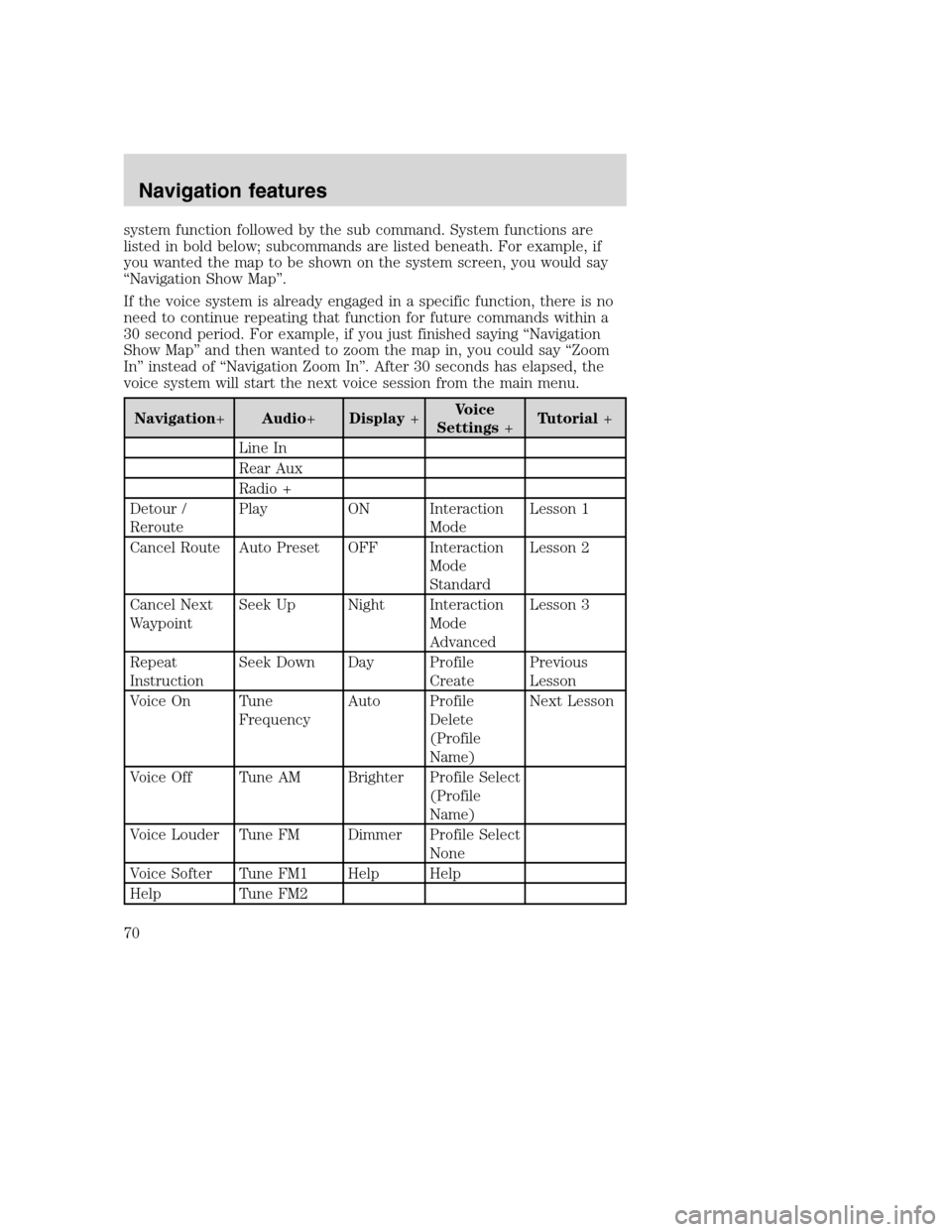
system function followed by the sub command. System functions are
listed in bold below; subcommands are listed beneath. For example, if
you wanted the map to be shown on the system screen, you would say
“Navigation Show Map”.
If the voice system is already engaged in a specific function, there is no
need to continue repeating that function for future commands within a
30 second period. For example, if you just finished saying “Navigation
Show Map” and then wanted to zoom the map in, you could say “Zoom
In” instead of “Navigation Zoom In”. After 30 seconds has elapsed, the
voice system will start the next voice session from the main menu.
Navigation+Audio+Display+Voice
Settings+Tutorial+
Line In
Rear Aux
Radio +
Detour /
ReroutePlay ON Interaction
ModeLesson 1
Cancel Route Auto Preset OFF Interaction
Mode
StandardLesson 2
Cancel Next
WaypointSeek Up Night Interaction
Mode
AdvancedLesson 3
Repeat
InstructionSeek Down Day Profile
CreatePrevious
Lesson
Voice On Tune
FrequencyAuto Profile
Delete
(Profile
Name)Next Lesson
Voice Off Tune AM Brighter Profile Select
(Profile
Name)
Voice Louder Tune FM Dimmer Profile Select
None
Voice Softer Tune FM1 Help Help
Help Tune FM2
2008(nv1)
Supplement
USA(fus)
Navigation features
70
Page 73 of 164
Navigation+Audio+Display+Voice
Settings+Tutorial+
Map
CommandsTune Preset #
Show Map Store Preset #
Zoom In
Zoom Out Help
Zoom In
MinimumCD+
Zoom In
MaximumPlay
Show
DestinationPlay Disc #
Show or Clear
Next
WaypointPlay Track #
Show or Clear
RoutePlay Folder #
Show North
UpPlay Disc #
Folder #
Track #
Show Heading
UpPlay Next
Disc
Destination
CommandsPlay Next
Folder
Route
Home/Return
HomePlay Next
Track
Destination
(Nametag)Play Previous
Disc
Play
NametagsPlay Previous
Folder
Destination or
Find a
RestaurantPlay Previous
Track
2008(nv1)
Supplement
USA(fus)
Navigation features
71
Page 77 of 164
Navigation+Audio+Display+Voice
Settings+Tutorial+
Destination or
Find an
Amusement
Theme ParkTune (#)
Destination or
Find a CasinoTune SR1
Destination or
Find a Movie
TheaterTune SR2
Destination or
Find a
MuseumTurn SR3
Destination or
Find a
Performing
ArtsPreset #
Destination or
Find a
Zoo/Botanical
GardensStore Preset #
Destination or
Find an ATMNext Channel
Destination
Bank/Banking
or Find a
BankPrevious
Channel
Destination or
Find a
Historical
Monument
2008(nv1)
Supplement
USA(fus)
Navigation features
75