140 Navigation
Destination input
Selecting the area of the destination
Towns of the same name are distinguished
by the area in which they are located. After
you have entered the place, a list of areas
may appear. The status bar indicates the
number of areas available, for example:
Town found [number].
�Press G or g to select an area.
�Press E.
�You can now enter a street
(
�page 141). Selecting a city center
After you have entered the city, you can
select a center (district).
�Press the CityCtr soft key.
�Press
g or G to select a center.
�Press E.
The Route Guidance menu will appear
(
�page 151). In addition to the center selection you can
use the following soft keys to determine
your destination:
�Map soft key:
Brings you to the destination input
directly above the map (
�page 147).
�POIs soft key:
Entering Points of Interest
(
�page 176).
151
Navigation
Route guidance
� Route guidance
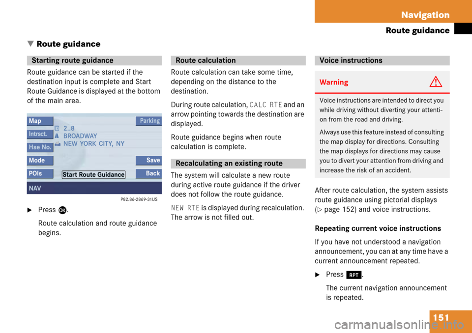
Route guidance can be started if the
destination input is complete and Start
Route Guidance is displayed at the bottom
of the main area.
�Press E.
Route calculation and route guidance
begins. Route calculation can take some time,
depending on the distance to the
destination.
During route calculation,
CALC RTE and an
arrow pointing towards the destination are
displayed.
Route guidance begins when route
calculation is complete.
The system will calculate a new route
during active route guidance if the driver
does not follow the route guidance.
NEW RTE is displayed during recalculation.
The arrow is not filled out. After route calculation, the system assists
route guidance using pictorial displays
(�page 152) and voice instructions.
Repeating current voice instructions
If you have not understood a navigation
announcement, you can at any time have a
current announcement repeated.
�Press j.
The current navigation announcement
is repeated.
Starting route guidance Route calculation
Recalculating an existing route
Voice instructions
WarningG
Voice instructions are in tended to direct you
while driving without diverting your attenti-
on from the road and driving.
Always use this feature instead of consulting
the map display for directions. Consulting
the map displays for directions may cause
you to divert your attention from driving and
increase the risk of an accident.
222 Glossary
Emergency callThis function places a call to a local
911 provider. It does not initiate a
->Tele Aid call. Please note that the
911 emergency call system is a public
service. Using it without due cause is a
criminal offense.
GPS (G
lobal Positioning System)
Satellite-based system for relaying
geographic location information to and
from vehicles equipped with special re-
ceivers. Employs DVD digital maps for
navigation. Heading Up
Dynamic map alignment, map is dis-
played facing driving direction pointing
up.
ID3 tag Additional information which may be
included in MP3 files (e.g. title, artist,
album).
ISO9660 A standard file system for recording
data on CDs.
Joliet Standard for recording data on CDs; an
extension of ISO 9660.
MP3 The term used in everyday speech for
->MPEG1 Audio Layer 3.
MPEG1 Audio Layer 3 A means of compressing digital audio
data. Multi session
A method for recording data, e.g. for
CDs. Data is written to the CD in a num-
ber of sessions.
Navigation DVD Contains all the destination addresses
(town, road, intersection, house num-
ber, special destinations) and the digi-
tal map material for a country or a
region for destination entry, route cal-
culation and destination guidance.
North Up The map is displayed facing north du-
ring route guidance.
POI (Point of Interest) Points of Interest include service stati-
ons, rest areas, parking lots, hospitals,
sight-seeing points, etc.
Provider is the network operator who makes
available (provides) telephone services