Page 177 of 242

175 Navigation*
Route guidance
The navigation displays are only visible
while route guidance is active.
To switch to the navigation display from
another display, e.g. from CD operation:
�Press b or c.
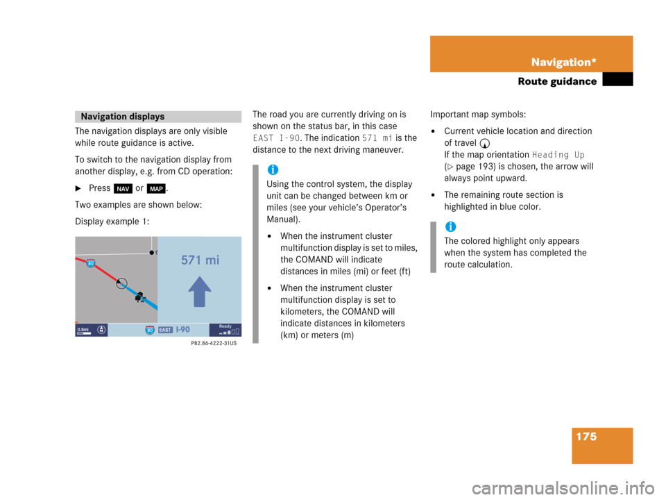
Two examples are shown below:
Display example 1:The road you are currently driving on is
shown on the status bar, in this case
EAST I-90. The indication 571 mi is the
distance to the next driving maneuver.Important map symbols:�Current vehicle location and direction
of travel y
If the map orientation
Heading Up
(�page 193) is chosen, the arrow will
always point upward.
�The remaining route section is
highlighted in blue color.
Navigation displays
i
Using the control system, the display
unit can be changed between km or
miles (see your vehicle’s Operator’s
Manual).
�When the instrument cluster
multifunction display is set to miles,
the COMAND will indicate
distances in miles (mi) or feet (ft)
�When the instrument cluster
multifunction display is set to
kilometers, the COMAND will
indicate distances in kilometers
(km) or meters (m)
i
The colored highlight only appears
when the system has completed the
route calculation.
Page 181 of 242

179 Navigation*
Route guidance
Route guidance in these areas
When you are
�entering a partially digitized area
or
�starting route guidance within such an
area,
the navigation system will inform you that
turn by turn guidance cannot be provided
with corresponding navigation displays
and voice announcements.Map display
Within these areas the display shows a
split screen with the map on the left-hand
side and a direction arrow on the right side
pointing to the destination instead of the
symbol for the next driving maneuver
(�page 180).
Route presentation
Usually the map highlights the active route
on verified roads with a blue line.
After route calculation, the route may
contain unverified road sections. Here, the
exact route guidance is suppressed and
these route sections will appear as blue
dotted lines. This type of line e.g. connects
two verified road sections, which are
displayed as blue lines or connects the end
of a verified road with a stopover or
destination located on an unverified road.
i
Displayed or audible distance to the
beginning of such an area is an
estimation. The actual distance may
differ.
WarningG
If the origin and destination are located very
close to each other, the system may not pro-
vide the shortest path to the destination
when you are travelling in an unverified area.
In most cases you will be directed to a veri-
fied road closest to the destination. This
may appear to be a long and unconvenient
route but it is safer. At your own risk, you
may choose to drive on the unverified roads
to the destination.
Page 182 of 242

180 Navigation*
Route guidance
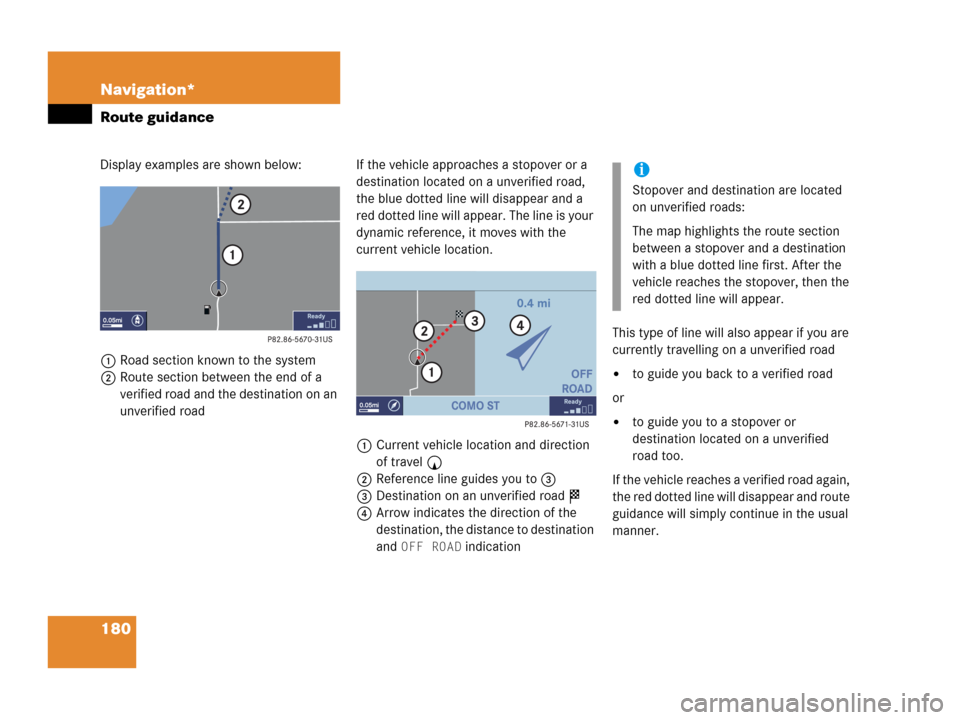
Display examples are shown below:
1Road section known to the system
2Route section between the end of a
verified road and the destination on an
unverified roadIf the vehicle approaches a stopover or a
destination located on a unverified road,
the blue dotted line will disappear and a
red dotted line will appear. The line is your
dynamic reference, it moves with the
current vehicle location.
1Current vehicle location and direction
of travel y
2Reference line guides you to 3
3Destination on an unverified road $
4Arrow indicates the direction of the
destination, the distance to destination
and
OFF ROAD indicationThis type of line will also appear if you are
currently travelling on a unverified road
�to guide you back to a verified road
or
�to guide you to a stopover or
destination located on a unverified
road too.
If the vehicle reaches a verified road again,
the red dotted line will disappear and route
guidance will simply continue in the usual
manner.
i
Stopover and destination are located
on unverified roads:
The map highlights the route section
between a stopover and a destination
with a blue dotted line first. After the
vehicle reaches the stopover, then the
red dotted line will appear.
Page 233 of 242

231 Glossary
ISO9660
A standard file system for recording
data on CDs.
Joliet
Standard for recording data on CDs; an
extension of ISO 9660.
LOGIC7 Surround
Playback method resulting in an impro-
ved spatial listening experience com-
pared to conventional stereo playback.
MP3
The term used in everyday speech for
->MPEG1 Audio Layer 3.
MPEG1 Audio Layer 3
A means of compressing digital audio
data.
Multi session
A method for recording data, e.g. for
CDs. Data is written to the CD in a num-
ber of sessions.Navigation DVD
Contains all available destination
addresses (town, road, intersection,
house number, special destinations)
and the digital map material for a coun-
try or a region for destination entry,
route calculation and destination
guidance at time of DVD production.
DVD maps do not cover all areas nor all
routes within an area.
North Up
The map is displayed facing north du-
ring route guidance.
NTSC (National Television System Com-
mittee)
A TV and video standard for USA and
Canada. This standard uses a composi-
te video signal, in which all information
- red, blue, and green signals (and
sometimes audio signals as well) are
mixed together.PAL (Phase Alternation Line)
A TV and video standard for most coun-
tries in western and middle
Europe. The PAL standard uses a
higher image resolution and a lower
picture frequency than the NTSC stan-
dard.
POI (Point of Interest)
Points of Interest include service stati-
ons, rest areas, parking lots, hospitals,
sight-seeing points, etc.
Provider
is the network operator who makes
available (provides) telephone services
PUK (Personal Unblocking Key)
must be entered if the wrong PIN was
entered three consecutive times.