Page 54 of 194
Drives51
General operation
RADIO, CD
NAME, TEL
NAV, INFO
CAR, SETUP
Tips
If outside temperatures are unusually high or low, the navigation
DVD function may be temporarily unavailable. A thermal switch has
been installed to protect the navigation DVD and the laser
scanner.Handling the navigation DVD or CD
Correct handling of the data carrier being used helps
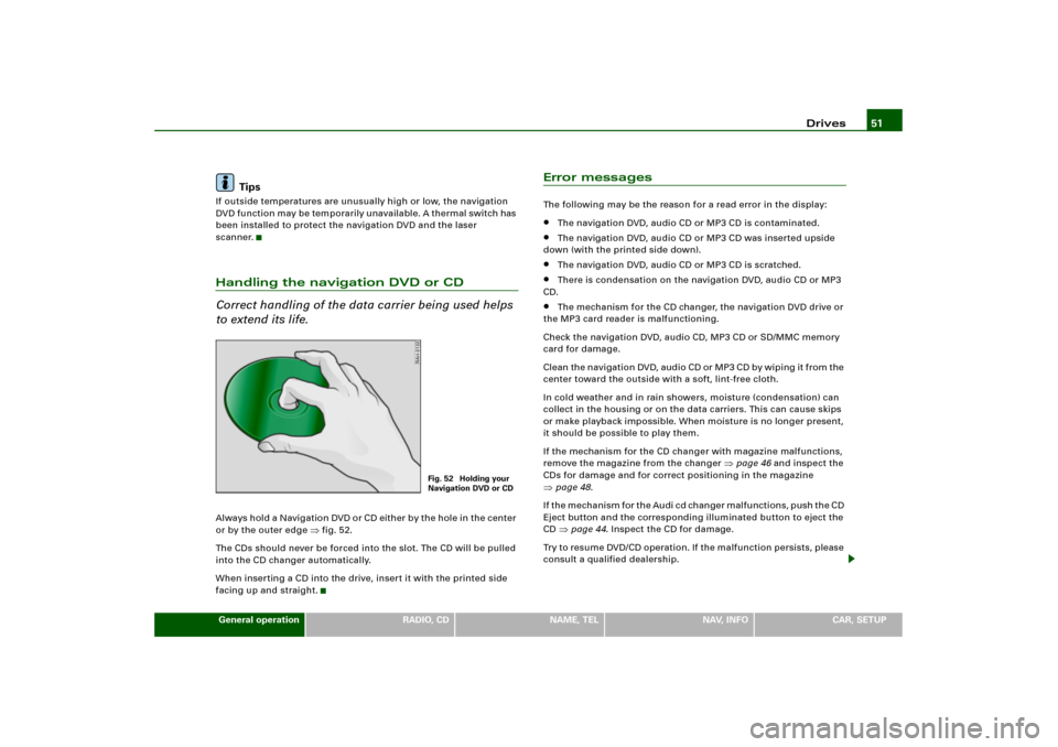
to extend its life.Alwa ys hold a N avigatio n DVD o r CD either b y the hole in the center
or by the outer edge
�fig.52.
The CDs should never be forced into the slot. The CD will be pulled
into the CD changer automatically.
When inserting a CD into the drive, insert it with the printed side
facing up and straight.
Error messagesThe following may be the reason for a read error in the display:�
The navigation DVD, audio CD or MP3 CD is contaminated.
�
The navigation DVD, audio CD or MP3 CD was inserted upside
down (with the printed side down).
�
The navigation DVD, audio CD or MP3 CD is scratched.
�
There is condensation on the navigation DVD, audio CD or MP3
CD.
�
The mechanism for the CD changer, the navigation DVD drive or
the MP3 card reader is malfunctioning.
Check the navigation DVD, audio CD, MP3 CD or SD/MMC memory
card for damage.
Cl e a n th e n a v i g a t io n DV D, a ud i o C D o r M P 3 C D b y w i p i n g it f ro m t he
center toward the outside with a soft, lint-free cloth.
In cold weather and in rain showers, moisture (condensation) can
collect in the housing or on the data carriers. This can cause skips
or make playback impossible. When moisture is no longer present,
it should be possible to play them.
If the mechanism for the CD changer with magazine malfunctions,
remove the magazine from the changer
�page 46 and inspect the
CDs for damage and for correct positioning in the magazine
�page 48.
I f t h e m e c h a n i s m f o r t h e A u d i c d c h a n g e r m a l f u n c t i o n s , p u s h t h e C D
Eject button and the corresponding illuminated button to eject the
CD �page 44. Inspect the CD for damage.
Try to resume DVD/CD operation. If the malfunction persists, please
consult a qualified dealership.
Fig. 52 Holding your
Navigation DVD or CD
Page 55 of 194
Drives 52
TipsIf outside temperatures are unusually high or low, navigation
DVD/ CD playback may be te mpo rarily una vailab le. A thermal switch
has been installed to protect the navigation DVD/CDs and the laser
scanner.
Page 100 of 194
Adjusting sound settings95
General operation
RADIO, CD
NAME, TEL
NAV, INFO
CAR, SETUP
Tips
If the volume is too high when the radio is turned on, it will be
reduced automatically to a level set at the factory. If the volume is
too low when the radio is turned on, it will be increased automati-
cally to a level set at the factory.
Page 114 of 194
Navigation (NAV)109
General operation
RADIO, CD
NAME, TEL
NAV, INFO
CAR, SETUP
Tips
�
The Navigation System is designed to provide you with
suggested routes in locating addresses, destinations and other
points of interest.
�
Changes in street names, construction zones, traffic flow, points
of interest or other road system changes are beyond the control of
Audi of America, Inc.
�
Complete, detailed mapping of lanes, roads, streets, toll roads,
highways, etc., is not possible, therefore you may encounter
discrepancies between the mapping and your actual location.
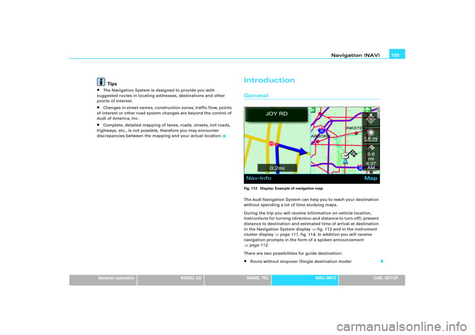
IntroductionGeneralFig. 112 Display: Example of navigation mapThe Audi Navigation System can help you to reach your destination
without spending a lot of time studying maps.
During the trip you will receive information on vehicle location,
in structions for turning (directio n and dis tance to turn-off), p resen t
distance to destination and estimated time of arrival at destination
in the Navigation System display
�fig.112 and in the instrument
cluster display
�page 111, fig.114. In addition you will receive
navigation prompts in the form of a spoken announcement
�page 112.
There are two possibilities for guide destination:�
Route without stopover (Single destination mode)
Page 118 of 194
Navigation (NAV)113
General operation
RADIO, CD
NAME, TEL
NAV, INFO
CAR, SETUP map
�page 143 and in Setup Navigation
�page 151 to d i s p l a y th e
map.
If you are navigating without stopovers, you have the option of
selecting from up to three routes, in addition to detailed route infor-
mation
�page 130.
If you are n avigatin g with stopovers, you are shown the entire route
with all stopovers and detailed information in an overview
�page 132.
You can also use the map as presented in the Navigation System
display to enter a destination
�page 128.
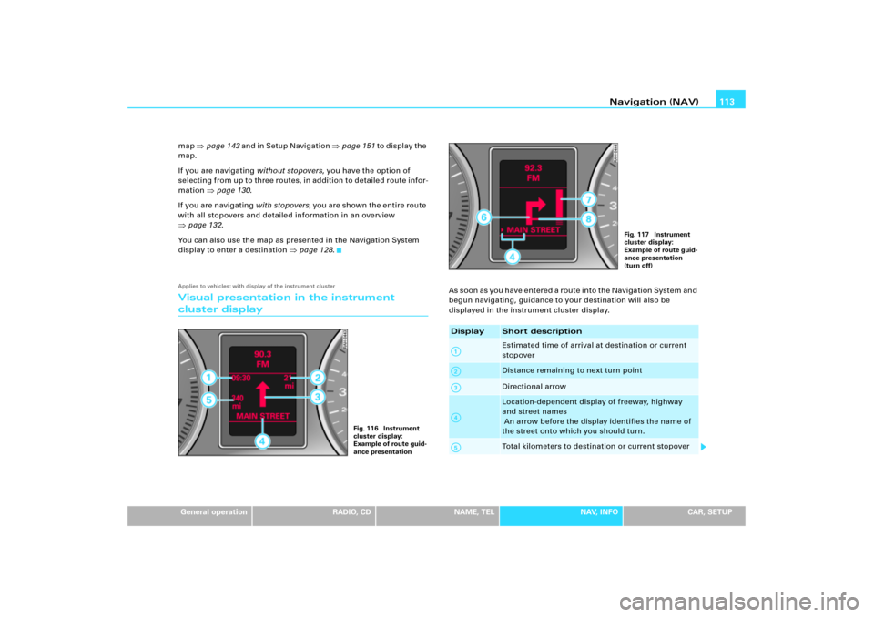
Applies to vehicles: with display of the instrument clusterVisual presentation in the instrument cluster display
A s s o o n a s y o u h a v e e n t e r e d a r o u t e i n t o t h e N a v i g a t i o n S y s t e m a n d
begun navigating, guidance to your destination will also be
displayed in the instrument cluster display.
Fig. 116 Instrument
cluster display:
Example of route guid-
ance presentation
Display
Shor t descriptionEstimated time of arrival at destination or current
stopoverDistance remaining to next turn pointDirectional arrowLocation-dependent display of freeway, highway
and street names
An arrow before the display identifies the name of
the street onto which you should turn.Total kilometers to destination or current stopover
Fig. 117 Instrument
cluster display:
Example of route guid-
ance presentation
(turn off)
A1A2A3A4A5
Page 120 of 194
Navigation (NAV)115
General operation
RADIO, CD
NAME, TEL
NAV, INFO
CAR, SETUP A s s o o n as y o u h a v e e n t e r e d a r o u t e i n t o t h e N a v i g a t i o n S y s t e m a n d
begun navigating, guidance to your destination will also be
displayed in the instrument cluster display.
When the turn-off is immediately ahead, the arrow points in the
direction in which you should turn. In addition, the name of the
s t r e e t i s s h o w n u n d e r t h e a r r o w. A b a r g r a p h
�page 114, fig.119 on
the right in the display takes you precisely to the turn-off point.If it is necessary to make a lane change before the turn off, you are
warned in plenty of time about this lane change before the turn-off
arrow by a second arrow
�page 111, fig.114.
Tips
With active guidance, you can switch to the trip computer display*
by pressing the trip computer reset button*. Pushing the trip
c o mp ut e r re s e t b ut to n * a g a in r e t ur n s y o u to g u i d a n c e . Yo u c a n fin d
detailed information about the trip computer* in the Owner's
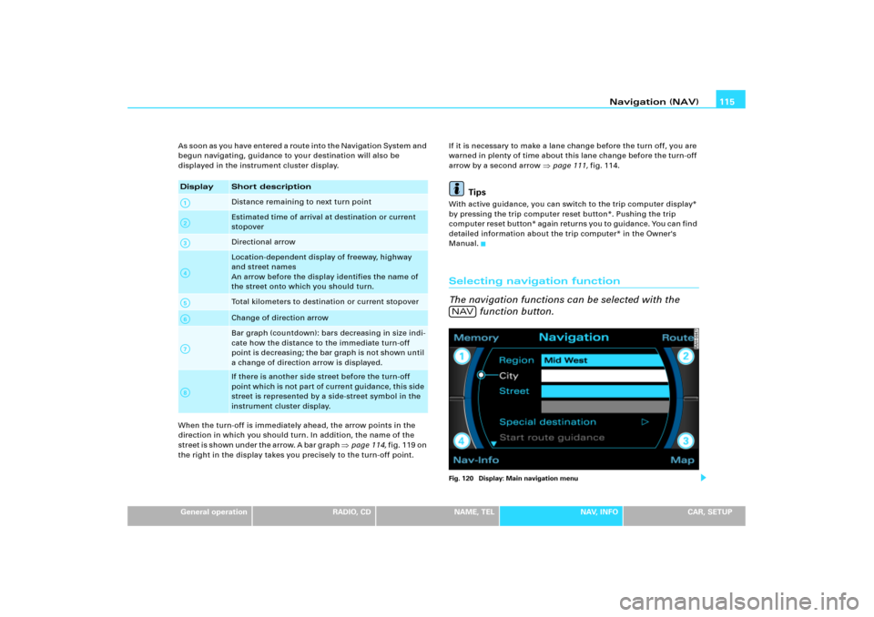
Manual.Selecting navigation function
The navigation functions can be selected with the
function button.Fig. 120 Display: Main navigation menu
Display
Short descriptionDistance remaining to next turn pointEstimated time of arrival at destination or current
stopoverDirectional arrowLocation-dependent display of freeway, highway
and street names
An arrow before the display identifies the name of
the street onto which you should turn.Total kilometers to destination or current stopoverChange of direction arrowBar graph (countdown): bars decreasing in size indi-
cate how the distance to the immediate turn-off
point is decreasing; the bar graph is not shown until
a change of direction arrow is displayed.If there is another side street before the turn-off
point which is not part of current guidance, this side
street is represented by a side-street symbol in the
instrument cluster display.
A1A�A A�A4A9A:A�
NAV
Page 122 of 194
Navigation (NAV)117
General operation
RADIO, CD
NAME, TEL
NAV, INFO
CAR, SETUP The following submenus are available in navigation
Setup function:
Main navigation menuEntering a navigation destination
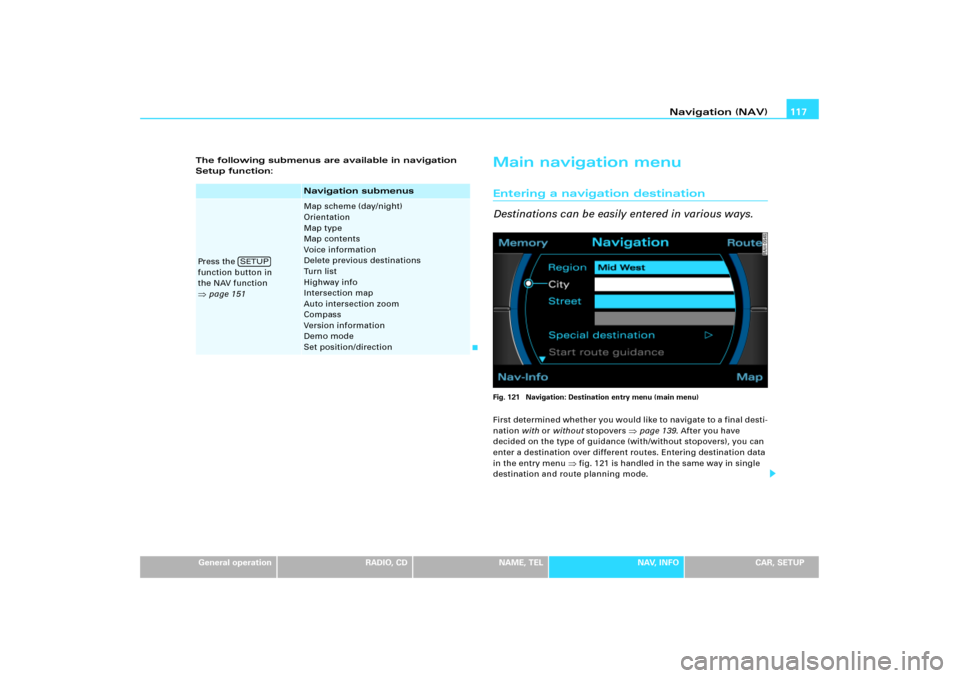
Destinations can be easily entered in various ways.Fig. 121 Navigation: Destination entry menu (main menu)First determined whether you would like to navigate to a final desti-
nation with or without stopovers
�page 139. After you have
decided on the type of guidance (with/without stopovers), you can
enter a destination over different routes. Entering destination data
in the entry menu
�fig.121 is handled in the same way in single
destination and route planning mode.
Navigation submenus
Press the
function button in
the NAV function �page 151
Map scheme (day/night)
Orientation
Map type
Map contents
Voice information
Delete previous destinations
Turn list
Highway info
Intersection map
Auto intersection zoom
Compass
Version information
Demo mode
Set position/direction
SETUP
Page 136 of 194
Navigation (NAV)131
General operation
RADIO, CD
NAME, TEL
NAV, INFO
CAR, SETUP
– Press the control knob to start the route guidance
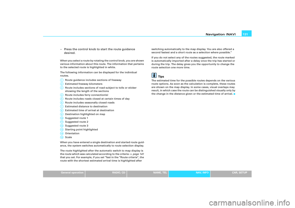
desired.When you select a route by rotating the control knob, you are shown
various information about this route. The information that pertains
to the selected route is highlighted in white.
The following information can be displayed for the individual
routes.
Route guidance includes sections of freeway
Estimated freeway kilometers
Route includes sections of road subject to tolls or sticker
showing the length of the sections
Route includes ferry connection(s)
Route includes roads closed at certain times of day
Route includes seasonally closed roads
Estimated distance to destination
Estimated time of arrival at destination
Destination highlighted on map
Suggested route 1
Suggested route 2
Suggested route 3
Starting point highlighted
Orientation
Scale
When you have entered a single destination and started route guid-
ance, the system switches automatically to route selection display.
The route highlighted after the automatic switch to map display is
the route which was calculated according to the criteria
�page 141
that you set. For e x ample, if you set “fast in the “Route criteria”, the
route with the shortest estimated arrival time is highlighted after switching automatically to the map display. You are also offered a
second fastest and a short route as a selection where possible.”
If you do not select any of the routes suggested, the route marked
is automatically imported after a delay once the trip has started or
during the trip. The delay gives you the opportunity to change the
route selection one more time.
Tips
The estimated time for the possible routes depends on the various
route options. As soon as the calculation is complete, these routes
are shown on the map display. In some cases, visual overlaps may
result, in which c ase the route ca n be distinguished vis ually on ly by
the change in the distance given or the estimated time of arrival.
A1A�A3A4A5A6A7A8A9A10A11A12A13A14A15