2007 Acura MDX navigation update
[x] Cancel search: navigation updatePage 114 of 166

Navigation System113
Database Limitations
You will find that some points of
interest (POI) may be missing when you
search the database. This can be caused
if at the time the database was gathered,
the name was misspelled, the place was
improperly categorized, or the POI
change is not yet in the database. This
means you may not find places listed
that you know exist. This is also true for
police agencies and hospitals. In
outlying areas, facilities listed may not
be the closest. Always check with local
information sources if you need law
enforcement or hospital services.
Every effort has been made to verify
that the system’s database was accurate
at the time it was created. However,
businesses do fail or move to new
locations, and new businesses start in
the old locations. For this reason, you
may occasionally find “inaccurate”
information when you select and drive
to a point of interest (for example, a
restaurant is now a jewelry store). The
number of these inaccuracies increases
the longer you go without an update. The digitized map database reflects
conditions as they existed at various
points in time before production.
Accordingly, your
DVD may contain
inaccurate or inco mplete data or
information due to the passage of time,
road construction, ch anging conditions,
or other causes.
In addition, this database does not
include, analyze, pr ocess, consider, or
reflect any of the following categories
of information:
Neighborhood quality or safety
Population density
Availability or proximity of law enforcement
Emergency, rescue, medical, or other assistance
Construction work, zones, or hazards
Road and lane closures
Legal restrictions (such as vehicular type, weight, load, height, and speed
restrictions)
Road slope or grade Bridge height, width, weight, or other
limits
Road, traffic or traffic facilities safety, or conditions
Weather conditions
Special events
Pavement characteristics or conditions
Traffic congestion
Travel time
We assume no liability for any incident
that may result from an error in the
program, or from changed conditions
not noted above.
Copyrights
infoUSA-Data: Certain business data provided by infoUS A, Inc., Omaha,
Nebraska, Copyright © 2003, All
Rights Reserved.
EXIT-Data: © ZENRIN CO., LTD. 2003. All Rights Reserved.
ZAGAT SURVEY: Copyright © [2003] Zagat Survey, LLC. All rights
reserved.
Page 115 of 166

114Navigation System
Customer Assistance
Reporting Errors
Occasionally, you may encounter
database errors.
If the error pertains to freeways and main “verified” roads shown in black
on the map, then report it either
online at
http://update.navteq.com/, or to
Acura Customer Services.
If the error involves a light brown “unverified” road, then do not report
it. These areas have not been verified,
and are provided for reference only
(see Map Overview on page 6).
For errors in points of interest (POI), like a business that has changed their
name, do not report them. Keep in
mind that depending on when the data
was collected, and when your DVD
was purchased, the database can be
out of date. The business may have
not reported the change(s), or not be
in the database at all. Update
Navigation DVDs are available for
purchase, usually in the fall of each
year. If the error does not involve the
database, such as if the vehicle
position icon does not follow the
road, screen error messages, or other
GPS related errors, see Frequently
Asked Questions on page 128, System
Limitations on page 111 , or
Troubleshooting on page 136.
Acura Automobile Customer
Service
Telephone: (800) 382-2238
Fax: (310) 783-3535
Acura Navi
America Honda Motor Co., Inc.
Acura Client Services
MS 500-2N-7E
1919 Torrance Blvd.
Torrance, CA 90501-2746
If you desire more detailed information
on detailed map coverage, contact any
Acura dealer. Map coverage
information is at the Navigation DVD
order link, “ordering a Navigation
DVD” at: www.acura.com. The link is
found in “ACURA STORE.” Check the
“Coverage MAPS” link.
Page 117 of 166

116Navigation System
Customer Assistance
Obtaining a Navigation
Update DVD
Acura is continually expanding the
scope of the navigation system.
Upgraded software may be made
available to navigation system owners
periodically, usually in the fall of each
year.
To purchase an updated DVD or a
replacement DVD, call (888) 549- 3798.
You can also order on-line at the
Navigation DVD order link, “ordering a
Navigation DVD” at: www.acura.com
The link is found in “ACURA STORE.”
NOTE:
DVDs are not available at your dealer. However, the dealer may
order a DVD for you as a courtesy.
There is no program for free DVD
updates.
The DVD order line staff cannot answer technical questions regarding
navigation operation, coverage, or
POIs.
Changing the DVD
NOTE:
The system’s database is stored on a
removable DVD. The system will not
work without the DVD. Ensure the door
remains closed at all times.
1. Remove the DVD while the ignition switch is in the Accessory (I) position
or in the ON (II) position.
2. Locate the control unit. It is under the driver’s seat.
3. Push the OPEN button. An error
message will display on the screen.
This is normal. 4. Push the
Eject button. The DVD will
automatically come out.
5. Pull the DVD straight out. Hold the DVD by the edges. Fingerprints,
scratches, or other contamination on
the playing surface can make the
DVD unreadable.
To install the Navigation DVD, make
sure the white label is facing up. Slide
the DVD into the slot. The DVD is
automatically pulled into the control
unit. Make sure you close the door.
Page 119 of 166

118Navigation System
Coverage Areas
Map Coverage
The system provides map coverage for
the following 48 US states, and southern
Canada. The US map coverage consists
of accurately mapped (verified)
metropolitan areas (in the following
list), and a less accurate (unverified)
rural database. Canada coverage
consists of major metropolitan areas,
and major roads connecting the
metropolitan areas within about 100
miles north of the U.S. border. If you
need additional North Canada coverage,
you may purchase the gray Canadian
DVD (see Obtaining a Navigation
Update DVD on page 116). See Map
Overview on page 6 for a discussion of
map coverage.
The cities and metropolitan areas in the
following list are fully mapped. Only
major streets, roads, and freeways have
been verified outside these areas. If your
route passes through these areas, routing
may be limited in these areas, depending
on your routing choices. See Unverified
Area Routing on page 92.
U.S. Detailed Coverage Areas
Alabama
Birmingham/Tuscaloosa
Huntsville
Mobile
Arizona Phoenix Metro
Sedona
Tucson
Arkansas Fayetteville
Hot Springs
Little Rock
California Bakersfield
Fresno
Los Angeles/San Diego Metro
Merced
Modesto
Sacramento Metro
San Francisco Bay (approximately
Monterey to Sonoma) - including
Monterey County and Hollister
San Luis Obispo
Stockton Colorado
Denver/Boulder/Colorado Springs/
Ski Resorts Metro area - including
Ft. Collins
Connecticut Bridgeport
Danbury
Hartford Metro
New Haven Metro
Norwalk
Stamford
Delaware Entire state - including Dover,
Wilmington Metro area, New Castle
County
Florida Cape Canaveral/Cocoa Beach/
Titusville
Florida Keys
Fort Myers Metro area - including
Naples
Fort Pierce
Gainesville
Jacksonville Metro - including St.
Johns County
Miami/Fort Lauderdale/West Palm
Beach Metro
Orlando/Daytona Beach/Melbourne
area - including Osceola County
Page 123 of 166

122Navigation System
Coverage Areas
West VirginiaCharleston
Harper’s Ferry Metro
Wisconsin Appleton
Beloit
Green Bay
Janesville
Kenosha County
Madison
Lake Geneva
Milwaukee Metro - including
Milwaukee, Ozaukee, Washington,
and Waukesha Counties
Neenah
Oshkosh
Racine
Sheboygan
Wausau
Wyoming Cheyenne
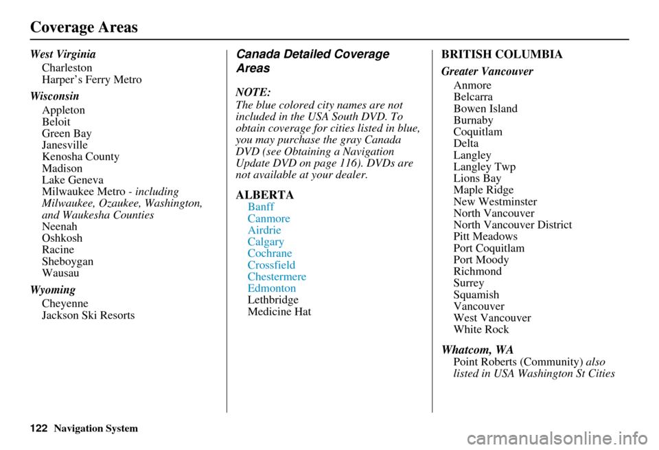
Jackson Ski ResortsCanada Detailed Coverage
Areas
NOTE:
The blue colored city names are not
included in the USA South DVD. To
obtain coverage for cities listed in blue,
you may purchase the gray Canada
DVD (see Obtaining a Navigation
Update DVD on page 116). DVDs are
not available at your dealer.
ALBERTA
Banff
Canmore
Airdrie
Calgary
Cochrane
Crossfield
Chestermere
Edmonton
Lethbridge
Medicine Hat
BRITISH COLUMBIA
Greater Vancouver Anmore
Belcarra
Bowen Island
Burnaby
Coquitlam
Delta
Langley
Langley Twp
Lions Bay
Maple Ridge
New Westminster
North Vancouver
North Vancouver District
Pitt Meadows
Port Coquitlam
Port Moody
Richmond
Surrey
Squamish
Vancouver
West Vancouver
White Rock
Whatcom, WA
Point Roberts (Community) also
listed in USA Washington St Cities
Page 132 of 166

Navigation System131
Frequently Asked Questions
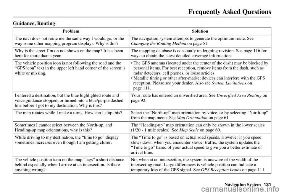
Guidance, Routing
Problem Solution
The navi does not route me the same way I would go, or the
way some other mapping progr am displays. Why is this? The navigation system attempts to
generate the optimum route. See
Changing the Routing Method on page 51.
Why is the street I’m on not shown on the map? It has been
here for more than a year. The mapping database is
constantly undergoing revision. See page 116 for
ways to obtain the latest de tailed coverage information.
The vehicle position icon is not following the road and the
“GPS icon” text in the upper left hand corner of the screen is
white or missing. The GPS antenna (located under the center of the dash) may be blocked by
personal items. For best reception, remove items from the dash, such as
radar detectors, cell phone s, or loose articles.
Metallic tinting or other after-marke t devices can interfere with the GPS
reception. Please see your dealer. Also see System Limitations on
page 111.
I entered a destination, but th e blue highlighted route and
voice guidance stopped, or turned into a blue/purple dashed
line before I got to my destination. Why is this? Your route has entered
an unverified area. See Unverified Area Routing on
page 92.
The map rotates while I make a turns, How can I stop this? Select the “North-up” map orientation by voice, or by selecting “North-up”
from the map menu. See Map Orientation on page 61.
Sometimes I cannot select between the North-up, and
Heading-up map orientations, why is this? The “Heading-up” map orientation can
only be shown in the lower scales
(1/20 - 1 mile scales). See Map Scale on page 60.
While driving to my destinati on, the “time to go” display
sometimes increases even though I am getting closer. The “Time to go” is based on actual
road speeds. However if you speed
slows down when you encounter slower traffic, the system updates the
“Time to go” based of your actual spee d to give you a better estimate of
arrival time.
The vehicle position icon on the map “lags” a short distance
behind especially when I arrive at an intersection. Is there
anything wrong? No, when at an intersection, the syst
em is unaware of the width of the
intersecting road. Large differences is vehicle position can indicate a
temporary loss of the GPS signal. See GPS Reception Issues on page 111.
Page 134 of 166

Navigation System133
Frequently Asked Questions
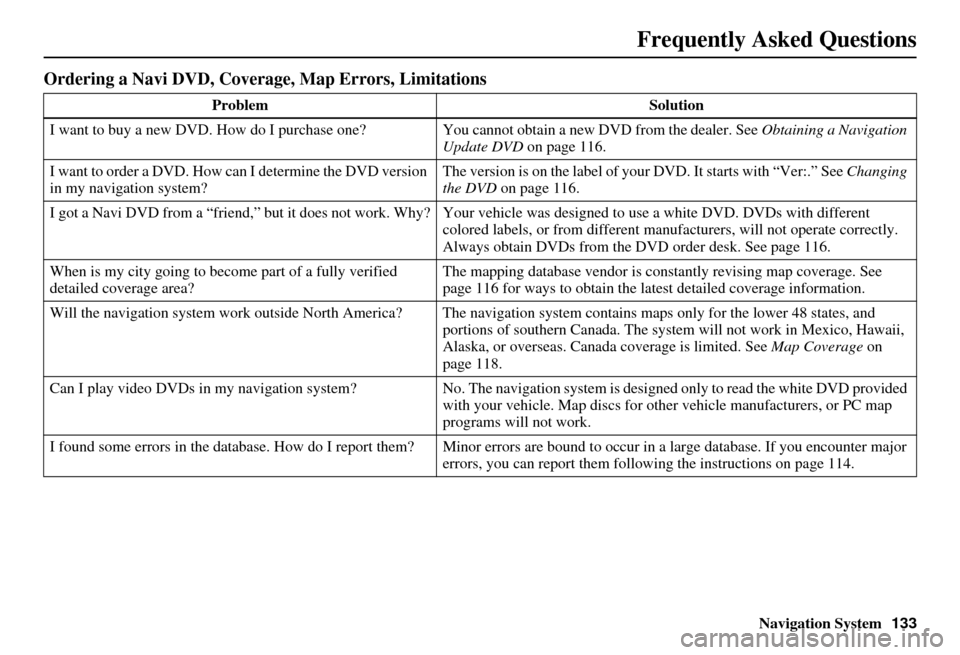
Ordering a Navi DVD, Coverage, Map Errors, Limitations
Problem Solution
I want to buy a new DVD. How do I purchase one? You cannot obtain a new DVD from the dealer. See Obtaining a Navigation
Update DVD on page 116.
I want to order a DVD. How ca n I determine the DVD version
in my navigation system? The version is on the label of your DVD. It starts with “Ver:.” See
Changing
the DVD on page 116.
I got a Navi DVD from a “friend,” but it does not work. Why? Your vehi cle was designed to use a white DVD. DVDs with different
colored labels, or from different manuf acturers, will not operate correctly.
Always obtain DVDs from the DVD order desk. See page 116.
When is my city going to become part of a fully verified
detailed coverage area? The mapping database vendor is constantly revising map coverage. See
page 116 for ways to obtain the latest
detailed coverage information.
Will the navigation system work outside North America? The navigation system contains maps only for the lower 48 states, and portions of southern Canada. The system will not work in Mexico, Hawaii,
Alaska, or overseas. Canada coverage is limited. See Map Coverage on
page 118.
Can I play video DVDs in my navigation sy stem?No. The navigation system is desi gned only to read the white DVD provided
with your vehicle. Map di scs for other vehicle manufacturers, or PC map
programs will not work.
I found some errors in the database. How do I report them? Mi nor errors are bound to occur in a large database. If you encounter major
errors, you can report them following the instructions on page 114.
Page 138 of 166

Navigation System137
Glossary
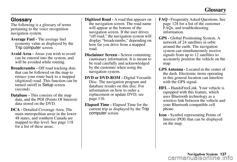
Glossary
The following is a glossary of terms
pertaining to the voice recognition
navigation system.
Average Fuel - The average fuel
economy value as displayed by the
Trip computer screen.
Avoid Area - Areas you wish to avoid
can be entered into the system, and
will be avoided while routing.
Breadcrumbs - Off road tracking dots
that can be followe d on the map to
retrace your route back to a mapped
(digitized) road. This function can be
turned on/off in Setup screen
(second).
Database - This consists of the map
data, and the POI (Points Of Interest)
data stored on the DVD.
DCA - Detailed Coverage Area. The
main metropolitan areas in the lower
48 states, and southern Canada are
mapped to this level. See page 118
for a list of these areas. Digitized Road -
A road that appears on
the navigation screen. The road name
will appear at the bottom of the
navigation screen. If the user drives
“off road,” the navigation system will
display “breadcrumbs,” depending on
how far you drive from a mapped
road.
Disclaimer Screen - Screen containing
cautionary information. It is meant to
be read carefully and acknowledged
by the customer when using the
navigation system.
DVD or DVD-ROM - Digital Versatile
Disc. The navigation program and
database resides on this disc. For
information on how to order a
replacement or update DVD, see
page 116.
Elapsed Time - Elapsed Time for the
current trip as displayed by the Trip
computer screen. FAQ -
Frequently Asked Questions. See
page 128 for a list of the customer
FAQs, and troubleshooting
information.
GPS - Global Positioning System. A
network of 24 satellites in orbit
around the earth. The navigation
system can simultaneously receive
signals from up to 12 satellites to
accurately position the vehicle on the
map.
GPS Antenna - Located in the center of
the dash. Electronic items operating
in this general location can interfere
with the GPS signal.
HFL - HandsFreeLink. Your vehicle is
equipped with this feature, which
uses Bluetooth technology as a
wireless link between the vehicle and
your Bluetooth compatible cell
phone.
Icon - Symbol representing Points of
Interest (POI) that can be displayed
on the map.