Page 155 of 242

153 Navigation*
Navigation main menu
�Destination memory
You can select destinations from the
Destination Memory (�page 194).
�Enter destination
Activates the Enter street menu
(
�page 156).
�Last destinations
You can select last destinations from
the
Last destinations memory
(
�page 192).
�Points of interest:
Brings you to the
Select point
category
menu (�page 196).
POIs are e.g. gas stations, parking
facilities or airports.
�Phone number:
You can select a POI by phone number.
Brings you to the
Enter POI phone
number
menu (�page 200).
�Today’s Plan:
You can select destinations from the
Today’s Plan list one after the other or
sort destinations as Bestway or Round
trip (
�page 202).Available soft keys
�Home soft key:
You can edit the home address and
start route guidance (
�page 169).
�Mode soft key:
You can edit the routing mode for the
next route guidance (
�page 154).
�Compass soft key:
You can display direction of travel,
altitude and steering angle of the
vehicle (
�page 171).
Page 173 of 242

171 Navigation*
Destination input
To cancel the compass screen in vehicles
with Navigation
�Press any soft key, then press the Back
soft key.
or
�Press b or c.
To cancel the Compass screen in vehicles
without Navigation
�Press the A, B, a or C
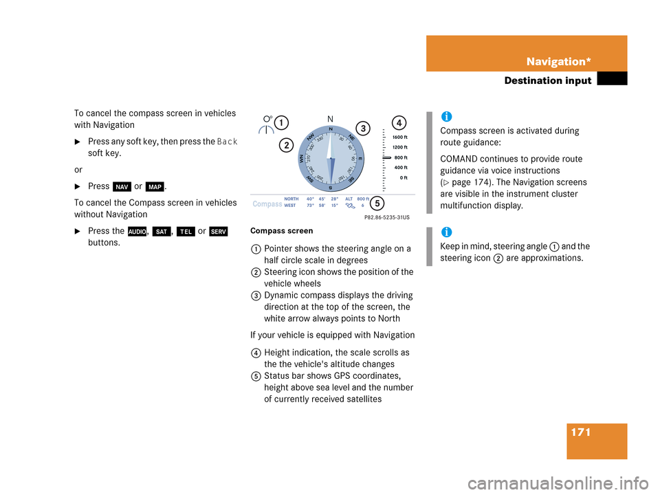
buttons.Compass screen
1Pointer shows the steering angle on a
half circle scale in degrees
2Steering icon shows the position of the
vehicle wheels
3Dynamic compass displays the driving
direction at the top of the screen, the
white arrow always points to North
If your vehicle is equipped with Navigation
4Height indication, the scale scrolls as
the the vehicle's altitude changes
5Status bar shows GPS coordinates,
height above sea level and the number
of currently received satellites
i
Compass screen is activated during
route guidance:
COMAND continues to provide route
guidance via voice instructions
(
�page 174). The Navigation screens
are visible in the instrument cluster
multifunction display.
i
Keep in mind, steering angle 1 and the
steering icon 2 are approximations.
Page 174 of 242
172 Navigation*
Destination input
Additional information for 1, 3 and 4
IndicationRemarks and
value range
1 Steering angle Pointer shows to the
left
-35° to 0°
Pointer shows to the
right
0° to +35°
3 Dynamic
compass card 0° to 360°
4 Height above
the sea level i
The white indicator
is fixed, the scale
scrolls as vehicle
altitude changes
Scale range:
The display unit is
set to miles
-328 ft to 19680 ft
The display unit is
set to km
-100 m to 6000 m
IndicationRemarks and
value rangei
Using the control system, the display
unit can be changed between km or
miles (see your vehicle’s Operator’s
Manual).
�When the instrument cluster
multifunction display is set to miles,
the COMAND will indicate
distances in miles (mi) or feet (ft)
�When the instrument cluster
multifunction display is set to
kilometers, the COMAND will
indicate distances in kilometers
(km) or meters (m)
Page 182 of 242

180 Navigation*
During route guidance
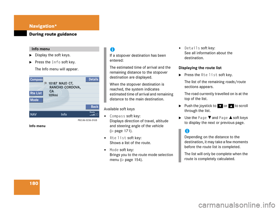
�Display the soft keys.
�Press the Info soft key.
The Info menu will appear.
Info menu
Available soft keys
�Compass soft key:
Displays direction of travel, altitude
and steering angle of the vehicle
(
�page 171).
�Rte list soft key:
Shows a list of the route.
�Mode soft key:
Brings you to the route mode selection
menu (
�page 154).
�Details soft key:
See all information about the
destination.
Displaying the route list
�Press the Rte list soft key.
The list of the remaining roads/route
sections appears.
The road currently travelled on is at the
top of the list.
�Push the joystick to G or g to scroll
through the list.
�Use the Page V and Page v soft keys
to display the next or previous page.
Info menui
If a stopover destination has been
entered:
The estimated time of arrival and the
remaining distance to the stopover
destination are displayed.
When the stopover destination is
reached, the system indicates
estimated time of arrival and remaining
distance to the main destination.
i
Depending on the distance to the
destination, it may take a few moments
before the route list is completed.
The list will only be complete when the
route is completely calculated.