Page 67 of 186
6. To slightly alter the destination.
Select the
Map key to display the map
screen of the area around the specified des-
tination (waypoints) .7. If necessary, operate the joystick to adjust
the location of the destination (waypoints) .
Press the ENTER button.
Select the
Destination key to confirm.
To set the destination (waypoints) , refer to
“Making the system guide the route with de-
tailed options” on page 5-31.INFO:
When a hospital is set as a destination, a tele-
phone number of the destination will be
displayed.
SETTING WITH THEMap KEY
This will enable you to zoom into the map for de-
tail and set the desired location. This works best
when you know the location geographically, or
want to check the geographical surroundings on
the map before setting the destinations.
INV1847INV1848INV1849
How do I program a destination?5-27
ZREVIEW COPYÐ2004 Maxima(max)
Navigation System OM(navi)ÐUSA_English(nna)
04/27/04Ðtbrooks
X
Page 70 of 186
2. Select theCountry key. Each time the EN-
TER button is pressed, the country selection
toggles between USA and Canada.
3. Then, the selected country will be displayed
at the right of the
Country key.
SETTING WITH THEHome KEY (in
easy mode)
Sets the home as a destination.
INFO:
In the Expert Mode, this key will not be displayed.
Turn on the highlighted amber
Short Menus
key in the [SETTING] screen.
1. Press the DEST button.
2. Select the
Home key.
INV1854INV1769
5-30How do I program a destination?
ZREVIEW COPYÐ2004 Maxima(max)
Navigation System OM(navi)ÐUSA_English(nna)
04/27/04Ðtbrooks
X
Page 73 of 186
![NISSAN MAXIMA 2004 A34 / 6.G Navigation Manual The [EDIT ROUTE] screen will be displayed.
2. Select a waypoint destination using one of
the destination selection procedures out-
lined earlier in the chapter.Select the conditions with high prioriti NISSAN MAXIMA 2004 A34 / 6.G Navigation Manual The [EDIT ROUTE] screen will be displayed.
2. Select a waypoint destination using one of
the destination selection procedures out-
lined earlier in the chapter.Select the conditions with high prioriti](/manual-img/5/674/w960_674-72.png)
The [EDIT ROUTE] screen will be displayed.
2. Select a waypoint destination using one of
the destination selection procedures out-
lined earlier in the chapter.Select the conditions with high priorities.
If you want to get to your destination in the short-
est time, select the
Shortest Time key.
Selecting the key will turn the indicator light in
the key ON; selecting it again will turn it OFF.
INFO:
cWhen you select the
OK key at this point,
route calculation will start without any addi-
tional waypoints.
cPress the PREV button to display the [EDIT
ROUTE] screen.cIt is also possible to set a waypoint by select-
ing the
Waypoint key in the [DEST. SET-
TING] screen.
Setting the priorities for route calcula-
tion
After the setting of destinations and waypoints is
completed, set the calculation conditions such
as route type with high priorities.
INV1859INV1857
How do I program a destination?5-33
ZREVIEW COPYÐ2004 Maxima(max)
Navigation System OM(navi)ÐUSA_English(nna)
04/27/04Ðtbrooks
X
Page 74 of 186

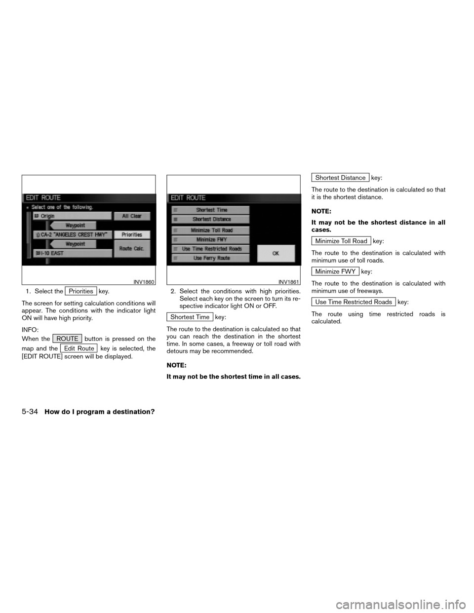
1. Select thePriorities key.
The screen for setting calculation conditions will
appear. The conditions with the indicator light
ON will have high priority.
INFO:
When the ROUTE button is pressed on the
map and the
Edit Route key is selected, the
[EDIT ROUTE] screen will be displayed.2. Select the conditions with high priorities.
Select each key on the screen to turn its re-
spective indicator light ON or OFF.
Shortest Time key:
The route to the destination is calculated so that
you can reach the destination in the shortest
time. In some cases, a freeway or toll road with
detours may be recommended.
NOTE:
It may not be the shortest time in all cases.
Shortest Distance key:
The route to the destination is calculated so that
it is the shortest distance.
NOTE:
It may not be the shortest distance in all
cases.
Minimize Toll Road key:
The route to the destination is calculated with
minimum use of toll roads.
Minimize FWY key:
The route to the destination is calculated with
minimum use of freeways.
Use Time Restricted Roads key:
The route using time restricted roads is
calculated.
INV1860INV1861
5-34How do I program a destination?
ZREVIEW COPYÐ2004 Maxima(max)
Navigation System OM(navi)ÐUSA_English(nna)
04/27/04Ðtbrooks
X
Page 103 of 186
4. Select the facility you wish to display, and
press the ENTER button.
INFO:
Every time the ENTER button is pressed, the in-
dicator lights of the items are turned ON and
OFF alternately.
ON: To display nearby icons.
OFF: To stop displaying nearby icons.The icons of the selected facilities will be
displayed.
INFO:
When the MAP button is pressed, the current
location will be displayed.
When the PREV button is pressed, the previ-
ous screen will reappear.INFO:
When a hospital is set as a destination, a tele-
phone number of the destination will be
displayed, if available.
INV1921INV1922INV1923
How do I use the Point of Interest (POI) feature?6-15
ZREVIEW COPYÐ2004 Maxima(max)
Navigation System OM(navi)ÐUSA_English(nna)
04/27/04Ðtbrooks
X
Page 111 of 186
The stored location will be displayed on the map.
INFO:
cIf you want to confirm several stored
locations, press the PREV button.
cTo go back to the map display, press the
MAP button.CHANGING THE LISTING ORDER
1. Select theSort key on the [EDIT AD-
DRESS BOOK] screen.2. To change the listing order, tilt the joystick
to the right or left, or press the ENTER
button.
When the left indicator on the
Sort key is
highlighted: list in the order of numbers
When the center indicator on the
Sort key is highlighted: list in the order
of icons
When the right indicator on the
Sort key is highlighted: list in alphabeti-
cal order
INV1932INV1933INV1934
How do I use the address book feature?7-7
ZREVIEW COPYÐ2004 Maxima(max)
Navigation System OM(navi)ÐUSA_English(nna)
04/27/04Ðtbrooks
X
Page 139 of 186

DIRECTIONS GIVEN AND THE DIS-
TANCE TO THE ROAD POINTS
Directions will differ depending on road type.
INFO:
Distances may vary depending on vehicle speed.
NOTIFICATION OF AN INTERSEC-
TION ON AN ORDINARY ROAD
“In a quarter mile (400 meters) , right (left) turn.”
“Right (left) turn ahead.”
NOTIFICATION OF CONSECUTIVE
INTERSECTIONS ON AN ORDINARY
ROAD
“In a quarter mile (400 meters) , right (left) turn,
then left (right) turn.”
“Right (left) turn ahead, then left (right) turn.”
NOTIFICATION OF AN ENTRANCE
TO A FREEWAY
“In a quarter mile (400 meters) freeway entrance
on your right onto (road number and direction) .”
“Freeway entrance on your right onto (road num-
ber and direction) .”
NOTIFICATION OF A FREEWAY
JUNCTION
“In about one mile (1.6 kilometers) , keep to the
right (left) onto (road number and direction) ,
then in a quarter mile keep to the left (right) .”
“Keep to the right (left) onto (road number and
direction) , then in a quarter mile (400 meters)
keep to the left (right) onto (road number and
direction) .”
“Keep to the left (right) onto (road number and
direction) .”
NOTIFICATION OF AN EXIT FROM A
FREEWAY
“In about one mile (1.6 kilometers) , exit on your
right.”
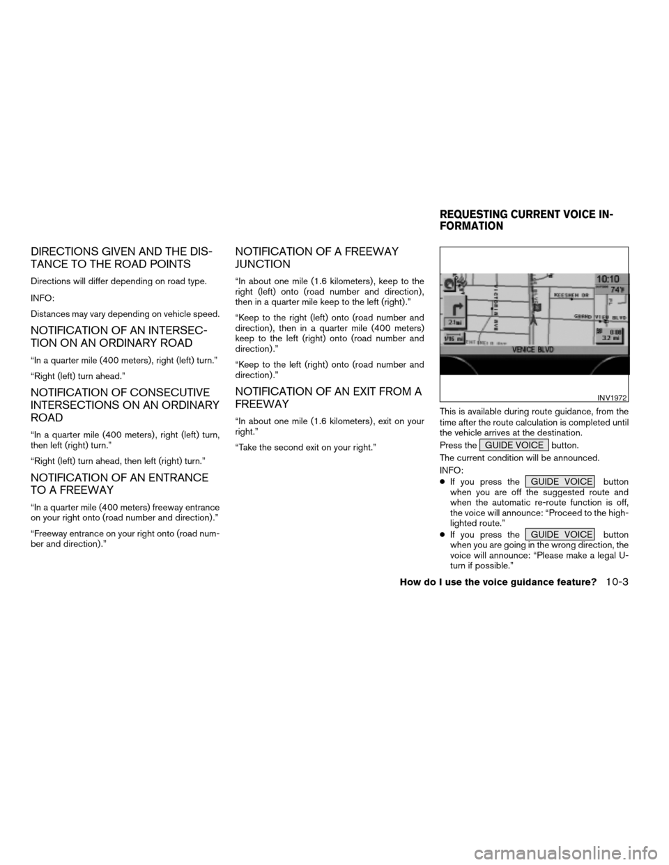
“Take the second exit on your right.”This is available during route guidance, from the
time after the route calculation is completed until
the vehicle arrives at the destination.
Press the GUIDE VOICE button.
The current condition will be announced.
INFO:
cIf you press the GUIDE VOICE button
when you are off the suggested route and
when the automatic re-route function is off,
the voice will announce: “Proceed to the high-
lighted route.”
cIf you press the GUIDE VOICE button
when you are going in the wrong direction, the
voice will announce: “Please make a legal U-
turn if possible.”
INV1972
REQUESTING CURRENT VOICE IN-
FORMATION
How do I use the voice guidance feature?10-3
ZREVIEW COPYÐ2004 Maxima(max)
Navigation System OM(navi)ÐUSA_English(nna)
04/27/04Ðtbrooks
X
Page 149 of 186
INFO:
cWhen the key is selected, the amber indicator
light will light up.
cWhen the MAP button is pressed after the
display setting, the [CURRENT LOCATION]
screen will appear.
When the PREV button is pressed, the
previous screen will reappear.You can manually scroll the map to check the lo-
cation of your choice.
1. Operating the joystick.
The map scrolls in the same direction as the joy-
stick movement.
INFO:
While the vehicle is traveling, a single operation
will move within the displayed area of the screen.
2. Press the MAP button to go back and
show the current vehicle position.
INFO:
You can also select the PREV button to go
back.
Display with the forward direction up
INV1984INV1985
SCROLLING THE MAP
How do I adjust the display?11-9
ZREVIEW COPYÐ2004 Maxima(max)
Navigation System OM(navi)ÐUSA_English(nna)
04/27/04Ðtbrooks
X