Page 109 of 243
102 Telephone*Telephone operationConducting a call
When the call is initiated, the call time ap-
pears in the screen.Use one of these three ways to end a call:
�
Press the right-hand rotary/push-
button v to confirm the “End” button
or call has been finished by the other
party.
or
�
Press a.
or
�
Press *.Subsequent dialing
Transmitting other dial tones:
�
During a call you can press the number
keys 1 through 0, u and t.
The numbers dialed will appear in the
menu for 10 seconds after the last key
is pressed (subsequent dialing display).
P82.85-9127-31
iDuring a conversation, you can enter a
telephone number in the notebook or
edit an existing one (
�page 115).
Page 137 of 243

130 NavigationImportant notes
� Important notesWarning
G
For safety reasons, you should only enter a
destination when the vehicle is stationary.
When the vehicle is in motion, a passenger
should enter the destination. Study manual
and select route before driving.
Do not watch display screen or operate but-
tons while the vehicle is in motion - let voice
instructions guide you. Stop at a safe locati-
on before using buttons or making correc-
tions.
Traffic regulations always have priority over
any route recommendations given.
Bear in mind that at a speed of just 30 mph
(approximately 50 km/h), your car is co-
vering a distance of 50 feet (approximately
14 m) every second.
The route calculated by COMAND is a re-
commendation on how to best reach your
selected destination.
During route guidance, you will not receive
any information on�
Traffic lights
�
Stop and yield signs
�
Parking or stopping zones
�
One-way streets
�
Narrow bridges
�
Similar traffic regulation data
You should therefore always strictly observe
traffic regulations while driving. Drive care-
fully and always obey traffic laws and road
signs even if they contradict COMAND in-
structions.
Page 143 of 243
136 NavigationQuick reference
Function
Page
f
Turn to
Highlight menu field, list
entry or character
Alter the map scale
Press to
Confirm entry/selection,
starting function or acti-
vating submenu
Activate map scale bar
151
151
g
Turn to
During voice output:
Lower (left)/raise (right)
the volume
Press to
Repeat current route in-
structions
h
Requesting and dis-
playing Info Services
System settings
202
205
j
Color screenFunction
Page
Page 158 of 243
151 Navigation
Destination input
Altering the map scale
9Current map scale
aScale selector
bNew map scale (filled arrow)
cSquare indicates map section which is
recalculated Activating the scale selector a.
�
Press + or ,.
or
�
Press the right-hand rotary/push-
button v.
iAs you move the crosshairs towards the
edge of the screen using the number
keys, an adjacent section of the map is
activated. It may take a few seconds to
point to each new map.
Adjacent map sections overlap some-
what so that destinations at the edge of
the map can be marked as well.
iA division mark corresponds to an avai-
lable scale. You can select 13 different
scales ranging from 0.05 miles/inch to
500 miles/inch.
Page 171 of 243
164 NavigationRoute guidanceAfter the destination is selected and the
route is calculated, the navigation system
will guide you to the destination using both
pictorial displays and voice outputs.
During route guidance, you can select the
following 3 screen displays:�
Symbol display
Always appears after a route has been
calculated
�
Map display
Activate the map with menu field 5,
switch back to symbol display with
menu field 8
�
Mix
As the vehicle approaches a maneuver
point, COMAND switches automatical-
ly from the map to the symbol display.
Once the turn has been completed, the
map is displayed again.
iIn the map display, menu fields 6, 8,
9 are removed after 6 seconds.
Turn the right-hand rotary/push-button
v to display the menu fields again.
iThe map appears automatically after 5
seconds if the vehicle is located on a
road which is not digitized (message
OFF ROAD).
If COMAND recognizes a stored road,
the symbol display is called up again.
Page 174 of 243
167 Navigation
Route guidance
Activating the location map
If route guidance is active�
Turn the right-hand rotary/push-button
v in the selection menu “Destination
Info” to highlight “Location map” and
press to confirm.
The location map faces north (North-
up).
1Geographic longitude and latitude for
your current location
2Number of satellites received
3Scale used the last time the location
map was activated
4Current vehicle location in the center of
the screen
5Name of the street the vehicle is
currently travelling onAltering the map scale (
�page 176).
Switching back to the symbol or map dis-
play
�
Press * twice.
If route guidance is switched off
�
Press l.
The location map will appear.
�
Press l again to activate the main
destination input menu.iIf the location map appears after
COMAND has been switched on,
pressb to activate the main destina-
tion input menu.
Page 177 of 243

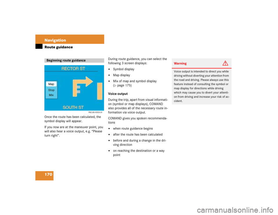
170 NavigationRoute guidanceOnce the route has been calculated, the
symbol display will appear.
If you now are at the maneuver point, you
will also hear a voice output, e.g. “Please
turn right”.During route guidance, you can select the
following 3 screen displays:
�
Symbol display
�
Map display
�
Mix of map and symbol display
(�page 175)
Voice output
During the trip, apart from visual informati-
on (symbol or map displays), COMAND
also provides all of the necessary route in-
formation via voice output.
COMAND gives you spoken recommenda-
tions
�
when route guidance begins
�
after the route has been calculated
�
before and during a change in the dri-
ving direction
�
on reaching the destination or a way
point
Beginning route guidance
Warning
G
Voice output is intended to direct you while
driving without diverting your attention from
the road and driving. Please always use this
feature instead of consulting the symbol or
map display for directions while driving
which may cause you to divert your attenti-
on from driving and increase your risk of ac-
cident.
Page 181 of 243
174 NavigationRoute guidance1Activates map display2Return to symbol display
3Last scale selected
Altering the map scale (
�page 176)
4Actual vehicle location
5Name of the street you will turn ontoYou can select one of the two possibilities:
�
Press the right-hand rotary/push-
button v to confirm 1.
or
�
Press l.
The map will appear in the scale last se-
lected.
Changing to map display
iCOMAND will remove the menu bar (ex-
cept for 3) after 6 seconds.�
Turn the right-hand rotary/push-
button v to recall the menu bar to
the screen.